Kunashaksky District Кунашакский район(Russian) | |
---|---|
Location of Kunashaksky District in Chelyabinsk Oblast | |
Coordinates: 55°42′N61°33′E / 55.700°N 61.550°E Coordinates: 55°42′N61°33′E / 55.700°N 61.550°E | |
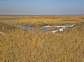
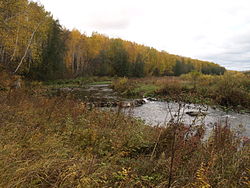
Bagaryak River, Kunashaksky District | |
Location | |
Country | Russia |
Federal subject | Chelyabinsk Oblast [1] |
Administrative structure (as of October 2012) | |
Administrative center | selo of Kunashak [1] |
Administrative divisions: [1] | |
selsoviet | 9 |
Inhabited localities: [1] | |
Rural localities | 73 |
Municipal structure (as of October 2012) | |
Municipally incorporated as | Kunashaksky Municipal District [1] |
Municipal divisions: [1] | |
Urban settlements | 0 |
Rural settlements | 9 |
Statistics | |
Area | 3,280 km2 (1,270 sq mi) [2] |
Population (2010 Census) | 30,112 inhabitants [3] |
• Urban | 0% |
• Rural | 100% |
Density | 9.18/km2 (23.8/sq mi) [4] |
Time zone | YEKT (UTC+05:00) [5] |
Official website | |
Kunashaksky District on WikiCommons |
Kunashaksky District (Russian : Кунашакский райо́н) is an administrative and municipal district (raion), one of the twenty-seven in Chelyabinsk Oblast, Russia. [1] It is located in the northeast of the oblast. The area of the district is 3,280 square kilometers (1,270 sq mi). [2] Its administrative center is the rural locality (a selo ) of Kunashak. [1] Population: 30,112 (2010 Census); [3] 32,225 (2002 Census); [6] 35,167 (1989 Census). [7] The population of Kunashak accounts for 20.9% of the district's total population. [3]
Russian is an East Slavic language, which is official in the Russian Federation, Belarus, Kazakhstan and Kyrgyzstan, as well as being widely used throughout Eastern Europe, the Baltic states, the Caucasus and Central Asia. It was the de facto language of the Soviet Union until its dissolution on 25 December 1991. Although nearly three decades have passed since the breakup of the Soviet Union, Russian is used in official capacity or in public life in all the post-Soviet nation-states, as well as in Israel and Mongolia.
A raion is a type of administrative unit of several post-Soviet states. The term is from the French "rayon", which is both a type of a subnational entity and a division of a city, and is commonly translated in English as "district".
The district was part of the Bashkir Autonomous Socialist Soviet Republic until January 1934, and together with neighboring Argayashsky District, formed the exclave Argayash Canton. The two districts were added to Chelyabinsk Oblast as the Argayash National Okrug, which itself only survived until November 1934.
Argayashsky District is an administrative and municipal district (raion), one of the twenty-seven in Chelyabinsk Oblast, Russia. It is located in the north of the oblast. The area of the district is 2,791 square kilometers (1,078 sq mi). Its administrative center is the rural locality of Argayash. Population: 41,387 (2010 Census); 42,808 ; 43,733 (1989 Census). The population of Argayash accounts for 24.3% of the district's total population.
The Argayash National Okrug was a national okrug for the Bashkirs of the Chelyabinsk Oblast of the RSFSR in the Soviet Union. It existed from January to November 1934.
Kopeysk is a city in Chelyabinsk Oblast, Russia, located southeast of Chelyabinsk. Population: 137,601 (2010 Census); 73,342 (2002 Census); 79,048 (1989 Census). The population growth between 2002 and 2010 was caused by the annexation of surrounding settlements.
Ust-Katav is a town in Chelyabinsk Oblast, Russia, located on the Yuryuzan River. Population: 23,580 (2010 Census); 25,898 (2002 Census); 31,218 (1989 Census).
Yuzhnouralsk is a town in Chelyabinsk Oblast, Russia, located on the Uvelka River 88 kilometers (55 mi) south of Chelyabinsk. Population: 37,877 (2010 Census); 39,275 (2002 Census); 41,335 (1989 Census).
Agapovsky District is an administrative and municipal district (raion), one of the twenty-seven in Chelyabinsk Oblast, Russia. It is located in the southwest of the oblast. The area of the district is 2,603.6 square kilometers (1,005.3 sq mi). Its administrative center is the rural locality of Agapovka. Population: 34,779 (2010 Census); 37,816 ; 35,919 (1989 Census). The population of Agapovka accounts for 18.9% of the district's total population.
Chesmensky District is an administrative and municipal district (raion), one of the twenty-seven in Chelyabinsk Oblast, Russia. It is located in the southeast of the oblast. The area of the district is 2,663 square kilometers (1,028 sq mi). Its administrative center is the rural locality of Chesma. Population: 20,185 (2010 Census); 20,459 ; 19,638 (1989 Census). The population of Chesma accounts for 32.3% of the district's total population.
Kartalinsky District is an administrative and municipal district (raion), one of the twenty-seven in Chelyabinsk Oblast, Russia. It is located in the southeast of the oblast. The area of the district is 4,737 square kilometers (1,829 sq mi). Its administrative center is the town of Kartaly. Population : 20,256 (2010 Census); 21,961 ; 22,170 (1989 Census).
Kizilsky District is an administrative and municipal district (raion), one of the twenty-seven in Chelyabinsk Oblast, Russia. It is located in the southwest of the oblast. The area of the district is 4,413 square kilometers (1,704 sq mi). Its administrative center is the rural locality of Kizilskoye. Population: 25,876 (2010 Census); 27,679 ; 30,220 (1989 Census). The population of Kizilskoye accounts for 25.7% of the district's total population.
Kusinsky District is an administrative and municipal district (raion), one of the twenty-seven in Chelyabinsk Oblast, Russia. It is located in the northwest of the oblast. The area of the district is 1,513 square kilometers (584 sq mi).} Its administrative center is the town of Kusa. Population: 29,392 (2010 Census); 32,738 ; 37,100 (1989 Census). The population of Kusa accounts for 63.9% of the district's total population.
Sosnovsky District is an administrative and municipal district (raion), one of the twenty-seven in Chelyabinsk Oblast, Russia. It is located in the northern central part of the oblast. The area of the district is 2,112 square kilometers (815 sq mi). Its administrative center is the rural locality of Dolgoderevenskoye. Population: 60,941 (2010 Census); 58,570 ; 54,328 (1989 Census). The population of Dolgoderevenskoye accounts for 12.6% of the district's total population.
Troitsky District is an administrative and municipal district (raion), one of the twenty-seven in Chelyabinsk Oblast, Russia. It is located in the central and eastern parts of the oblast. The area of the district is 4,591 square kilometers (1,773 sq mi). Its administrative center is the town of Troitsk. Population: 28,059 (2010 Census); 33,816 ; 34,831 (1989 Census).
Uvelsky District is an administrative and municipal district (raion), one of the twenty-seven in Chelyabinsk Oblast, Russia. It is located in the eastern central part of the oblast. The area of the district is 2,330 square kilometers (900 sq mi). Its administrative center is the rural locality of Uvelsky. Population: 31,867 (2010 Census); 32,188 ; 29,513 (1989 Census). The population of the administrative center accounts for 33.0% of the district's total population.
Uysky District is an administrative and municipal district (raion), one of the twenty-seven in Chelyabinsk Oblast, Russia. It is located in the west of the oblast. The area of the district is 2,637 square kilometers (1,018 sq mi). Its administrative center is the rural locality of Uyskoye. Population: 26,184 (2010 Census); 28,555 ; 29,132 (1989 Census). The population of Uyskoye accounts for 28.1% of the district's total population.
Varnensky District is an administrative and municipal district (raion), one of the twenty-seven in Chelyabinsk Oblast, Russia. It is located in the southeast of the oblast. The area of the district is 3,853 square kilometers (1,488 sq mi). Its administrative center is the rural locality of Varna. Population: 27,357 (2010 Census); 30,802 ; 30,773 (1989 Census). The population of Varna accounts for 36.1% of the district's total population.
Yemanzhelinsky District is an administrative and municipal district (raion), one of the twenty-seven in Chelyabinsk Oblast, Russia. It is located in the center of the oblast. The area of the district is 129 square kilometers (50 sq mi). Its administrative center is the town of Yemanzhelinsk. Population : 21,868 (2010 Census).
Lokomotivny is a closed urban locality in Chelyabinsk Oblast, Russia, located 264 kilometers (164 mi) southwest from Chelyabinsk. Population: 8,498 (2010 Census); 10,741 (2002 Census).
Karabash is a town in Chelyabinsk Oblast, Russia, located 90 kilometers (56 mi) northwest of Chelyabinsk. Population: 13,152 (2010 Census); 15,942 ; 17,006 (1989 Census).
Kunashak is a rural locality and the administrative center of Kunashaksky District, Chelyabinsk Oblast, Russia. Population: 6,296 (2010 Census); 5,993 (2002 Census); 5,703 (1989 Census).
Oktyabrskoye is a rural locality and the administrative center of Oktyabrsky District, Chelyabinsk Oblast, Russia. Population: 6,780 (2010 Census); 7,562 (2002 Census); 7,975 (1989 Census).