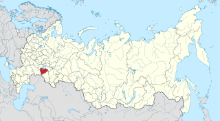
Kuybyshev, Russia

Last updated

Kuybyshev (Russian : Куйбышев) is the name of several inhabited localities in Russia.

Russian language East Slavic language

Russian is an East Slavic language, which is official in the Russian Federation, Belarus, Kazakhstan and Kyrgyzstan, as well as being widely used throughout Eastern Europe, the Baltic states, the Caucasus and Central Asia. It was the de facto language of the Soviet Union until its dissolution on 25 December 1991. Although nearly three decades have passed since the breakup of the Soviet Union, Russian is used in official capacity or in public life in all the post-Soviet nation-states, as well as in Israel and Mongolia.

The classification system of the types of inhabited localities in Russia, the former Soviet Union, and some other post-Soviet states has certain peculiarities compared with the classification systems in other countries.

Contents

Modern localities

Urban localities
Kuybyshev, Novosibirsk Oblast Town in Novosibirsk Oblast, Russia

Kuybyshev is a town in Novosibirsk Oblast, Russia, located on the Om River, 315 kilometers (196 mi) west of Novosibirsk, the administrative center of the oblast. Population: 45,299 (2010 Census); 48,848 (2002 Census); 51,171 (1989 Census); 40,000 (1970).

Novosibirsk Oblast First-level administrative division of Russia

Novosibirsk Oblast is a federal subject of Russia located in southwestern Siberia. Its administrative and economic center is the city of Novosibirsk. The population was 2,788,849 as of the 2018 Census.

Rural localities
Sredneakhtubinsky District District in Volgograd Oblast, Russia

Sredneakhtubinsky District is an administrative district (raion), one of the thirty-three in Volgograd Oblast, Russia. As a municipal division, it is incorporated as Sredneakhtubinsky Municipal District. It is located in the southeast of the oblast. The area of the district is 2,039 square kilometers (787 sq mi). Its administrative center is the urban locality of Srednyaya Akhtuba. Population: 58,962 (2010 Census); 55,341 ; 48,555 (1989 Census). The population of Srednyaya Akhtuba accounts for 24.5% of the district's total population.

Volgograd Oblast First-level administrative division of Russia

Volgograd Oblast is a federal subject of Russia, located in the Volga region of Southern Russia. Its administrative center is Volgograd. The population of the oblast was 2,610,161 in the 2010 Census.

Renamed localities

Samara Oblast First-level administrative division of Russia

Samara Oblast is a federal subject of Russia. Its administrative center is the city of Samara. From 1935 to 1991, it was known as Kuybyshev Oblast. As of the 2010 Census, the population of the oblast was 3,215,532.

Bolgar, Spassky District, Republic of Tatarstan Town in Tatarstan, Russia

Bolgar is a town and the administrative center of Spassky District in the Republic of Tatarstan, Russia, located on the left bank of the Volga River, 140 kilometers (87 mi) from Kazan. As of the 2010 Census, its population was 8,650.

Spassky District, Republic of Tatarstan District in Republic of Tatarstan, Russia

Spassky District is an administrative and municipal district (raion), one of the forty-three in the Republic of Tatarstan, Russia. It is located in the southwest of the republic. The area of the district is 2,028 square kilometers (783 sq mi). Its administrative center is the town of Bolgar. Population: 20,554 (2010 Census); 21,779 ; 23,346 (1989 Census). The population of Bolgar accounts for 42.1% of the district's total population. There are some historical buildings on the territory of the district and the Museum of Bread.

Alternative names

Rubtsovsky District District in Altai Krai, Russia

Rubtsovsky District is an administrative and municipal district (raion), one of the fifty-nine in Altai Krai, Russia. It is located in the southwest of the krai. The area of the district is 3,339 square kilometers (1,289 sq mi). Its administrative center is the city of Rubtsovsk. Population: 24,556 (2010 Census); 26,407 (2002 Census); 26,060 (1989 Census).

Altai Krai First-level administrative division of Russia

Altai Krai is a federal subject of Russia. It borders with the regions of, clockwise from the west, Kazakhstan, Novosibirsk and Kemerovo Oblasts, and the Altai Republic. The krai's administrative center is the city of Barnaul. As of the 2010 Census, the population of the krai was 2,419,755.

Related Research Articles

Ilyinka is the name of several inhabited localities in Russia.

Beryozovka or Berezovka is the name of several inhabited localities in Russia.

Progress is the name of several inhabited localities in Russia.

Oktyabrsky, Oktyabrskaya or Oktyabrskoye is the name of several inhabited localities in Russia.

Komsomolsky, Komsomolskaya, or Komsomolskoye is the name of several inhabited localities in Russia.

Romanovka is the name of several inhabited localities in Russia.

Gorny, Gornaya, or Gornoye is the name of several inhabited localities in Russia.

Krasny Yar is the name of several inhabited localities in Russia.

Kuybyshevo is the name of several rural localities in Russia:

Mirny, Mirnaya, or Mirnoye is the name of several inhabited localities in Russia.

Samarsky, Samarskaya, or Samarskoye is the name of several rural localities in Russia:

Priozerny/Priozyorny, Priozernaya/Priozyornaya, or Priozernoye/Priozyornoye is the name of several rural localities in Russia.

Mokhovoy, Mokhovaya, or Mokhovoye is the name of several rural localities in Russia.

Ivanovka is the name of several rural localities in Russia.

Borovoy, Borovaya, or Borovoye is the name of several inhabited localities in Russia.

Mikhaylovka is the name of several inhabited localities in Russia.

Vishnevka is the name of several rural localities in Russia.

Peschany, Peschanaya, or Peschanoye is the name of several rural localities in Russia.

Mezhdurechye is the name of several rural localities in Russia: