Sandnes (help·info) is a city and municipality in Rogaland county, Norway. It is the 8th largest city in Norway and it lies immediately south of the city of Stavanger, the 4th largest city in Norway. Together, the Stavanger/Sandnes area is the 3rd largest urban area in Norway.
Florø (help·info) is a town and the administrative centre of Flora Municipality in Sogn og Fjordane county, Norway. The town was founded by royal decree in 1860 as a ladested on the island of Florelandet, located between the Botnafjorden and Solheimsfjorden. Florø is Norway's westernmost town—west of Amsterdam, Brussels, and Nice. It is the most western town on the mainland in the Nordic countries.

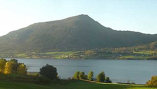
Bud is a fishing village in Fræna Municipality in Møre og Romsdal county in western Norway. The village is located on the Romsdal peninsula along the Atlanterhavsveien, west of the village of Hustad, north of the village of Tornes, and east of the Bjørnsund islands. The 0.69-square-kilometre (170-acre) village has a population (2013) of 760. This gives it a population density of 1,101 inhabitants per square kilometre (2,850/sq mi).
Måløy is a town and the administrative centre of the municipality of Vågsøy in Sogn og Fjordane county, Norway. Måløy is located on the southeastern side of the island of Vågsøy, about 3 kilometres (1.9 mi) northeast of the village of Holvika and about 6 kilometres (3.7 mi) south of the village of Raudeberg. The Måløy Bridge connects the town centre to the area of Deknepollen on the mainland. Sør-Vågsøy Church is located in Måløy.

Nordfjordeid is the administrative centre of the municipality of Eid in Sogn og Fjordane county, western Norway. It is located at the end of the Eidsfjorden, an arm off of the main Nordfjorden, west of the large lake Hornindalsvatnet. The village of Stårheim is located about 12 kilometres (7.5 mi) to the west, the village of Mogrenda is about 5 kilometres (3.1 mi) to the east, and the village of Lote is about 7 kilometres (4.3 mi) to the southeast.
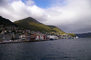
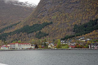
Brattvåg is the administrative centre of Haram Municipality in Møre og Romsdal county, Norway. The village is located on the Norwegian mainland, along the west side of the Samfjorden. It is 12.5 kilometres (7.8 mi) northwest of Vatne/Eidsvik. The 1.7-square-kilometre (0.66 sq mi) village has a population (2013) of 2,388; giving the village a population density of 1,405 inhabitants per square kilometre (3,640/sq mi).

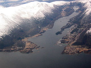
Vatne is a village and former municipality in Haram Municipality in Møre og Romsdal county, Norway. The village of Vatne is located at the southern end of the Vatnefjorden in the eastern part of Haram Municipality. The 1.64-square-kilometre (0.63 sq mi) village has a population (2013) of 1,876 which gives it a population density of 1,144 inhabitants per square kilometre (2,960/sq mi). Other villages in the Vatne area include Eidsvik and Tennfjord to the south of the village of Vatne and Helle to the north of it.

Sandane is the administrative centre of the municipality of Gloppen in Sogn og Fjordane county, Norway. It is located at the end of the Gloppefjorden, along the European route E39 highway. Sandane is 20 kilometres (12 mi) south of the village of Nordfjordeid and about 16 kilometres (9.9 mi) west of the village of Byrkjelo. Sandane Airport, Anda is located 10 kilometres (6.2 mi) northwest of Sandane along highway E39. Sandane has several suburban areas that surround the nearby fjord such as Sørstranda to the west and Vereide to the northwest.

Eidsvåg is a village in Nesset Municipality in Møre og Romsdal county, Norway. It is the administrative centre of the municipality. Eidsvåg is located at the end of the Langfjorden on the isthmus connecting the Romsdal peninsula to the Norwegian mainland. It is located about 8.5 kilometres (5.3 mi) southwest of the village of Raudsand, about 20 kilometres (12 mi) north of the village of Eresfjord, and 9 kilometres (5.6 mi) north of the village of Boggestranda. Nesset Church is located in this village.

Sogndalsfjøra is the administrative center of the municipality of Sogndal in Sogn og Fjordane county, Norway. It is located where the river Sogndalselvi runs out in the Sogndalsfjorden, a branch of the large Sognefjorden. The village is located about 3.5 kilometres (2.2 mi) northwest of the village of Kjørnes, about 10 kilometres (6.2 mi) northwest of the village of Kaupanger, and about 31 kilometres (19 mi) southeast of the village of Fjærland.
Skei is the administrative centre of the municipality of Jølster in Sogn og Fjordane county, Norway. The village is located at the northeastern end of the lake Jølstravatnet. Skei is 20 kilometres (12 mi) south of the village of Byrkjelo, 25 kilometres (16 mi) northeast of the villages of Vassenden/Langhaugane, and about 13 kilometres (8.1 mi) east of the village of Ålhus. Skei is located just west of Jostedalsbreen National Park. The village lies at the intersection of two major regional highways: European route E39 and Norwegian National Road 5.

Dale or Dale i Sunnfjord is the administrative centre of the municipality of Fjaler in Sogn og Fjordane county, Norway. The village is located at the mouth of the river Vassdalselva on the southern shore of the Dalsfjorden in the northern part of Fjaler, about 6.5 kilometres (4.0 mi) northeast of the village of Flekke and about 20 kilometres (12 mi) west of the village of Bygstad.

Vikedal or Vikadal is a village in Vindafjord municipality in Rogaland county, Norway. The village is located along the krosfjorden, about 7 kilometres (4.3 mi) south of the village of Sandeid and about 8 kilometres (5.0 mi) northwest of the village of Imslandsjøen. Vikedal Church is located in this village.

Manger is the administrative center of Radøy municipality in Hordaland county, Norway. The village lies in the central part of the island of Radøy, along the Radfjorden. The village of Bøvågen lies about 10 kilometres (6 mi) to the northwest and the village of Sæbø lies about 10 kilometres (6 mi) to the southeast. The 1.05-square-kilometre (260-acre) village has a population (2013) of 1012, giving the village a population density of 964 inhabitants per square kilometre (2,500/sq mi).

Osøyro is the administrative centre of Os municipality in Hordaland county, Norway. The village lies on the southwestern part of the Bergen Peninsula, along the western shore of the Fusafjorden, about 25 kilometres (16 mi) south of the city centre of Bergen. The European route E39 highway runs through the village on its way to Bergen. There is a car ferry from the east side of Osøyro to the village of Fusa, across the Fusafjorden. Os Church is located in the village.
Bryggja is a village in eastern part of Vågsøy Municipality in Sogn og Fjordane county, Norway. It is located on the mainland, along the northern shore of the Nordfjorden. The village is located about 15 kilometres (9.3 mi) east of the urban area of Måløy–Deknepollen–Tennebø in Vågsøy and it is about 25 kilometres (16 mi) west of Stårheim in neighboring Eid municipality. The small village of Totland lies just west of Bryggja.
Langøy or Langøyneset is a village in Averøy Municipality in Møre og Romsdal county, Norway. It is located on the northern part of the island of Averøya. It is located mainly on the small island of Langøya, off the northern coast of the main island of Averøya. The village is west of the village of Bremsnes and northeast of the village of Kårvåg. The Langøy Chapel is located here. The 0.65-square-kilometre (160-acre) village has a population (2012) of 359, which gives the village a population density of 552 inhabitants per square kilometre (1,430/sq mi). The Hestskjær Lighthouse lies about 2 kilometres (1.2 mi) north of this village.

Hermansverk or Leikanger is a large village in the municipality of Leikanger in Sogn og Fjordane county, Norway. The village serves as the administrative centre of both the municipality of Leikanger and also Sogn og Fjordane county.

Stryn is the administrative centre of Stryn Municipality in Sogn og Fjordane county, Norway. The village is located on the shore of a small bay off of the main Nordfjorden. The mouth of the river Stryneelva is in the village. The village sits about 3.5 kilometres (2.2 mi) west of the village of Nedstryn.