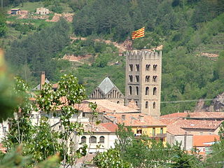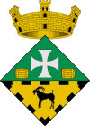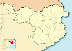
Ripoll is the capital of the comarca of Ripollès, in the province of Girona, Catalonia, Spain. It is located on confluence of the Ter River and its tributary Freser, next to the Pyrenees near the French border. The population was 11,057 in 2009.

Roda de Ter is a municipality in the comarca of Osona, province of Barcelona, Catalonia, Spain, near Vic, on the Ter River above the Sau Reservoir. Population: 5,435 (2004), area: 2.18 km². Its church is dedicated to St. Peter. Main monuments: Pont Vell and the Capella del Sòl del Pont. The Virgin Mary, La Mare de Déu del Sòl del Pont is the patron of the village.

Les Masies de Roda is a municipality in the province of Barcelona, Catalonia, Spain. It is situated near the Ter River. It has an estimated population of 710, and an area of some 16.5 km².

Manlleu is municipality in the comarca of Osona, in the province of Barcelona, Catalonia, northern Spain.

La Pobla de Claramunt is a municipality in the comarca of the Anoia in Catalonia, Spain. It is situated on the edge of the Òdena Basin at the entrance to the Capellades Gorge. The town is dominated by Claramunt castle, on a hilltop some 150 m above the modern settlement: the castle was, with Castellbell castle, one of the main points of control of access to the Llobregat valley and hence to Barcelona. With neighbouring Capellades, La Pobla de Claramunt is an important centre for paper manufacture. It is served by a station on the FGC railway line R6 from Barcelona and Martorell to Igualada and by the C-244 road from Igualada to Vilafranca del Penedès.

Alt Àneu is a municipality in the comarca of the Pallars Sobirà in Catalonia, Spain. It is the largest municipality in Catalonia in terms of area at 1,913.79 square kilometres (738.92 sq mi), but it has only about 400 people. It is situated on the Noguera Pallaresa river, and is served by the C-13 road, which links it with Sort and to the Aran Valley over the Port de la Bonaigua (2072 m). The ajuntament is in València d'Àneu.

Tavertet is a small town located above some cliffs, 900m above sea level, in the area known as Collsacabra, north of the Guilleries, in the comarca of Osona in Catalonia.

Sant Gregori is a mountain of the Guilleries Massif, Catalonia, Spain. It has an elevation of 1,090.8 metres above sea level.

Sant Guim de Freixenet is a municipality in the comarca of la Segarra in Catalonia, Spain.

Flaçà is a town in the Gironès county of Girona Province, Catalonia, Spain. It occupies an area of 6.67 square kilometers and extends the hills of the Lloreda Valley and alluvial plain of the Ter river. It borders the Ter River to the north and the municipality of Sant Jordi Desvalls to the west with the municipalities of Sant Joan de Mollet Sant Marti Vell to the south and to east, the towns of Foixà and la Pera. The current population is 1,070 people.

Pellaea calomelanos is a species of fern. It is found in eastern and southern Africa where it is associated with Afromontane vegetation, as well as on Madagascar, The Comoros, and the Mascarene Islands. Disjunct populations are found in northern India, Spain, and the Azores.

Castellcir is a village in the province of Barcelona and autonomous community of Catalonia, Spain. The municipality covers an area of 34.2 square kilometres (13.2 sq mi) and the population in 2014 was 718. The municipality includes an exclave to the west. Since May 2015 it has been part of the new comarca of Moianès; previously it was in Vallès Oriental.

Monistrol de Calders is a village in the province of Barcelona and autonomous community of Catalonia, Spain. The municipality covers an area of 21.96 square kilometres (8.48 sq mi) and the population in 2014 was 695. Since May 2015 it has been part of the new comarca of Moianès; previously it was in Bages.

La Roca del Vallès is a village in the comarca of Vallès Oriental in the province of Barcelona and Catalonia. The municipality covers an area of 36.9 square kilometres (14.2 sq mi) and the population in 2014 was 10,518.

Santa Maria d'Oló is a village in the province of Barcelona and autonomous community of Catalonia, Spain. The municipality covers an area of 66.18 square kilometres (25.55 sq mi) and the population in 2014 was 1,065. Since May 2015 it has been part of the new comarca of Moianès; previously it was in Bages.

Cervià de Ter is a village in the province of Girona and autonomous community of Catalonia, Spain. The municipality covers an area of 9.97 square kilometres (3.85 sq mi) and the population in 2014 was 934.

Palol de Revardit is a village in the province of Girona and autonomous community of Catalonia, Spain. The municipality covers an area of 18 square kilometres (6.9 sq mi), and, as of 2011, had a population of 471 people.

Sarrià de Ter is a village in the province of Girona and autonomous community of Catalonia, Spain. It is part of the metropolitan area of the city of Girona.

Vilallonga de Ter is a village in the province of Girona and autonomous community of Catalonia, Spain.

Pasteral Reservoir is a reservoir located on the Ter river, on the border between La Cellera de Ter and Amer, Catalonia, Spain. The reservoir has a storage capacity of 233 hm³ and the dam has a structural height of 33 m and a crest length of 150 m.


