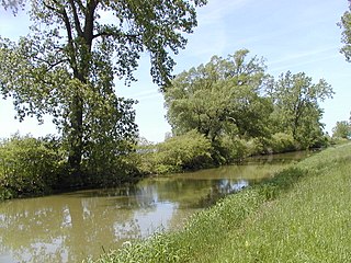
The Great Meadows Wildlife Refuge is a 12-mile-long (19 km) river wetlands conservation area, in two major parcels, stretching from the towns of Billerica, Massachusetts (downstream) to Wayland, Massachusetts (upstream), along the Concord River and Sudbury River.

Lake Thibadeau National Wildlife Refuge is a 3,868-acre (1,565 ha) National Wildlife Refuge in the U.S. state of Montana, 15 mi (24 km) northeast of Havre, Montana. This refuge is a part of the Bowdoin Wetland Management District (WMD), and is managed from Bowdoin National Wildlife Refuge. The refuge is an easement refuge almost entirely on privately owned property and consists of grassland, marshes and cropland.

The Upper Mississippi River National Wildlife and Fish Refuge is a 240,000-acre (970 km2), 261-mile long (420 km) National Wildlife Refuge located in and along the Upper Mississippi River. It runs from Wabasha, Minnesota in the north to Rock Island, Illinois in the south.
Hobart Lake National Wildlife Refuge is a 2,077-acre (8.41 km2) Easement Refuge located in Barnes County, North Dakota five miles west of Valley City. The refuge is divided in half by Interstate Highway 94 running east and west. The United States Fish and Wildlife Service owns 277 acres (1.12 km2) in fee title and the remaining acres are covered by easement. Three nesting islands in the northeast corner of the refuge that were constructed by Ducks Unlimited have been submerged since 1993.
Stoney Slough National Wildlife Refuge is a 2,000-acre (810 ha) easement refuge with 1,120 acres (450 ha) owned in fee title and the remaining area of 880 acres (360 ha) covered by easement. The United States Fish and Wildlife Service fee title of 1,120 acres allows some wetland and upland management. The wetland areas on the Refuge cover approximately 600 acres (240 ha) in four permanent pools and two temporary pools. Water management using a series of canals and a water control structure is possible when there is sufficient spring runoff. The Refuge is a popular stopover for snow geese and white-fronted geese during fall migration.
Lake Nettie National Wildlife Refuge is a 3,055-acre (1,236 ha) National Wildlife Refuge (NWR) in the U.S. state of North Dakota. 2,420 acres (980 ha) of the refuge are public while the remaining 635 acres (257 ha) is an easement on privately owned land, but the landowners and U.S. Government work cooperatively to protect the resources. The U.S. Fish and Wildlife Service oversees Lake Nettie NWR from offices at Audubon National Wildlife Refuge.
Stewart Lake National Wildlife Refuge is a 2,230-acre (900 ha) National Wildlife Refuge (NWR) in the U.S. state of North Dakota. Almost 1,600 acres (650 ha) of Stewart Lake NWR is an easement refuge and is on privately owned land, but the landowners and U.S. Government work cooperatively to protect the resources. The remaining acreage is on public lands. The U.S. Fish and Wildlife Service oversees Stewart Lake NWR from their offices at Audubon National Wildlife Refuge.

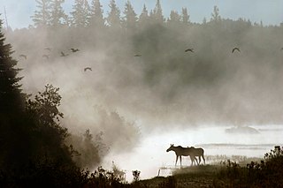
The Koyukuk National Wildlife Refuge is a 3,500,000-acre (14,000 km2) conservation area in Alaska. It lies within the floodplain of the Koyukuk River, in a basin that extends from the Yukon River to the Purcell Mountains and the foothills of the Brooks Range. This region of wetlands is home to fish, waterfowl, beaver and Alaskan moose, and wooded lowlands where two species of fox, bears, wolf packs, Canadian lynx and marten prowl.
Aroostook National Wildlife Refuge is located on part of the former Loring Air Force Base, in Aroostook County, Maine. It was established in 1998, when 4,700 acres (19 km2) were transferred from the United States Air Force to the United States Fish and Wildlife Service. This refuge also administers some 2,400 acres (970 ha) of wetland conservation easements throughout Aroostook County. It is close to the state park where visitors hike for particular seasons. In a portion of Maine where the landscape is dominated by agricultural crops such as potatoes and broccoli, Aroostook National Wildlife Refuge protects valuable wildlife habitat. The variety of habitat types attracts a diversity of wildlife species.
Sunkhaze Meadows National Wildlife Refuge is located in the Town of Milford, Penobscot County, Maine, approximately fourteen miles north of Bangor. The refuge was established in 1988 to ensure the ecological integrity of the Sunkhaze Meadows peat bog and the continued availability of its wetland, stream, forest and wildlife resources to the citizens of the United States. The purpose of acquisition, under the authority of the Fish and Wildlife Act of 1956 was "... for the development, advancement, management, conservation, and protection of fish and wildlife resources ..." and "... for the benefit of the United States Fish and Wildlife Service, in performing its activities and services. Such acceptance may be subject to the terms of any restrictive or affirmative covenant, or condition of servitude ..." The Land and Water Conservation Fund was the source of funding for the purchase
Northern Tallgrass Prairie National Wildlife Refuge was established to provide a means of working with individuals, groups, private organizations, and government entities to permanently preserve a portion of the remaining remnant tracts of northern tallgrass prairie in Minnesota and Iowa. The United States Fish and Wildlife Service is acquiring remnant prairie tracts for the refuge in both easement and fee title interests from willing sellers.
The Great River National Wildlife Refuge protects approximately 11,600 acres (47 km2) along 120 miles (190 km) of the Mississippi River, stretching north of St. Louis, Missouri. Three separate units are located in the floodplain, on both the Illinois and Missouri sides of the river.
Cedar Point National Wildlife Refuge was donated to the United States Fish and Wildlife Service in 1964 by the owners of the Cedar Point Shooting Club. Currently, the refuge consists of 2,445 acres (9.9 km2) of marsh, divided into three pools. The largest pool, almost 2,000 acres (8 km2), is the largest contiguous marsh in Ohio's Lake Erie marshes.
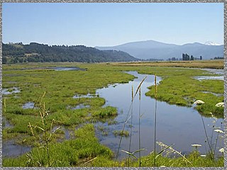
Located on the Columbia River, 10 miles (16 km) east of Vancouver, Washington, the 1,049-acre Steigerwald Lake National Wildlife Refuge consists of historic riverine flood plain habitat, semi-permanent wetlands, cottonwood-dominated riparian corridors, pastures, and remnant stands of Oregon white oak.
Whittlesey Creek National Wildlife Refuge is part of a large wetland complex on Lake Superior, near Ashland, Wisconsin. These coastal wetlands are a significant part of the wildlife habitat and aquatic resources of the south shore of Lake Superior.

J. Clark Salyer National Wildlife Refuge is located along the Souris River in Bottineau and McHenry Counties in north-central North Dakota. The refuge of 58,693 acres (237.5 km2) extends from the Manitoba border southward for approximately 45 miles (72 km) in an area which was once Glacial Lake Souris. The area is old lake bottom and has extremely flat topography and a high density of temporary wetlands.
Ardoch National Wildlife Refuge is a National Wildlife Refuge in Walsh County, North Dakota. It is managed under Devils Lake Wetland Management District.
Dakota Lake National Wildlife Refuge is a National Wildlife Refuge in North Dakota. It is managed under Kulm Wetland Management District.
Canfield Lake National Wildlife Refuge is a National Wildlife Refuge in Burleigh County, North Dakota. It is a privately owned property with refuge easement rights for flooding with 3 acres owned in fee, and is one of six easement refuges managed under Long Lake National Wildlife Refuge. It is closed to hunting.

The Windom Wetland Management District acquires and manages Waterfowl Production Areas, enforces wetland easements, and provides conservation assistance to landowners in 12 southwestern Minnesota counties. The landscape is dominated by intense, row-crop agriculture, which has led to the drainage of most wetlands and widespread water quality problems. Deteriorating drainage tile systems and the abundance of historic wetland basins provide unlimited opportunities for wetland restorations.