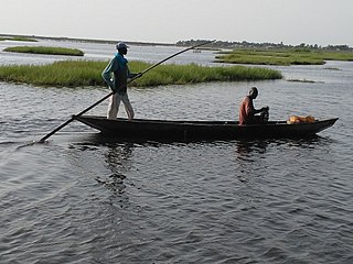
Athiémè is a town and arrondissement located in the Mono Department of Benin. The commune covers an area of 220 square kilometres and as of 2013 had a population of 56,483 people.
Comè is a town and arrondissement located in the Mono Department of Benin. The commune covers an area of 163 square kilometres and as of 2012 had a population of 33,507 people. It was home to a refugee camp for Togolese refugees until it was closed in 2006.
Tchaourou is a commune, arrondissement, and city located in the Borgou Department of Benin, a country in Western Africa, formerly known as Dahomey. It is the birthplace of former Beninese president Yayi Boni. It is 50 kilometres (31 mi) south of Parakou.
Toviklin is a town, arrondissement, and commune in the Kouffo Department of south-western Benin. The commune covers an area of 120 square kilometres and as of 2013 had a population of 88,611 people.

Bopa is a town, arrondissement, and commune in the Mono Department of south-western Benin.The commune covers an area of 365 square kilometres and as of 2002 had a population of 70,268 people.
Houéyogbé is a town, arrondissement, and commune in the Mono Department of south-western Benin. The commune covers an area of 290 square kilometres and as of 2002 had a population of 74,492 people.
Nodi is a town and arrondissement in the Atakora Department of northwestern Benin. It is an administrative division under the jurisdiction of the commune of Matéri. According to the population census conducted by the Institut National de la Statistique Benin on February 15, 2002, the arrondissement had a total population of 8,706.
Kinkinhoué is an arrondissement in the Kouffo department of Benin. It is an administrative division under the jurisdiction of the commune of Djakotomey. According to the population census conducted by the Institut National de la Statistique Benin on February 15, 2002, the arrondissement had a total population of 4,988.
Adoukandji is an arrondissement in the Kouffo department of Benin. It is an administrative division under the jurisdiction of the commune of Lalo. According to the population census conducted by the Institut National de la Statistique Benin on February 15, 2002, the arrondissement had a total population of 8,596.
Ahondjinnako is an arrondissement in the Kouffo department of Benin. It is an administrative division under the jurisdiction of the commune of Lalo. According to the population census conducted by the Institut National de la Statistique Benin on February 15, 2002, the arrondissement had a total population of 4,891.
Ahomadégbé is an arrondissement in the Kouffo department of Benin. It is an administrative division under the jurisdiction of the commune of Lalo. According to the population census conducted by the Institut National de la Statistique Benin on February 15, 2002, the arrondissement had a total population of 3,556.
Banigbé is an arrondissement in the Kouffo department of Benin. It is an administrative division under the jurisdiction of the commune of Lalo. According to the population census conducted by the Institut National de la Statistique Benin on February 15, 2002, the arrondissement had a total population of 5,027.
Gnizounmè is an arrondissement in the Kouffo department of Benin. It is an administrative division under the jurisdiction of the commune of Lalo. According to the population census conducted by the Institut National de la Statistique Benin on February 15, 2002, the arrondissement had a total population of 7,455.
Hlassamè is an arrondissement in the Kouffo department of Benin. It is an administrative division under the jurisdiction of the commune of Lalo. According to the population census conducted by the Institut National de la Statistique Benin on February 15, 2002, the arrondissement had a total population of 13,183.
Lokogba is an arrondissement in the Kouffo department of Benin. It is an administrative division under the jurisdiction of the commune of Lalo. According to the population census conducted by the Institut National de la Statistique Benin on February 15, 2002, the arrondissement had a total population of 12,492.
Tchito is an arrondissement in the Kouffo department of Benin. It is an administrative division under the jurisdiction of the commune of Lalo. According to the population census conducted by the Institut National de la Statistique Benin on February 15, 2002, the arrondissement had a total population of 3,888.
Tohou is an arrondissement in the Kouffo department of Benin. It is an administrative division under the jurisdiction of the commune of Lalo. According to the population census conducted by the Institut National de la Statistique Benin on February 15, 2002, the arrondissement had a total population of 5,572.
Zalli is an arrondissement in the Kouffo department of Benin. It is an administrative division under the jurisdiction of the commune of Lalo. According to the population census conducted by the Institut National de la Statistique Benin on February 15, 2002, the arrondissement had a total population of 4,987.
Doutou is an arrondissement in the Mono department of Benin. It is an administrative division under the jurisdiction of the commune of Houéyogbé. According to the population census conducted by the Institut National de la Statistique Benin on February 15, 2002, the arrondissement had a total population of 22,099.
Sahé is an arrondissement in the Zou department of Benin. It is an administrative division under the jurisdiction of the commune of Agbangnizoun. According to the population census conducted by the Institut National de la Statistique Benin on February 15, 2002, the arrondissement had a total population of 5,730.


