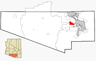
Tucson Estates is a census-designated place (CDP) in Pima County, Arizona, United States. The population was 9,755 at the 2000 census.

Delleker is a census-designated place (CDP) in Plumas County, California, USA. The population was 705 at the 2010 census, up from 674 at the 2000 census.

Lakeview is a census-designated place (CDP) in Riverside County, California, United States. The population was 2,104 at the 2010 census, up from 1,619 at the 2000 census. The community is named for nearby Mystic Lake.

Santa Ynez is a census-designated place (CDP) in the Santa Ynez Valley of Santa Barbara County, California.

Stanford is a census-designated place (CDP) in the northwest corner of Santa Clara County, California, United States. It is the home of Stanford University. The population was 21,150 at the 2020 census.

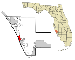
Bee Ridge is a census-designated place (CDP) in Sarasota County, Florida, United States. The population was 9,955 at the 2020 census. It is part of the Sarasota metropolitan area.

Desoto Lakes is a census-designated place (CDP) in Sarasota County, Florida, United States. The population was 3,646 at the 2010 US Census. It is part of the Bradenton–Sarasota–Venice Metropolitan Statistical Area.

Fruitville is a census-designated place (CDP) in Sarasota County, Florida, United States. The population was 15,484 at the 2020 census. It is part of the North Port–Sarasota–Bradenton Metropolitan Statistical Area.

Lake Sarasota is a census-designated place (CDP) in Sarasota County, Florida, United States. The population was 4,679 at the 2010 census. It is part of the North Port–Sarasota–Bradenton Metropolitan Statistical Area.

Nokomis is an unincorporated town in Sarasota County and a census-designated place (CDP) along the Gulf Coast of Florida, United States, located south of Osprey and just north of Venice. The town has access to the coast through Nokomis Public Beach and Casey Key. The town's population was 3,167 at the 2010 census. It is part of the Bradenton–Sarasota–Venice Metropolitan Statistical Area.

North Sarasota is a census-designated place (CDP) in Sarasota County, Florida, United States. The population was 6,982 at the 2010 census. It is part of the Bradenton–Sarasota–Venice Metropolitan Statistical Area.

Sarasota Springs is a census-designated place (CDP) in Sarasota County, Florida, United States. The population was 14,395 at the 2010 census. It is part of the Bradenton–Sarasota–Venice Metropolitan Statistical Area.

South Gate Ridge is a census-designated place (CDP) in Sarasota County, Florida, United States. The population was 5,688 at the 2010 census. It is part of the Bradenton–Sarasota–Venice Metropolitan Statistical Area.

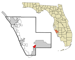
South Sarasota is a census-designated place (CDP) in Sarasota County, Florida, United States. The population was 4,950 at the 2010 census. It is part of the Bradenton–Sarasota–Venice Metropolitan Statistical Area.

Southgate is a census-designated place (CDP) in Sarasota County, Florida, United States. The population was 7,173 at the 2010 census. It is part of the Bradenton–Sarasota–Venice Metropolitan Statistical Area.

The Meadows is a census-designated place (CDP) in Sarasota County, Florida, United States. The population was 3,994 at the 2010 census. The CDP is part of the Bradenton–Sarasota–Venice Metropolitan Statistical Area.
Warm Mineral Springs is a census-designated place (CDP) in Sarasota County, Florida, United States. The population was 5,061 at the 2010 census. It is part of the Bradenton–Sarasota–Venice Metropolitan Statistical Area.
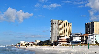
Miramar Beach is a census-designated place (CDP) in Walton County, Florida, United States. The population was 6,146 at the 2010 census. Although many other coastal localities in Florida have appended "Beach" to their names to distinguish themselves from an adjacent inland or cross-bay municipality – such as Miami Beach, St. Pete Beach, Fort Myers Beach, Panama City Beach, Melbourne Beach, Cocoa Beach, and Jacksonville Beach – the city of Miramar, Florida is actually over 450 miles (720 km) away in South Florida. Miramar Beach is due east of Destin, Florida. It is often considered to be part of the city of Destin. However, it has its own ZIP code (32550) and is in Walton County, whereas Destin is in Okaloosa County.

West Laurel is an unincorporated area and census-designated place (CDP) in Prince George's County, Maryland, United States. Per the 2020 census, the population was 4,428.
Lakewood Ranch is a planned community and census-designated place in southeastern Manatee County and northeastern Sarasota County, Florida, United States, consisting of approximately 31,000 acres (13,000 ha). It is part of the North Port-Bradenton-Sarasota, Florida Metropolitan Statistical Area.