The Rhine is one of the major European rivers. The river begins in the Swiss canton of Graubünden in the southeastern Swiss Alps. It forms part of the Swiss-Liechtenstein, Swiss-Austrian, Swiss-German borders. After that the Rhine defines much of the Franco-German border, after which it flows in a mostly northerly direction through the German Rhineland. Finally in Germany the Rhine turns into a predominantly westerly direction and flows into the Netherlands where it eventually empties into the North Sea.

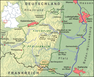
The Palatinate is a historical region of Germany (Deutschland). In the Middle Ages it was known as the Rhenish Palatinate (Rheinpfalz) and Lower Palatinate (Unterpfalz), which strictly speaking designated only the western part of the Electorate of the Palatinate, as opposed to the Upper Palatinate (Oberpfalz). It occupies roughly the southernmost quarter of the German federal state of Rhineland-Palatinate (Rheinland-Pfalz), covering an area of 2,105 square miles (5,450 km2) with about 1.4 million inhabitants. Its residents are known as Palatines (Pfälzers).
The Rhineland is a loosely defined area of Western Germany along the Rhine, chiefly its middle section.

Bas-Rhin is a department in Alsace which is a part of the Grand Est super-region of France. The name means 'Lower Rhine', referring to its lower altitude among the two French Rhine departments: it is downstream of the Haut-Rhin department. Note that both belong to the European Upper Rhine region. It is, with the Haut-Rhin, one of the two departments of the traditional Alsace region which until 1871, also included the area now known as the Territoire de Belfort. The more populous and densely populated of the pair, it had 1,140,057 inhabitants in 2019. The prefecture is based in Strasbourg. The INSEE and Post Code is 67.

The Upper Rhine is the section of the Rhine in the Upper Rhine Plain between Basel in Switzerland and Bingen in Germany. The river is marked by Rhine-kilometres 170 to 529.

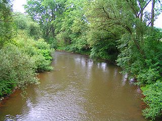
The Lahn is a 245.6-kilometre-long (152.6 mi), right tributary of the Rhine in Germany. Its course passes through the federal states of North Rhine-Westphalia (23.0 km), Hesse (165.6 km), and Rhineland-Palatinate (57.0 km).
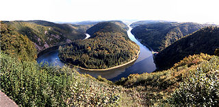
The Saar is a river in northeastern France and western Germany, and a right tributary of the Moselle. It rises in the Vosges mountains on the border of Alsace and Lorraine and flows northwards into the Moselle near Trier. It has two headstreams, that both start near Mont Donon, the highest peak of the northern Vosges. After 246 kilometres (153 mi) the Saar flows into the Moselle at Konz (Rhineland-Palatinate) between Trier and the Luxembourg border. It has a catchment area of 7,431 square kilometres (2,869 sq mi).
The Kyll, noted by the Roman poet Ausonius as Celbis, is a 128-kilometre-long (80 mi) river in western Germany, left tributary of the Moselle. It rises in the Eifel mountains, near the border with Belgium and flows generally south through the towns Stadtkyll, Gerolstein, Kyllburg and east of Bitburg. It flows into the Moselle in Ehrang, a suburb of Trier.
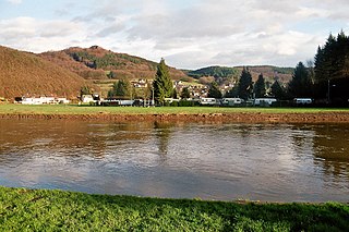
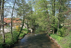
The Wied is a river in Rhineland-Palatinate, Germany, and a right tributary of the Rhine.
The Sauer is a river in France (Alsace) and Germany (Rhineland-Palatinate). A left tributary of the river Rhine, its total length is about 85 kilometres (53 mi), of which 64 km (40 mi) in France. Its upper course, in Germany, is called Saarbach. Its source is in the Palatinate forest, near the French border, south of Pirmasens. It flows into France near Schœnau, and continues through Wœrth and north of Haguenau. It flows into the Rhine in Seltz, opposite the mouth of the Murg.

The Glan is a river in southwestern Germany, right tributary of the Nahe. It is approximately 68 km long. It rises in the Saarland, northwest of Homburg. It flows generally north, through Rhineland-Palatinate, and empties into the Nahe near Odernheim am Glan, at Staudernheim, across the Nahe from Bad Sobernheim. Other towns along the Glan are Altenglan, Glan-Münchweiler, Lauterecken and Meisenheim.

Heinzenhausen on the Lauter is an Ortsgemeinde – a municipality belonging to a Verbandsgemeinde, a kind of collective municipality – in the Kusel district in Rhineland-Palatinate, Germany. It belongs to the Verbandsgemeinde of Lauterecken-Wolfstein.

The Queich is a tributary of the Rhine, which rises in the southern part of the Palatinate Forest, and flows through the Upper Rhine valley to its confluence with the Rhine in Germersheim. It is 52 kilometres (32 mi) long and is one of the four major drainage systems of the Palatinate Forest along with the Speyerbach, Lauter and Schwarzbach. The Queich flows through the towns Hauenstein, Annweiler am Trifels, Siebeldingen, Landau, Offenbach an der Queich and Germersheim.
The term 'Mundat Forest' refers to two forests that overlie the modern border between Germany and France near Wissembourg, Alsace. The Upper Mundat Forest is a small part of the mountainous Palatinate Forest. The smaller Lower Mundat Forest forms a fraction of the Bienwald in the Upper Rhine valley.

The Palatine Watershed forms the main drainage divide in the Palatinate between the Upper Rhine and the Middle Rhine, the two successive sections of the river Rhine that flow through the German state of Rhineland-Palatinate.

The Otterbach is a stream, 42 kilometres long, in South Palatinate in the German state of Rhineland-Palatinate, that flows eastwards and northeastwards towards the Upper Rhine.

The Salzbach, which is initially called the Kröppenbach and then the Buchbach, is with a length of around 17 kilometres (11 mi) the longest tributary of the Lauter, which here in its upper reaches is known as the Wieslauter. It flows through the northwestern Wasgau, a hill range which comprises the southern part of the Palatinate Forest in the German state of Rhineland-Palatinate and the northern part of the Vosges in the French departments of Bas-Rhin and Moselle.

The Mehrbach is a river, 23-kilometre-long (14 mi) long, and a tributary of the Wied. Its GKZ is 27164, its catchment has an area of 65.868 km2 (25.432 sq mi).