![]() | Look up Leeward Islands in Wiktionary, the free dictionary. |
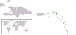
Leeward Islands is the northern islands of the Lesser Antilles.
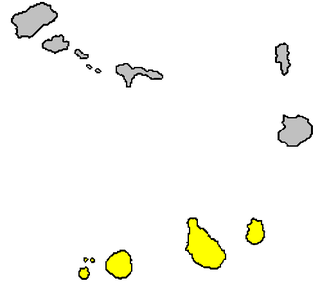
The Leeward Islands are a group of islands geographically situated where the northeastern Caribbean Sea meets the western Atlantic Ocean. Starting with the Virgin Islands east of Puerto Rico, they extend southeast to Guadeloupe and its dependencies. In English, the term Leeward Islands refers to the northern islands of the Lesser Antilles chain. The more southerly part of this chain, geographically starts with Martinique and is called the Windward Islands. The island of Dominica is geographically and historically part of the Leeward Islands, however for political reasons in 1940 the management of the island was transferred from the British Leeward Islands to the British Windward Islands.
Leeward Islands may also refer to:
The Leeward Islands are the western part of the Society Islands in French Polynesia, an overseas collectivity of France in the South Pacific. They lie south of the Line Islands, east of the Cooks and north of the Austral Islands. Their area is 395 km² with a population of over 33,000. The islands to the west comprise a three atoll group: Manuae, Motu One atoll, lying most northerly of the Leeward Islands, and to the southeast Maupihaa atoll. More to the east lies a mainly high island cluster consisting of Maupiti, Tupai atoll, Bora Bora, the most known of the Leeward Islands in the western world due to its World War II United States naval base and subsequent tourism industry, Taha'a, lying just north of the largest island of the group, Raiatea which possesses the largest city and local capital of the Leeward Islands, namely Uturoa, as well as the highest elevation, the just over 1,000 m mount Tefatua, and finally the easternmost island of the group, Huahine which at high tide is divided into two: Huahine Nui to the north and Huahine Iti to the south.
The Sotavento Islands is the southern island group of the Cape Verde archipelago. There are four main islands. The western three islands, Brava, Fogo and Santiago, are rocky and volcanic agricultural islands, with the longest histories of human habitation. The fourth and easternmost island Maio is a flat desert island whose economy was primarily based on salt, giving it more in common with the Barlavento islands Sal and Boa Vista. The Ilhéus do Rombo are barren islets north of Brava. The total area of the Sotavento Islands is 1,803 km2 (696 sq mi).
The Northwestern Hawaiian Islands or Leeward Islands are the small islands and atolls in the Hawaiian island chain located northwest of the islands of Kauai and Niihau. Politically, they are all part of Honolulu County in the U.S. state of Hawaii, except Midway Atoll, which is a territory distinct from Hawaii and grouped as one of the United States Minor Outlying Islands. The United States Census Bureau defines this area, except Midway, as Census Tract 114.98 of Honolulu County. Its total land area is 3.1075 square miles (8.048 km2). All the islands except Nihoa are north of the Tropic of Cancer, making them the only islands in Hawaii that lie outside the tropics.
The Leeward Antilles are a chain of islands in the Caribbean – specifically, the southerly islands of the Lesser Antilles along the southeastern fringe of the Caribbean Sea, just north of the Venezuelan coast of the South American mainland. The Leeward Antilles, while among the Lesser Antilles, are not to be confused with the Leeward Islands to the northeast.
Leeward is the opposite of Windward
![]() | disambiguation page lists articles about distinct geographical locations with the same name. If an internal link led you here, you may wish to change the link to point directly to the intended article. | This
The Netherlands Antilles was a constituent country of the Kingdom of the Netherlands. The country consisted of several island territories located in the Caribbean Sea. The islands were also informally known as the Dutch Antilles. The country came into being in 1954 as the autonomous successor of the Dutch colony of Curaçao and Dependencies, and was dissolved in 2010. The former Dutch colony of Surinam, although it was relatively close by on the continent of South America, did not become part of the Netherlands Antilles but became a separate autonomous country in 1954. All the island territories that belonged to the Netherlands Antilles remain part of the kingdom today, although the legal status of each differs. As a group they are still commonly called the Dutch Caribbean, regardless of their legal status.
The Virgin Islands are an archipelago in the Caribbean Sea. They are geologically and biogeographically the easternmost part of the Greater Antilles, the northern islands belonging to the Puerto Rican trench and St. Croix being a displaced part of the same geologic structure. Politically, the British Virgin Islands have been governed as the western island group of the Leeward Islands, which are the northern part of the Lesser Antilles, and form the border between the Caribbean Sea and the Atlantic Ocean. The archipelago is separated from the true Lesser Antilles by the Anegada Passage and from the main island of Puerto Rico by the Virgin Passage.
The Lesser Antilles is a group of islands in the Caribbean Sea. Most form a long, partly volcanic island arc between the Greater Antilles to the north-west and the continent of South America. The islands form the eastern boundary of the Caribbean Sea with the Atlantic Ocean. Together, the Lesser Antilles and the Greater Antilles compose the Antilles. When combined with the Lucayan Archipelago, all three are known as the West Indies.
The Antilles (; is an archipelago bordered by the Caribbean Sea to the south and west, the Gulf of Mexico to the northwest, and the Atlantic Ocean to the north and east.
Windward is the direction upwind from the point of reference, alternatively the direction from which the wind is coming. Leeward is the direction downwind from the point of reference. The leeward region of mountains generally remains dry as compared to the windward. The side of a ship that is towards the leeward is its lee side. If the vessel is heeling under the pressure of the wind, this will be the "lower side". During the age of sail, the term weather was used as a synonym for windward in some contexts, as in the weather gage.
The Windward Islands, also known as the Islands of Barlovento, are the southern, generally larger islands of the Lesser Antilles, within the West Indies. They lie south of the Leeward Islands, approximately between latitudes 10° and 16° N and longitudes 60° and 62° W. The name was also used to refer to a British colony in these islands, existing between 1833 and 1960 and consisting of the islands of: Saint Lucia, Saint Vincent, the Grenadines, Grenada, Barbados, Tobago, The island of Dominica was traditionally a part of the Leeward Islands until 1940, when it was transferred from the Leeward Islands colony to the Windward Islands.)
The West Indies is a region of the North Atlantic Ocean and the Caribbean that includes the island countries and surrounding waters of three major archipelagos: the Greater Antilles, the Lesser Antilles, and the Lucayan Archipelago.
The territory of Cape Verde is divided into 22 concelhos (municipalities), and subdivided into 32 freguesias.
The Caribbean bioregion is a biogeographic region that includes the islands of the Caribbean Sea and nearby Atlantic islands, which share a fauna, flora and mycobiota distinct from surrounding bioregions.
The Caribbean is a region of the Americas that consists of the Caribbean Sea, its islands and the surrounding coasts. The region is southeast of the Gulf of Mexico and the North American mainland, east of Central America, and north of South America.
The Battle of St. Kitts or St. Cristopher was a successful Spanish expedition that seized the islands of Saint Kitts and Nevis from the English and French during the Anglo-Spanish War (1625–30).
The Dutch Caribbean are the territories, colonies, and countries, both former and current, of the Dutch Empire and the Kingdom of the Netherlands that are located in the Lesser Antilles archipelago of the Caribbean Sea.
Anguillian cuisine is the cuisine of Anguilla, a British overseas territory in the Caribbean, one of the most northerly of the Leeward Islands in the Lesser Antilles. The cuisine is influenced by native Caribbean, African, Spanish, French and English cuisines.