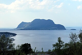
Tysnes is a municipality in Hordaland county, Norway. It is located in the traditional district of Sunnhordland. The administrative centre is the village of Uggdal. Other population centres in Tysnes include the villages of Våge and Onarheim. The island municipality is located in a group of islands near the mouth of the Hardangerfjorden. The majority of the municipal population lives on the island of Tysnesøya, the largest island in the municipality.

Giske is an island municipality in Møre og Romsdal county, Norway. The municipality lies north-northwest of the town of Ålesund in the traditional district of Sunnmøre. The municipal centre is Valderhaugstrand. Other population centres include the villages of Roald and Alnes and Leitebakk. The municipality is part of the Ålesund Region.

Vatne is a village and former municipality in Haram Municipality in Møre og Romsdal county, Norway. The village of Vatne is located at the southern end of the Vatnefjorden in the eastern part of Haram Municipality. The 1.64-square-kilometre (0.63 sq mi) village has a population (2013) of 1,876 which gives it a population density of 1,144 inhabitants per square kilometre (2,960/sq mi). Other villages in the Vatne area include Eidsvik and Tennfjord to the south of the village of Vatne and Helle to the north of it.

Roald is a village in Giske Municipality in Møre og Romsdal county, Norway. The village is located on the northern part of the island Vigra. Roald is about 20 kilometres (12 mi) north of the city centre of Ålesund, connected via two undersea tunnels which opened in 1987. Ålesund Airport, Vigra is 2 kilometres (1.2 mi) south of the village of Roald. Vigra Church is located a short distance south of Roald.

Alnes is a small village in Giske Municipality in Møre og Romsdal county, Norway. It is located on the (isolated) north side of the island of Godøya, about 4 kilometres (2.5 mi) northwest of the village of Leitebakk. The rest of the island's population is located on the southern half of the island, separated from Alnes by a large mountain. Alnes is accessible through a tunnel through the mountainous center part of the island.
Hoffland or Hovland is a village in Ålesund Municipality in Møre og Romsdal county, Norway. The village is located on the western end of the island of Ellingsøya, about 3 kilometres (1.9 mi) northeast of the town of Ålesund and about 5 kilometres (3.1 mi) west of the village of Myklebost.

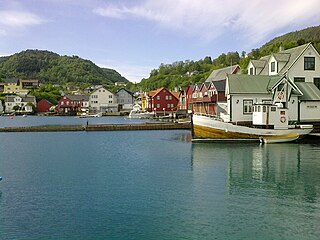
Byrknes is a fishing village in the municipality of Gulen in Sogn og Fjordane county, Norway. It is located on the western shore of the island of Byrknesøyna. It is about 16 kilometres (9.9 mi) southwest of the municipal center of Eivindvik, about 17 kilometres (11 mi) west of the village of Dalsøyra, and about 14 kilometres (8.7 mi) northwest of the Mongstad industrial area in neighboring Lindås and Austrheim municipalities to the south. The Sognesjøen strait is located to the northwest of the village.

Raudeberg is a village in Vågsøy Municipality in Sogn og Fjordane county, Norway. It is located on the east side of the island of Vågsøy. The villages of Refvika, Vedvika, and Langeneset are located a few kilometers to the north, and the town of Måløy is about 6 kilometres (3.7 mi) to the south. The island of Silda is located about 2 kilometres (1.2 mi) northeast of the village of Raudeberg. Nord-Vågsøy Church is located on the eastern edge of the village, right along the coast.
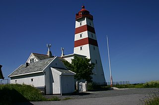
Alnes lighthouse was established in 1852 to guide fishing boats safely to the harbor of the small fishing community of Alnes on Godøy island on the west coast of Norway. It is located on the north side of Godøy island in the municipality of Giske in Møre og Romsdal county, about 4 kilometres (2.5 mi) northwest of Leitebakk.

Vågsvåg is a village in Vågsøy Municipality in Sogn og Fjordane county, Norway. It is located on the southern shore of the island of Vågsøy along the Vågsfjorden, a part of the main Nordfjorden. The village looks across the fjord towards the island of Husevågøy.
Remøya is an island in the municipality of Herøy in Møre og Romsdal county, Norway. The island is located north of the municipal center of Fosnavåg. The island is connected to other islands via a network of bridges. The Remøy Bridge connects it to the island Leinøya and the Runde Bridge connects it to Runde. The highest point on the island is Vardan which is 191 metres (627 ft) above sea level. The island has an area of 3.6 square kilometres (1.4 sq mi).

Nordstrand is a little village area in Giske Municipality in Møre og Romsdal county, Norway. The village is located on the east side of the island of Valderøya. The administrative center of Giske Municipality is Valderhaugstrand, an area on the south side of the island that is part of the Nordstrand urban area. The 2.7-square-kilometre (670-acre) island has a population (2013) of 3,700; giving the island a population density of 1,370 inhabitants per square kilometre (3,500/sq mi).

Rensvik is a village in Kristiansund Municipality in Møre og Romsdal county, Norway. The village is located on the northern part of the island of Frei, just west of the Omsund Bridge which connects to the island of Nordlandet to the north. The 1.65-square-kilometre (410-acre) village has a population (2013) of 2,501; which gives the village a population density of 1,516 inhabitants per square kilometre (3,930/sq mi).
Giske is an island in Giske Municipality in Møre og Romsdal county, Norway. It covers an area of 2.67 square kilometers (1.03 sq mi) and had 717 residents in 2010. It is flat, with the highest point 23 meters (75 ft) above mean sea level. The island is connected by the Giske Bridge to the neighbouring island of Valderøya to the east and by the Godøy Tunnel to the island of Godøy to the south-west. Giske Church, dating back to the year 1180, sits on the southern coast of the island.
Årset is a village in Ålesund Municipality in Møre og Romsdal county, Norway. The village is located along the Ellingsøyfjorden on the southern shore of the island of Ellingsøya, about 4 kilometres (2.5 mi) east of the village of Myklebost and about 12 kilometres (7.5 mi) west of the village of Tennfjord in Haram Municipality.

Vigra is an island in Giske Municipality in Møre og Romsdal county, Norway. The 20-square-kilometre (7.7 sq mi) island is located north of the islands of Valderøya and Giske, west of the mainland of Haram Municipality, and southwest of the island of Lepsøya. Vigra has a road connection to the mainland via the Vigra Fixed Link, a series of tunnels and bridges that connect all the islands of Giske Municipality to the city of Ålesund to the south. The island was formerly part of Vigra Municipality.

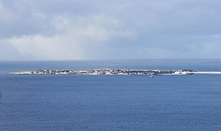
Selje is the administrative centre of Selje Municipality in Sogn og Fjordane county, Norway. The village is located at the southwestern base of the Stadlandet peninsula at the entrance to the Moldefjorden. The village lies about 17 kilometres (11 mi) northeast of the town of Måløy and about 65 kilometres (40 mi) southwest of the town of Ålesund. The small island of Selja lies just off the coast of the village. The 0.65-square-kilometre (160-acre) village has a population (2013) of 651, giving the village a population density of 1,002 inhabitants per square kilometre (2,600/sq mi). Selje Church is located in the village.

Sæbøvik is a village in Kvinnherad municipality in Hordaland county, Norway. The village is located on the narrow, western part of the island of Halsnøya, about 6 kilometres (3.7 mi) west of the village of Høylandsbygd and immediately east of the village of Eidsvik. The village is located at the southern end of the Halsnøy Tunnel.

Sunde is a village in Kvinnherad municipality in Hordaland county, Norway. The village is located along the Hardangerfjorden, just north of the island of Halsnøya. The northern entrance to the Halsnøy Tunnel is located in Sunde. The large urban village of Husnes lies just to the north of Sunde, on the other end of the lake Onarheimsvatnet.