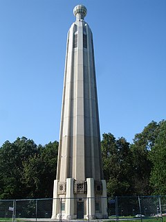
Lincoln Park is an urban park in Chicago, which gave its name to the Lincoln Park, Chicago community area.

Newark is the most populous city in the U.S. state of New Jersey and the seat of Essex County. As one of the nation's major air, shipping, and rail hubs, the city had a population of 285,154 in 2017, making it the nation's 70th-most populous municipality, after being ranked 63rd in the nation in 2000.

Route 27 is a state highway in New Jersey, United States. It runs 38.53 mi (62.01 km) from U.S. Route 206 in Princeton, Mercer County northeast to an interchange with Route 21 and Broad Street in Newark, Essex County. The route passes through many communities along the way, including New Brunswick, Metuchen, Rahway, and Elizabeth. Route 27 is a two- to four-lane undivided highway for most of its length, passing through a variety of urban and suburban environments. It intersects many roads along the way, including Route 18 in New Brunswick, Interstate 287 in Edison, the Garden State Parkway in Woodbridge Township, Route 35 in Rahway, Route 28 in Elizabeth, and U.S. Route 22 in Newark. Route 27 crosses the Raritan River on the Albany Street Bridge, which connects Highland Park on the east with New Brunswick on the west.
Edison is a township in Middlesex County, New Jersey, United States, in the New York City metropolitan area. Situated in north-central New Jersey, Edison lies within the core of the Raritan Valley region. As of the 2010 United States Census, Edison had a total population of 99,967, retaining its position as the fifth-most populous municipality in New Jersey. The 2010 population reflected an increase of 2,280 (+2.3%) from the 97,687 counted in the 2000 Census, which had in turn increased by 9,007 (+10.2%) from the 88,680 counted in 1990. Edison's population has been above the 100,000 threshold since 2010, increasing by 2.5% to a Census-estimated 102,450 in 2017.
Route 25 was a major state highway in New Jersey, United States prior to the 1953 renumbering, running from the Benjamin Franklin Bridge in Camden to the Holland Tunnel in Jersey City. The number was retired in the renumbering, as the whole road was followed by various U.S. Routes: US 30 coming off the bridge in Camden, US 130 from the Camden area north to near New Brunswick, US 1 to Tonnele Circle in Jersey City, and US 1 Business to the Holland Tunnel.

Downtown Newark is the Central Business District of Newark in Essex County, New Jersey, United States.

Edison is an NJ Transit station located 30.3 miles (48.8 km) southwest of New York City on the Northeast Corridor Line, in Edison, New Jersey. It is at the corner of Central and Plainfield Avenues in the Stelton neighborhood of Edison which is located in the southwestern corner of the Township, and accessible by car via Reed Street. A small privately run convenience store operates in the waiting room of the north/New York City-bound platform. Passengers use a ticket machine as there is no station agent or station office. Elevators and ramps make both the north- and south-bound platforms wheelchair accessible. With the growing population of Edison, ridership has increased over the last 10–15 years, resulting in a shortage of parking spaces on weekdays and heavy traffic during rush hours.
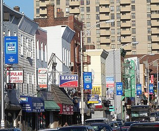
India Square, also known as "Little India," is a commercial and restaurant district in the Marion Section of Jersey City, New Jersey. The area is home to the highest concentration of Asian Indians in the Western Hemisphere, and is a rapidly growing Indian American ethnic enclave within the New York Metropolitan Area. The neighborhood is centered on Newark Avenue, between Tonnele Avenue and JFK Boulevard, and is considered to be part of the larger Journal Square District. This area has been home to the largest outdoor Navratri festivities in New Jersey as well as several Hindu temples. This portion of Newark Avenue is lined with groceries including Patel Brothers and Subzi Mandi Cash & Carry, electronics vendors, video stores, clothing stores, and restaurants and is one of the busier pedestrian areas of this part of the city, often stopping traffic for hours. According to the 2000 census, there were nearly 13,000 Indians living in this two-block stretch in Jersey City, up from 3,000 in 1980, increasing commensurately between 2000 and 2010. As of the 2010 Census, over 27,000 Asian Indians accounted for 10.9% of Jersey City's population, the highest proportion of any major U.S. city.

Lincoln Park is a city square and neighborhood, also known as "the Coast," in Newark, Essex County, New Jersey, United States. It is bounded by the Springfield/Belmont, South Broad Valley, South Ironbound and Downtown neighborhoods. It is bounded by Martin Luther King Jr. Blvd. to the west, West Kinney St. to the north, the McCarter Highway to the east and South St., Pennsylvania Avenue, Lincoln Park and Clinton Avenue to the south. Part of the neighborhood is a historic district listed on the New Jersey Register of Historic Places and the National Register of Historic Places. Lincoln Park as a street turns into Clinton Avenue toward the south and north edge of the park.
The Newark Plank Road was a major artery between Hudson Waterfront at Paulus Hook and city of Newark further inland across the New Jersey Meadows. As its name suggests, a plank road was constructed of wooden planks laid side-to-side on a roadbed. Similar roads, the Bergen Point Plank Road, the Hackensack Plank Road and Paterson Plank Road, travelled to the locales for which they are named. The name is no longer used, the route having been absorbed into other streets and freeways.
U.S. Route 1 is a United States highway which parallels the East Coast of the United States, running from Key West, Florida in the south to Fort Kent, Maine at the Canadian border in the north. Of the entire length of the route, 66.06 miles (106.31 km) of it runs through New Jersey. It enters the state from Pennsylvania on the Trenton–Morrisville Toll Bridge over the Delaware River in the state capital of Trenton, running through the city on the Trenton Freeway. From here, US 1 continues northeast as a surface divided highway through suburban areas continuing into Middlesex County and passing through New Brunswick and Edison. US 1 merges with US 9 in Woodbridge, and the two routes continue through northern New Jersey as US 1/9 to the George Washington Bridge over the Hudson River in Fort Lee. At this point, the road continues into New York City along with I-95.

The Gateway Region is the primary urbanized area of the northeastern section of New Jersey, United States. It is anchored by Newark, the state's most populous city, and is often also known as the Newark metropolitan area.

Military Park station is an underground station on the Newark City Subway Line of the Newark Light Rail. The station is owned and service is operated by New Jersey Transit. The station is located at the intersection of Raymond Boulevard, Park Place and Broad Street in Downtown Newark at Military Park. The station was opened in 1935 and called Broad Street Station. It was renamed so only one station in the system would carry the name Broad Street when Downtown Newark's stations were connected by the Newark Light Rail Line. The station is decorated with beige tiles and colored tiles for borders, mosaics and street indicator signs. This station is not wheelchair accessible, but the adjacent stations, Penn Station and Washington Street, are.
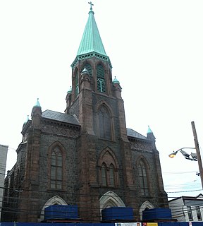
The Village is a neighborhood in the western section of Historic Downtown in Jersey City. It is bordered by Hamilton Park and Harsimus Cove to the east and the Turnpike Extension to the west, on the other side of which Jones Park and Mary Benson Park are located. Newark Avenue is the major street across the Village from Grove Street at the east to Bergen Hill at the west. The neighborhood for many years was considered the city's "Little Italy" neighborhood. Brunswick Street, between 1st and 10th Streets was once full of merchants and nicknamed "Bushel Avenue". St. Anthony of Padua Roman Catholic Church at 457 Monmouth St. received its historic designation on March 22, 2004.

Mulberry Commons, originally called Triangle Park, is a planned public park in Newark, New Jersey. It was first proposed in 2005 to be the centerpiece of 22 acres (8.9 ha) of the city's Downtown surrounded by Gateway Center, Newark Penn Station, Government Center and Prudential Center, a 19,000 seat arena which opened in 2007. The city had acquired deed to the park land in conjunction with the construction of the arena, but the project had not been further developed.


