This is list of Alpine lakes in India.
This is list of Alpine lakes in India.


Lake Mansarovar, also called Mapam Yumtso locally, is a high altitude freshwater lake fed by the Kailash Glaciers near Mount Kailash in Burang County, Ngari Prefecture, Tibet Autonomous Region, China. The lake along with Mount Kailash to its north are sacred sites in four religions: Hinduism, Jainism, Buddhism and Bön.

Lake Rakshastal is a saltwater lake in Tibet Autonomous Region, China, lying just west of Lake Manasarovar and south of Mount Kailash. The Sutlej River originates at Rakshastal's northwestern tip.
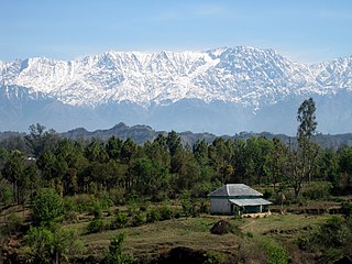
Dhauladhar is a mountain range which is part of a lesser Himalayan chain of mountains. It rises from the Shivalik hills, to the north of Kangra and Mandi. Dharamsala, the headquarters of Kangra district and the winter capital of Himachal Pradesh, lies on its southern spur in the Kangra Valley. Chamba lies to the North of this range.
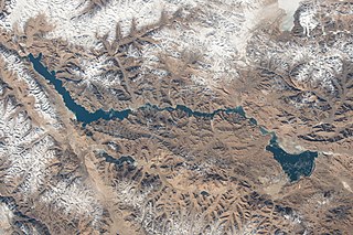
Pangong Tso or Pangong Lake is an endorheic lake spanning eastern Ladakh and West Tibet situated at an elevation of 4,225 m (13,862 ft). It is 134 km (83 mi) long and divided into five sublakes, called Pangong Tso, Tso Nyak, Rum Tso and Nyak Tso. Approximately 50% of the length of the overall lake lies within Tibet in China, 40% in Ladakh, India and the remaining 10% is disputed and is a de facto buffer zone between India and China. The lake is 5 km (3.1 mi) wide at its broadest point. All together it covers almost 700 km2. During winter the lake freezes completely, despite being saline water. It has a land-locked basin separated from the Indus River basin by a small elevated ridge, but is believed to have been part of the latter in prehistoric times.
Yamdrok Lake is a freshwater lake in Tibet, it is one of the three largest lakes in Tibet. It is over 72 km (45 mi) long. The lake is surrounded by many snow-capped mountains and is fed by numerous small streams. The lake has an outlet stream at its far western end and means turquoise in English due to its color.

Tso Moriri or Lake Moriri or "Mountain Lake", is a lake in the Changthang Plateau of Ladakh in India. The lake and surrounding area are protected as the Tso Moriri Wetland Conservation Reserve.

Tso Chigma or Chandra Taal, or Chandra Tal is a lake in the Spiti part of the Lahul and Spiti district of Himachal Pradesh, India. Chandra Taal is near the source of the Chandra River. Despite the rugged and inhospitable surroundings, it is in a protected niche with some flowers and wildlife in summer. It is a favourite spot for tourists and high-altitude trekkers. It is usually associated with Spiti, although geographically it is separated from Spiti. Kunzum La separates Lahaul and Spiti valleys.
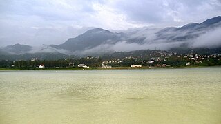
Gobind Sagar Lake is a reservoir situated in Una and Bilaspur districts of Himachal Pradesh, India. It is formed by the Bhakra Dam.

Manimahesh Lake is a high altitude lake situated close to the Manimahesh Kailash Peak in the Pir Panjal Range of the Himalayas, in the Bharmour subdivision of Chamba district of the Indian state of Himachal Pradesh. The religious significance of this lake is next to that of the Lake Manasarovar in Tibet.
Jore Pokhri Wildlife Sanctuary is situated in Darjeeling District, West Bengal. It is the habitat of some high-altitude animals like Himalayan Salamander, locally known as 'Gora'. Many animals and birds are found there. Jore Pokhari is a small village on a hilltop which is almost 20 kilometers away from Darjeeling town. The main feature of Jore Pokhri is the twin lakes after which the place is named. Jore means two in Nepali and Pokhri means Lake. The boundary of one lake is surrounded with seating arrangements for visitors, and there is a huge model of snake in the middle of the lake.
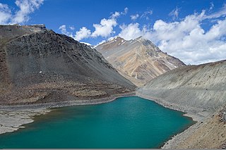
Suraj Tal, also called Tso Kamtsi or Surya Tal, is an 800 m (2,600 ft) long lake that lies just below the 4,890 m (16,040 ft) high Bara-lacha-la pass in Lahaul and Spiti district of the Indian state of Himachal Pradesh. It is the third-highest lake in India and the 21st-highest in the world. Suraj Tal Lake is just below the source of the Bhaga River that joins the Chandra River downstream at Tandi to form the Chandrabhaga River in Himachal Pradesh. The Chandrabhaga River is known as the Chenab as it enters the Jammu region of Jammu and Kashmir. The other major tributary of the Chandrabhaga, the Chandra, originates and flows south-east of the Bara-lacha La.

The Manimahesh Kailash Peak, 5,653 metres (18,547 ft), also known as Chamba Kailash, which stands towering high over the Manimahesh Lake, is believed to be the abode of Lord Shiva, the Hindu deity. It is located in the Bharmour subdivision of the Chamba district in the Indian state of Himachal Pradesh. The peak is 26 kilometres (16 mi) from Bharmour in the Budhil valley. It is one of the major pilgrimage sites as well as a popular trekking destination in Himachal Pradesh. The Manimahesh Lake is at the base of the Kailash peak at 3,950 metres (12,960 ft) and is also held in deep veneration by people of Himachal Pradesh, particularly the Gaddi tribe of the region. In the month of Bhadon, on the eighth day of the new moon period a fair is held in the precincts of the lake that attracts thousands of pilgrims.

Kotra Tso, or Guozha Lake , previously called Lake Lighten, is a glacial lake in Rutog County in the Ngari Prefecture in the northwest of the Tibet Autonomous Region of China. It lies in the western Kunlun Mountains to the northwest of Bangda Lake, not far from the regional border with Xinjiang. Located at an altitude of 5080 metres, it covers an area of 244 square kilometres with a maximum depth of 81.9 metres and has a drainage basin containing 62 glaciers.

Tourism in Gilgit-Baltistan, an administered territory of Pakistan, focuses on its access to various mountain ranges and alpine terrain.
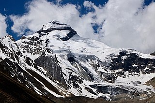
Adi Kailash, also known as Shiva Kailash, Chota Kailash, Baba Kailash or Jonglingkong Peak, is a mountain located in the Himalayan mountain range in the Pithoragarh district of Uttarakhand, India. Adi Kailash & Limpiyadhura Pass are both located northwest of Gunji. The Lipulekh Pass, Old Lipulekh Peak & Om Parvat are located northeast of Gunji. Adi Kailash base camp, near the Hindu Shiva temple on the banks of sacred Jolingkong Lake, is located 17 km northwest of Kuthi (Kuti) village in Kuthi Yankti Valley. The Adi Kailash Yatra Circuit route-1 via Gunji, the eastern-southeastern route, is reached by the Pithoragagh-Lipulekh Pass Highway (PLPH) and its Gunji-Lampiya Dhura Pass Road (GLDPR) paved motorable spur via Kuthi Yankti Valley from Gunji to Adi Kailash. The Adi Kailash Yatra Circuit route-2 via Darma Valley, the western-southwestern route, begins by going up the Darma Valley and then crossing the Sin La pass south of Brahma Parvat to go to Kuthi Yankti Valley to Jolingkong Lake Base Camp. Many travellers who take the route-2, after the Adi Kailash darshan chose to traverse the route-1 in reverse direction till Gunji where they can join the Om Parvat & Mount Kailash-Lake Manasarovar Tibetan pilgrimage route along the Sharda River. Kailash-Mansarovar, Adi Kailash and Om Parvat are sacred to Hindus.
Kupup is a hamlet in the Indian state of Sikkim near the border with China. It lies in a transverse valley below the Dongkya Range, close to the Jelep La pass. A nearby moraine ridge across the valley forms part of the watershed between the Teesta and Dichu river basins. To the southeast of the ridge is the lake Bitang Tso, also called the Elephant Lake or Kupup Lake, from which the Dichu river is conventionally believed to originate.

Darebu Cuo or Darab Co or Tarap Tso or Darebu Lake is a high-altitude alpine lake in Tibet, China.