The New York City Landmarks Preservation Commission (LPC), formed in 1965, is the New York City governmental commission that administers the city's Landmarks Preservation Law. Since its founding, it has designated over a thousand landmarks, classified into four categories: individual landmarks, interior landmarks, scenic landmarks, and historic districts.
The New York City borough of Manhattan consists of the main island of Manhattan; the neighborhood of Marble Hill, located on the North American mainland; and several smaller islands. The LPC has designated fifteen landmarks on four smaller islands in Manhattan, including two historic districts, twelve individual landmarks, and one interior landmark. These designations comprise two on Ellis Island, six on Governors Island, one on Liberty Island, and six on Roosevelt Island. The designations include the Statue of Liberty, a national monument, as well as numerous buildings that are all also on the National Register of Historic Places (NRHP).
The New York City borough of Manhattan contains numerous smaller islands in addition to the main island of Manhattan. [2] Three of these islands, Ellis Island, Governors Island, and Liberty Island, are located in Upper New York Bay, [3] : 9 though jurisdiction of Ellis Island is shared with neighboring Jersey City, New Jersey, and Liberty Island is an exclave of Manhattan within New Jersey. [4] [5] There are also several islands in the East River, including U Thant Island, Roosevelt Island, Mill Rock, and Randalls and Wards Islands, [3] : 151 which are legally part of Manhattan. [2]
The New York City Landmarks Preservation Commission (LPC) is the New York City governmental commission that administers the city's Landmarks Preservation Law. [6] Formed in 1965, [7] the commission administers four types of landmarks: individual landmarks, which consist of the exteriors of objects or structures; interior landmarks, which consist of the interiors of structures; scenic landmarks, which include city-owned "parks or other landscape features"; and historic districts, which consist of geographically cohesive collections of buildings with a distinct architectural style. [8] Some are also on the National Register of Historic Places (NRHP), a separate program administered by the National Park Service. [9] As of May 2020 [update] , the LPC has designated 149 historic districts, 1,439 individual landmarks, 120 interior landmarks, and 11 scenic landmarks. [10]
The smaller islands in Manhattan contain two historic districts, twelve individual landmarks, and one interior landmark. [11] Both historic districts contain landmarks within them: the Ellis Island Historic District includes one interior landmark while the Governors Island Historic District contains five individual landmarks. [11] As of May 2020 [update] , all twelve individual landmarks on Manhattan's smaller islands are on the NRHP; [12] Ellis Island and the Statue of Liberty are also part of the Statue of Liberty National Monument, [13] and all landmarks on Governors Island are also part of the Governors Island National Monument. [14] In addition, the Statue of Liberty is a World Heritage Site designated by UNESCO, [15] and both the Statue of Liberty and Ellis Island are on the New Jersey Register of Historic Places. [16]
The LPC designated its first landmarks on smaller islands in Manhattan during 1967, when five buildings on Governors Island were given individual-landmark status. [17] The LPC subsequently gave individual-landmark status to six buildings on Roosevelt Island in March 1976; the structures included a house, a lighthouse, a chapel, and three former hospitals. [18] That September, the LPC also designated the Statue of Liberty as a city landmark. [19] The LPC designated the entirety of Ellis Island as a historic district in 1993, [20] [21] : 76–77 although most of the island is in New Jersey. [5] The interior of the registry room inside Ellis Island's main building was also designated at the same time. [22] : 1 In 1997, the LPC designated 90 acres (36 ha) of Governors Island as a historic district, which included approximately 100 buildings. The designation overlays that of the five individual landmarks that had been previously designated. [23]
Despite the protections given by the LPC, some landmarks have fallen into decay after their designations. [24] These landmarks have included the Octagon Tower, [25] Blackwell House, [26] and Smallpox Hospital on Roosevelt Island. [27] The Octagon Tower was incorporated into an apartment complex in 2005 after the LPC approved the tower's renovation. [28]
[lower-alpha 1] | Landmark name | Image | Date listed [lower-alpha 2] | Location | Island | Description |
---|---|---|---|---|---|---|
1 | Ellis Island Historic District | 40°41′58″N74°02′30″W / 40.699398°N 74.041723°W | Ellis Island | A group of some 30 structures that formed the Ellis Island federal immigration station. [21] | ||
2 | Governor's Island Historic District | 40°41′26″N74°00′59″W / 40.690516°N 74.016415°W | Governors Island | A group of over 100 structures that were used by the U.S. military continuously for over two centuries. [29]
|
All of these individual landmarks are also listed on the NRHP. [12]
[lower-alpha 1] | Landmark name | Image | Date listed [lower-alpha 2] | Location | Island | Description |
---|---|---|---|---|---|---|
1 | The Admiral's House | Nolan Park 40°41′25″N74°00′50″W / 40.690278°N 74.013889°W | Governors Island | Used by the commanding officers of the Army and Coast Guard units. [30] | ||
2 | Blackwell House | 501 Main Street 40°45′38″N73°57′05″W / 40.760556°N 73.951389°W | Roosevelt Island | Built in 1796 by a descendant of the first English owner of the island. [31] | ||
3 | Block House | Nolan Park on Barry Road 40°41′20″N74°00′51″W / 40.688889°N 74.014167°W | Governors Island | A small military prison on Governors Island. [32] | ||
4 | Castle Williams | Hay Road and Andes Road 40°41′34″N74°01′11″W / 40.692778°N 74.0197°W | Governors Island | A circular 19th century fortification of red sandstone on the northwest point of Governors Island, part of a system of forts to protect New York City from naval attack. [33] | ||
5 | Chapel of the Good Shepherd | 543 Main Street 40°45′42″N73°57′02″W / 40.761667°N 73.950556°W | Roosevelt Island | A historic Episcopal church designed by architect Frederick Clarke Withers, now known as the Good Shepherd Community Ecumenical Center. [34] | ||
6 | Fort Jay | Quadrangle Road 40°41′29″N74°00′59″W / 40.691389°N 74.016389°W | Governors Island | A 1794 coastal star fort, built to defend New York Harbor. [35] | ||
7 | The Governor's House | Building 2, Andes Road 40°41′27″N74°00′48″W / 40.690833°N 74.013333°W | Governors Island | A historic house on Governors Island. [36] | ||
8 | Lighthouse | North end of Roosevelt Island 40°46′22″N73°56′26″W / 40.772778°N 73.940556°W | Roosevelt Island | An 1872 lighthouse located at the northeast tip of Roosevelt Island in the East River. [37] | ||
9 | The Octagon | 888 Main Street 40°46′08″N73°56′38″W / 40.768889°N 73.943889°W | Roosevelt Island | Originally serving as the main entrance to the New York City Lunatic Asylum, which opened in 1841, it was designed by Alexander Jackson Davis. [38] | ||
10 | Smallpox Hospital | E Road 40°45′06″N73°57′36″W / 40.751667°N 73.96°W | Roosevelt Island | Originally designed by architect James Renwick Jr., the 100-bed hospital opened in 1856, when the area was known as Blackwell's Island. Its ruins have been stabilized and preserved. [39] | ||
11 | Statue of Liberty | Liberty Island, New York Harbor 40°41′21″N74°02′40″W / 40.689154°N 74.044441°W | Liberty Island | The iconic statue named Liberty Enlightening the World [1] | ||
12 | Strecker Memorial Laboratory | E Road 40°45′09″N73°57′31″W / 40.7525°N 73.958611°W | Roosevelt Island | Built in 1892 to serve as a laboratory for City Hospital, it was "the first institution in the nation for pathological and bacteriological research." The building was designed by architects Frederick Clarke Withers and Walter Dickson in the Romanesque Revival style. [40] |
[lower-alpha 1] | Landmark name | Image | Date listed [lower-alpha 2] | Location | Island | Description |
---|---|---|---|---|---|---|
1 | Ellis Island, Main Building (Interior) | Ellis Island 40°41′57″N74°02′22″W / 40.699160°N 74.039491°W | Ellis Island | The interior of the second- and third-floor registry room of Ellis Island's main building, where immigrants were processed. [22] |
Fifth Avenue is a major thoroughfare in the borough of Manhattan in New York City. It stretches north from Washington Square Park in Greenwich Village to West 143rd Street in Harlem. It is one of the most expensive shopping streets in the world.
The New York City Landmarks Preservation Commission (LPC) is the New York City agency charged with administering the city's Landmarks Preservation Law. The LPC is responsible for protecting New York City's architecturally, historically, and culturally significant buildings and sites by granting them landmark or historic district status, and regulating them after designation. It is the largest municipal preservation agency in the nation. As of July 1, 2020, the LPC has designated more than 37,000 landmark properties in all five boroughs. Most of these are concentrated in historic districts, although there are over a thousand individual landmarks, as well as numerous interior and scenic landmarks.
Whitehall Street is a street in the South Ferry/Financial District neighborhood of Lower Manhattan in New York City, near the southern tip of Manhattan Island. The street begins at Bowling Green to the north, where it is a continuation of the southern end of Broadway. Whitehall Street stretches four blocks to the southern end of FDR Drive, adjacent to the Staten Island Ferry's Whitehall Terminal, on landfill beyond the site of Peter Stuyvesant's 17th-century house.
New York City's Theater District is an area and neighborhood in Midtown Manhattan where most Broadway theaters are located, as well as many other theaters, movie theaters, restaurants, hotels, and other places of entertainment. It is bounded by West 40th Street on the south, West 54th Street on the north, Sixth Avenue on the east and Eighth Avenue on the west, and includes Times Square. The Great White Way is the name given to the section of Broadway which runs through the Theater District.
1 Hanover Square is a commercial building on the southwestern edge of Hanover Square in the Financial District of Lower Manhattan in New York City. It was the site of the United States' first cotton futures exchange, the New York Cotton Exchange.
The Chamber of Commerce Building is a commercial building on 65 Liberty Street, between Liberty Place and Broadway, in the Financial District of Manhattan in New York City. Designed by architect James Barnes Baker, the four-story Beaux-Arts building was constructed between 1901 and 1902 as the first headquarters to be built specifically for the Chamber of Commerce of the State of New York.
Stone Street is a short street in the Financial District of Manhattan in New York City. It runs in two sections between Whitehall Street in the west and Hanover Square in the east. The street originally ran as one continuous roadway from Whitehall Street to Hanover Square, but the section between Broad Street and Coenties Alley was eliminated in 1980 to make way for the Goldman Sachs building at 85 Broad Street. The one-block-long western section between Whitehall and Broad Streets carries vehicular traffic, while the two-block-long eastern section between Coenties Alley and Hanover Square is a pedestrian zone.
The Scribner Building is a commercial structure at 155 Fifth Avenue, near 21st Street, in the Flatiron District of Manhattan in New York City. Designed by Ernest Flagg in the Beaux Arts style, it was completed in 1893 as the corporate headquarters of Charles Scribner's Sons publishing company.
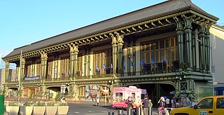
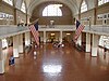
The Battery Maritime Building is a building at South Ferry on the southern tip of Manhattan Island in New York City. Located at 10 South Street, near the intersection with Whitehall Street, it is composed of an operational ferry terminal at ground level, as well as a hotel and event space on the upper stories. The ground story contains three ferry slips that are used for excursion trips and ferries to Governors Island, as well as commuter trips to Port Liberté, Jersey City. The upper stories contain the Cipriani South Street event space, operated by Cipriani S.A., and are also being converted to a 47-room hotel called Casa Cipriani.
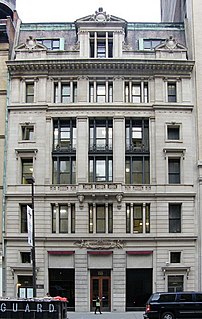
The Liberty Tower, formerly the Sinclair Oil Building, is a 33-story residential building in the Financial District of Manhattan in New York City. It is at 55 Liberty Street at the northwest corner with Nassau Street. It was built in 1909–10 as a commercial office building and was designed by Henry Ives Cobb in a Gothic Revival style.
The Osborne, also known as the Osborne Apartments or 205 West 57th Street, is an apartment building at Seventh Avenue and 57th Street in Midtown Manhattan in New York City. The Osborne was originally designed by James Edward Ware and constructed from 1883 to 1885. An annex to the west, designed by Alfred S. G. Taylor and Julian Clarence Levi, was constructed in 1906. The Osborne is the second oldest luxury apartment building in New York City, behind the Dakota.
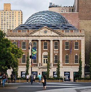
The Surrogate's Courthouse is a historic building at the northwest corner of Chambers and Centre Streets in the Civic Center of Manhattan in New York City. Completed in 1907, it was designed in the Beaux Arts style. John Rochester Thomas created the original plans while Arthur J. Horgan and Vincent J. Slattery oversaw the building's completion. The building faces City Hall Park and the Tweed Courthouse to the south and the Manhattan Municipal Building to the east.
44 Union Square, also known as 100 East 17th Street and the Tammany Hall Building, is a three-story building at 44 Union Square East in Union Square, Manhattan, in New York City. It is at the southeast corner of Union Square East/Park Avenue South and East 17th Street. The neo-Georgian structure was erected in 1928–1929 and designed by architects Thompson, Holmes & Converse and Charles B. Meyers for the Tammany Society political organization, also known as Tammany Hall. It is the organization's oldest surviving headquarters building.
The Pepsi-Cola sign is a neon sign at Gantry Plaza State Park in the Long Island City neighborhood of Queens in New York City. The sign, visible from Manhattan and the East River, was built in 1940 and originally installed atop PepsiCo 's bottling factory nearby. It is composed of a 50-foot (15 m) depiction of a Pepsi bottle, as well as lettering that reflected PepsiCo's logo when the sign was commissioned.
The Excelsior Power Company Building is a residential building at 33–43 Gold Street in the Financial District of Manhattan in New York City. It was designed in the Romanesque Revival style by William C. Gunnell and built by Robert L. Darragh. Completed in 1889, it is Manhattan's oldest known remaining building erected specifically for commercial power generation.