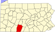
Marker title Image Date dedicated Location Marker type Topics Anderson House June 25, 1951 E. Pitt St. between Juliana & Richard Sts., Bedford 40°01′09″N 78°30′08″W / 40.01912°N 78.50235°W / 40.01912; -78.50235 (Anderson House ) City Buildings, Business & Industry, Houses & Homesteads Bedford County October 17, 1982 Courthouse, S. Juliana & Penn Sts., Bedford 40°01′03″N 78°30′13″W / 40.01752°N 78.50367°W / 40.01752; -78.50367 (Bedford County ) City Forts, French & Indian War, Government & Politics, Government & Politics 18th Century, Roads Bedford Springs June 4, 1947 Business U.S. 220, Bedford Springs 39°59′47″N 78°30′25″W / 39.9963°N 78.50683°W / 39.9963; -78.50683 (Bedford Springs ) Roadside Business & Industry, Cities & Towns, Government & Politics 19th Century, Medicine & Science Bedford Village n/a Old main highways leading into Bedford 40°01′07″N 78°29′29″W / 40.01862°N 78.49145°W / 40.01862; -78.49145 (Bedford Village ) Roadside Early Settlement, Forts, French & Indian War, George Washington, Military, Whiskey Rebellion Benjamin Walker Homestead May 13, 2006 407 Rainbow Dr., Alum Bank, PA 15521, 1.5 mi. N of Pleasantville - Rt. 56 onto Beutman Rd., .5 mi. N to location Roadside African American, Civil War, Underground Railroad Bonnet Tavern April 24, 1992 Jct. U.S. 30/Pa. 31, 4 miles W of Bedford 40°02′32″N 78°33′38″W / 40.04222°N 78.56042°W / 40.04222; -78.56042 (Bonnet Tavern ) Roadside George Washington, Military, Inns & Taverns, Whiskey Rebellion Capt. Phillips' Rangers Memorial September 2, 1964 At site, Pa. 26, 2 miles NW of Saxton Roadside American Revolution, Military, Native American Espy House June 25, 1951 E. Pitt St. between Juliana & Richard Sts., Bedford 40°01′09″N 78°30′10″W / 40.0191°N 78.50288°W / 40.0191; -78.50288 (Espy House ) City American Revolution, George Washington, Houses & Homesteads, Military, Whiskey Rebellion Forbes Camp November 17, 1947 U.S. 30 W of Schellsburg 40°02′56″N 78°38′52″W / 40.04882°N 78.64787°W / 40.04882; -78.64787 (Forbes Camp ) Roadside French & Indian War, Military Forbes Road November 17, 1947 Jct. U.S. 30 & Pa. 31, 4 miles W of Bedford 40°02′34″N 78°33′36″W / 40.04283°N 78.56°W / 40.04283; -78.56 (Forbes Road ) Roadside French & Indian War, Roads, Transportation Forbes Road - Washington & Bouquet Meeting July 26, 2008 Bedford Valley Rd. (Rt. 220) between Providence Lutheran Church and Goodness Grows Landscaping, 2 miles N of Centerville Roadside French & Indian War, George Washington, Military, Roads Forbes Road (Fort Juniata) January 9, 1952 U.S. 30, 6.2 miles E of Everett 39°59′46″N 78°16′07″W / 39.99598°N 78.26857°W / 39.99598; -78.26857 (Forbes Road - Fort Juniata ) Roadside French & Indian War, Military, Roads, Transportation Forbes Road, 1758, Fort Bedford to Fort Duquesne - Fort Bedford-Raystown (PLAQUE) n/a On wall at NW corner Pitt & Juliana Sts., Bedford 40°01′09″N 78°30′15″W / 40.01903°N 78.50425°W / 40.01903; -78.50425 (Forbes Road, 1758, Fort Bedford to Fort Duquesne - Fort Bedford-Raystown -PLAQUE ) Plaque Forts, French & Indian War, Military, Roads Forbes Road, 1758, Fort Bedford to Fort Duquesne - Fort Dewart McLeans' Encampment (PLAQUE) n/a US 30, opposite old shot factory at curve at bottom of hill leading to Ship Hotel, just E of Somerset Co. line (MISSING) Plaque Forts, French & Indian War, Military, Roads Forbes Road, 1758, Fort Bedford to Fort Duquesne - Shawnee Cabins Encampment (PLAQUE) n/a US 30 at W edge Schellsburg 40°02′56″N 78°38′52″W / 40.0488°N 78.64765°W / 40.0488; -78.64765 (Forbes Road, 1758, Fort Bedford to Fort Duquesne - Shawnee Cabins Encampment -PLAQUE ) Plaque French & Indian War, Military, Roads Forbes Road, 1758, Fort Bedford to Fort Duquesne - The Forks (PLAQUE) n/a Junction US 30 & PA 31, 4 miles W of Bedford 40°02′34″N 78°33′35″W / 40.04285°N 78.55983°W / 40.04285; -78.55983 (Forbes Road, 1758, Fort Bedford to Fort Duquesne - The Forks -PLAQUE ) Plaque French & Indian War, Military, Roads Fort Bedford October 6, 1972 U.S. 30 near site in Bedford 40°12′04″N 78°30′17″W / 40.201017°N 78.50467°W / 40.201017; -78.50467 (Fort Bedford ) Roadside Forts, French & Indian War, Military Fraser Tavern March 1, 1952 NE corner E. Pitt & Richard Sts., Bedford 40°01′09″N 78°30′06″W / 40.0192°N 78.50162°W / 40.0192; -78.50162 (Fraser Tavern ) City Buildings, Business & Industry, George Washington, Inns & Taverns Gettysburg Campaign June 29, 1963 SR 1005 (former Pa. 36 & LR 286) 5 miles S of Loysburg 40°06′03″N 78°23′22″W / 40.1009°N 78.38953°W / 40.1009; -78.38953 (Gettysburg Campaign ) Roadside Civil War, Military King's House March 1, 1951 E. Pitt St. between Juliana & Richard Sts., Bedford 40°01′09″N 78°30′12″W / 40.01903°N 78.5034°W / 40.01903; -78.5034 (King's House ) City French & Indian War, Houses & Homesteads, Military Old Log Church September 1, 1974 Lincoln Hwy. (US 30), near Cemetery Rd., just W of Schellsburg 40°02′58″N 78°39′20″W / 40.04932°N 78.65545°W / 40.04932; -78.65545 (Old Log Church ) Roadside Buildings, Religion Pennsylvania January 18, 1949 Pa. 96, 1000 ft. from state line Roadside Government & Politics, Government & Politics 17th Century, William Penn Pennsylvania January 18, 1949 U.S. 220, 1650 feet from state line 39°43′33″N 78°42′35″W / 39.72573°N 78.70965°W / 39.72573; -78.70965 (Pennsylvania ) Roadside Government & Politics, Government & Politics 17th Century, William Penn Pennsylvania Turnpike n/a South Midway Service Plaza, just W of Turnpike Exit 11, Bedford 40°01′49″N 78°29′35″W / 40.03022°N 78.49312°W / 40.03022; -78.49312 (Pennsylvania Turnpike ) Roadside Government & Politics 20th Century, Roads, Transportation Pennsylvania Turnpike n/a North Midway Service Plaza just W of Turnpike exit 11, Bedford 40°01′50″N 78°29′31″W / 40.03062°N 78.49203°W / 40.03062; -78.49203 (Pennsylvania Turnpike ) Roadside Government & Politics 20th Century, Roads, Transportation Phillips' Rangers February 25, 1966 Pa. 26, 2 miles NW of Saxton Roadside American Revolution, Military, Native American Rural Electrification March 1, 1989 Pa. 869 at New Enterprise 40°01′02″N 78°29′08″W / 40.01715°N 78.48547°W / 40.01715; -78.48547 (Rural Electrification ) Roadside Business & Industry, Electricity Rural Electrification June 2, 1989 E Pitt St. / Lincoln Hwy. (SR 4010 / old US 30) at Clark Bldg. & Donohue Manor Rds., .5 mile E of Bedford Roadside Business & Industry, Electricity Russell House June 25, 1951 203 S. Juliana St., Bedford (Missing) City Buildings, Government & Politics, Government & Politics 19th Century, Houses & Homesteads Shawnee Cabins November 17, 1947 US 30 near Mill Rd., W of Schellsburg 40°02′55″N 78°38′51″W / 40.04873°N 78.6476°W / 40.04873; -78.6476 (Shawnee Cabins ) Roadside Early Settlement, Native American, Paths & Trails The Squares June 25, 1951 S. Juliana St. at W Penn St., Bedford 40°01′03″N 78°30′13″W / 40.01738°N 78.50358°W / 40.01738; -78.50358 (Squares, The ) Roadside Government & Politics, Government & Politics 18th Century, William Penn 


