Gwynedd is a county and preserved county in the north-west of Wales. It shares borders with Powys, Conwy County Borough, Denbighshire, Anglesey over the Menai Strait, and Ceredigion over the River Dyfi. The scenic Llŷn Peninsula and most of Snowdonia National Park are in Gwynedd. Bangor is the home of Bangor University.

A site of special scientific interest (SSSI) in Great Britain or an area of special scientific interest (ASSI) in the Isle of Man and Northern Ireland is a conservation designation denoting a protected area in the United Kingdom and Isle of Man. SSSI/ASSIs are the basic building block of site-based nature conservation legislation and most other legal nature/geological conservation designations in the United Kingdom are based upon them, including national nature reserves, Ramsar sites, Special Protection Areas, and Special Areas of Conservation. The acronym "SSSI" is often pronounced "triple-S I".

The Countryside Council for Wales was a Welsh Assembly sponsored body responsible for wildlife conservation, landscape and countryside access authority of Wales.
The history of local government in Wales in a recognisably modern form emerged during the late 19th century. Administrative counties and county boroughs were first established in Wales in 1889. Urban and rural districts were formed in 1894. These were replaced in 1974 by a two-tier authority system across the country comprising eight counties and, within them, thirty-seven districts. This system was itself replaced by the introduction of 22 single-tier authorities in 1996.

Anglesey is an island off the north-west coast of Wales. It forms a principal area known as the Isle of Anglesey, that includes Holy Island across the narrow Cymyran Strait and some islets and skerries. Anglesey island, at 260 square miles (673 km2), is the largest in Wales, the seventh largest in Britain, largest in the Irish Sea and second most populous there after the Isle of Man. Isle of Anglesey County Council administers 276 square miles (715 km2), with a 2011 census population of 69,751, including 13,659 on Holy Island. The Menai Strait to the mainland is spanned by the Menai Suspension Bridge, designed by Thomas Telford in 1826, and the Britannia Bridge, built in 1850 and replaced in 1980. The largest town is Holyhead on Holy Island, whose ferry service with Ireland handles over two million passengers a year. The next largest is Llangefni, the county council seat. From 1974 to 1996 Anglesey was part of Gwynedd. Most full-time residents are habitual Welsh speakers. The Welsh name Ynys Môn is used for the UK Parliament and Senedd constituencies. The postcodes are LL58–LL78. It is also a historic county of Wales.

The following outline is provided as an overview of and topical guide to Wales:

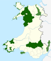
Wales, a country that is part of the United Kingdom, contains protected areas under various designations. The largest designation by land area is Wales' three national parks, followed by the five Areas of Outstanding Natural Beauty.

Cwm Cadnant is a community and former electoral ward in Anglesey, north Wales. Named after the local river, Afon Cadnant, which flows through it, the community takes in the area between the Menai Bridge and Beaumaris. The community includes the villages of Llandegfan, Hen Bentref Llandegfan and Llansadwrn and at the 2001 census it had a population of 2,222, increasing slightly to 2,254 at the 2011 census.

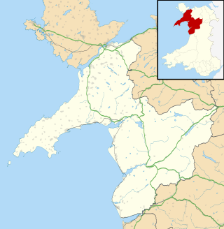
Beddmanarch–Cymyran is a site of special scientific interest (SSSI) on the Welsh island of Anglesey extending to just over 900 hectares, and centred on the Cymyran Strait. It was first notified in 1961 for its coastal botanical and ornithological interest. The site is also a marine protected area as it includes intertidal areas and contains marine components.