List of World Heritage Sites in Western Asia

Last updated

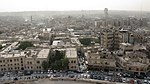
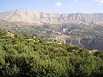
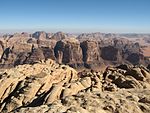
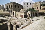
The UNESCO (United Nations Educational, Scientific and Cultural Organization) has designated 95 World Heritage Sites in 18 countries (also called "state parties") of Western Asia: Armenia, Azerbaijan, Bahrain, Cyprus, Georgia, Iran, Iraq, Israel, Jordan, Lebanon, Oman, Palestine, Saudi Arabia, Syria, Turkey, United Arab Emirates, Qatar and Yemen. While Egypt is partially in Western Asia, its World Heritage Sites are listed under Africa instead. One site is located in Jerusalem. [nb 1] Kuwait is the only country in the region that does not have any World Heritage Sites. [1] [2] Arabian Oryx Sanctuary was designated as a World Heritage Site of Oman in 1994 but was delisted in 2007. As the protected area was reduced by 90% as a result of Oman's decision, UNESCO delisted the site. [3]

Contents

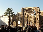
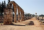
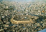
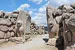
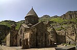
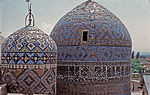
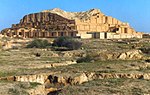
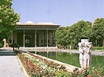
In this region, Iran is home to the most inscribed sites with 27 sites. [4] The first sites to be recognized by UNESCO from the region were Persepolis, Meidan Emam, Esfahan, Tchogha Zanbil (Iran) and the Ancient City of Damascus (Syria). [5] Each year, UNESCO's World Heritage Committee may inscribe new sites on the list, or delist sites that no longer meet the criteria. Selection is based on ten criteria: six for cultural heritage (ivi) and four for natural heritage (viix). [6] Some sites, designated "mixed sites," represent both cultural and natural heritage. In Western Asia, there are 67 cultural, 1 natural, and 3 mixed sites. [7]

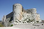
The World Heritage Committee may also specify that a site is endangered, citing "conditions which threaten the very characteristics for which a property was inscribed on the World Heritage List." Seven sites in this region are currently listed as endangered; one site (Bahla Fort) had been listed previously, and possible danger listing has been considered by UNESCO in a number of other cases. [8]

Legend

The table is sortable by column by clicking on the Sort both.gif at the top of the appropriate column; alphanumerically for the site, area, and year columns; by state party for the location column; and by criteria type for the criteria column. Transborder sites sort at the bottom.
Map all coordinates using: OpenStreetMap
Site; named after the World Heritage Committee's official designation [4]
Location; at city, regional, or provincial level and geocoordinates
Criteria; as defined by the World Heritage Committee [6]
Area; in hectares and acres. If available, the size of the buffer zone has been noted as well. A value of zero implies that no data has been published by UNESCO
Year; during which the site was inscribed to the World Heritage List
Description; brief information about the site, including reasons for qualifying as an endangered site, if applicable

World Heritage Sites

  † In danger
SiteImageLocation Criteria Area
ha (acre)
YearDescriptionRefs
Aflaj Irrigation Systems of Oman FalajDaris.JPG Sharqiyah and Batinah Regions, Flag of Oman.svg  Oman
22°59′56″N57°32′10″E / 22.99889°N 57.53611°E / 22.99889; 57.53611 (Aflaj Irrigation Systems of Oman)
Cultural:
(v)
1,456 (3,600); buffer zone 16,404 (40,540)2006 [9]
Al-Ahsa Jabal Al Qara Cave - Al Hassa, Saudi Arabia jb[?] a[?] khaarr guh, a[?] hs, s+di arreeby 12.JPG Al-Ahsa Governorate, Flag of Saudi Arabia.svg  Saudi Arabia
25°25′46″N49°37′19″E / 25.42944°N 49.62194°E / 25.42944; 49.62194 (Al-Ahsa)
Cultural:
(iii)(iv)(v)
8,544 (21,110); buffer zone 21,556 (53,270)2018 [10]
Al-Hijr Archaeological Site (Madâin Sâlih) Madain Saleh (6730361263).jpg Al Madinah Province, Flag of Saudi Arabia.svg  Saudi Arabia
26°47′1″N37°57′18″E / 26.78361°N 37.95500°E / 26.78361; 37.95500 (Al-Hijr Archaeological Site (Madâin Sâlih))
Cultural:
(ii)(iii)
1,621 (4,010); buffer zone 1,659 (4,100)2008 [11]
Al Zubarah Archaeological Site Zubara Fort.jpg Madinat ash Shamal, Flag of Qatar.svg  Qatar
25°58′41″N51°1′47″E / 25.97806°N 51.02972°E / 25.97806; 51.02972 (Al Zubarah Archaeological Site)
Cultural:
(iii)(iv)(v)
416 (1,030); buffer zone 7,196 (17,780)2013 [12]
Ancient City of Aleppo Aleppo, View of the city, Syria.jpg Aleppo Governorate, Flag of Syria.svg  Syria
36°14′0″N37°10′0″E / 36.23333°N 37.16667°E / 36.23333; 37.16667 (Ancient City of Aleppo)
Cultural:
(iii)(iv)
350 (860)1986 [13]
Ancient City of Bosra Bosra pano Syria.jpg Daraa Governorate, Flag of Syria.svg  Syria
32°31′5″N36°28′54″E / 32.51806°N 36.48167°E / 32.51806; 36.48167 (Ancient City of Bosra)
Cultural:
(i)(iii)(vi)
1980 [14]
Ancient City of Damascus The Jupiter temple in Damascus.jpg Damascus Governorate, Flag of Syria.svg  Syria
33°30′41″N36°18′23″E / 33.51139°N 36.30639°E / 33.51139; 36.30639 (Ancient City of Damascus)
Cultural:
(i)(ii)(iii)(iv)(vi)
86 (210)1979 [15]
Ancient City of Qalhat Bibi Maryam mausoleum.jpg Ash Sharqiyah South Governorate, Flag of Oman.svg  Oman
22°42′N59°22′E / 22.700°N 59.367°E / 22.700; 59.367 (Ancient City of Qalhat)
Cultural:
(ii)(iii)
75.82 (187.4); buffer zone 170.09 (420.3)2018 [16]
Ancient Villages of Northern Syria Serjilla 01.jpg Aleppo and Idlib Governorates, Flag of Syria.svg  Syria
36°20′3″N36°50′39″E / 36.33417°N 36.84417°E / 36.33417; 36.84417 (Ancient Villages of Northern Syria)
Cultural:
(iii)(iv)(v)
12,290 (30,400)2011 [17]
Anjar Anjar - Cardo vu du nord 2.jpg Beqaa Governorate, Flag of Lebanon.svg  Lebanon
33°43′33″N35°55′47″E / 33.72583°N 35.92972°E / 33.72583; 35.92972 (Anjar)
Cultural:
(iii)(iv)
1984 [18]
Archaeological Site of Troy Troy1.jpg Çanakkale Province, Flag of Turkey.svg  Turkey
39°57′23″N26°14′20″E / 39.95639°N 26.23889°E / 39.95639; 26.23889 (Archaeological Site of Troy)
Cultural:
(ii)(iii)(vi)
158 (390)1998 [19]
Archaeological Sites of Bat, Al-Khutm and Al-Ayn World Heritage Grave Al Ayn Oman.JPG Ad Dhahirah Region, Flag of Oman.svg  Oman
23°16′11″N56°44′42″E / 23.26972°N 56.74500°E / 23.26972; 56.74500 (Archaeological Sites of Bat, Al-Khutm and Al-Ayn)
Cultural:
(iii)(iv)
1988 [20]
Armenian Monastic Ensembles of Iran Qareh kelissa.jpg West Azerbaijan, Flag of Iran.svg  Iran
38°58′44″N45°28′24″E / 38.97889°N 45.47333°E / 38.97889; 45.47333 (Armenian Monastic Ensembles of Iran)
Cultural:
(ii)(iii)(vi)
129 (320); buffer zone 655 (1,620)2008including: St Thaddeus Monastery, St Stepanos Monastery, Chapel of Dzordzor, Chapel of Chupan, Church of the Holy Mother of God [21]
Ashur (Qal'at Sherqat)
Flickr - The U.S. Army - www.Army.mil (218).jpg
Salah ad Din Governorate, Flag of Iraq.svg  Iraq
35°27′32″N43°15′35″E / 35.45889°N 43.25972°E / 35.45889; 43.25972 (Ashur (Qal'at Sherqat))
Cultural:
(iii)(iv)
70 (170); buffer zone 100 (250)2003 [22]
[23]
At-Turaif District in ad-Dir'iyah Diriyahpic.jpg Riyadh Province, Flag of Saudi Arabia.svg  Saudi Arabia
24°44′3″N46°34′21″E / 24.73417°N 46.57250°E / 24.73417; 46.57250 (At-Turaif District in ad-Dir'iyah)
Cultural:
(ii)(iii)
29 (72)2008 [24]
Baalbek Baalbek-Bacchus.jpg Baalbek-Hermel Governorate, Flag of Lebanon.svg  Lebanon
34°0′25″N36°12′18″E / 34.00694°N 36.20500°E / 34.00694; 36.20500 (Baalbek)
Cultural:
(i)(iv)
1984 [25]
Babylon US Navy 030529-N-5362A-001 A U.S. Marine Corps Humvee vehicle drives down a road at the foot of Saddam Hussein's former Summer palace with ruins of ancient Babylon in the background.jpg Hillah, Flag of Iraq.svg  Iraq
32°32′11″N44°25′15″E / 32.53639°N 44.42083°E / 32.53639; 44.42083 (Babylon)
Cultural:
(iii)(vi)
1,054.3 (2,605) ; buffer zone 154.5 (382)2019 [26]
Bahá’i Holy Places in Haifa and the Western Galilee CarmelArc.jpg Haifa and North District, Flag of Israel.svg  Israel
32°49′46″N34°58′18″E / 32.82944°N 34.97167°E / 32.82944; 34.97167 (Bahá’i Holy Places in Haifa and the Western Galilee)
Cultural:
(iii)(vi)
63 (160); buffer zone 255 (630)2008 [27]
Bahla Fort Bahla Fort.jpg Ad Dakhiliyah Region, Flag of Oman.svg  Oman
22°57′51″N57°18′4″E / 22.96417°N 57.30111°E / 22.96417; 57.30111 (Bahla Fort)
Cultural:
(iv)
1987 [28]
Bam and its Cultural Landscape BAM IR2726.JPG Kerman, Flag of Iran.svg  Iran
29°07′00.68″N58°22′06.51″E / 29.1168556°N 58.3684750°E / 29.1168556; 58.3684750 (Bam and its Cultural Landscape)
Cultural:
(ii)(iii)(iv)(v)
2004 [29]
Baptism Site “Bethany Beyond the Jordan” (Al-Maghtas) Bethany (5).JPG Jordan River, Flag of Jordan.svg  Jordan
31°50′13″N35°32′50″E / 31.83694°N 35.54722°E / 31.83694; 35.54722 (Baptism Site “Bethany Beyond the Jordan” (Al-Maghtas))
Cultural:
(iii)(vi)
294 (730); buffer zone 957 (2,360)2015 [30]
Biblical tells - Megiddo, Hazor, Beer Sheba Hatzor-IsraeliteBastion.jpg Flag of Israel.svg  Israel
32°35′50″N35°10′56″E / 32.59722°N 35.18222°E / 32.59722; 35.18222 (Biblical Tels - Megiddo, Hazor, Beer Sheba)
Cultural:
(ii)(iii)(iv)(vi)
96 (240); buffer zone 604 (1,490)2005 [31]
Bisotun Darius I the Great's inscription.jpg Kermanshah, Flag of Iran.svg  Iran
34°23′18″N47°26′12″E / 34.38833°N 47.43667°E / 34.38833; 47.43667 (Bisotun)
Cultural:
(ii)(iii)
187 (460); buffer zone 361 (890)2006 [32]
Bursa and Cumalıkızık: the Birth of the Ottoman Empire 71 Bursa la Grande Moschea.jpg City of Bursa and village of Cumalıkızık, Bursa Province, Flag of Turkey.svg  Turkey
40°11′5″N29°3′44″E / 40.18472°N 29.06222°E / 40.18472; 29.06222 (City of Bursa)
Cultural:
(i)(ii)(iii)(iv)(vi)
193 (480)2014 [33]
Byblos ByblosPort.jpg Mount Lebanon Governorate, Flag of Lebanon.svg  Lebanon
34°7′9″N35°38′51″E / 34.11917°N 35.64750°E / 34.11917; 35.64750 (Byblos)
Cultural:
(iii)(iv)(vi)
1984 [34]
Caves of Maresha and Bet-Guvrin in the Judean Lowlands as a Microcosm of the Land of the Caves Beit Guvrin 1.JPG Southern District, Flag of Israel.svg  Israel
31°36′0″N34°53′44″E / 31.60000°N 34.89556°E / 31.60000; 34.89556 (Caves of Maresha and Bet-Guvrin)
Cultural:
(V)
259 (640)2014 [35]
Cathedral and Churches of Echmiatsin and the Archaeological Site of Zvartnots Ejmiadzin Cathedral2.jpg Armavir Province, Flag of Armenia.svg  Armenia
40°9′34″N44°17′43″E / 40.15944°N 44.29528°E / 40.15944; 44.29528 (Cathedral and Churches of Echmiatsin and the Archaeological Site of Zvartnots)
Cultural:
(ii)(iii)
74 (180)2000 [36]
Choirokoitia Khirokitia1.jpg Larnaca District, Flag of Cyprus.svg  Cyprus
34°47′54″N33°20′36″E / 34.79833°N 33.34333°E / 34.79833; 33.34333 (Choirokoitia)
Cultural:
(ii)(iii)(iv)
1998 [37]
Birthplace of Jesus: Church of the Nativity and the Pilgrimage Route, Bethlehem Church of the nativity beth.jpg Bethlehem Governorate, Flag of Palestine.svg  Palestine
31°42′16″N35°12′28″E / 31.70444°N 35.20778°E / 31.70444; 35.20778 (Church of the Nativity)
Cultural:
(iv), (vi)
2.98 (7.4)2012 [38] [39] [40]
Erbil Citadel Hawler Castle.jpg Flag of Kurdistan.svg  Iraqi Kurdistan,Flag of Iraq.svg  Iraq
36°11′28″N44°0′33″E / 36.19111°N 44.00917°E / 36.19111; 44.00917 (Erbil Citadel)
Cultural:
(iv)
16 (40); buffer zone 268 (660)2014 [41]
City of Safranbolu Safranbolu traditional houses.jpg City and district of Safranbolu, Karabük Province, Flag of Turkey.svg  Turkey
41°15′36″N32°41′23″E / 41.26000°N 32.68972°E / 41.26000; 32.68972 (City of Safranbolu)
Cultural:
(ii)(iv)(v)
193 (480)1994 [42]
Crac des Chevaliers and Qal’at Salah El-Din Krak des Chevaliers 14.jpg Homs and Latakia Governorates, Flag of Syria.svg  Syria
34°46′54″N36°15′47″E / 34.78167°N 36.26306°E / 34.78167; 36.26306 (Crac des Chevaliers and Qal’at Salah El-Din)
Cultural:
(ii)(iv)
9 (22)2006 [43]
Cultural Sites of Al Ain (Hafit, Hili, Bidaa Bint Saud and Oases Areas) Alley in Al Ain Oasis.JPG Flag of the United Arab Emirates.svg  United Arab Emirates
24°4′4″N55°48′23″E / 24.06778°N 55.80639°E / 24.06778; 55.80639 (Cultural Sites of Al Ain (Hafit, Hili, Bidaa Bint Saud and Oases Areas))
Cultural:
(iii)(iv)(v)
4,945 (12,220); buffer zone 7,605 (18,790)2011 [44]
Dilmun Burial Mounds A'ali Burial Mounds.jpg Northern Governorate and Southern Governorate, Flag of Bahrain.svg  Bahrain
26°8′59″N50°30′46″E / 26.14972°N 50.51278°E / 26.14972; 50.51278 (Dilmun Burial Mounds)
Cultural:
(iii)(iv)
168.45 (416.2) ; buffer zone 383.46 (947.6)2019 [45]
Gelati Monastery Gelati 1661.jpg Imereti, Flag of Georgia.svg  Georgia
42°17′41″N42°46′6″E / 42.29472°N 42.76833°E / 42.29472; 42.76833 (Gelati Monastery)
Cultural:
(iv)
4.2 (10); buffer zone 1,246 (3,080)1994 [nb 2] [46]
Gobustan Rock Art Cultural Landscape Ancient Azerbaijan 4.jpg Garadagh and Absheron districts, Flag of Azerbaijan.svg  Azerbaijan
40°7′30″N49°22′30″E / 40.12500°N 49.37500°E / 40.12500; 49.37500 (Gobustan Rock Art Cultural Landscape)
Cultural:
(iii)
537 (1,330); buffer zone 3,096 (7,650)2007 [47]
Golestan Palace View of Shams-ol-Emareh.jpg Tehran, Flag of Iran.svg  Iran
35°40′49″N51°25′14″E / 35.68028°N 51.42056°E / 35.68028; 51.42056 (Golestan Palace)
Cultural:
(i)(ii)(iii)(iv)
5.3 (13); buffer zone 26 (64)2013 [48]
Gonbad-e Qabus Gonbadkavoos.jpg Golestan, Flag of Iran.svg  Iran
37°15′29″N55°10′8″E / 37.25806°N 55.16889°E / 37.25806; 55.16889 (Gonbad-e Qabus)
Cultural:
(i)(ii)(iii)(iv)
1.48 (3.7); buffer zone 18 (44)2012 [49]
Great Mosque and Hospital of Divriği DivrigiUluCami (2006).jpg city and district of Divriği, Sivas Province, Flag of Turkey.svg  Turkey
39°22′25″N38°7′25″E / 39.37361°N 38.12361°E / 39.37361; 38.12361 (Great Mosque and Hospital of Divriği)
Cultural:
(i)(iv)
2,016 (4,980)1985 [50]
Göbekli Tepe Gobekli Tepe, Urfa.jpg Şanlıurfa Province, Flag of Turkey.svg  Turkey
37°13′23″N38°55′21″E / 37.22306°N 38.92250°E / 37.22306; 38.92250 (Göbekli Tepe)
Cultural:
(i)(ii)(iv)
126 (310); buffer zone 461 (1,140)2018 [51]
Göreme National Park and the Rock Sites of Cappadocia Goreme valley fairy chimneys.jpg Nevşehir Province in Central Anatolia Region, Flag of Turkey.svg  Turkey
38°40′0″N34°51′0″E / 38.66667°N 34.85000°E / 38.66667; 34.85000 (Göreme National Park and the Rock Sites of Cappadocia)
Mixed:
(i)(iii)(v)(vii)
9,576 (23,660)1985 [52]
Hatra Hatra ruins.jpg Ninawa Governorate, Flag of Iraq.svg  Iraq
35°35′17″N42°43′6″E / 35.58806°N 42.71833°E / 35.58806; 42.71833 (Hatra)
Cultural:
(ii)(iii)(iv)(vi)
324 (800)1985 [53]
Hattusha: the Hittite Capital Lion Gate, Hattusa 01.jpg Sungurlu, Çorum Province, Flag of Turkey.svg  Turkey
40°0′50″N34°37′14″E / 40.01389°N 34.62056°E / 40.01389; 34.62056 (Hattusha: the Hittite Capital)
Cultural:
(i)(ii)(iii)(iv)
268 (660)1986 [54]
Hebron/Al-Khalil Old Town Hebron-(Abraham)-Mosche.JPG Hebron Governorate,
Flag of Palestine.svg  Palestine
31°31′30″N35°06′30″E / 31.52500°N 35.10833°E / 31.52500; 35.10833
Cultural:
(ii)(iv)(vi)
20.6 (51)2017The centre of interest of the town was the site of Al mosque -Ibrahim / the tomb of the Patriarchs whose buildings are in a compound built in the 1st century CE to protect the tombs of the patriarch Abraham / Ibrahim and his family. [55]
Hierapolis-Pamukkale Pamukkale00.JPG Denizli Province, Flag of Turkey.svg  Turkey
37°55′26″N29°7′24″E / 37.92389°N 29.12333°E / 37.92389; 29.12333 (Hierapolis-Pamukkale)
Mixed:
(iii)(iv)(vii)
1,077 (2,660)1988 [56]
Ḥimā Cultural Area Petroglyph at Bir Hima in Saudi Arabia.jpg Najran Province, Flag of Saudi Arabia.svg  Saudi Arabia
18°14′55″N44°27′6″E / 18.24861°N 44.45167°E / 18.24861; 44.45167 (Bir Hima Rock Petroglyphs and Inscriptions)
Cultural:
(iii)
242.17 (598.4); buffer zone 31,757.83 (78,475.3)2021 [57]
Historic Areas of Istanbul Topkapi Palace Hagia Sophia Blue Mosque.jpg Istanbul city and Istanbul Province, Flag of Turkey.svg  Turkey
41°0′30″N28°58′48″E / 41.00833°N 28.98000°E / 41.00833; 28.98000 (Historic Areas of Istanbul)
Cultural:
(i)(ii)(iii)(iv)
678 (1,680)1985 [58]
Historic Centre of Sheki with the Khan's Palace Shaki khan palace 1.jpg Sheki, Flag of Azerbaijan.svg  Azerbaijan
41°12′12″N47°11′15″E / 41.20333°N 47.18750°E / 41.20333; 47.18750 (Sheki)
Cultural:
(ii)(v)
120.5 (298) ; buffer zone 146 (360)2019 [59]
Historic Jeddah, the Gate to Makkah Traditional house in Al Balad.JPG Jeddah, Flag of Saudi Arabia.svg  Saudi Arabia
21°29′2″N39°11′15″E / 21.48389°N 39.18750°E / 21.48389; 39.18750 (Jeddah)
Cultural:
(ii)(iv)(vi)
18 (44) ; buffer zone 114 (280)2014 [60]
Historical Monuments of Mtskheta Gamsakhurdia street, Mtskheta. (Photo A. Muhranoff, 2011).jpg Mtskheta-Mtianeti, Flag of Georgia.svg  Georgia
41°51′N44°43′E / 41.850°N 44.717°E / 41.850; 44.717 (Historical Monuments of Mtskheta)
Cultural:
(iii)(iv)
1994
Historic Town of Zabid Zabid, Yemen.jpg Al Hudaydah Governorate, Flag of Yemen.svg  Yemen
14°11′53″N43°19′48″E / 14.19806°N 43.33000°E / 14.19806; 43.33000 (Historic Town of Zabid)
Cultural:
(iii)
1993 [61]
[62]
Hyrcanian Forests Ghaleye Rud Khan (40) 4.jpg Golestan, Mazandaran and Gilan Province, Flag of Iran.svg  Iran
37°25′17.3″N55°43′27.4″E / 37.421472°N 55.724278°E / 37.421472; 55.724278 (Hyrcanian forests)
Natural:
(ix)
129,484.74 (319,963.8) ; buffer zone 177,128.79 (437,694.8)2019 [63]
Incense Route – Desert Cities in the Negev Avdat-v.jpg Negev, Flag of Israel.svg  Israel
30°32′28″N35°9′39″E / 30.54111°N 35.16083°E / 30.54111; 35.16083 (Incense Route – Desert Cities in the Negev)
Cultural:
(iii)(v)
2005 [64]
Land of Frankincense Ruins6.JPG Dhofar Governorate, Flag of Oman.svg  Oman
18°15′12″N53°38′51″E / 18.25333°N 53.64750°E / 18.25333; 53.64750 (Land of Frankincense)
Cultural:
(iii)(iv)
850 (2,100); buffer zone 1,243 (3,070)2000 [37] [65]
Palestine: Land of Olives and Vines – Cultural Landscape of Southern Jerusalem, Battir Bitar1893.jpg Bethlehem Governorate, Flag of Palestine.svg  Palestine
31°43′11″N35°7′50″E / 31.71972°N 35.13056°E / 31.71972; 35.13056 (Land of Olives and Vines)
Cultural:
(iv), (v)
2014 [66]
Masada Masada room by David Shankbone.jpg South District, Flag of Israel.svg  Israel
31°18′49″N35°21′10″E / 31.31361°N 35.35278°E / 31.31361; 35.35278 (Masada)
Cultural:
(iii)(iv)(vi)
276 (680); buffer zone 28,965 (71,570)2001 [67]
Masjed-e Jāmé of Isfahan Jame Mosque Esfahan courtyard.jpg Isfahan, Flag of Iran.svg  Iran
32°40′11″N51°41′7″E / 32.66972°N 51.68528°E / 32.66972; 51.68528 (Masjed-e Jāmé of Isfahan)
Cultural:
(ii)
2.08 (5.1); buffer zone 19 (47)2012 [68]
Meidan Emam, Esfahan Esfahan-shah-sq.jpg Isfahan, Flag of Iran.svg  Iran
32°39′27″N51°40′40″E / 32.65750°N 51.67778°E / 32.65750; 51.67778 (Meidan Emam, Esfahan)
Cultural:
(i)(v)(vi)
1979 [69]
Monasteries of Haghpat and Sanahin Haghpat-Nshan.jpg Haghpat and Sanahin, Lori Province, Flag of Armenia.svg  Armenia
41°5′42″N44°42′37″E / 41.09500°N 44.71028°E / 41.09500; 44.71028 (Monasteries of Haghpat and Sanahin)
Cultural:
(ii)(iv)
2.65 (6.5); buffer zone 24 (59)1996 [nb 3] [70]
Monastery of Geghard and the Upper Azat Valley Geghard.jpg near Goght, Kotayk Province, Flag of Armenia.svg  Armenia
40°9′32″N44°47′48″E / 40.15889°N 44.79667°E / 40.15889; 44.79667 (Monastery of Geghard and the Upper Azat Valley)
Cultural:
(ii)
2.70 (6.7)2000 [71]
Nemrut Dağ Mount Nemrut.jpg Adiyaman Province, Flag of Turkey.svg  Turkey
38°2′12″N38°45′49″E / 38.03667°N 38.76361°E / 38.03667; 38.76361 (Nemrut Dağ)
Cultural:
(i)(iii)(iv)
11 (27)1987 [72]
Neolithic Site of Çatalhöyük CatalHoyukSouthArea.JPG Central Anatolia Region, Flag of Turkey.svg  Turkey
37°40′0″N32°49′41″E / 37.66667°N 32.82806°E / 37.66667; 32.82806 (Neolithic Site of Çatalhöyük)
Cultural:
(iii)(iv)
37 (91); buffer zone 111 (270)2012 [73]
Old City of Acre Acre - Akko Tower.jpg Western Galilee, Flag of Israel.svg  Israel
32°55′42″N35°5′2″E / 32.92833°N 35.08389°E / 32.92833; 35.08389 (Old City of Acre)
Cultural:
(ii)(iii)(v)
63 (160)2001 [74]
Old City of Jerusalem and its Walls Temple Mount.JPG Jerusalem
31°46′36.12″N35°14′3.12″E / 31.7767000°N 35.2342000°E / 31.7767000; 35.2342000 (Old City of Jerusalem and its Walls)
Cultural:
(ii)(iii)(vi)
1981As a holy city for Judaism, Christianity and Islam, Jerusalem holds great symbolic importance and is recognized by all three religions as the site of Abraham's sacrifice. The Western Wall delimits the quarters of the different religious communities, while the Resurrection rotunda in the Church of the Holy Sepulchre houses Christ's tomb. [75]
Pergamon and its Multi-Layered Cultural Landscape Pergamon - 01.jpg Bergama, Izmir Province Flag of Turkey.svg  Turkey
39°7′33″N27°10′48″E / 39.12583°N 27.18000°E / 39.12583; 27.18000 (Pergamom)
Cultural:
(i)(ii)(iii)(iv)(vi)
333 (820); buffer zone 477 (1,180)2014 [76]
Old City of Sana'a Sana.jpg Sana'a Governorate, Flag of Yemen.svg  Yemen
15°21′20″N44°12′29″E / 15.35556°N 44.20806°E / 15.35556; 44.20806 (Old City of Sana'a)
Cultural:
(iv)(v)(vi)
1986 [77]
Shahr-i Sokhta wrwdy ql`h rstm.JPG Sistan and Baluchestan Province,Flag of Iran.svg  Iran
30°35′38″N61°19′40″E / 30.59389°N 61.32778°E / 30.59389; 61.32778 (Shahr-i Sokhta)
Cultural:
(ii)(iii)(iv)
1,456 (3,600); buffer zone 2,200 (5,400)2014 [78]
Old Walled City of Shibam Shibam Wadi Hadhramaut Yemen.jpg Hadhramaut Governorate, Flag of Yemen.svg  Yemen
15°55′37″N48°37′36″E / 15.92694°N 48.62667°E / 15.92694; 48.62667 (Old Walled City of Shibam)
Cultural:
(iii)(iv)(v)
1982 [79]
Ouadi Qadisha (the Holy Valley) and the Forest of the Cedars of God (Horsh Arz el-Rab) Qadisha.jpg North Lebanon Governorate, Flag of Lebanon.svg  Lebanon
34°14′36″N36°2′56″E / 34.24333°N 36.04889°E / 34.24333; 36.04889 (Ouadi Qadisha (the Holy Valley) and the Forest of the Cedars of God (Horsh Arz el-Rab))
Cultural:
(iii)(iv)
1998 [80]
Painted Churches in the Troodos Region Pedoulas Konstantin.jpg Troodos Mountains, Limassol and Nicosia Districts, Flag of Cyprus.svg  Cyprus
34°55′13″N33°5′45″E / 34.92028°N 33.09583°E / 34.92028; 33.09583 (Painted Churches in the Troodos Region)
Cultural:
(iii)(vi)
1985 [nb 4] [81]
[82]
Paphos House of Aion, Paphos - Apollo and Marsyas Mosaic.jpg Paphos District, Flag of Cyprus.svg  Cyprus
34°45′30″N32°24′20″E / 34.75833°N 32.40556°E / 34.75833; 32.40556 (Paphos)
Cultural:
(iii)(vi)
1980 [83]
Pasargadae CyrustheGreatTomb 22059.jpg Pars, Flag of Iran.svg  Iran
30°11′38″N53°10′2″E / 30.19389°N 53.16722°E / 30.19389; 53.16722 (Pasargadae)
Cultural:
(1)(ii)(iii)(iv)
160 (400); buffer zone 7,127 (17,610)2004 [84]
Pearling, Testimony of an Island Economy Isa Bin Ali House.jpg Muharraq Governorate, Flag of Bahrain.svg  Bahrain
26°14′29″N50°36′49″E / 26.24139°N 50.61361°E / 26.24139; 50.61361 (Pearling, Testimony of an Island Economy)
Cultural:
(iii)
35,087 (86,700); buffer zone 95,876 (236,910)2012 [85]
Persepolis Persepolis - Tachara 01.jpg Fars, Flag of Iran.svg  Iran
29°56′4″N52°52′25″E / 29.93444°N 52.87361°E / 29.93444; 52.87361 (Persepolis)
Cultural:
(i)(iii)(vi)
13 (32)1979 [86]
Petra Al Khazneh.jpg Ma'an Governorate, Flag of Jordan.svg  Jordan
30°19′50″N35°26′36″E / 30.33056°N 35.44333°E / 30.33056; 35.44333 (Petra)
Cultural:
(i)(iii)(iv)
1985 [87]
Qal’at al-Bahrain – Ancient Harbour and Capital of Dilmun
Bahrain Fort 7.jpg
Northern Governorate, Flag of Bahrain.svg  Bahrain
26°13′59″N50°31′20″E / 26.23306°N 50.52222°E / 26.23306; 50.52222 (Qal’at al-Bahrain – Ancient Harbour and Capital of Dilmun)
Cultural:
(ii)(iii)(iv)
32 (79); buffer zone 1,238 (3,060)2005 [nb 5] [88]
[89]
Quseir Amra Qusayr Amra.jpg Zarqa Governorate, Flag of Jordan.svg  Jordan
31°48′7″N36°35′9″E / 31.80194°N 36.58583°E / 31.80194; 36.58583 (Qasr Amra)
Cultural:
(i)(iii)(iv)
1985 [90]
Rock Art in the Hail Region lnqwsh lSkhry@ jb@ Hy'l.jpg Hail Region, Flag of Saudi Arabia.svg  Saudi Arabia
28°2′16.8″N40°32′40.92″E / 28.038000°N 40.5447000°E / 28.038000; 40.5447000 (Rock Art in the Hail Region)
Cultural:
(i)(iii)
2,043.8 (5,050); buffer zone 3,609.5 (8,919)2015 [91]
Samarra Archaeological City
Great Mosque of Samarra.jpg
Salah ad Din Governorate, Flag of Iraq.svg  Iraq
34°20′28″N43°49′25″E / 34.34111°N 43.82361°E / 34.34111; 43.82361 (Ashur (Qal'at Sherqat))
Cultural:
(ii)(iii)(iv)
15,058 (37,210); buffer zone 31,414 (77,630)2007 [92]
[93]
Sassanid Archaeological Landscape of Fars Region Takht-jamshid.jpg Fars Province, Flag of Iran.svg  Iran
29°46′39″N51°34′13″E / 29.77750°N 51.57028°E / 29.77750; 51.57028 (Sassanid Archaeological Landscape of Fars Region)
Cultural:
(ii)(iii)(iv)
639 (1,580); buffer zone 12,715 (31,420)2018 [94]
Selimiye Mosque and its Social Complex Edirne 7333 Nevit.JPG Edirne, East Thrace, Flag of Turkey.svg  Turkey
41°40′40″N26°33′34″E / 41.67778°N 26.55944°E / 41.67778; 26.55944 (Selimiye Mosque and its Social Complex)
Cultural:
(i)(iv)
2.50 (6.2); buffer zone 38 (94)2011 [95]
Sheikh Safi al-din Khānegāh and Shrine Ensemble in Ardabil The mausoleums of Sheikh Safi.jpg Ardabil, Ardabil Province, Flag of Iran.svg  Iran
38°14′55″N48°17′29″E / 38.24861°N 48.29139°E / 38.24861; 48.29139 (Sheikh Safi al-din Khānegāh and Shrine Ensemble in Ardabil)
Cultural:
(i)(ii)(iv)
2.14 (5.3); buffer zone 13 (32)2010 [96]
Shushtar Historical Hydraulic System Sushtar Bridge.jpg Khuzestan, Flag of Iran.svg  Iran
32°1′7″N48°50′9″E / 32.01861°N 48.83583°E / 32.01861; 48.83583 (Shushtar Historical Hydraulic System)
Cultural:
(i)(ii)(v)
240 (590); buffer zone 1,572 (3,880)2009 [97]
Site of Palmyra Temple of Bel, Palmyra 15.jpg Homs Governorate, Flag of Syria.svg  Syria
34°33′15″N38°16′0″E / 34.55417°N 38.26667°E / 34.55417; 38.26667 (Site of Palmyra)
Cultural:
(i)(ii)(iv)
0.36 (0.89)1980 [98]
Sites of Human Evolution at Mount Carmel: The Nahal Me’arot / Wadi el-Mughara Caves Caiobadner - mount carmel.JPG Mount Carmel, Flag of Israel.svg  Israel
32°40′12″N34°57′55″E / 32.67000°N 34.96528°E / 32.67000; 34.96528 (Sites of Human Evolution at Mount Carmel: The Nahal Me’arot / Wadi el-Mughara Caves)
Cultural:
(iii)(v)
54 (130); buffer zone 370 (910)2012 [99]
Socotra Archipelago Socotra dragon tree.JPG Hadhramaut Governorate, Flag of Yemen.svg  Yemen
12°30′N53°50′E / 12.500°N 53.833°E / 12.500; 53.833 (Socotra Archipelago)
Natural:
(x)
410,460 (1,014,300); buffer zone 1,740,958 (4,302,000)2008 [100]
Soltaniyeh Solt dome 1.JPG Zanjan, Flag of Iran.svg  Iran
36°26′7″N48°47′48″E / 36.43528°N 48.79667°E / 36.43528; 48.79667 (Soltaniyeh)
Cultural:
(ii)(iii)(iv)
790 (2,000); buffer zone 350 (860)2005 [101]
Tabriz Historic Bazaar Complex Carpet Bazaar of Tabriz.JPG Tabriz, Flag of Iran.svg  Iran
38°4′53″N46°17′35″E / 38.08139°N 46.29306°E / 38.08139; 46.29306 (Tabriz Historic Bazaar Complex)
Cultural:
(ii)(iii)(iv)
29 (72); buffer zone 75 (190)2010 [102]
Takht-e Soleyman Takht-e-soleiman-1.jpg West Azerbaijan, Flag of Iran.svg  Iran
36°36′14″N47°14′6″E / 36.60389°N 47.23500°E / 36.60389; 47.23500 (Takht-e Soleyman)
Cultural:
(i)(ii)(iii)(iv)(vi)
10 (25); buffer zone 7,438 (18,380)2003 [103]
Tchogha Zanbil Choghazanbil2.jpg Khuzestan, Flag of Iran.svg  Iran
32°5′0″N48°32′0″E / 32.08333°N 48.53333°E / 32.08333; 48.53333 (Tchogha Zanbil)
Cultural:
(iii)(iv)
1979 [104]
The Persian Garden 40sotoon.jpg Pars, Flag of Iran.svg  Iran
30°10′0″N53°10′0″E / 30.16667°N 53.16667°E / 30.16667; 53.16667 (The Persian Garden)
Cultural:
(i)(ii)(iii)(iv)(vi)
716 (1,770); buffer zone 9,740 (24,100)2011including 9 selected gardens in Iran: Pasargadae, Chehel Sotoun, Fin, Eram, Shazdeh, Dolatabad, Abbasabad, Akbarieh, Pahlevanpour [105]
Tyre TyreAlMina.jpg South Lebanon Governorate, Flag of Lebanon.svg  Lebanon
33°16′15″N35°11′46″E / 33.27083°N 35.19611°E / 33.27083; 35.19611 (Tyre)
Cultural:
(iii)(vi)
154 (380)1984 [106]
Um er-Rasas (Kastrom Mefa'a) Umm Rasas House ruins.JPG Amman Governorate, Flag of Jordan.svg  Jordan
31°30′6″N35°55′14″E / 31.50167°N 35.92056°E / 31.50167; 35.92056 (Um er-Rasas (Kastrom Mefa'a))
Cultural:
(i)(iv)(vi)
24 (59); buffer zone 90 (220)2005 [107]
Upper Svaneti Mestia. General view.jpg Mestia District, Samegrelo-Zemo Svaneti, Flag of Georgia.svg  Georgia
42°54′59″N43°0′41″E / 42.91639°N 43.01139°E / 42.91639; 43.01139 (Upper Svaneti)
Cultural:
(iv)(v)
1.06 (2.6); buffer zone 19 (47)1996 [108]
Wadi Rum Protected Area GabelRum01 ST 07.JPG Aqaba Governorate, Flag of Jordan.svg  Jordan
29°38′N35°26′E / 29.633°N 35.433°E / 29.633; 35.433 (Wadi Rum Protected Area)
Mixed:
(iii)(v)(vii)
74,180 (183,300); buffer zone 59,177 (146,230)2011 [109]
Walled City of Baku with the Shirvanshah's Palace and Maiden Tower Hajji Gayyib bathhouse, 2005.jpg Absheron Peninsula, Flag of Azerbaijan.svg  Azerbaijan
40°22′0″N49°50′0″E / 40.36667°N 49.83333°E / 40.36667; 49.83333 (Walled City of Baku with the Shirvanshah's Palace and Maiden Tower)
Cultural:
(iv)
22 (54)2000 [110]
White City of Tel-Aviv—the Modern Movement White building in ben yehuda st.jpg Tel Aviv, Flag of Israel.svg  Israel
32°4′0″N34°47′0″E / 32.06667°N 34.78333°E / 32.06667; 34.78333 (White City of Tel-Aviv -- the Modern Movement)
Cultural:
(ii)(iv)
140 (350); buffer zone 197 (490)2003 [111]
Xanthos-Letoon Xanthos ruins.jpg Muğla and Antalya Provinces, Flag of Turkey.svg  Turkey
36°20′6″N29°19′13″E / 36.33500°N 29.32028°E / 36.33500; 29.32028 (Xanthos-Letoon)
Cultural:
(ii)(iii)
126 (310); buffer zone 63 (160)1988 [112]

Notes

  1. Site proposed by Jordan. UNESCO has stated that "In line with relevant UN resolutions, East Jerusalem remains part of the occupied Palestinian territory, and the status of Jerusalem must be resolved in permanent status negotiations between Israel and the Palestinians."
  2. Significantly reduced in 2017 and name changed from Bagrati Cathedral and Gelati Monastery to the present name.
  3. Extended in 2000 to include the Sanahin Monastery and name change from Monastery of Haghpat to the present name.
  4. Extended in 2001 to include the church Metamorfosis tou Sotiros (Transfiguration of the Saviour) in Palaichori.
  5. Minor modification of the core zone and enlargement of the buffer zone in 2008.

References

General
Notes
  1. "Number of World Heritage Properties by region". UNESCO . Retrieved 10 September 2011.
  2. "Composition of macro geographical (continental) regions, geographical sub-regions, and selected economic and other groupings". Geographical region and composition of each region. United Nations Statistics Division. 2010. Retrieved 20 October 2011.
  3. Arabian Oryx Sanctuary, UNESCO
  4. 1 2 "World Heritage List". UNESCO . Retrieved 23 June 2014.
  5. "Number of World Heritage properties inscribed each Year". UNESCO . Retrieved 8 September 2011.
  6. 1 2 "The Criteria for Selection". UNESCO . Retrieved 10 September 2011.
  7. "World Heritage List Nominations". UNESCO . Retrieved 28 May 2010.
  8. "World Heritage in Danger". UNESCO . Retrieved 28 May 2010.
  9. "Aflaj Irrigation Systems of Oman". UNESCO . Retrieved 17 Aug 2011.
  10. "Al-Ahsa Oasis, an Evolving Cultural Landscape". UNESCO . Retrieved 29 June 2018.
  11. "Al-Hijr Archaeological Site (Madâin Sâlih)". UNESCO . Retrieved 17 Aug 2011.
  12. "Al Zubarah Archaeological Site". UNESCO . Retrieved 4 Aug 2013.
  13. "Ancient City of Aleppo". UNESCO . Retrieved 17 Aug 2011.
  14. "Ancient City of Bosra". UNESCO . Retrieved 17 Aug 2011.
  15. "Ancient City of Damascus". UNESCO . Retrieved 17 Aug 2011.
  16. "Ancient City of Qalhat". UNESCO . Retrieved 29 June 2018.
  17. "Ancient Villages of Northern Syria". UNESCO . Retrieved 17 Aug 2011.
  18. "Anjar". UNESCO . Retrieved 17 Aug 2011.
  19. "Archaeological Site of Troy". UNESCO . Retrieved 7 Dec 2011.
  20. "Archaeological Sites of Bat, Al-Khutm and Al-Ayn". UNESCO . Retrieved 17 Aug 2011.
  21. "Armenian Monastic Ensembles of Iran". UNESCO . Retrieved 3 December 2010.
  22. "Ashur (Qal'at Sherqat)". UNESCO . Retrieved 17 Aug 2011.
  23. 27th session 2003 , pp. 123–124
  24. "At-Turaif District in ad-Dir'iyah". UNESCO . Retrieved 17 Aug 2011.
  25. "Baalbek". UNESCO . Retrieved 17 Aug 2011.
  26. "Babylon". UNESCO . Retrieved 27 Aug 2019.
  27. "Bahá'i Holy Places in Haifa and the Western Galilee". UNESCO . Retrieved 17 Aug 2011.
  28. "Bahla Fort". UNESCO . Retrieved 17 Aug 2011.
  29. "Bam and its Cultural Landscape". UNESCO . Retrieved 3 December 2010.
  30. "Baptism Site "Bethany Beyond the Jordan" (Al-Maghtas)". UNESCO . Retrieved 6 Oct 2015.
  31. "Biblical Tels - Megiddo, Hazor, Beer Sheba". UNESCO . Retrieved 17 Aug 2011.
  32. "Bisotun". UNESCO . Retrieved 3 December 2010.
  33. "Bursa and Cumalıkızık: the Birth of the Ottoman Empire". UNESCO . Retrieved 4 Aug 2014.
  34. "Byblos". UNESCO . Retrieved 17 Aug 2011.
  35. "Caves of Maresha and Bet-Guvrin in the Judean Lowlands as a Microcosm of the Land of the Caves". UNESCO . Retrieved 11 Nov 2017.
  36. "Cathedral and Churches of Echmiatsin and the Archaeological Site of Zvartnots". UNESCO . Retrieved 17 Aug 2011.
  37. 1 2 "Choirokoitia". UNESCO . Retrieved 17 Aug 2011.
  38. Nativity Church: 1st World Heritage Site under 'Palestine Archived 2012-06-29 at the Wayback Machine
  39. Birthplace of Jesus: Church of the Nativity and the Pilgrimage Route, Bethlehem
  40. "The site of the Birthplace of Jesus in Bethlehem (Palestine) removed from the List of World Heritage in Danger". UNESCO. Retrieved 7 July 2019.
  41. "Erbil Citadel". UNESCO . Retrieved 4 Aug 2014.
  42. "City of Safranbolu". UNESCO . Retrieved 7 Dec 2011.
  43. "Crac des Chevaliers and Qal'at Salah El-Din". UNESCO . Retrieved 17 Aug 2011.
  44. "Cultural Sites of Al Ain (Hafit, Hili, Bidaa Bint Saud and Oases Areas)". UNESCO . Retrieved 10 Dec 2011.
  45. "Dilmun Burial Mounds". UNESCO . Retrieved 27 Aug 2019.
  46. "Gelati Monastery". UNESCO . Retrieved 14 November 2017.
  47. "Gobustan Rock Art Cultural Landscape". UNESCO . Retrieved 10 Dec 2011.
  48. "Golestan Palace". UNESCO . Retrieved 8 July 2013.
  49. "Gonbad-e Qabus". UNESCO . Retrieved 8 July 2013.
  50. "Great Mosque and Hospital of Divriği". UNESCO . Retrieved 7 Dec 2011.
  51. "Göbekli Tepe". Unesco. Retrieved 1 Jul 2018.
  52. "Göreme National Park and the Rock Sites of Cappadocia". UNESCO . Retrieved 7 Dec 2011.
  53. "Hatra". UNESCO . Retrieved 17 Aug 2011.
  54. "Hattusha: the Hittite Capital". UNESCO . Retrieved 7 Dec 2011.
  55. "Hebron/Al-Khalil Old Town - UNESCO World Heritage Centre". Unesco. Retrieved 7 Jul 2017.
  56. "Hierapolis-Pamukkale". UNESCO . Retrieved 7 Dec 2011.
  57. "Ḥimā Cultural Area". UNESCO World Heritage Centre. Retrieved 2021-07-31.
  58. "Historic Areas of Istanbul". UNESCO . Retrieved 7 Dec 2011.
  59. "Historic Centre of Sheki with the Khan's Palace". UNESCO . Retrieved 27 Aug 2019.
  60. "Historic Jeddah, the Gate to Makkah". UNESCO . Retrieved 4 Aug 2014.
  61. "Historic Town of Zabid". UNESCO . Retrieved 17 Aug 2011.
  62. 24th session 2000 , pp. 26–27
  63. "Hyrcanian forests". UNESCO . Retrieved 27 Aug 2019.
  64. "Incense Route – Desert Cities in the Negev". UNESCO . Retrieved 17 Aug 2011.
  65. "Land of Frankincense". UNESCO . Retrieved 17 Aug 2011.
  66. Land of Olives and Vines
  67. "Masada". UNESCO . Retrieved 17 Aug 2011.
  68. "Masjed-e Jāmé of Isfahan". UNESCO . Retrieved 8 July 2013.
  69. "Meidan Emam, Esfahan". UNESCO . Retrieved 3 December 2010.
  70. "Monasteries of Haghpat and Sanahin". UNESCO . Retrieved 17 Aug 2011.
  71. "Monastery of Geghard and the Upper Azat Valley". UNESCO . Retrieved 17 Aug 2011.
  72. "Nemrut Dağ". UNESCO . Retrieved 7 Dec 2011.
  73. "Neolithic Site of Çatalhöyük". UNESCO . Retrieved 4 Aug 2013.
  74. "Old City of Acre". UNESCO . Retrieved 17 Aug 2011.
  75. "Old City of Jerusalem and its Walls". UNESCO . Retrieved 17 August 2011.
  76. "Pergamon and its Multi-Layered Cultural Landscape". UNESCO . Retrieved 4 Aug 2014.
  77. "Old City of Sana'a". UNESCO . Retrieved 17 Aug 2011.
  78. "Shahr-e Sūkhté". UNESCO . Retrieved 22 June 2014.
  79. "Old Walled City of Shibam". UNESCO . Retrieved 17 Aug 2011.
  80. "Ouadi Qadisha (the Holy Valley) and the Forest of the Cedars of God (Horsh Arz el-Rab)". UNESCO . Retrieved 17 Aug 2011.
  81. "Painted Churches in the Troodos Region". UNESCO . Retrieved 17 Aug 2011.
  82. "Decision - 25COM X.B - Painted Churches in the Troodos Region [Extension to include the Church of Ayia Sotira, Palaichori] (Cyprus)". UNESCO . Retrieved 17 Aug 2011.
  83. "Paphos". UNESCO . Retrieved 17 Aug 2011.
  84. "Pasargadae". UNESCO . Retrieved 3 December 2010.
  85. "Pearling, Testimony of an Island Economy". UNESCO . Retrieved 4 Aug 2013.
  86. "Persepolis". UNESCO . Retrieved 3 December 2010.
  87. "Petra". UNESCO . Retrieved 17 Aug 2011.
  88. "Qal'at al-Bahrain – Ancient Harbour and Capital of Dilmun". UNESCO . Retrieved 17 Aug 2011.
  89. "Evaluatinos of Cultural Properties: 32nd ordinary session" (PDF). UNESCO. p. 37. Retrieved 17 Aug 2011.
  90. "Quseir Amra". UNESCO . Retrieved 17 Aug 2011.
  91. "Rock Art in the Hail Region of Saudi Arabia". UNESCO World Heritage Centre. Retrieved 2019-02-08.
  92. "Samarra Archaeological City". UNESCO . Retrieved 17 Aug 2011.
  93. 31st session 2007 , pp. 152–153
  94. "Sassanid Archaeological Landscape of Fars Region". Unesco. Retrieved 1 Jul 2018.
  95. "Selimiye Mosque and its Social Complex". UNESCO . Retrieved 7 Dec 2011.
  96. "Sheikh Safi al-din Khānegāh and Shrine Ensemble in Ardabil". UNESCO . Retrieved 3 December 2010.
  97. "Shushtar Historical Hydraulic System". UNESCO . Retrieved 3 December 2010.
  98. "Site of Palmyra". UNESCO . Retrieved 17 Aug 2011.
  99. "Sites of Human Evolution at Mount Carmel: The Nahal Me'arot / Wadi el-Mughara Caves". UNESCO . Retrieved 16 Jul 2012.
  100. "Socotra Archipelago". UNESCO . Retrieved 17 Aug 2011.
  101. "Soltaniyeh". UNESCO . Retrieved 3 December 2010.
  102. "Tabriz Historic Bazaar Complex". UNESCO . Retrieved 3 December 2010.
  103. "Takht-e Soleyman". UNESCO . Retrieved 3 December 2010.
  104. "Tchogha Zanbil". Unesco. Retrieved 2018-07-01.
  105. "The Persian Garden". UNESCO . Retrieved 3 December 2011.
  106. "Tyre". UNESCO . Retrieved 17 Aug 2011.
  107. "Um er-Rasas (Kastrom Mefa'a)". UNESCO . Retrieved 17 Aug 2011.
  108. "Upper Svaneti". UNESCO . Retrieved 17 Aug 2011.
  109. "Wadi Rum Protected Area". UNESCO . Retrieved 17 Aug 2011.
  110. "Walled City of Baku with the Shirvanshah's Palace and Maiden Tower". UNESCO . Retrieved 10 Dec 2011.
  111. "White City of Tel-Aviv -- the Modern Movement". UNESCO . Retrieved 17 Aug 2011.
  112. "Xanthos-Letoon". UNESCO . Retrieved 7 Dec 2011.