This table shows an overview of the immovable heritage sites in the Flemish town Hamont-Achel . This list is part of Belgium's national heritage.

Beschermd erfgoed is the official term to describe Flemish National Heritage Sites listed by law to protect and spread awareness of Belgian cultural heritage, specifically in Flanders. The term is also used nationwide to refer to national heritage sites. Because Belgium is officially a tri-lingual country, the other nationwide terms used in the rest of the country are the French term Bien classé and the German term Kulturdenkmal.

Hamont-Achel is a municipality located in the Belgian province of Limburg. It was founded in 1977 by a fusion of the city Hamont and the village Achel. On January 1, 2006, Hamont-Achel had a total population of 13,770. The total area is 43.66 km² which gives a population density of 315 inhabitants per km². The municipality houses the Trappist Abbey of Achel, part of which is Brouwerij de Achelse Kluis, one of the 11 Trappist breweries.
| Object | Status? | Year/architect | Town/section | Address | Coordinates | Number? | Image |
|---|---|---|---|---|---|---|---|
| Wooden cross with cast iron figure of Christ (nl)(fr) | Hamont-Achel | Achelpoort | 51°15′04″N5°32′33″E / 51.25108°N 5.54250°E | 79993 Info | |||
| House (nl) | Hamont-Achel | Kapelstraat 4 | 51°15′08″N5°32′26″E / 51.25220°N 5.54066°E | 79994 Info | |||
| House (nl) | Hamont-Achel | Achelpoort 12 | 51°15′06″N5°32′32″E / 51.25180°N 5.54230°E | 79995 Info | |||
| The Boerke (Bocholt) (nl)(fr) | Hamont-Achel | Kapelstraat 2 | 51°15′08″N5°32′27″E / 51.25229°N 5.54079°E | 79996 Info | |||
| elongated farm (nl)(fr) | Hamont-Achel | Achterhoek 9 | 51°14′38″N5°31′35″E / 51.24379°N 5.52634°E | 79997 Info | |||
| elongated farm (nl)(fr) | Hamont-Achel | Beverbeek 12 | 51°15′55″N5°31′34″E / 51.26516°N 5.52621°E | 79998 Info | |||
| Castle Beverbeek (nl)(fr) | Hamont-Achel | Beverbeek 19 | 51°16′35″N5°30′56″E / 51.27651°N 5.51544°E | 79999 Info | |||
| Chapel of the Black Sisters (nl)(fr) | Hamont-Achel | Bosstraat 7 | 51°14′58″N5°32′26″E / 51.24938°N 5.54057°E | 80001 Info | |||
| Single building ordinance: workhouse-house (nl)(fr) | Hamont-Achel | Bosstraat 48 | 51°14′57″N5°32′12″E / 51.24910°N 5.53657°E | 80002 Info | |||
| Detached house, double house (nl)(fr) | Hamont-Achel | Bosstraat 73 | 51°14′51″N5°31′58″E / 51.24760°N 5.53290°E | 80004 Info | |||
| Single elongated farm (nl)(fr) | Hamont-Achel | Bosstraat 105 | 51°14′51″N5°31′43″E / 51.24750°N 5.52870°E | 80005 Info | |||
| store (nl)(fr) | Hamont-Achel | Brouwersstraat 1 | 51°15′06″N5°32′42″E / 51.25155°N 5.54510°E | 80006 Info | |||
| store (nl)(fr) | Hamont-Achel | Brouwersstraat 3 | 51°15′06″N5°32′42″E / 51.25155°N 5.54510°E | 80006 Info | |||
| store (nl)(fr) | Hamont-Achel | Brouwersstraat 5 | 51°15′06″N5°32′42″E / 51.25155°N 5.54510°E | 80006 Info | |||
| store (nl)(fr) | Hamont-Achel | Brouwersstraat 7 | 51°15′06″N5°32′42″E / 51.25155°N 5.54510°E | 80006 Info | |||
| Wooden cross with witbeschilderde cast iron figure of Christ (nl)(fr) | Hamont-Achel | Budelpoort | 51°15′07″N5°32′50″E / 51.25196°N 5.54734°E | 80007 Info | |||
| House, double house (nl)(fr) | Hamont-Achel | Budelpoort 34 | 51°15′10″N5°33′00″E / 51.25269°N 5.55013°E | 80008 Info | |||
| Tollhouse (former) (nl)(fr) | Hamont-Achel | Budelpoort 44 | 51°15′10″N5°33′03″E / 51.25281°N 5.55095°E | 80009 Info | |||
| Formerly "Bierkasteel", now "Erkenhof" (nl)(fr) | Hamont-Achel | Budelpoort 47 | 51°15′14″N5°33′05″E / 51.25390°N 5.55127°E | 80010 Info | |||
| Salvator's College (former), "Wico Campus Salvator" (nl)(fr) | Hamont-Achel | Collegestraat 25 | 51°13′55″N5°32′28″E / 51.23202°N 5.54118°E | 80011 Info | |||
| Two linked houses (nl)(fr) | Hamont-Achel | Groenstraat 47 | 51°14′50″N5°32′56″E / 51.24722°N 5.54901°E | 80012 Info | |||
| Two linked houses (nl)(fr) | Hamont-Achel | Groenstraat 49 | 51°14′50″N5°32′56″E / 51.24722°N 5.54901°E | 80012 Info | |||
| Single elongated farm (nl)(fr) | Hamont-Achel | Grote Haart 22 | 51°15′16″N5°31′18″E / 51.25432°N 5.52153°E | 80013 Info | |||
| Boskapel Our Lady of Perpetual-Assistance- (nl)(fr) | Hamont-Achel | Hees | 51°14′29″N5°30′55″E / 51.24149°N 5.51525°E | 80014 Info | |||
| Double House (nl) | Hamont-Achel | Hoogstraat 7 | 51°15′05″N5°32′37″E / 51.25131°N 5.54357°E | 80016 Info | |||
| Double House (nl) | Hamont-Achel | Hoogstraat 9 | 51°15′05″N5°32′37″E / 51.25131°N 5.54357°E | 80016 Info | |||
| Former kapelanie, now a private residence (nl)(fr) | Hamont-Achel | Hoogstraat 33 | 51°15′08″N5°32′41″E / 51.25224°N 5.54482°E | 80017 Info | |||
| elongated farm (nl)(fr) | Hamont-Achel | Kapelstraat 88 | 51°15′12″N5°31′44″E / 51.25344°N 5.52890°E | 80018 Info | |||
| presbytery St. Lawrence Church (nl)(fr) | Hamont-Achel | Kerkstraat 1 | 51°15′06″N5°32′47″E / 51.25173°N 5.54636°E | 80019 Info |  | ||
| Town Pump (nl)(fr) | Hamont-Achel | Kerkstraat | 51°15′06″N5°32′50″E / 51.25175°N 5.54713°E | 80020 Info | |||
| Former border cafe "The Running Tap" (nl)(fr) | Hamont-Achel | Keunenlaan 4 | 51°15′13″N5°33′06″E / 51.25348°N 5.55172°E | 80021 Info | |||
| Detached farmhouse with separate components (nl)(fr) | Hamont-Achel | Kleine Haart 30 | 51°15′26″N5°31′11″E / 51.25724°N 5.51977°E | 80022 Info | |||
| Remnants of the Ursuline Convent "Stalleken van Bethlehem" (nl)(fr) | Hamont-Achel | Kloosterstraat 2 | 51°15′03″N5°32′52″E / 51.25073°N 5.54771°E | 80023 Info | |||
| Chapel of the Ursulines convent (nl)(fr) | Hamont-Achel | Kloosterstraat | 51°15′04″N5°32′54″E / 51.25108°N 5.54841°E | 80024 Info | |||
| Subsidized Free Primary School, since 1993, "De Buitinge" (nl)(fr) | Hamont-Achel | Kloosterstraat 2 | 51°15′03″N5°32′52″E / 51.25071°N 5.54767°E | 80025 Info | |||
| Nursery school (nl)(fr) | Hamont-Achel | Kloosterstraat | 51°15′03″N5°32′49″E / 51.25073°N 5.54698°E | 80026 Info | |||
| School for girls (nl)(fr) | Hamont-Achel | Kloosterstraat | 51°15′01″N5°32′48″E / 51.25025°N 5.54653°E | 80027 Info | |||
| Single elongated farm (nl) | Hamont-Achel | Krekelhoeve 3 | 51°14′56″N5°31′08″E / 51.24883°N 5.51899°E | 80028 Info | |||
| Single elongated farm (nl)(fr) | Hamont-Achel | Krekelhoeve 7 | 51°14′58″N5°31′12″E / 51.24946°N 5.51997°E | 80029 Info | |||
| Salvator Mundi Parish (nl)(fr) | Hamont-Achel | 't Lo | 51°14′00″N5°32′22″E / 51.23347°N 5.53946°E | 80030 Info | |||
| Subsidized Free Primary Hamont-Lo (nl)(fr) | Hamont-Achel | 't Lo 13 | 51°14′03″N5°32′30″E / 51.23417°N 5.54159°E | 80031 Info | |||
| Single double house (nl)(fr) | Hamont-Achel | 't Lo 46 | 51°13′56″N5°32′20″E / 51.23226°N 5.53900°E | 80032 Info | |||
| elongated farm (nl)(fr) | Hamont-Achel | Lozenweg 10 | 51°14′30″N5°32′54″E / 51.24176°N 5.54824°E | 80033 Info | |||
| The Castle of Lo de l'Escaille (nl)(fr) | Hamont-Achel | Lozenweg 100 | 51°13′32″N5°32′47″E / 51.22561°N 5.54640°E | 80034 Info | |||
| The Castle of Lo de l'Escaille (nl)(fr) | Hamont-Achel | Lozenweg 102 | 51°13′32″N5°32′47″E / 51.22561°N 5.54640°E | 80034 Info | |||
| The Castle of Lo or "de l'Escaille" (nl)(fr) | Hamont-Achel | Lozenweg 104 | 51°13′32″N5°32′47″E / 51.22561°N 5.54640°E | 80034 Info | |||
| Napoleon's Mill (nl)(fr) | Hamont-Achel | Dr. Mathijsenstraat 3 | 51°15′03″N5°32′23″E / 51.25087°N 5.53973°E | 80035 Info | |||
| elongated farm (nl)(fr) | Hamont-Achel | Mulk 63 | 51°15′49″N5°33′03″E / 51.26358°N 5.55075°E | 80036 Info | |||
| elongated farm (nl)(fr) | Hamont-Achel | Mulk 116 | 51°15′48″N5°32′25″E / 51.26336°N 5.54022°E | 80037 Info | |||
| elongated farm (nl)(fr) | Hamont-Achel | Mulk 120 | 51°15′48″N5°32′18″E / 51.26321°N 5.53827°E | 80038 Info | |||
| Pump platform of stone (nl)(fr) | Hamont-Achel | Stad | 51°15′04″N5°32′44″E / 51.25123°N 5.54544°E | 80039 Info | |||
| House Geusens (nl) | Hamont-Achel | Stad 4 | 51°15′02″N5°32′36″E / 51.25048°N 5.54337°E | 80040 Info | |||
| House Spaas (nl) | Hamont-Achel | Stad 21 | 51°15′05″N5°32′40″E / 51.25141°N 5.54446°E | 80042 Info | |||
| House Gijbels (nl) | Hamont-Achel | Stad 27 | 51°15′05″N5°32′41″E / 51.25148°N 5.54472°E | 80043 Info | |||
| Hegge House (nl) | Hamont-Achel | Stad 32 | 51°15′03″N5°32′41″E / 51.25076°N 5.54483°E | 80044 Info | |||
| De Pool House or "Rijcken" (nl) | Hamont-Achel | Stad 37 | 51°15′06″N5°32′44″E / 51.25157°N 5.54565°E | 80045 Info | |||
| House Cuppens (nl) | Hamont-Achel | Stad 39 | 51°15′06″N5°32′45″E / 51.25155°N 5.54583°E | 80046 Info | |||
| "Huis Van Engelen" (nl) | Hamont-Achel | Stad 44 | 51°15′03″N5°32′46″E / 51.25092°N 5.54622°E | 80047 Info | |||
| House"De Gulden Poort" (nl) | Hamont-Achel | Stadswaag 8 | 51°15′02″N5°32′33″E / 51.25042°N 5.54241°E | 80048 Info | |||
| House (nl) | Hamont-Achel | Stadswaag 20 | 51°15′00″N5°32′34″E / 51.24990°N 5.54291°E | 80049 Info | |||
| former hotel and restaurant "Neuf" (nl) | Hamont-Achel | Stationsplein 4 | 51°14′48″N5°32′41″E / 51.24679°N 5.54479°E | 80051 Info | |||
| House (nl) | Hamont-Achel | Stationsstraat 12 | 51°14′54″N5°32′38″E / 51.24835°N 5.54376°E | 80052 Info | |||
| House, double house (nl)(fr) | Hamont-Achel | Stationsstraat 18 | 51°14′53″N5°32′38″E / 51.24809°N 5.54375°E | 80053 Info | |||
| "Teutenwoning Henri Rijcken" (nl) | Hamont-Achel | Stationsstraat 28 | 51°14′51″N5°32′38″E / 51.24757°N 5.54398°E | 80054 Info | |||
| Saint Therese Chapel Mulk (nl)(fr) | Hamont-Achel | Toomstraat | 51°15′53″N5°32′58″E / 51.26479°N 5.54948°E | 80055 Info | |||
| Cast iron boundary (nl)(fr) | Hamont-Achel | Toomstraat | 51°16′01″N5°33′19″E / 51.26683°N 5.55541°E | 80056 Info | |||
| Column-shaped water tower of 1957 (nl)(fr) | Hamont-Achel | Watertorenstraat | 51°14′44″N5°31′38″E / 51.24568°N 5.52710°E | 80058 Info | |||
| Sacred Heart Chapel of the district Achterhoek (nl)(fr) | Hamont-Achel | Windmolenstraat | 51°14′32″N5°32′06″E / 51.24218°N 5.53503°E | 80059 Info | |||
| Single, elongated farm (nl)(fr) | Hamont-Achel | Winter 9 | 51°14′06″N5°31′26″E / 51.23509°N 5.52381°E | 80060 Info | |||
| Detached village house (nl)(fr) | Hamont-Achel | Achel Statie 7 | 51°16′05″N5°28′28″E / 51.26795°N 5.47447°E | 80061 Info | |||
| Former customs house "De Acht Zaligheden" (nl)(fr) | Hamont-Achel | Achel Statie 11 | 51°16′06″N5°28′26″E / 51.26837°N 5.47393°E | 80062 Info | |||
| Former customs house "De Acht Zaligheden" (nl)(fr) | Hamont-Achel | Achel Statie 13 | 51°16′06″N5°28′26″E / 51.26837°N 5.47393°E | 80062 Info | |||
| Former customs house "De Acht Zaligheden" (nl)(fr) | Hamont-Achel | Achel Statie 15 | 51°16′06″N5°28′26″E / 51.26837°N 5.47393°E | 80062 Info | |||
| Former customs house "De Acht Zaligheden" (nl)(fr) | Hamont-Achel | Achel Statie 17 | 51°16′06″N5°28′26″E / 51.26837°N 5.47393°E | 80062 Info | |||
| Former customs house "De Acht Zaligheden" (nl)(fr) | Hamont-Achel | Achel Statie 19 | 51°16′06″N5°28′26″E / 51.26837°N 5.47393°E | 80062 Info | |||
| Former customs house "De Acht Zaligheden" (nl)(fr) | Hamont-Achel | Achel Statie 21 | 51°16′06″N5°28′26″E / 51.26837°N 5.47393°E | 80062 Info | |||
| Former customs house "De Acht Zaligheden" (nl)(fr) | Hamont-Achel | Achel Statie 23 | 51°16′06″N5°28′26″E / 51.26837°N 5.47393°E | 80062 Info | |||
| Former customs house "De Acht Zaligheden" (nl)(fr) | Hamont-Achel | Achel Statie 25 | 51°16′06″N5°28′26″E / 51.26837°N 5.47393°E | 80062 Info | |||
| Detached town house "Les Agnelets" (nl)(fr) | Hamont-Achel | Achel Statie 35 | 51°16′09″N5°28′25″E / 51.26916°N 5.47357°E | 80063 Info | |||
| Single residential house (nl)(fr) | Hamont-Achel | Achel Statie 50 | 51°16′21″N5°28′14″E / 51.27259°N 5.47048°E | 80064 Info | |||
| Single residential house (nl)(fr) | Hamont-Achel | Achel Statie 78 | 51°16′28″N5°28′12″E / 51.27445°N 5.46987°E | 80065 Info | |||
| Detached former farmhouse elongated (nl)(fr) | Hamont-Achel | Bergeind 2 | 51°14′58″N5°28′52″E / 51.24958°N 5.48113°E | 80067 Info | |||
| Wijkschool of Achel Station (nl)(fr) | Hamont-Achel | Berkenstraat 2 | 51°16′22″N5°28′22″E / 51.27265°N 5.47286°E | 80068 Info | |||
| "Beverbeekhoeve" or "Grote Hoeve" (nl) | Hamont-Achel | Beverbeek 21 | 51°16′43″N5°30′47″E / 51.27864°N 5.51299°E | 80069 Info | |||
| Former forester's house of the castle Genes Pants (nl)(fr) | Hamont-Achel | Catharinadal | 51°15′13″N5°29′06″E / 51.25374°N 5.48493°E | 80070 Info | |||
| Former forester's house of the castle Genes Pants (nl)(fr) | Hamont-Achel | Catharinadal 1 | 51°15′13″N5°29′06″E / 51.25374°N 5.48493°E | 80070 Info | |||
| remnants of "Catharinadal" (nl) | Hamont-Achel | Catharinadal | 51°15′13″N5°29′07″E / 51.25356°N 5.48541°E | 80071 Info | |||
| Castle Genes Pants (nl)(fr) | Hamont-Achel | Catharinadal 3 | 51°15′11″N5°29′15″E / 51.25294°N 5.48746°E | 80072 Info | |||
| Former Franciscan Monastery Catharinadal (nl)(fr) | Hamont-Achel | Catharinadal 5 | 51°15′12″N5°29′06″E / 51.25332°N 5.48489°E | 80073 Info | |||
| Open schob (nl)(fr) | Hamont-Achel | Catharinadal 9 | 51°15′08″N5°29′06″E / 51.25211°N 5.48491°E | 80074 Info | |||
| Achelse Safe (nl)(fr) | Hamont-Achel | De Kluis 1 | 51°17′56″N5°29′16″E / 51.29890°N 5.48782°E | 80075 Info | |||
| House Croymans (nl) | Hamont-Achel | Dorpsstraat 7 | 51°15′10″N5°28′48″E / 51.25286°N 5.47992°E | 80076 Info | |||
| House Croymans (nl) | Hamont-Achel | Dorpsstraat 9 | 51°15′10″N5°28′48″E / 51.25286°N 5.47992°E | 80076 Info | |||
| Single house (nl)(fr) | Hamont-Achel | Dorpsstraat 34 | 51°15′12″N5°28′45″E / 51.25329°N 5.47920°E | 80077 Info | |||
| former home of Pieter Jan Brouwer (nl)(fr) | Hamont-Achel | Dorpsstraat 46 | 51°15′10″N5°28′43″E / 51.25264°N 5.47871°E | 80078 Info | |||
| former home of Master Sak (nl)(fr) | Hamont-Achel | Dorpsstraat 62 | 51°15′07″N5°28′44″E / 51.25206°N 5.47888°E | 80080 Info | |||
| War Memorial of W.O. I. (nl)(fr) | Hamont-Achel | Generaal Dempseylaan | 51°15′20″N5°28′44″E / 51.25562°N 5.47898°E | 80082 Info | |||
| Simonshuis (nl) | Hamont-Achel | Generaal Dempseylaan 1 | 51°15′20″N5°28′40″E / 51.25553°N 5.47784°E | 80083 Info |  | ||
| Eight artificially elevated mounds from the Iron Age (nl)(fr) | Hamont-Achel | Grote Haart | 51°15′54″N5°31′15″E / 51.26507°N 5.52079°E | 80084 Info |  | ||
| Chapel of Our Lady of Peace (nl)(fr) | Hamont-Achel | Klein Bien | 51°14′40″N5°28′10″E / 51.24442°N 5.46946°E | 80086 Info | |||
| De Tomp (nl) | Hamont-Achel | Koebroekerweg | 51°16′01″N5°29′50″E / 51.26685°N 5.49722°E | 80087 Info | 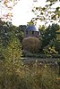 | ||
| Parish and St. Monulphus Gondulph (nl)(fr) | Hamont-Achel | Michielsplein | 51°15′17″N5°28′45″E / 51.25468°N 5.47914°E | 80089 Info | |||
| kiosk (nl)(fr) | Hamont-Achel | Michielsplein | 51°15′15″N5°28′45″E / 51.25419°N 5.47903°E | 80090 Info | |||
| Cast iron village pump (nl)(fr) | Hamont-Achel | Michielsplein | 51°15′11″N5°28′47″E / 51.25301°N 5.47982°E | 80091 Info | |||
| 'T Mulke (nl) | Hamont-Achel | Molendijk 45 | 51°16′21″N5°29′55″E / 51.27259°N 5.49865°E | 80092 Info | |||
| Chapel of Our Lady in Distress (nl)(fr) | Hamont-Achel | Orchideeënlaan | 51°15′12″N5°29′44″E / 51.25331°N 5.49545°E | 80093 Info | |||
| St. Joseph Chapel (nl)(fr) | Hamont-Achel | Orchideeënlaan | 51°15′14″N5°29′08″E / 51.25395°N 5.48545°E | 80094 Info | |||
| Natural stone border marker (nl) | Hamont-Achel | Orchideeënlaan | 51°15′14″N5°29′49″E / 51.25377°N 5.49699°E | 80095 Info | |||
| elongated farm "Melskens" (nl) | Hamont-Achel | Oude Baan 30 | 51°15′41″N5°28′42″E / 51.26130°N 5.47833°E | 80097 Info | |||
| Barn near a modern house (nl) | Hamont-Achel | Oude Pastorijstraat 32 | 51°15′27″N5°28′20″E / 51.25754°N 5.47229°E | 80098 Info | |||
| electricity cabin (nl)(fr) | Hamont-Achel | Pastoor Bungenerslaan | 51°15′22″N5°28′45″E / 51.25619°N 5.47923°E | 80099 Info | |||
| former presbytery (nl)(fr) | Hamont-Achel | Pastoor Bungenerslaan 2 | 51°15′19″N5°28′47″E / 51.25517°N 5.47961°E | 80100 Info | |||
| Former girls' school and convent of the Sisters Jozefienen (nl)(fr) | Hamont-Achel | Pastoor Bungenerslaan 14 | 51°15′23″N5°28′47″E / 51.25625°N 5.47961°E | 80101 Info | |||
| elongated farm (nl)(fr) | Hamont-Achel | Rodenrijt | 51°16′10″N5°28′10″E / 51.26933°N 5.46932°E | 80102 Info | |||
| "Huis Van Waesberghe" (nl) | Hamont-Achel | Schutterijstraat 3 | 51°15′15″N5°28′41″E / 51.25411°N 5.47810°E | 80103 Info | |||
| "Finding of Holy Cross" Parish (nl)(fr) | Hamont-Achel | Sint Odilialaan | 51°16′29″N5°28′29″E / 51.27468°N 5.47465°E | 80104 Info | |||
| Painted iron boundary marker (nl)(fr) | Hamont-Achel | Sint Odilialaan | 51°17′17″N5°28′12″E / 51.28818°N 5.47013°E | 80105 Info | |||
| Old house Ceelen (nl)(fr) | Hamont-Achel | Thomas Watsonlaan 4 | 51°15′03″N5°28′46″E / 51.25092°N 5.47931°E | 80106 Info | |||
| Old house Ceelen (nl)(fr) | Hamont-Achel | Thomas Watsonlaan 6 | 51°15′03″N5°28′46″E / 51.25092°N 5.47931°E | 80106 Info | |||
| Single residential house (nl)(fr) | Hamont-Achel | Thomas Watsonlaan 32 | 51°14′57″N5°28′48″E / 51.24927°N 5.47994°E | 80107 Info | |||
| Former weigh house (nl) | Hamont-Achel | Wagerdijk | 51°16′00″N5°30′22″E / 51.26662°N 5.50615°E | 80108 Info | |||
| Single elongated farm (nl)(fr) | Hamont-Achel | Witteberg 14 | 51°15′35″N5°28′00″E / 51.25980°N 5.46659°E | 80109 Info | |||
| elongated farm (nl)(fr) | Hamont-Achel | Eind 68 | 51°16′01″N5°28′36″E / 51.26681°N 5.47653°E | 80110 Info | |||
| Single residential house (nl)(fr) | Hamont-Achel | Generaal Dempseylaan 10 | 51°15′24″N5°28′44″E / 51.25677°N 5.47889°E | 80111 Info |

