This table shows an overview of the immovable heritage sites in the Flemish town Hasselt . This list is part of Belgium's national heritage.

Beschermd erfgoed is the official term to describe Flemish National Heritage Sites listed by law to protect and spread awareness of Belgian cultural heritage, specifically in Flanders. The term is also used nationwide to refer to national heritage sites. Because Belgium is officially a tri-lingual country, the other nationwide terms used in the rest of the country are the French term Bien classé and the German term Kulturdenkmal.

Hasselt is a Flemish city and municipality, and capital of the province of Limburg in Belgium. The Hasselt municipality includes the original city of Hasselt, plus the old communes of Sint-Lambrechts-Herk, Wimmertingen, Kermt, Spalbeek, Kuringen, Stokrooie, Stevoort and Runkst, as well as the hamlets and parishes of Kiewit, Godsheide and Rapertingen.
| Object | Status? | Year/architect | Town/section | Address | Coordinates | Number? | Image |
|---|---|---|---|---|---|---|---|
| House "Het Verxken" or "Het Wilt Vercken" (nl)(fr) | Hasselt | Aldestraat 10-12 | 50°55′49″N5°20′05″E / 50.93041°N 5.33475°E | 21834 Info |  | ||
| Neoclassical house (nl)(fr) | Hasselt | Aldestraat 16 | 50°55′49″N5°20′05″E / 50.93041°N 5.33475°E | 21834 Info |  | ||
| The Golden House Swaen (nl)(fr) | Hasselt | Aldestraat 29 | 50°55′49″N5°20′05″E / 50.93041°N 5.33475°E | 21834 Info |  | ||
| Neoclassical house (nl)(fr) | Hasselt | Aldestraat 34 | 50°55′49″N5°20′05″E / 50.93041°N 5.33475°E | 21834 Info |  | ||
| Neoclassical house (nl)(fr) | Hasselt | Aldestraat 36 | 50°55′49″N5°20′05″E / 50.93041°N 5.33475°E | 21834 Info |  | ||
| Neoclassical house (nl)(fr) | Hasselt | Aldestraat 46 | 50°55′49″N5°20′05″E / 50.93041°N 5.33475°E | 21834 Info |  | ||
| Neoclassical house (nl)(fr) | Hasselt | Aldestraat 48 | 50°55′49″N5°20′05″E / 50.93041°N 5.33475°E | 21834 Info |  | ||
| Neoclassical house (nl)(fr) | Hasselt | Aldestraat 50 | 50°55′49″N5°20′05″E / 50.93041°N 5.33475°E | 21834 Info |  | ||
| Neoclassical house (nl)(fr) | Hasselt | Aldestraat 52 | 50°55′49″N5°20′05″E / 50.93041°N 5.33475°E | 21834 Info |  | ||
| Mansion (nl)(fr) | Hasselt | Aldestraat 38 | 50°55′49″N5°20′07″E / 50.93019°N 5.33536°E | 21843 Info |  | ||
| House "Heusden" (nl)(fr) | Hasselt | Aldestraat 44 | 50°55′49″N5°20′06″E / 50.93032°N 5.33500°E | 21844 Info |  | ||
| House "The Lombard Huys" (nl)(fr) | Hasselt | Aldestraat 53 | 50°55′51″N5°20′06″E / 50.93076°N 5.33492°E | 21845 Info |  | ||
| houses (nl)(fr) | Hasselt | Badderijstraat 21 | 50°55′56″N5°20′32″E / 50.93215°N 5.34209°E | 21846 Info |  | ||
| houses (nl)(fr) | Hasselt | Badderijstraat 23 | 50°55′56″N5°20′32″E / 50.93215°N 5.34209°E | 21846 Info |  | ||
| houses (nl)(fr) | Hasselt | Badderijstraat 24 | 50°55′56″N5°20′32″E / 50.93215°N 5.34209°E | 21846 Info |  | ||
| neoclassical corner house (nl)(fr) | Hasselt | Bampslaan 4 | 50°55′47″N5°19′53″E / 50.92985°N 5.33144°E | 21850 Info |  | ||
| Neoclassical mansion (nl)(fr) | Hasselt | Bampslaan 13 | 50°55′49″N5°19′53″E / 50.93030°N 5.33141°E | 21851 Info |  | ||
| Left Home "ANTVERPIA" (nl)(fr) | Hasselt | Bampslaan 26 | 50°55′49″N5°19′49″E / 50.93019°N 5.33035°E | 21852 Info |  | ||
| Right House "ANTVERPIA" (nl)(fr) | Hasselt | Bampslaan 28 | 50°55′49″N5°19′49″E / 50.93019°N 5.33035°E | 21852 Info |  | ||
| Mansion, corner house (nl)(fr) | Hasselt | Bampslaan 37 | 50°55′50″N5°19′48″E / 50.93060°N 5.33005°E | 21853 Info |  | ||
| House "Den Eendenbeck" (nl) | Hasselt | Bonnefantenstraat 19 | 50°55′59″N5°20′24″E / 50.93313°N 5.33997°E | 21856 Info |  | ||
| Flat, wide house (nl)(fr) | Hasselt | Bonnefantenstraat 26 | 50°56′00″N5°20′23″E / 50.93322°N 5.33968°E | 21857 Info |  | ||
| Flat, wide house (nl)(fr) | Hasselt | Botermarkt 5 | 50°55′50″N5°20′18″E / 50.93049°N 5.33838°E | 21858 Info |  | ||
| House "At the Golden Scissors" (nl) | Hasselt | Botermarkt 17 | 50°55′49″N5°20′20″E / 50.93035°N 5.33887°E | 21859 Info |  | ||
| House "De Mereminne" (nl) | Hasselt | Botermarkt 19 | 50°55′49″N5°20′20″E / 50.93035°N 5.33895°E | 21860 Info |  | ||
| Homes, part of the former "De Keyser Croon" (nl)(fr) | Hasselt | Botermarkt 22 | 50°55′50″N5°20′19″E / 50.93058°N 5.33866°E | 21861 Info |  | ||
| Homes, part of the former "De Keyser Croon" (nl)(fr) | Hasselt | Botermarkt 24 | 50°55′50″N5°20′19″E / 50.93058°N 5.33866°E | 21861 Info |  | ||
| House "De Roosemarynboom" (nl) | Hasselt | Botermarkt 26 | 50°55′50″N5°20′20″E / 50.93057°N 5.33889°E | 21862 Info |  | ||
| Corner house "De Drij Dragonders" (nl) | Hasselt | Botermarkt 28 | 50°55′50″N5°20′21″E / 50.93057°N 5.33913°E | 21863 Info |  | ||
| House, now pub (nl)(fr) | Hasselt | Casterstraat 46 | 50°55′40″N5°20′58″E / 50.92786°N 5.34949°E | 21864 Info |  | ||
| Corner house of 1867 (nl)(fr) | Hasselt | Demerstraat 2 | 50°55′51″N5°20′15″E / 50.93077°N 5.33755°E | 21865 Info |  | ||
| House "Het Boogsken" or "Den Gulden Boog" (nl) | Hasselt | Demerstraat 3 | 50°55′51″N5°20′17″E / 50.93078°N 5.33792°E | 21866 Info |  | ||
| Property of 1867 (nl)(fr) | Hasselt | Demerstraat 4 | 50°55′51″N5°20′15″E / 50.93090°N 5.33757°E | 21867 Info |  | ||
| Neoclassical homes (nl)(fr) | Hasselt | Demerstraat 6-8 | 50°55′51″N5°20′15″E / 50.93097°N 5.33751°E | 21868 Info |  | ||
| Neoclassical homes (nl)(fr) | Hasselt | Demerstraat 12 | 50°55′51″N5°20′15″E / 50.93097°N 5.33751°E | 21868 Info |  | ||
| Neoclassical homes (nl)(fr) | Hasselt | Demerstraat 12 | 50°55′51″N5°20′15″E / 50.93097°N 5.33751°E | 21868 Info |  | ||
| House "Den IJseren Hoedt" (nl) | Hasselt | Demerstraat 9 | 50°55′51″N5°20′17″E / 50.93092°N 5.33801°E | 21869 Info |  | ||
| House "Het Groot Fortuyn", former distillery (nl) | Hasselt | Demerstraat 21 | 50°55′53″N5°20′18″E / 50.93133°N 5.33828°E | 21871 Info |  | ||
| House "Sint-Joseph" (nl) | Hasselt | Demerstraat 33 | 50°55′54″N5°20′17″E / 50.93157°N 5.33816°E | 21872 Info |  | ||
| House "De Fransche Kroon", former jenever distillery (nl) | Hasselt | Demerstraat 37 | 50°55′54″N5°20′18″E / 50.93173°N 5.33828°E | 21873 Info |  | ||
| Two houses, wide houses (nl)(fr) | Hasselt | Demerstraat 39 | 50°55′54″N5°20′18″E / 50.93179°N 5.33820°E | 21874 Info |  | ||
| Two houses, wide houses (nl)(fr) | Hasselt | Demerstraat 41 | 50°55′54″N5°20′18″E / 50.93179°N 5.33820°E | 21874 Info |  | ||
| House "De Warande", former jenever distillery (nl) | Hasselt | Demerstraat 43-45 | 50°55′55″N5°20′17″E / 50.93189°N 5.33817°E | 21875 Info |  | ||
| House in neoclassical style (nl)(fr) | Hasselt | Demerstraat 46 | 50°56′02″N5°20′21″E / 50.93383°N 5.33914°E | 21876 Info |  | ||
| House in neoclassical style (nl)(fr) | Hasselt | Demerstraat 48 | 50°56′02″N5°20′21″E / 50.93383°N 5.33914°E | 21876 Info |  | ||
| Houses in neoclassical style (nl)(fr) | Hasselt | Demerstraat 49 | 50°56′02″N5°20′21″E / 50.93383°N 5.33914°E | 21876 Info |  | ||
| Houses in neoclassical style (nl)(fr) | Hasselt | Demerstraat 50 | 50°56′02″N5°20′21″E / 50.93383°N 5.33914°E | 21876 Info |  | ||
| Houses in neoclassical style (nl)(fr) | Hasselt | Demerstraat 53 | 50°56′02″N5°20′21″E / 50.93383°N 5.33914°E | 21876 Info |  | ||
| Houses in neoclassical style (nl)(fr) | Hasselt | Demerstraat 68 | 50°56′02″N5°20′21″E / 50.93383°N 5.33914°E | 21876 Info |  | ||
| Houses in neoclassical style (nl)(fr) | Hasselt | Demerstraat 70 | 50°56′02″N5°20′21″E / 50.93383°N 5.33914°E | 21876 Info | |||
| Houses in neoclassical style (nl)(fr) | Hasselt | Demerstraat 72 | 50°56′02″N5°20′21″E / 50.93383°N 5.33914°E | 21876 Info | |||
| Houses in neoclassical style (nl)(fr) | Hasselt | Demerstraat 74 | 50°56′02″N5°20′21″E / 50.93383°N 5.33914°E | 21876 Info |  | ||
| Houses in neoclassical style (nl)(fr) | Hasselt | Demerstraat 76 | 50°56′02″N5°20′21″E / 50.93383°N 5.33914°E | 21876 Info |  | ||
| Houses in neoclassical style (nl)(fr) | Hasselt | Demerstraat 78 | 50°56′02″N5°20′21″E / 50.93383°N 5.33914°E | 21876 Info |  | ||
| Houses in neoclassical style (nl)(fr) | Hasselt | Demerstraat 88 | 21876 Info | ||||
| Houses in neoclassical style (nl)(fr) | Hasselt | Demerstraat 90 | 21876 Info | ||||
| Houses in neoclassical style (nl)(fr) | Hasselt | Demerstraat 92 | 21876 Info | ||||
| Houses in neoclassical style (nl)(fr) | Hasselt | Demerstraat 94 | 21876 Info | ||||
| house (nl)(fr) | Hasselt | Demerstraat 58 | 50°55′58″N5°20′18″E / 50.93280°N 5.33834°E | 21877 Info |  | ||
| House "De Gulden Spoor" (nl) | Hasselt | Demerstraat 69 | 50°55′57″N5°20′19″E / 50.93258°N 5.33869°E | 21878 Info |  | ||
| Corner house "The Prince of Luyck" (nl) | Hasselt | Diesterstraat 1 | 50°55′50″N5°19′58″E / 50.93044°N 5.33291°E | 21881 Info |  | ||
| Corner house (nl) | Hasselt | Diesterstraat 24-26 | 50°55′50″N5°19′58″E / 50.93044°N 5.33291°E | 21881 Info |  | ||
| Corner houses (nl)(fr) | Hasselt | Thonissenlaan 1 | 50°55′50″N5°19′58″E / 50.93044°N 5.33291°E | 21881 Info |  | ||
| House "De Kleyn Gasthuyskerck" (nl) | Hasselt | Diesterstraat 4 | 50°55′48″N5°20′01″E / 50.93005°N 5.33357°E | 21882 Info |  | ||
| House "Die Witte Lersse" (nl) | Hasselt | Diesterstraat 6 | 50°55′48″N5°20′01″E / 50.93009°N 5.33355°E | 21883 Info |  | ||
| House "De Witte Leeuw" (nl) | Hasselt | Diesterstraat 8 | 50°55′48″N5°20′00″E / 50.93009°N 5.33345°E | 21884 Info |  | ||
| house (nl)(fr) | Hasselt | Diesterstraat 9 | 50°55′50″N5°20′01″E / 50.93045°N 5.33371°E | 21885 Info |  | ||
| House "In den Gaper" (nl) | Hasselt | Diesterstraat 11 | 50°55′50″N5°20′01″E / 50.93045°N 5.33362°E | 21886 Info |  | ||
| The Peasant Dance House (nl)(fr) | Hasselt | Diesterstraat 13 | 50°55′50″N5°20′01″E / 50.93068°N 5.33363°E | 21887 Info |  | ||
| House "De Wal" (nl) | Hasselt | Diesterstraat 15 | 50°55′50″N5°20′00″E / 50.93046°N 5.33338°E | 21889 Info |  | ||
| house (nl)(fr) | Hasselt | Diesterstraat 18 | 50°55′49″N5°19′59″E / 50.93027°N 5.33318°E | 21890 Info | 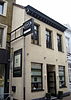 | ||
| House "Cornu" (nl) | Hasselt | Diesterstraat 20 | 50°55′49″N5°19′59″E / 50.93029°N 5.33303°E | 21891 Info |  | ||
| Neoclassical house (nl)(fr) | Hasselt | Dokter Willemsstraat 12 | 50°55′51″N5°20′02″E / 50.93086°N 5.33399°E | 21892 Info |  | ||
| Neoclassical house (nl)(fr) | Hasselt | Dokter Willemsstraat 22 | 50°55′51″N5°20′02″E / 50.93086°N 5.33399°E | 21892 Info |  | ||
| Neoclassical house (nl)(fr) | Hasselt | Dokter Willemsstraat 26 | 50°55′51″N5°20′02″E / 50.93086°N 5.33399°E | 21892 Info |  | ||
| Neoclassical house (nl)(fr) | Hasselt | Dokter Willemsstraat 30 | 50°55′51″N5°20′02″E / 50.93086°N 5.33399°E | 21892 Info |  | ||
| house (nl)(fr) | Hasselt | Dokter Willemsstraat 24 | 50°55′51″N5°20′03″E / 50.93095°N 5.33405°E | 21893 Info |  | ||
| House of L. Willems (former) (nl) | Hasselt | Dokter Willemsstraat 28 | 50°55′52″N5°20′02″E / 50.93109°N 5.33401°E | 21894 Info |  | ||
| Property in neotraditionele style (nl)(fr) | Hasselt | Dorpsstraat 8 | 50°55′55″N5°20′08″E / 50.93205°N 5.33556°E | 21895 Info | 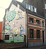 | ||
| house (nl)(fr) | Hasselt | Dorpsstraat 13 | 50°55′56″N5°20′06″E / 50.93213°N 5.33511°E | 21897 Info | 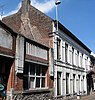 | ||
| Flat, wide house (nl)(fr) | Hasselt | Fruitmarkt 3 | 50°55′48″N5°20′16″E / 50.93006°N 5.33787°E | 21898 Info |  | ||
| Flat, wide house (nl)(fr) | Hasselt | Fruitmarkt 14 | 50°55′49″N5°20′18″E / 50.93038°N 5.33837°E | 21899 Info |  | ||
| Hospital St. Barbaradal and gray convent (nl)(fr) | Hasselt | Thonissenlaan 75 | 50°56′02″N5°20′19″E / 50.93398°N 5.33858°E | 21900 Info |  | ||
| The section house Nieuwen Bauw, former hotel (nl)(fr) | Hasselt | Groenplein | 50°55′52″N5°20′13″E / 50.93105°N 5.33694°E | 21901 Info | 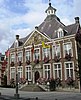 | ||
| Huizen "De Draeck" en "De Sleutel" (nl) | Hasselt | Grote Markt | 50°55′46″N5°20′13″E / 50.92947°N 5.33702°E | 21903 Info |  | ||
| House "De Voetboge Camer" (nl) | Hasselt | Grote Markt 2 | 50°55′46″N5°20′13″E / 50.92957°N 5.33697°E | 21904 Info |  | ||
| House "Het Sweert" (nl) | Hasselt | Grote Markt 3 | 50°55′47″N5°20′13″E / 50.92963°N 5.33702°E | 21905 Info |  | ||
| House "Den Cop" or "Den Gulden Cop" (nl) | Hasselt | Grote Markt 5 | 50°55′47″N5°20′15″E / 50.92968°N 5.33758°E | 21906 Info |  | ||
| House "Die Kettel" or "De Gouden Ketting" (nl) | Hasselt | Grote Markt 9 | 50°55′47″N5°20′16″E / 50.92963°N 5.33791°E | 21908 Info |  | ||
| House "De Koning van Polen" (nl) | Hasselt | Grote Markt 11 | 50°55′46″N5°20′17″E / 50.92957°N 5.33802°E | 21909 Info |  | ||
| house (nl)(fr) | Hasselt | Grote Markt 13 | 50°55′46″N5°20′18″E / 50.92937°N 5.33829°E | 21910 Info |  | ||
| House "Het Slot" (nl) | Hasselt | Grote Markt 14 | 50°55′46″N5°20′17″E / 50.92933°N 5.33818°E | 21911 Info |  | ||
| Corner house "De Drij Pistolen" (nl) | Hasselt | Grote Markt 15 | 50°55′45″N5°20′17″E / 50.92928°N 5.33810°E | 21912 Info |  | ||
| Buildings with shopping arcade (nl)(fr) | Hasselt | Grote Markt 16-17-18 | 50°55′45″N5°20′16″E / 50.92917°N 5.33773°E | 21913 Info |  | ||
| Augustinian Monastery (former) (nl)(fr) | Hasselt | Havermarkt 45 | 50°55′46″N5°20′04″E / 50.92951°N 5.33445°E | 21914 Info |  | ||
| House "De Cleyne Draeck" (nl) | Hasselt | Havermarkt | 50°55′46″N5°20′13″E / 50.92943°N 5.33702°E | 21915 Info |  | ||
| House "De Pandour" or "De Roode Engel" (nl) | Hasselt | Havermarkt 3 | 50°55′46″N5°20′13″E / 50.92948°N 5.33692°E | 21916 Info |  | ||
| House "Het Leerske" or "Die Leerse" (nl) | Hasselt | Havermarkt 4 | 50°55′45″N5°20′13″E / 50.92924°N 5.33692°E | 21917 Info |  | ||
| Commercial Court neoclassical mansion (nl)(fr) | Hasselt | Havermarkt 8 | 50°55′45″N5°20′12″E / 50.92911°N 5.33663°E | 21918 Info |  | ||
| Court (nl)(fr) | Hasselt | Havermarkt 10 | 50°55′44″N5°20′10″E / 50.92893°N 5.33619°E | 21919 Info |  | ||
| house "De Sterre" (nl) | Hasselt | Havermarkt 11 | 50°55′46″N5°20′11″E / 50.92950°N 5.33633°E | 21920 Info |  | ||
| house "De Seehondt" (nl) | Hasselt | Havermarkt 13 | 50°55′46″N5°20′11″E / 50.92950°N 5.33633°E | 21920 Info |  | ||
| corner house "De Gulden Sadel" (nl) | Hasselt | Havermarkt 12 | 50°55′45″N5°20′09″E / 50.92903°N 5.33577°E | 21921 Info |  | ||
| Flat, wide house (nl)(fr) | Hasselt | Havermarkt 14 | 50°55′44″N5°20′08″E / 50.92897°N 5.33556°E | 21922 Info |  | ||
| house "De Kleyne Gulden Put" (nl) | Hasselt | Havermarkt 19 | 50°55′46″N5°20′09″E / 50.92944°N 5.33589°E | 21923 Info |  | ||
| mansion "Den Cleynen Eenhoeren" (nl) | Hasselt | Havermarkt 22 | 50°55′45″N5°20′06″E / 50.92912°N 5.33505°E | 21924 Info |  | ||
| house "De Gulden Put" (nl) | Hasselt | Havermarkt 21 | 50°55′46″N5°20′08″E / 50.92951°N 5.33569°E | 21925 Info |  | ||
| house "De Gulden Put" (nl) | Hasselt | Havermarkt 23 | 50°55′46″N5°20′08″E / 50.92951°N 5.33569°E | 21925 Info |  | ||
| mansion "De Groote Eenhoren" (nl) | Hasselt | Havermarkt 24 | 50°55′45″N5°20′05″E / 50.92906°N 5.33479°E | 21926 Info |  | ||
| mansion "Sint-Augustinus" (nl) | Hasselt | Havermarkt 28 | 50°55′45″N5°20′05″E / 50.92909°N 5.33462°E | 21927 Info |  | ||
| house "De Cat" (nl) | Hasselt | Havermarkt 27 | 50°55′46″N5°20′08″E / 50.92942°N 5.33550°E | 21928 Info |  | ||
| neoclassical house (nl)(fr) | Hasselt | Havermarkt 29 | 50°55′46″N5°20′07″E / 50.92942°N 5.33539°E | 21929 Info |  | ||
| post Office (nl)(fr) | Hasselt | Havermarkt 31-33 | 50°55′46″N5°20′07″E / 50.92948°N 5.33516°E | 21930 Info |  | ||
| Mansion in eclectic style of 1913 (nl)(fr) | Hasselt | Havermarkt 32 | 50°55′45″N5°20′03″E / 50.92909°N 5.33428°E | 21931 Info |  | ||
| Baroque corner house in the 1925 (nl)(fr) | Hasselt | Havermarkt 47 | 50°55′46″N5°20′03″E / 50.92954°N 5.33412°E | 21933 Info |  | ||
| Sacred Heart Parish (nl)(fr) | Hasselt | Plantenstraat 75 | 50°56′08″N5°19′37″E / 50.93543°N 5.32688°E | 21934 Info |  | ||
| house "Het Corenvat" en "Het Cleyn Coren vat" (nl) | Hasselt | Botermarkt 25 | 50°55′49″N5°20′22″E / 50.93022°N 5.33936°E | 21935 Info |  | ||
| mansion "Het Hemelrijk" (nl) | Hasselt | Hemelrijk 13 | 50°55′48″N5°20′24″E / 50.93004°N 5.33987°E | 21936 Info |  | ||
| mansion "De Helm" (nl) | Hasselt | Hoogstraat 1 | 50°55′47″N5°20′15″E / 50.92975°N 5.33761°E | 21937 Info |  | ||
| house "De Roos" (nl) | Hasselt | Hoogstraat 2 | 50°55′47″N5°20′14″E / 50.92983°N 5.33724°E | 21938 Info |  | ||
| house "De Seven Weeen" (nl) | Hasselt | Hoogstraat 4 | 50°55′48″N5°20′14″E / 50.92993°N 5.33722°E | 21939 Info |  | ||
| house "De Reep" or "Moriaenshoek" (nl) | Hasselt | Hoogstraat 5 | 50°55′48″N5°20′16″E / 50.92992°N 5.33772°E | 21940 Info |  | ||
| house "De Suikerton" or "De Suikerpot" (nl) | Hasselt | Hoogstraat 7 | 50°55′48″N5°20′16″E / 50.92997°N 5.33773°E | 21941 Info |  | ||
| house "De Dry Cronen", apotheek (nl) | Hasselt | Hoogstraat 8 | 50°55′48″N5°20′14″E / 50.93005°N 5.33720°E | 21942 Info |  | ||
| house "Het Molenyser" (nl) | Hasselt | Hoogstraat 9 | 50°55′48″N5°20′15″E / 50.93004°N 5.33763°E | 21943 Info |  | ||
| house "Het Swert Schaep" (nl) | Hasselt | Hoogstraat 12 | 50°55′48″N5°20′14″E / 50.93013°N 5.33724°E | 21944 Info |  | ||
| Flat, wide house (nl)(fr) | Hasselt | Hoogstraat 15 | 50°55′49″N5°20′16″E / 50.93035°N 5.33773°E | 21945 Info |  | ||
| house "De Pereboom" (nl) | Hasselt | Hoogstraat 24 | 50°55′50″N5°20′15″E / 50.93044°N 5.33747°E | 21948 Info |  | ||
| house "De Molensteen" (nl) | Hasselt | Hoogstraat 26 | 50°55′50″N5°20′15″E / 50.93049°N 5.33738°E | 21949 Info |  | ||
| Homes, houses wide (nl)(fr) | Hasselt | Isabellastraat 13 | 50°55′58″N5°20′11″E / 50.93271°N 5.33635°E | 21950 Info | 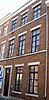 | ||
| Homes, houses wide (nl)(fr) | Hasselt | Isabellastraat 15 | 50°55′58″N5°20′11″E / 50.93271°N 5.33635°E | 21950 Info |  | ||
| Homes, houses wide (nl)(fr) | Hasselt | Isabellastraat 17 | 50°55′58″N5°20′11″E / 50.93271°N 5.33635°E | 21950 Info |  | ||
| Homes, houses wide (nl)(fr) | Hasselt | Isabellastraat 19 | 50°55′58″N5°20′11″E / 50.93271°N 5.33635°E | 21950 Info |  | ||
| Chapel of Our Lady Virga Jesse (nl) | Hasselt | Kapelstraat | 50°55′47″N5°20′11″E / 50.92973°N 5.33631°E | 21952 Info |  | ||
| house "Den Crans" (nl) | Hasselt | Kapelstraat 1 | 50°55′47″N5°20′14″E / 50.92983°N 5.33724°E | 21953 Info |  | ||
| house "Het Kalf" or "Het Gulden Kalf" (nl) | Hasselt | Kapelstraat 4 | 50°55′47″N5°20′13″E / 50.92969°N 5.33698°E | 21954 Info |  | ||
| house "Den Turck" later "De Forteyne" (nl) | Hasselt | Kapelstraat 3 | 50°55′47″N5°20′14″E / 50.92986°N 5.33710°E | 21955 Info |  | ||
| house "De Gulden Borsse" or "Gulden Beurse" (nl) | Hasselt | Kapelstraat 5 | 50°55′48″N5°20′13″E / 50.92989°N 5.33704°E | 21956 Info |  | ||
| house "Den Swarten Hoedt" (nl) | Hasselt | Kapelstraat 6A-6B | 50°55′47″N5°20′13″E / 50.92970°N 5.33691°E | 21957 Info |  | ||
| house "De Groote Pellicaen", voormalige herberg (nl) | Hasselt | Kapelstraat 43 | 50°55′48″N5°20′06″E / 50.93011°N 5.33513°E | 21958 Info |  | ||
| house "De Kleine Mortier" or "Het Oud College" (nl) | Hasselt | Kapelstraat 44 | 50°55′47″N5°20′03″E / 50.92977°N 5.33414°E | 21959 Info |  | ||
| mansion "De Gulden Mortier" (nl) | Hasselt | Kapelstraat 46 | 50°55′47″N5°20′02″E / 50.92981°N 5.33401°E | 21960 Info |  | ||
| house "De Groote Seyssen" or "Die Gulden Seyssen" (nl) | Hasselt | Kapelstraat 47 | 50°55′48″N5°20′06″E / 50.93001°N 5.33491°E | 21961 Info |  | ||
| house "Sinte-Geertruyde" (nl) | Hasselt | Kapelstraat 48 | 50°55′48″N5°20′02″E / 50.92987°N 5.33393°E | 21962 Info |  | ||
| house "De Arent" or "Den Swerten Aer" (nl) | Hasselt | Kapelstraat 49 | 50°55′48″N5°20′05″E / 50.93010°N 5.33462°E | 21963 Info | 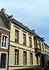 | ||
| house "Het Lombardenhuys" (nl) | Hasselt | Kapelstraat 51 | 50°55′48″N5°20′04″E / 50.93003°N 5.33445°E | 21964 Info |  | ||
| house "De Reep" (nl) | Hasselt | Kapelstraat 55 | 50°55′48″N5°20′03″E / 50.93010°N 5.33414°E | 21965 Info |  | ||
| house "De Wijzer" (nl) | Hasselt | Kapelstraat 57 | 50°55′48″N5°20′02″E / 50.93013°N 5.33402°E | 21966 Info |  | ||
| Meeting House Literary Society (nl)(fr) | Hasselt | Koning Albertstraat 1 | 50°55′45″N5°20′14″E / 50.92925°N 5.33709°E | 21967 Info |  | ||
| house "De Bruyne Visch" (nl) | Hasselt | Koning Albertstraat 5-7 | 50°55′45″N5°20′13″E / 50.92903°N 5.33698°E | 21968 Info |  |

