List of largest cities in Organisation of Islamic Cooperation member countries

Last updated

This is a list of the largest cities in the Organisation of Islamic Cooperation member states, based on the United Nations World Urbanization Prospects report (2010 population estimates from the report's 2007 revision). [1]

Contents

Largest urban agglomerations in the OIC

RankCityImagesPopulationCountryStatistical concept [2] Area (km²) [3]
1 Jakarta [4]
Jakarta Panorama.jpg
30,214,303Flag of Indonesia.svg  Indonesia Urban agglomeration [5] 6,392
2 Karachi [6]
EFU Life By Asif Akbar.jpg
20,500,000Flag of Pakistan.svg  Pakistan Urban agglomeration4,966
3 Dhaka [7]
GulshanDhaka.jpg
18,898,000Flag of Bangladesh.svg  Bangladesh Urban agglomeration2,161
4 Greater Cairo
Towers on the Nile.jpg
18,420,000Flag of Egypt.svg  Egypt Official metropolitan area1,310
5 Lagos [8]
Lagos skyline.jpg
17,060,307Flag of Nigeria.svg  Nigeria Urban agglomeration [9] 907
6 Istanbul
LeventPano3.jpg
14,500,000Flag of Turkey.svg  Turkey Metropolitan municipality 5,343
7 Tehran [10]
Tehran from Qeytariyeh.jpg
13,532,000Flag of Iran.svg  Iran City proper1,489
8 Lahore [10]
Badshahi Mosquee, Lahore.jpg
11,126,285Flag of Pakistan.svg  Pakistan Urban agglomeration1,370
9 Bandung [4]
Modern Bragaweg (27156618256).jpg
8,199,892Flag of Indonesia.svg  Indonesia Urban agglomeration1,876
10 Faisalabad [10]
Clock Tower Faisalabad by Usman Nadeem.jpg
7,873,910Flag of Pakistan.svg  Pakistan Urban agglomeration1,097
11 Islamabad-Rawalpindi [11]
Faisal Masjid From Damn e koh.jpg
7,412,205Flag of Pakistan.svg  Pakistan Metropolitan Area6,451
12 Surabaya [4]
Ciputra World distant from Ahmad Yani Flyover 2015.jpg
7,302,283Flag of Indonesia.svg  Indonesia Urban agglomeration [5] 2,787
13 Baghdad
Baghdad Red zone.jpg
6,625,000Flag of Iraq.svg  Iraq Metropolitan area730
14 Semarang
Mesjid Agung Semarang 2009.jpg
6,544,289Flag of Indonesia.svg  Indonesia Urban agglomeration5,287
15 Kuala Lumpur [10]
FourSeasonsKL January2018.jpg
6,088,000Flag of Malaysia.svg  Malaysia Metropolitan area [5] 673
16 Riyadh [10]
Riyadh Skyline showing the King Abdullah Financial District (KAFD) and the famous Kingdom Tower .jpg
5,666,000Flag of Saudi Arabia.svg  Saudi Arabia City proper1,550
17 Khartoum [10]
Strato en Hartumo (Sudano) 003.jpg
5,185,000Flag of Sudan.svg  Sudan Urban agglomeration580
18 Ankara
Sogutozu, Ankara.jpg
5,045,083Flag of Turkey.svg  Turkey Urban agglomeration [12] 2,516
19 Gujranwala [10]
Nishan-E-Manzil Gujranwala 20140925.jpg
5,014,196Flag of Pakistan.svg  Pakistan Urban agglomeration1,556
20 Chittagong
Chittagong city skyline.jpg
5,012,000Flag of Bangladesh.svg  Bangladesh Official metropolitan area990
21 Multan [13]
Shah Rukn e Alam by M Ali Mir 03.jpg
4,745,109Flag of Pakistan.svg  Pakistan City District 3,721
22 Alexandria
Sea Of Alex.JPG
4,421,000Flag of Egypt.svg  Egypt City proper2,970
23 Peshawar [10]
Islamia College University, Peshawar Nightview.jpg
4,269,079Flag of Pakistan.svg  Pakistan Urban agglomeration1,257
24 Abidjan
Abidjan-Plateau1.JPG
4,175,000Flag of Cote d'Ivoire.svg  Ivory Coast Urban agglomeration2,550
25 Medan [14]
Medan20150219-1.jpg
4,103,696Flag of Indonesia.svg  Indonesia Metropolitan area1,991
26 Yogyakarta
Gadjah Mada HeadOffice.jpg
4,010,436Flag of Indonesia.svg  Indonesia Urban agglomeration1,900
27 Sargodha [15]
Shaheen Enclave Sargodha.jpg
3,903,588Flag of Pakistan.svg  Pakistan City District 5,854
28 Sialkot [16]
Clock Tower, Sialkot 21.jpg
3,893,672Flag of Pakistan.svg  Pakistan City District 3,016
29 Kabul
Modern Kabul - panoramio.jpg
3,768,000Flag of Afghanistan.svg  Afghanistan City proper275
30 Bahawalpur [17] Noor mahal.jpg 3,668,106Flag of Pakistan.svg  Pakistan City District 24,830
31 Algiers
Alger Hilton.JPG
3,574,000Flag of Algeria.svg  Algeria Urban agglomeration [18] 363
32 Mashhad Aerial View of Koohsangi street, Mashhad, Iran.png 3,131,586 [19] Flag of Iran.svg  Iran City proper3,946

See also

References and notes

  1. World Urbanization Prospects, 2007 revision (online data) Archived 2009-06-18 at the Wayback Machine
  2. "Archived copy". Archived from the original on 2009-05-05. Retrieved 2009-12-25.CS1 maint: archived copy as title (link)
  3. The area figures are taken from individual national censuses according to the criteria and statistical concepts noted in the World Urbanization Prospects.
  4. 1 2 3 "Indonesia: Jawa" . Retrieved 2017-07-05.
  5. 1 2 3 Data refer to the functional urban area, that is, contiguous areas which are consistently urban in character as indicated by levels of population density, economic functions and facilities.
  6. http://tribune.com.pk/story/614409/population-explosion-put-an-embargo-on-industrialisation-in-karachi
  7. "Dhaka population" . Retrieved 2017-07-05.
  8. "Archived copy". Archived from the original on 2015-10-18. Retrieved 2016-02-21.CS1 maint: archived copy as title (link)
  9. Data refer to Lagos State
  10. 1 2 3 4 5 6 7 8 http://www.demographia.com/db-worldua.pdf
  11. "Pakistan: Provinces and Major Cities - Population Statistics, Maps, Charts, Weather and Web Information". citypopulation.de.
  12. Ankara includes Altindag, Cankaya, Etimesgut, Golbasi, Keçioren, Mamak, Sincan and Yenimahalle
  13. "Pakistan: Provinces and Major Cities - Population Statistics, Maps, Charts, Weather and Web Information". citypopulation.de.
  14. http://www.citypopulation.de/php/indonesia-sumatera-admin.php
  15. "Pakistan: Provinces and Major Cities - Population Statistics, Maps, Charts, Weather and Web Information". citypopulation.de.
  16. "Pakistan: Provinces and Major Cities - Population Statistics, Maps, Charts, Weather and Web Information". citypopulation.de.
  17. "Pakistan: Provinces and Major Cities - Population Statistics, Maps, Charts, Weather and Web Information". citypopulation.de.
  18. Data refer to the Governorate of Grand Algiers.
  19. "Archived copy" (PDF). Archived from the original (PDF) on 2014-07-03. Retrieved 2008-02-27.CS1 maint: archived copy as title (link)

Related Research Articles

Districts of Pakistan

The Districts of Pakistan, are the third-order administrative divisions of Pakistan, below provinces and divisions, but forming the first-tier of local government. In total, there are 154 districts in Pakistan including the Capital Territory and the districts of Azad Kashmir and Gilgit Baltistan. These districts are further divided into Tehsils, Union Councils.

Kotri City in Sindh, Pakistan

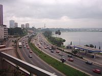
Kotri is a city and the headquarters of the Kotri Taluka of Jamshoro District of Sindh province in Pakistan. Located on the right bank of the Indus River, it is the 29th largest city in Pakistan. It is also the largest city of Jamshoro District.

Mianwali City in Punjab, Pakistan

Mianwali is the capital city of Mianwali District, Pakistan. It is the 81st largest city of Pakistan. City was on the name of famous sufi Syed Mian Ali Sultan Zakriya Shah Gillani AlQadri R.A.

Decade Volcanoes

The Decade Volcanoes are 16 volcanoes identified by the International Association of Volcanology and Chemistry of the Earth's Interior (IAVCEI) as being worthy of particular study in light of their history of large, destructive eruptions and proximity to populated areas. The Decade Volcanoes project encourages studies and public-awareness activities at these volcanoes, with the aim of achieving a better understanding of the volcanoes and the dangers they present, and thus being able to reduce the severity of natural disasters.

Ghotki City in Sindh, Pakistan

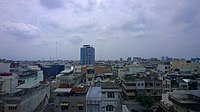
Ghotki, is a city in northern Sindh, Pakistan. It is the headquarters of Ghotki District and Ghotki Taluka. It is the 87th largest city of Pakistan by population. Ghotki is famous for Date Palm

Jhang City in Punjab, Pakistan

Jhang is the capital city of Jhang District, in the central portion of the province of Punjab, Pakistan. Situated on the east bank of the Chenab river, it is the 18th largest city of Pakistan by population.

Shahpur, Punjab City in Punjab, Pakistan

Shahpur is a city and capital of Shahpur Tehsil, located in Sargodha District in the Punjab province, of Pakistan. It lies on the Jhelum River. Shahpur is distributed in two sectors, Shahpur Sadar and Shahpur City. Shahpur Sadar is known for its British offices, district jail and possesses huge number of prominent members of Chadhar's Tribe, mainly active in regional politics.

Khanpur, Rahim Yar Khan City in Punjab, Pakistan

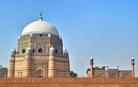
Khanpur is a city and capital of Khanpur Tehsil of the Rahim Yar Khan District, Bahawalpur Division, in the Punjab province of Pakistan. It is the 45th largest city of Pakistan by population according to the 2017 census.

Kamoke City in Punjab, Pakistan

Kamoke is a city in Gujranwala District, Punjab, Pakistan. It is the 30th largest city of Pakistan. The city is the capital of Kamoke Tehsil, which is an administrative subdivision of the district and is itself subdivided into eight Union Councils. It is located on the Grand Trunk Road 21 km [13.0 mi] from Gujranwala and 44 km [27.3 mi] from Lahore.

Bhalwal City in Punjab, Pakistan

Bhalwal, is a city and capital of Bhalwal Tehsil of Sargodha District in the centre of the Punjab province of Pakistan. It is the 99th largest city of Pakistan, according to 2017 census. The town of Bhalwal is the headquarters of Bhalwal Tehsil and lies in an agricultural area, close to the M-2 motorway. Bhalwal is famous for Orange crops of Pakistan

Mirpur Mathelo City in Sindh, Pakistan

Mirpur Mathelo is a city in Ghotki District, Sindh province, Pakistan. The city is administratively subdivided into ten union councils. It is the 97th largest city in Pakistan with a population of 100,760 according to 2017 census.