List of largest cities of U.S. states and territories by population

Last updated

This is a list of the five most populous incorporated cities and the capital city in all 50 U.S. states, the District of Columbia, and the 5 inhabited territories of the United States.

Contents

List

State, federal
district, or territory
State, federal district,
or territory population [1]
Most populous2nd most populous3rd most populous4th most populous5th most populousCapital (if not
otherwise listed)
NamePopulationNamePopulationNamePopulationNamePopulationNamePopulationNamePopulation
Flag of Alabama.svg  Alabama 4,887,871 Huntsville 215,006 Montgomery 200,603 Birmingham 197,575 Mobile 187,041 Tuscaloosa 99,600 [2]
Flag of Alaska.svg  Alaska 737,438 Anchorage 291,538 Juneau 32,197 Fairbanks 31,516 Wasilla 10,529 Sitka 8,647
Flag of American Samoa.svg  American Samoa 55,519 [3] Tafuna 7,945 [4] Nuʻuuli 3,955 Pago Pago 3,656 'Ili'ili 3,195 Pava'ia'i 2,450 [note 1]
Flag of Arizona.svg  Arizona 7,171,646 Phoenix 1,660,272 Tucson 545,975 Mesa 508,958 Chandler 257,165 Scottsdale 255,310
Flag of Arkansas.svg  Arkansas 3,013,852 Little Rock 202,591 Fayetteville 93,949 Fort Smith 89,142 Springdale 84,161 Jonesboro 78,576
Flag of California.svg  California 39,557,045 Los Angeles 3,997,984 San Diego 1,425,976 San Jose 1,030,119 San Francisco 884,198 Fresno 530,093 Sacramento (6)508,529
Flag of Colorado.svg  Colorado 5,695,564 Denver 719,238 Colorado Springs 483,829 Aurora 374,114 Fort Collins 167,830 Lakewood 156,798
Flag of Connecticut.svg  Connecticut 3,605,944 Bridgeport 148,654 Stamford 135,470 New Haven 134,023 Hartford 121,054 Waterbury 114,403
Flag of Delaware.svg  Delaware 967,171 Wilmington 70,635 Dover 38,079 Newark 33,673 Middletown 22,582 Smyrna 11,580
Flag of Washington, D.C.svg  District of Columbia 702,455 Washington, D.C. 702,455
Flag of Florida.svg  Florida 21,538,187 Jacksonville 949,611 Miami 467,963 Tampa 384,959 Orlando 307,573 St. Petersburg 258,308 Tallahassee (8)196,169
Flag of Georgia (U.S. state).svg  Georgia 10,711,908 Atlanta 498,715 Columbus 206,922 Augusta 202,081 Macon 157,346 Savannah 147,780
Flag of Guam.svg  Guam 159,358 Dededo 44,943 Yigo 20,539 Tamuning 19,685 Mangilao 15,191 Barrigada 8,875 Hagåtña (18)1,051
Flag of Hawaii.svg  Hawaii 1,420,491 Honolulu 1 347,397 East Honolulu 1 49,914 Pearl City 1 47,698 Hilo 1 43,263 Kailua 1 38,635
Flag of Idaho.svg  Idaho 1,754,208 Boise 228,790 Meridian 106,894 Nampa 96,252 Idaho Falls 63,398 Caldwell 56,541
Flag of Illinois.svg  Illinois 12,741,080 Chicago 2,705,994 Aurora 198,187 Naperville 148,304 Joliet 148,099 Rockford 146,526 Springfield (6)114,694
Flag of Indiana.svg  Indiana 6,691,878 Indianapolis 867,125 Fort Wayne 267,633 Evansville 117,963 South Bend 103,290 Carmel 99,329
Flag of Iowa.svg  Iowa 3,156,145 Des Moines 216,853 Cedar Rapids 133,174 Davenport 102,085 Sioux City 82,396 Iowa City 76,290
Flag of Kansas.svg  Kansas 2,911,505 Wichita 389,225 Overland Park 197,219 Kansas City 156,607 Olathe 139,605 Topeka 125,904
Flag of Kentucky.svg  Kentucky 4,468,402 Louisville 620,578 Lexington 323,780 Bowling Green 68,401 Owensboro 59,809 Covington 40,366 Frankfort (15)27,679
Flag of Louisiana.svg  Louisiana 4,659,978 New Orleans 399,187 Baton Rouge 221,599 Shreveport 185,902 Lafayette 126,143 Lake Charles 78,001
Flag of Maine.svg  Maine 1,338,404 Portland 66,417 Lewiston 35,944 Bangor 31,997 South Portland 25,606 Auburn 23,196 Augusta (10)18,681
Flag of Maryland.svg  Maryland 4 6,042,718 Baltimore 594,282 Columbia 104,156 Germantown 91,347 Silver Spring 83,267 Waldorf 78,904 Annapolis (7)39,174
Flag of Massachusetts.svg  Massachusetts 6,902,149 Boston 699,927 Worcester 185,877 Springfield 155,032 Cambridge 118,977 Lowell 111,670
Flag of Michigan.svg  Michigan 9,995,915 Detroit 672,662 Grand Rapids 200,217 Warren 134,587 Sterling Heights 132,964 Ann Arbor 121,890 Lansing (6)118,427
Flag of Minnesota.svg  Minnesota 5,611,179 Minneapolis 427,728 Saint Paul 312,818 Rochester 117,902 Duluth 85,884 Bloomington 85,578
Flag of Mississippi.svg  Mississippi 2,986,530 Jackson 164,422 Gulfport 71,870 Southaven 54,944 Biloxi 45,968 Hattiesburg 45,951
Flag of Missouri.svg  Missouri 6,126,452 Kansas City 508,090 Saint Louis 302,838 Springfield 168,122 Columbia 123,180 Independence 116,925 Jefferson City (15)42,838
Flag of Montana.svg  Montana 1,062,305 Billings 116,827 Missoula 74,428 Great Falls 58,701 Bozeman 48,532 Butte 34,284 Helena (6)32,315
Flag of Nebraska.svg  Nebraska 1,929,268 Omaha 468,262 Lincoln 287,401 Bellevue 53,627 Grand Island 51,478 Kearney 33,761
Flag of Nevada.svg  Nevada 3,034,392 Las Vegas 649,876 Henderson 317,189 Reno 259,746 North Las Vegas 246,133 Paradise 219,178 Carson City (10)55,414
Flag of New Hampshire.svg  New Hampshire 1,356,458 Manchester 112,525 Nashua 89,246 Concord 43,412 Dover 31,771 Rochester 31,366
Flag of New Jersey.svg  New Jersey 8,908,520 Newark 282,090 Jersey City 265,549 Paterson 145,627 Elizabeth 128,885 Edison 100,008 Trenton (10)83,974
Flag of New Mexico.svg  New Mexico 2,095,428 Albuquerque 560,218 Las Cruces 102,926 Rio Rancho 98,023 Santa Fe 94,528 Roswell 47,635
Flag of New York.svg  New York 19,542,209 New York City 8,879,928 Buffalo 278,349 Yonkers 211,569 Rochester 211,328 Syracuse 148,620 Albany (6)97,279
Flag of North Carolina.svg  North Carolina 10,383,620 Charlotte 882,367 Raleigh 478,956 Greensboro 298,329 Durham 278,547 Winston-Salem 248,232
Flag of North Dakota.svg  North Dakota 760,077 Fargo 124,844 Bismarck 73,112 Grand Forks 56,948 Minot 47,340 West Fargo 36,566
Flag of the Northern Mariana Islands.svg  Northern Mariana Islands 53,883 Saipan 2 48,220 Tinian 2 3,136 Rota 2 2,527 Northern Islands 2 0
Flag of Ohio.svg  Ohio 11,689,442 Columbus 895,477 Cleveland 382,817 Cincinnati 302,605 Toledo 273,782 Akron 198,006
Flag of Oklahoma.svg  Oklahoma 3,943,079 Oklahoma City 649,021 Tulsa 400,669 Norman 123,471 Broken Arrow 109,471 Edmond 93,127
Flag of Oregon.svg  Oregon 4,190,713 Portland 661,189 Salem 173,442 Eugene 171,245 Gresham 110,158 Hillsboro 108,389
Flag of Pennsylvania.svg  Pennsylvania 12,807,060 Philadelphia 1,587,828 Pittsburgh 301,048 Allentown 126,238 Erie 96,471 Reading 88,495 Harrisburg (9)50,183
Flag of Puerto Rico.svg  Puerto Rico 3,195,153 San Juan 320,967 Bayamón 170,480 Carolina 147,661 Ponce 133,191 Caguas 124,434
Flag of Rhode Island.svg  Rhode Island 1,057,315 Providence 179,335 Cranston 81,274 Warwick 80,847 Pawtucket 71,847 East Providence 47,476
Flag of South Carolina.svg  South Carolina 5,124,712 Charleston 150,277 Columbia 136,632 North Charleston 114,852 Mount Pleasant 90,801 Rock Hill 74,372
Flag of South Dakota.svg  South Dakota 882,235 Sioux Falls 181,883 Rapid City 75,443 Aberdeen 28,562 Brookings 24,509 Watertown 22,655 Pierre (8)13,980
Flag of Tennessee.svg  Tennessee 6,770,010 Nashville 681,928 Memphis 650,618 Knoxville 187,500 Chattanooga 180,557 Clarksville 163,648
Flag of Texas.svg  Texas 28,701,845 Houston 2,325,502 San Antonio 1,532,233 Dallas 1,356,785 Austin 993,649 Fort Worth 902,938
Flag of Utah.svg  Utah 3,161,105 Salt Lake City 200,591 West Valley City 136,401 Provo 118,178 West Jordan 116,046 Orem 97,521
Flag of Vermont.svg  Vermont 626,299 Burlington 44,743 South Burlington 20,292 Colchester 17,524 Rutland 15,807 Bennington 15,333 Montpelier (16)8,074
Flag of the United States Virgin Islands.svg Virgin Islands (U.S.) 106,405 Charlotte Amalie 3 18,481 Sion Farm 3 13,003 Northside 3 10,049 East End 3 5,128 Southcentral 3 3,277
Flag of Virginia.svg  Virginia 8,517,685 Virginia Beach 450,189 Norfolk 244,076 Chesapeake 242,634 Richmond 228,783 Arlington 224,906
Flag of Washington.svg  Washington 7,535,591 Seattle 754,567 Spokane 219,190 Tacoma 216,279 Vancouver 183,012 Bellevue 147,599 Olympia (23)52,555
Flag of West Virginia.svg  West Virginia 1,805,832 Charleston 47,215 Huntington 46,048 Morgantown 30,955 Parkersburg 29,675 Wheeling 26,771
Flag of Wisconsin.svg  Wisconsin 5,813,568 Milwaukee 592,025 Madison 258,054 Green Bay 108,827 Kenosha 100,164 Racine 77,432
Flag of Wyoming.svg  Wyoming 577,737 Cheyenne 63,957 Casper 57,461 Laramie 32,473 Gillette 31,903 Rock Springs 23,082

Census-designated places on the list

Note 1: The only incorporated place in Hawaii is the City & County of Honolulu. A portion of it, the Honolulu District, is sometimes regarded as the "city" for statistical purposes, although it has no government separate from that of the City and County as a whole. The U.S. Census Bureau defines Honolulu CDP (census-designated place) to coincide with the Honolulu District. Thus for Hawaii, the largest CDPs are ranked.

Note 2: The 4 municipalities of the Northern Mariana Islands are listed. Each municipality is divided into smaller villages, but the municipalities are considered the primary subdivisions (as in how Saipan is usually listed as the capital rather than Capitol Hill, Saipan). The five largest villages are Garapan (3,983), Dandan (3,280), Koblerville (2,493), Finasisu (2,491) and Kagman III (2,402), with Capitol Hill being the 19th largest village at 1,028 people.

Note 3: The most populous sub-districts of the U.S. Virgin Islands (as defined by the U.S. Census Bureau) are listed. [5] The three largest towns are Charlotte Amalie (10,354), Christiansted (2,433) and Frederiksted (859).

Note 4: Though Maryland has a number of incorporated places, many major population centers, usually suburbs in the Baltimore-Washington corridor, are census-designated places. For a list of incorporated places, see List of incorporated places in Maryland. If only incorporated places are considered, Annapolis, Maryland's capital, is the seventh-largest city of the state.

See also

Notes

  1. Although Pago Pago is the capital of American Samoa, Fagatogo (population 1,737) is the seat of government.

Related Research Articles

<span class="mw-page-title-main">Honolulu</span> Capital city of the U.S. state of Hawaii

Honolulu is the capital and most populous city of the U.S. state of Hawaii, which is in the Pacific Ocean. An unincorporated city, it is the county seat of the consolidated City and County of Honolulu, situated along the southeast coast of the island of Oʻahu, and is the westernmost and southernmost major U.S. city. Honolulu is Hawaii's main gateway to the world. It is also a major hub for business, finance, hospitality, and military defense in both the state and Oceania. The city is characterized by a mix of various Asian, Western, and Pacific cultures, reflected in its diverse demography, cuisine, and traditions.
<span class="mw-page-title-main">County (United States)</span> Subdivision used by most states in the United States

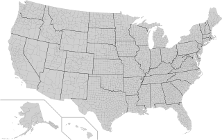
In the United States, a county or county equivalent is an administrative or political subdivision of a U.S. state or other territories of the United States which consists of a geographic area with specific boundaries and usually some level of governmental authority. The term "county" is used in 48 states, while Louisiana and Alaska have functionally equivalent subdivisions called parishes and boroughs, respectively. The specific governmental powers of counties vary widely between the states, with many providing some level of services to civil townships, municipalities, and unincorporated areas. Certain municipalities are in multiple counties; New York City is uniquely partitioned into five counties, referred to at the city government level as boroughs. Some municipalities have been consolidated with their county government to form consolidated city-counties, or have been legally separated from counties altogether to form independent cities. Conversely, those counties in Connecticut, Rhode Island, eight of Massachusetts's 14 counties, and Alaska's Unorganized Borough have no government power, existing only as geographic distinctions.

A census-designated place (CDP) is a concentration of population defined by the United States Census Bureau for statistical purposes only.

<span class="mw-page-title-main">Kapolei, Hawaii</span> Census-designated place in Hawaii, United States

Kapolei is a planned community in Honolulu County, Hawaiʻi, United States, on the island of Oʻahu. It is colloquially known as the "second city" of Oʻahu, in relation to Honolulu. For statistical purposes, the United States Census Bureau has defined Kapolei as a census-designated place (CDP) within the consolidated city-county of Honolulu.

Peppermill Village is an unincorporated community near Maryland Route 214 in Prince George's County, Maryland, United States. Per the 2020 census, the population was 5,264. FedExField, Metrorail's Blue Line, and Hampton Mall shopping center are all located nearby. Because it is not formally incorporated, it has no official boundaries, but the United States Census Bureau has defined a census-designated place (CDP) consisting of Peppermill Village and the adjacent community of Carmody Hills, for statistical purposes.

In 45 of the 50 states of the United States, the county is used for the level of local government immediately below the state itself. Louisiana uses parishes, and Alaska uses boroughs. In Connecticut, Massachusetts, and Rhode Island, some or all counties within states have no governments of their own; the counties continue to exist as legal entities, however, and are used by states for some administrative functions and by the United States Census bureau for statistical analysis. There are 3,242 counties and county equivalent administrative units in total, including the District of Columbia and 100 county-equivalents in the U.S. territories.
<span class="mw-page-title-main">Eastern District, American Samoa</span> District of American Samoa

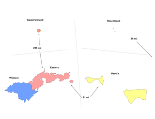
The Eastern District is one of the primary districts of American Samoa. It consists of the eastern portion of Tutuila, American Samoa's largest island, plus the island of Aunu'u. The district has a land area of 67.027 km2 and a 2010 census population of 23,030. It contains 34 villages plus a portion of Nuʻuuli village. Among these are Pago Pago, Fagatogo, and Utulei.

<span class="mw-page-title-main">Honolulu County, Hawaii</span> County in Hawaii, United States

Honolulu County, officially known as the City and County of Honolulu, is a consolidated city-county in the U.S. state of Hawaii. The city-county includes both Urban Honolulu and the rest of the neighborhoods on the island of Oʻahu, as well as several minor outlying islands, including all of the Northwestern Hawaiian Islands except Midway Atoll.

In the United States, a principal city is the largest incorporated place with a population of at least 10,000 in a core-based statistical area (CBSA) or New England city and town area (NECTA), or if no incorporated place of least 10,000 population is present in the CBSA or NECTA, the largest incorporated place or census designated place (CDP) in the CBSA or NECTA. Additional places that meet specific criteria are also identified as principal cities. The title of each metropolitan or micropolitan statistical area consists of the names of up to three of its principal cities and the name of each state into which the metropolitan or micropolitan statistical area extends.

References

  1. Staff, Website Services & Coordination. "US Census Bureau 2010 Census Interactive Population Map". www.census.gov. Archived from the original on 2013-07-30. Retrieved 2016-04-13.
  2. "Alabama – Place. GCT-PH1. Population, Housing Units, Area, and Density: 2000". U.S. Census Bureau. Archived from the original on 2020-02-12. Retrieved 2008-09-28.{{cite journal}}: Cite journal requires |journal= (help)
  3. CIA World Factbook. American Samoa. Retrieved July 5, 2019.
  4. American FactFinder. Profile of General Demographic characteristics: 2010. 2010 American Samoa demographic profile data. Geography set to "Tafuna village, American Samoa" Archived 2017-05-03 at the Wayback Machine . Retrieved July 5, 2019.
  5. Census.gov. 2010 Census - U.S. Virgin Islands Districts and Subdistricts. Retrieved September 21, 2018.