This table shows an overview of the protected heritage sites in the Walloon town Chièvres . This list is part of Belgium's national heritage.
Beschermd erfgoed is the official term to describe Flemish National Heritage Sites listed by law to protect and spread awareness of Belgian cultural heritage, specifically in Flanders. The term is also used nationwide to refer to national heritage sites. Because Belgium is officially a tri-lingual country, the other nationwide terms used in the rest of the country are the French term Bien classé and the German term Kulturdenkmal.
Chièvres is a Walloon municipality located in the Belgian province of Hainaut. On January 1, 2006, Chièvres had a total population of 6,198. The total area is 46.91 km² which gives a population density of 132 inhabitants per km². Chièvres Air Base is located in the municipality.
Object | Year/architect | Town/section | Address | Coordinates | Number? | Image |
---|---|---|---|---|---|---|
The chapel of Saint-Jean Baptiste (nl)(fr) | Chièvres | 50°35′05″N3°48′29″E / 50.584708°N 3.808141°E | 51014-CLT-0001-01 Info | |||
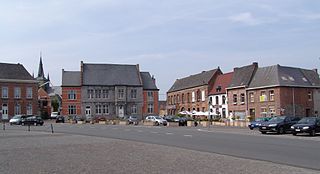
Château d'Egmont (nl)(fr) | Chièvres | Grand'Place, n° s 16-17 | 50°35′16″N3°48′29″E / 50.587669°N 3.808097°E | 51014-CLT-0002-01 Info | ||
The church of Saint-Martin (nl)(fr) | Chièvres | 50°35′18″N3°48′24″E / 50.588449°N 3.806596°E | 51014-CLT-0003-01 Info | |||
Tower Gavre (nl)(fr) | Chièvres | 50°35′20″N3°48′21″E / 50.588850°N 3.805827°E | 51014-CLT-0004-01 Info | |||
Sections of water retaining walls, a 325 m south of the tower of Gavre and the other 145 m to the east (nl)(fr) | Chièvres | 50°35′14″N3°48′19″E / 50.587334°N 3.805168°E | 51014-CLT-0005-01 Info | |||
The chapel de la Ladrerie (nl)(fr) | Chièvres | rue d'Ath, n° 43 | 50°35′50″N3°48′05″E / 50.597360°N 3.801496°E | 51014-CLT-0006-01 Info | ||
fortified house (nl)(fr) | Chièvres | rue de la Cour, n° 38 et alentours | 50°33′35″N3°44′41″E / 50.559608°N 3.744717°E | 51014-CLT-0007-01 Info | ||
The Basilica of Notre-Dame Cathedral and its surroundings (nl)(fr) | Chièvres | 50°34′52″N3°46′27″E / 50.581092°N 3.774061°E | 51014-CLT-0008-01 Info | |||
Defense Wall south of the city, Faubourg Saint-Jean (nl)(fr) | Chièvres | 50°35′09″N3°48′24″E / 50.585756°N 3.806537°E | 51014-CLT-0009-01 Info |
Wikimedia Commons has media related to Cultural heritage monuments in Chièvres . |
A World Heritage Site is a landmark or area which is selected by the United Nations Educational, Scientific and Cultural Organization (UNESCO) as having cultural, historical, scientific or other form of significance, and is legally protected by international treaties. The sites are judged important to the collective interests of humanity.
Wanze is a Walloon municipality of Belgium located in the province of Liège. It consists of the former municipalities of Wanze, Antheit, Bas-Oha, Huccorgne, Moha and Vinalmont.
Bütgenbach is a municipality located in the Belgian province of Liège. On January 1, 2006, Bütgenbach had a total population of 5,574. The total area is 97.31 km² which gives a population density of 57 inhabitants per km². As part of the German-speaking Community of Belgium, the official language in this municipality is German.
Raeren is a municipality located in the Belgian province of Liège. It was part of Germany until the First World War, after which it became part of Belgium. It is one of several towns in Eastern Belgium which still predominantly speak German.
Remicourt is a Walloon municipality located in the Belgian province of Liège. On January 1, 2006, Remicourt had a total population of 5,012. The total area is 22.58 km² which gives a population density of 222 inhabitants per km². It includes since 1977 the former municipalities of Momalle, Hodeige, Lamine, and Pousset.
This list of military installations consists of a collection of military related lists worldwide:
Ferrières is a Walloon municipality located in the Belgian province of Liège. On January 1, 2006, Ferrières had a total population of 4,449. The total area is 56.90 km² with a population density of 78 inhabitants per km².
The Arrondissement of Ath is one of the seven administrative arrondissements in the Province of Hainaut, Belgium. It is not a judicial arrondissement. Two of its municipalities, Brugelette and Chièvres, are part of the Judicial Arrondissement of Mons, while the others are part of the Judicial Arrondissement of Tournai.
Chièvres Air Base is a United States Air Force operated airfield located 1 nautical mile east southeast of the Walloon town of Chièvres in the province of Hainaut, Belgium and about 12 mi (19 km) from Headquarters, Supreme Headquarters Allied Powers Europe (SHAPE), in Casteau. It is mainly used to provide logistic support to NATO and SHAPE. The station and support facilities are operated by the United States Army Garrison Benelux for NATO.
Heritage registers in Belgium include immovable heritage such as World Heritage Sites, and National heritage sites, but also intangible cultural heritage. The agency responsible for keeping and updating inventories of immovable heritage is dependent on the region, as is the name for the object, which is called Beschermd erfgoed, Biens classés or Kulturdenkmal depending on the language of the municipality of the location.
This page is an overview of the list of protected heritage sites in Liège (province), alphabetically ordered by town name. This list is part of the national heritage of Belgium.
This page is an overview of the list of protected heritage sites in Hainaut (province), alphabetically ordered by town name. This list is part of the protected heritage sites of Belgium.
This page is an overview of the beschermd erfgoed in Luxembourg (Belgium), alphabetically ordered by town name. This list is part of the protected heritage sites of Belgium.