This table shows an overview of the protected heritage sites in the Walloon town Pont-à-Celles . This list is part of Belgium's national heritage.

Beschermd erfgoed is the official term to describe Flemish National Heritage Sites listed by law to protect and spread awareness of Belgian cultural heritage, specifically in Flanders. The term is also used nationwide to refer to national heritage sites. Because Belgium is officially a tri-lingual country, the other nationwide terms used in the rest of the country are the French term Bien classé and the German term Kulturdenkmal.

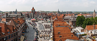
Pont-à-Celles is a Walloon municipality located in the Belgian province of Hainaut. On January 1, 2006, Pont-à-Celles had a total population of 16,292. The total area is 55.73 km² which gives a population density of 292 inhabitants per km².
| Object | Year/architect | Town/section | Address | Coordinates | Number? | Image |
|---|---|---|---|---|---|---|
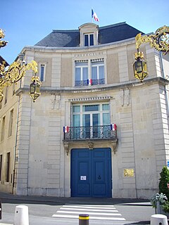
| rectory (nl)(fr) | Pont-à-celles | Pont-a-Celles | 50°30′42″N4°21′51″E / 50.511773°N 4.364046°E | 52055-CLT-0001-01 Info |  | |
| Organ in the Church of Sainte-Vierge (nl)(fr) | Pont-à-celles | Obaix | 50°31′39″N4°21′46″E / 50.527573°N 4.362723°E | 52055-CLT-0002-01 Info | ||
| Ensemble of "Terre à l'Danse" (nl)(fr) | Pont-à-celles | Pont-à-Celles | 50°29′11″N4°25′20″E / 50.486310°N 4.422241°E | 52055-CLT-0003-01 Info | ||
| Chapel of Sainte Anne, protection around entire plot n ° 114 around the chapel (nl)(fr) | Pont-à-celles | Luttre | 50°30′46″N4°23′10″E / 50.512703°N 4.386045°E | 52055-CLT-0005-01 Info |  | |
| Site "Bons Villers" (nl)(fr) | Pont-à-celles | Liberchies | 50°30′28″N4°26′25″E / 50.507694°N 4.440170°E | 52055-CLT-0006-01 Info | ||
| Site of castellum: area of special value (nl)(fr) | Pont-à-celles | Liberchies-Brunehault | 50°30′19″N4°25′46″E / 50.505226°N 4.429405°E | 52055-CLT-0007-01 Info | ||
| The main facade and the roof of Art Nouveau house on the rue des Ecoles No. 26 in Pont-a-Celles, (except the outhouse right) and the window in the door at the rear, a protection zone established around the house (nl)(fr) | Pont-à-celles | 50°30′45″N4°21′33″E / 50.512407°N 4.359067°E | 52055-CLT-0008-01 Info |  | ||
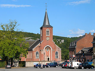
| Facades and roofs of the chapel of Notre-Dame de la Charité (nl)(fr) | Pont-à-celles | rue de Scoumont te Obaix-Rosseignes | 50°32′37″N4°18′36″E / 50.543628°N 4.310054°E | 52055-CLT-0009-01 Info | ||
| Facades and roofs of the local school, setting conservation (nl)(fr) | Pont-à-celles | rue Fond Nachez n°1 te Thiméon | 50°29′24″N4°25′42″E / 50.489988°N 4.428407°E | 52055-CLT-0010-01 Info |  | |
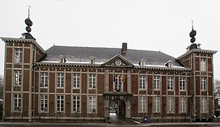
| Facades and roofs of the farm of the diocese (nl)(fr) | Pont-à-celles | chaussée de Fleurus 29, te Thiméon | 50°29′28″N4°25′50″E / 50.491156°N 4.430626°E | 52055-CLT-0011-01 Info |  | |
| Archaeological site of Liberchies: area of special value (nl)(fr) | Pont-à-celles | 50°30′28″N4°26′25″E / 50.507694°N 4.440170°E | 52055-PEX-0001-01 Info | |||
| Archaeological site of Liberchies: area of special value (nl)(fr) | Pont-à-celles | 50°30′19″N4°25′46″E / 50.505226°N 4.429405°E | 52055-PEX-0002-01 Info |