This article needs additional citations for verification .(May 2010) (Learn how and when to remove this template message) |


This article needs additional citations for verification .(May 2010) (Learn how and when to remove this template message) |


| Rank | Country / Territory | Population 2011 est. [1] | Area (km²) | Density (persons/km²). | Notes |
| 1 | 15,007,343 | 283,561 | 52.9 | ||
| 2 | 44,725,543 | 1,138,914 | 41 | ||
| 3 | 27,635,743 | 912,050 | 30.3 | ||
| 4 | 203,429,773 | 8,547,403 | 23.8 | ||
| 5 | 29,248,943 | 1,285,216 | 22.8 | ||
| 6 | 16,888,760 | 756,626 | 22.3 | ||
| 7 | 3,308,535 | 175,016 | 18.9 | ||
| 8 | 6,459,058 | 406,752 | 15.9 | ||
| 9 | 41,769,726 | 2,780,400 | 15.0 | ||
| 10 | 10,118,683 | 1,098,581 | 9.2 | ||
| 11 | 744,768 | 214,969 | 3.5 | ||
| 12 | 274,652 | 90,000 | 3.1 | ||
| 13 | 491,989 | 163,265 | 3.0 | ||
| 14 | 3,140 | 12,173 | 0.26 | 2008 est. [2] | |
| Total | 400,106,656 | 17,864,926 | 22.4 |

This is a list of the lists of islands in the world grouped by country, by continent, by body of water, and by other classifications. For rank-order lists, see the other lists of islands below.

Population density is a measurement of population per unit area, or exceptionally unit volume; it is a quantity of type number density. It is frequently applied to living organisms, most of the time to humans. It is a key geographical term. In simple terms, population density refers to the number of people living in an area per square kilometre.

Canada ranks 38th by population, comprising about 0.5% of the world's total, with over 38 million Canadians as of 2020. Being, however, the fourth-largest country by land area, the vast majority of the country is sparsely inhabited, with most of its population south of the 55th parallel north and more than half of Canadians live in just two provinces: Ontario and Quebec. Though Canada's population density is low, many regions in the south such as the Quebec City–Windsor Corridor, have population densities higher than several European countries. Canada's largest population centres are Toronto, Montreal, Vancouver, Calgary, Edmonton and Ottawa with those six being the only ones with more than one million people. The large size of Canada's north, which is not arable, and thus cannot support large human populations, significantly lowers the country's carrying capacity. Therefore, the population density of the habitable land in Canada can be modest to high depending on the region.

An urban area, or built-up area, is a human settlement with a high population density and infrastructure of built environment. Urban areas are created through urbanization and are categorized by urban morphology as cities, towns, conurbations or suburbs. In urbanism, the term contrasts to rural areas such as villages and hamlets; in urban sociology or urban anthropology it contrasts with natural environment. The creation of early predecessors of urban areas during the urban revolution led to the creation of human civilization with modern urban planning, which along with other human activities such as exploitation of natural resources led to a human impact on the environment. "Agglomeration effects" are in the list of the main consequences of increased rates of firm creation since. This is due to conditions created by a greater level of industrial activity in a given region. However, a favorable environment for human capital development would also be generated simultaneously.

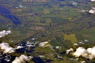
Tawatinaw is a hamlet in Alberta, Canada within Westlock County. It is located on Township Road 614, 2 kilometres (1.2 mi) east of Highway 2 and approximately 70 kilometres (43 mi) north of the City of Edmonton.

The districts of Peru are the third-level country subdivisions of Peru. They are subdivisions of the provinces, which in turn are subdivisions of the larger regions or departments. There are 1,838 districts in total.

Cremona is a village in Southern Alberta, Canada. It is located north of Cochrane and west of Carstairs, along the Cowboy Trail. It is likely named for Cremona, Italy.
This is a list of lists of countries and territories by various criteria. A country or territory is a geographical area, either in the sense of nation or state.
This is a list of lists of cities in Europe. Lists of countries includes countries that fall to at least some extent within European geographical boundaries according to certain definitions.

Woking is a hamlet in northwestern Alberta, Canada within Saddle Hills County. It is named for the town of Woking in Surrey, England.

Craven is a village in the Canadian province of Saskatchewan within the Rural Municipality of Longlaketon No. 219 and Census Division No. 6. The village lies northeast of the Town of Lumsden in the Qu'Appelle Valley.
The Earth has a population of 7.8 billion, with an overall population density of 50 people per km2, excluding Antarctica. Nearly two-thirds of the world's population lives in Asia, with more than 2.7 billion in the countries of China and India combined. The world's literacy rate has increased dramatically in the last 40 years, from 66.7% in 1979 to 86.3% today. Lower literacy levels are mostly attributable to poverty. Lower literacy rates are mostly found in South Asia and Sub-Saharan Africa. The world's largest ethnic group is Han Chinese, with Mandarin being the world's most spoken language in terms of native speakers.
This is a list of countries and territories in Europe by population density.