Lister Cove

Last updated
Location of Varna Peninsula in the South Shetland Islands. Varna-Peninsula-location-map.png
Location of Varna Peninsula in the South Shetland Islands.
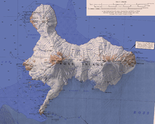
Topographic map of Livingston Island. Livingston-Island-Map-2010-15.png
Topographic map of Livingston Island.

Lister Cove is a 2.1 km wide cove indenting for 1.55 km the northeast coast of Varna Peninsula, Livingston Island in the South Shetland Islands, Antarctica south of Pomorie Point and north of Karavelova Point. The cove is fed by Rose Valley Glacier.

Varna Peninsula

Varna Peninsula is a roughly rectangular predominantly ice-covered peninsula forming the northeast extremity of Livingston Island in the South Shetland Islands, Antarctica. It is bounded by Hero Bay to the northwest, by Moon Bay to the southeast, and by McFarlane Strait to the northeast.

Livingston Island Island of the South Shetland Islands

Livingston Island is an Antarctic island, part of the South Shetlands Archipelago in the Southern Ocean. It was the first land discovered south of 60° south latitude in 1819, a historic event that marked the end of a centuries-long pursuit of the mythical Terra Australis Incognita and the beginning of the exploration and utilization of real Antarctica. The name Livingston, although of unknown derivation, has been well established in international usage since the early 1820s.

South Shetland Islands A group of islands north of the Antarctic Peninsula

The South Shetland Islands are a group of Antarctic islands with a total area of 3,687 square kilometres (1,424 sq mi). They lie about 120 kilometres (75 mi) north of the Antarctic Peninsula, and between 430 kilometres (270 mi) to 900 kilometres (560 mi) south-west from the nearest point of the South Orkney Islands. By the Antarctic Treaty of 1959, the islands' sovereignty is neither recognized nor disputed by the signatories and they are free for use by any signatory for non-military purposes.

It was named by James Weddell. British mapping in 1825 and 1968, and Bulgarian mapping in 2005 and 2009 from the Tangra 2004/05 survey.

James Weddell British Antarctic explorer

James Weddell FRSE was a British sailor, navigator and seal hunter who in February 1823 sailed to latitude of 74°15′S and into a region of the Southern Ocean that later became known as the Weddell Sea. He is one of the very few human beings to have a sea named after him.

Tangra 2004/05

The Tangra 2004/05 Expedition was commissioned by the Antarctic Place-names Commission at the Ministry of Foreign Affairs of Bulgaria, managed by the Manfred Wörner Foundation, and supported by the Bulgarian Antarctic Institute, the Institute of Mathematics and Informatics at the Bulgarian Academy of Sciences, Bulgarian Posts Plc; the Uruguayan Antarctic Program, Peregrine Shipping (Australia), and Petrol Ltd, TNT, Mtel, Bulstrad, Polytours, B. Bekyarov and B. Chernev (Bulgaria).

Coordinates: 62°29′42.5″S60°04′19.8″W / 62.495139°S 60.072167°W / -62.495139; -60.072167

Geographic coordinate system Coordinate system

A geographic coordinate system is a coordinate system that enables every location on Earth to be specified by a set of numbers, letters or symbols. The coordinates are often chosen such that one of the numbers represents a vertical position and two or three of the numbers represent a horizontal position; alternatively, a geographic position may be expressed in a combined three-dimensional Cartesian vector. A common choice of coordinates is latitude, longitude and elevation. To specify a location on a plane requires a map projection.

Maps

International Standard Book Number Unique numeric book identifier

The International Standard Book Number (ISBN) is a numeric commercial book identifier which is intended to be unique. Publishers purchase ISBNs from an affiliate of the International ISBN Agency.

Related Research Articles

Eliseyna Cove cove

Eliseyna Cove is a 3 km wide cove indenting for 1.4 km in the northwest coast of Varna Peninsula between Slab Point to the north and Kotis Point to the south. The cove is named after the Iskar Gorge settlement of Eliseyna in western Bulgaria.

Pomorie Point

Pomorie Point is a point on the coast of McFarlane Strait forming the north side of the entrance to Lister Cove, Varna Peninsula, Livingston Island in the South Shetland Islands, Antarctica.

Rozhen Peninsula

Rozhen Peninsula extends 9 km in the southwest direction towards Barnard Point, Livingston Island in the South Shetland Islands, Antarctica, and 8.8 km wide. It is bounded by False Bay and its segment Inept Cove to the west, Bransfield Strait to the southeast and Brunow Bay to the east. Its interior is occupied by the Friesland Ridge of Tangra Mountains.

Shopski Cove cove

Shopski Cove is a 2.6 km wide cove indenting for 1.9 km the southwest coast of Greenwich Island in the South Shetland Islands, Antarctica, between Triangle Point and the westernmost extremity of the moraine spit of Provadiya Hook protecting Yankee Harbour. Shape enhanced as a result of Bravo Glacier’s retreat in the late 20th and early 21st century. The area was visited by early 19th century sealers operating from Yankee Harbour.

Desolation Island (South Shetland Islands)

Desolation Island is one of the minor islands in the South Shetlands archipelago, Antarctica situated at the entrance to Hero Bay, Livingston Island. The island is V-shaped with its northern coast indented by Kozma Cove. Surface area 3.12 square kilometres (1.20 sq mi).

Zornitsa Cove

Zornitsa Cove is the 7 km wide cove indenting for 3.1 km the north coast of Livingston Island in the South Shetland Islands, Antarctica. Entered between Rowe Point and Scesa Point on the west side of Ioannes Paulus II Peninsula. Bulgarian mapping in 2009.

Johnsons Dock cove

Johnsons Dock is a sheltered 500 m wide cove indenting for 900 m the northwest coast of Hurd Peninsula on Livingston Island in the South Shetland Islands, Antarctica. It is part of South Bay entered north of Ballester Point. Surmounted by Charrúa Ridge on the northeast. The cove was frequented by early 19th century sealers.

Sayer Nunatak

Sayer Nunatak is a rocky peak rising to 210 m south of Williams Point on Varna Peninsula, at the north edge of the ice cap of Livingston Island in the South Shetland Islands, Antarctica. The nunatak is forming the north extremity of Vidin Heights and surmounting Dragon Cove to the northeast, Griffin Cove to the north-northwest and Charybdis Cove to the southwest.

Polish Bluff

Polish Bluff is a point forming the southwest side of the entrance to Española Cove and the northeast side of the entrance to Argentina Cove in Hurd Peninsula, Livingston Island in the South Shetland Islands, Antarctica. The area was visited by early 19th century sealers operating from nearby Johnsons Dock.

Salisbury Bluff

Salisbury Bluff is the point forming the south side of the entrance to Las Palmas Cove in Hurd Peninsula, Livingston Island in the South Shetland Islands, Antarctica and surmounted by a 161 m height. The area was visited by early 19th century sealers operating from nearby Johnsons Dock.

Sally Rocks

Sally Rocks is a small group of rocks trending southwestwards in South Bay just off the west coast of Hurd Peninsula, Livingston Island in the South Shetland Islands, Antarctica.

Española Cove cove

Española Cove is a 1.2 km wide embayment indenting for 250 m the northwest coast of Hurd Peninsula, Livingston Island in the South Shetland Islands, Antarctica. It is part of South Bay entered between Ballester Point and Polish Bluff. The cove is used for the transfer of people and cargo to the Spanish base Juan Carlos I situated at its head. The area was frequented by early 19th century sealers operating from nearby Johnsons Dock.

Argentina Cove cove

Argentina Cove is a 1.28 km wide embayment indenting for 330 m the southeast coast of Hurd Peninsula, Livingston Island in the South Shetland Islands, Antarctica. It is part of South Bay, entered between Polish Bluff and Henry Bluff. The area was frequented by early 19th century sealers operating from nearby Johnsons Dock.

Las Palmas Cove cove

Las Palmas Cove is a 1.97 km wide embayment indenting for 500 m the northwest coast of Hurd Peninsula on Livingston Island in the South Shetland Islands, Antarctica. It is part of South Bay, Livingston Island entered between Henry Bluff and Salisbury Bluff. The area was visited by early 19th century sealers operating from nearby Johnsons Dock. It also where the Las Palmas Glacier terminates.

Buena Nueva Cove cove

Buena Nueva Cove is a small open cove, 900 m wide and indenting for 200 m the northwest coast of False Bay, Livingston Island in the South Shetland Islands, Antarctica southeast of MacGregor Peaks and east of Castro Peak on Hurd Peninsula. The area was visited by early 19th century sealers.

Glaciar Rocoso Cove cove

Glaciar Rocoso Cove is a small open cove, part of False Bay, Livingston Island in the South Shetland Islands, Antarctica. It is 920 m wide and indenting for 180 m the southeast coast of Hurd Peninsula east-northeast of Binn Peak and south-southwest of Nusha Hill. The area was visited by early 19th century sealers.

Yasen Point

Yasen Point is the sharp, rocky point on the south coast of Livingston Island in the South Shetland Islands, Antarctica, forming the west side of the entrance to Mateev Cove. Situated on the east side of the small ice-free promontory ending in Hannah Point to the west.

Mateev Cove

Mateev Cove is the 700 m wide cove indenting for 290 m the south coast of Livingston Island in the South Shetland Islands, Antarctica. Part of South Bay, entered east of Yasen Point. Aldan Rock is the largest in a small group of rocks lying off the eastern part of the cove. The UK base camp Station P operated at the cove’s head during the 1957/58 summer season.

Dañobeitia Crag sharp rocky hill on the north coast of Livingston Island in the South Shetland Islands, Antarctica

Dañobeitia Crag is the sharp rocky hill rising to 205 m on the north coast of Livingston Island in the South Shetland Islands, Antarctica. It is surmounting Siddins Point, formed by an offshoot of the hill, Hero Bay to the north and its parts Vasilev Bay to the east and Maleshevo Cove to the southwest.

References

Composite Gazetteer of Antarctica The authoritative international gazetteer containing all the Antarctic toponyms

The Composite Gazetteer of Antarctica (CGA) of the Scientific Committee on Antarctic Research (SCAR) is the authoritative international gazetteer containing all Antarctic toponyms published in national gazetteers, plus basic information about those names and the relevant geographical features. The Gazetteer includes also parts of the International Hydrographic Organization (IHO) General Bathymetric Chart of the Oceans (GEBCO) gazetteer for under-sea features situated south of 60° south latitude.