Open-pit mining, also known as open-cast or open-cut mining and in larger contexts mega-mining, is a surface mining technique of extracting rock or minerals from the earth from an open-air pit, sometimes known as a borrow.

Wrexham is a city and the administrative centre of Wrexham County Borough in Wales. It is located between the Welsh mountains and the lower Dee Valley, near the border with Cheshire in England. Historically in the county of Denbighshire, and later the county of Clwyd in 1974, it has been the principal settlement of Wrexham County Borough since 1996.

Wrexham County Borough is a county borough, with city status, in the north-east of Wales. It borders England to the east and south-east, Powys to the south-west, Denbighshire to the west and Flintshire to the north-west. The county borough has a population of 136,055. The city of Wrexham is its largest settlement, which together with villages such as Gwersyllt, New Broughton, Bradley and Rhostyllen form a built-up area with 65,692 residents. Villages in the county borough also include Holt, Ruabon, Rhosllanerchrugog, Johnstown, Acrefair, Bangor-on-Dee, and Coedpoeth amongst others. The county borough has one other outlying town, Chirk, to its south, and various rural settlements in the county borough's large salient in the Ceiriog Valley, and the English Maelor.
Rhosllanerchrugog is a village and community in Wrexham County Borough, Wales. It lies within the historic county of Denbighshire. The entire built-up area including Penycae, Ruabon and Cefn Mawr had a population of 25,362.

Ruabon is a village and community in Wrexham County Borough, Wales. The name comes from Rhiw Fabon, rhiw being the Welsh word for "slope" or "hillside" and Fabon being a mutation from St Mabon, the original church name, of earlier, Celtic origin. An older English spelling, Rhuabon, can sometimes be seen.

Coedpoeth is a village and community in Wrexham County Borough, Wales. The built-up area with Minera had a population of 5,723 in the 2011 census.

Blaenavon Industrial Landscape, in and around Blaenavon, Torfaen, Wales, was inscribed a World Heritage Site by UNESCO in 2000. The Blaenavon Ironworks, now a museum, was a major centre of iron production using locally mined or quarried iron ore, coal and limestone. Raw materials and products were transported via horse-drawn tramroads, canals and steam railways. The Landscape includes protected or listed monuments of the industrial processes, transport infrastructure, workers' housing and other aspects of early industrialisation in South Wales.

Acrefair is a village in Wrexham County Borough, north-east Wales, in the community of Cefn. It was formerly part of the ancient parish of Ruabon, and is located between Wrexham and Llangollen. It is close to the villages of Trevor, Cefn Mawr, Ruabon and Plas Madoc. The name Acrefair originates from the Welsh word for acres—acrau, or acre in the local Welsh dialect—and Mair, the Welsh name for Mary. The English meaning of Acrefair is Mary's Acres.
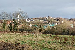
Cefn Mawr is a village in the community of Cefn within Wrexham County Borough, Wales. Its name translates as "big ridge". The population in 2001 was 6,669, increasing to 7,051 in 2011.
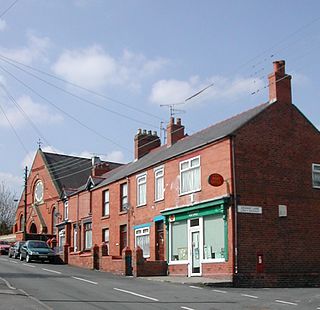
Ponciau is a village within the community of Rhosllanerchrugog, Wrexham County Borough, Wales. It is close to the villages of Legacy, Pentre Bychan and Johnstown and is overlooked by Ruabon Mountain.

Brymbo is a village and community in Wrexham County Borough, Wales. It lies in the hilly country to the west of Wrexham city, largely surrounded by farmland.

Pen-y-cae is a village and community in Wrexham County Borough, Wales. The population of the community taken at the 2011 census was 3,389. It adjoins the larger village of Rhosllanerchrugog.

Bersham is a village in Wrexham County Borough, Wales, that lies next to the River Clywedog, and is in the community of Esclusham. Bersham was historically a major industrial centre of the area, but despite this the village still retains a rural feeling.

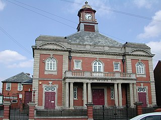
Johnstown is a village in Wrexham County Borough, Wales, and forms part of the old coal mining community of Rhosllannerchrugog. It is thought to have been named after John Bury, a mid 19th century member of Wrexham's first Town Council, who built a number of houses in the area.
The Stringfellow Acid Pits are a toxic waste dump, and a Superfund site, located in Jurupa Valley, California, United States, just north of the neighborhood of Glen Avon. The site became the center of national news coverage in the early 1980s, in part because it was considered one of the most polluted sites in California, and because it became linked with mismanagement and scandal in the U.S. Environmental Protection Agency.

Cilgwyn quarry is a slate quarry located on the north edge of the Nantlle Vale, in North Wales. It is one of the earliest slate quarries in Great Britain, being worked as early as the 12th century. King Edward I of England was reputed to have stayed in a house roofed by Cilgwyn slates, during the Welsh wars of independence. It is one of the major slate quarries in the Nantlle Valley area.
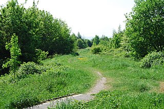
Bonc yr Hafod is a country park, on the former site of Hafod Colliery, near Johnstown and Pentre Bychan in Wrexham County Borough, Wales. The country park is centred on a former spoil tip hill, known locally as "Picnic Mountain", rising up 150 metres (490 ft). The country park is 90 acres (0.36 km2) in size of mainly woodlands and grasslands. The park is home to one of the largest community woodlands in North East Wales.

The industrial revolution in Wales was the adoption and developments of new technologies in Wales in the 18th and 19th centuries, resulting in increases in the scale of industry in Wales, as part of the wider Industrial Revolution.

Plas Madoc is a housing estate and former electoral ward near Acrefair, in the Cefn community in Wrexham County Borough, Wales. It is located seven miles to the south-west of Wrexham, and contains The Land adventure playground, and a community-run leisure centre with a swimming pool. The area is one of the most deprived areas in Wales, and the fourth most deprived LSOA in Wrexham County Borough.

