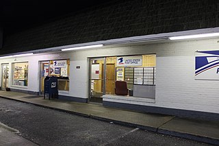
A ZIP Code is a postal code used by the United States Postal Service (USPS) in a system it introduced in 1963. The term ZIP is an acronym for Zone Improvement Plan; it was chosen to suggest that the mail travels more efficiently and quickly when senders use the code in the postal address. The basic format consists of five digits. An extended ZIP+4 code was introduced in 1983 which includes the five digits of the ZIP Code, followed by a hyphen and four additional digits that reference a more specific location.

Mount Alto is an unincorporated community in far western Jackson County, West Virginia, USA. It lies along West Virginia Route 331 northwest of the city of Ripley, the county seat of Jackson County. Its elevation is 709 feet (216 m). Mount Alto had a post office, which closed on June 20, 2009.

Monterville is an unincorporated community in Randolph County, West Virginia, United States. Monterville is 12.5 miles (20.1 km) southwest of Huttonsville. Monterville had a post office, which closed on June 20, 2009.
Dothan is an unincorporated community in Fayette County, West Virginia, United States. Dothan is located on West Virginia Route 612 4 miles (6.4 km) west of Oak Hill. Dothan had a post office, which closed on October 5, 1991.
Saxon is an unincorporated community in Raleigh County, West Virginia, United States. Saxon is 12.5 miles (20.1 km) west of Beckley. Saxon had a post office, which closed on June 27, 2009.
Centerville is an unincorporated community in Tyler County, West Virginia, USA. Centerville is located along West Virginia Route 18 5.4 miles (8.7 km) southeast of Middlebourne. Centerville has a post office with ZIP code 26320; the post office uses the name Alma.

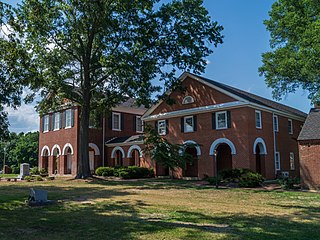
Hartfield is an unincorporated community in Middlesex County, Virginia, United States. Hartfield is located at the junction of Virginia State Route 3 and Virginia State Route 33, 9 miles (14 km) east-southeast of Saluda. Hartfield has a post office with ZIP code 23071, which opened on September 5, 1889.

Miles is an unincorporated community in Mathews County, Virginia, United States. Miles is located on Whites Neck 3 miles (4.8 km) southwest of Mathews. Miles had a post office, which closed on July 4, 1992.
North is an unincorporated community in Mathews County, Virginia, United States. North is located on Virginia State Route 14 4.75 miles (7.64 km) west of Mathews. North has a post office with ZIP code 23128.
Glade Hill is an unincorporated community in Franklin County, Virginia, United States. Glade Hill is located on Virginia State Route 40 7.2 miles (11.6 km) east of Rocky Mount. Glade Hill has a post office with ZIP code 24092, which opened on April 1, 1837.
Blackwater is an unincorporated community in Lee County, Virginia, United States. Blackwater is located along Virginia State Route 70 5.4 miles (8.7 km) southeast of Jonesville. Blackwater has a post office with ZIP code 24221.
Andover is an unincorporated community in Wise County, Virginia, United States. Andover is located along Virginia State Route 78 1.4 miles (2.3 km) northwest of Appalachia. Andover had a post office until it closed on November 3, 2008; it still has its own ZIP code, 24215.
Horsepen is an unincorporated community in Tazewell County, Virginia, United States. Horsepen is located along the West Virginia state line 5.4 miles (8.7 km) north of Tazewell, Virginia. Horsepen has a post office with ZIP code 24619.
Wolford is an unincorporated community in Buchanan County, Virginia, United States. Wolford is 8.4 miles (13.5 km) northeast of Grundy. Wolford has a post office with ZIP code 24658, which opened on August 22, 1949. The community was likely named for John Wolford, a pioneer.
Broadford is an unincorporated community in Smyth County, Virginia, United States. Broadford is located along Laurel Creek at the junction of Virginia State Route 42 and Virginia State Route 91 10.8 miles (17.4 km) northwest of Marion. Broadford has a post office with ZIP code 24316.
Fishers Hill is an unincorporated community in Shenandoah County, Virginia, United States. Fishers Hill is 2.1 miles (3.4 km) west of Strasburg. Fishers Hill has a post office with ZIP code 22626, which opened on July 28, 1882.
Crystal Hill is an unincorporated community in Halifax County, Virginia, United States. Crystal Hill is located on State Route 626 6.3 miles (10.1 km) north of Halifax. Crystal Hill has a post office with ZIP code 24539, which opened on March 6, 1879.
Vernon Hill is an unincorporated community in Halifax County, Virginia, United States. Vernon Hill is located on Virginia State Route 360 9.7 miles (15.6 km) west of Halifax. Vernon Hill has a post office with ZIP code 24597, which opened on September 8, 1856.

Locust Hill is an unincorporated community in Breckinridge County, Kentucky, United States. Locust Hill is located at the junction of Kentucky Route 1073 and Kentucky Route 1401, 6.7 miles (10.8 km) east-southeast of Hardinsburg. Locust Hill had a post office from June 4, 1909 to February 22, 1985.

Duncanville is an unincorporated community in Tuscaloosa County, Alabama, United States. Duncanville is located along U.S. Route 82, 12.5 miles (20.1 km) southeast of Tuscaloosa. Duncanville has a post office with ZIP code 35456, which opened on August 22, 1898. Duncanville was named in honor of either William M. Duncan, a local property owner, or W. Butler Duncan, an official with the Gulf, Mobile, and Northern Railroad.