
Corfe Castle is a village and civil parish in the English county of Dorset. It is the site of a ruined castle of the same name. The village and castle stand over a gap in the Purbeck Hills on the route between Wareham and Swanage. The village lies in the gap below the castle, and is some eight kilometres south-east of Wareham, and the same distance west of Swanage. Both the current main A351 road from Lytchett Minster to Swanage and the Swanage Railway thread their way through the gap and the village.

Bolingbroke, now called Old Bolingbroke, is a village and civil parish in the East Lindsey district of Lincolnshire, England. The population at the 2001 census was 298 in 128 households. The parish population at the census 2011 had risen to 325.

Herstmonceux is a village and civil parish in the Wealden District of East Sussex, England, which includes Herstmonceux Castle.

Shaw-cum-Donnington is a civil parish in West Berkshire, Berkshire, England with all of its urban or suburban area immediately north of the largest town in the district, Newbury. It comprises the villages of Shaw and Donnington and contains the partially ruined castle of Donnington Castle which has most of its various outside walls intact.

Castle Acre is a village and civil parish in the English county of Norfolk. The village is situated on the River Nar some 4 miles (6.4 km) north of the town of Swaffham. It is 15 miles (24 km) east of the town of King's Lynn, 33 miles (53 km) west of the city of Norwich, and 103 miles (166 km) from London.

Castle Rising is a village and civil parish in the English county of Norfolk. It is best known for the castle which dominates the village. The village is situated some 8 kilometres (5.0 mi) north-east of the town of King's Lynn and 60 kilometres (37 mi) west of the city of Norwich. The River Babingley skirts the north of the village separating Castle Rising from the site of the lost village of Babingley.

Highclere is a village and civil parish situated in the North Wessex Downs in the Basingstoke and Deane district of Hampshire, England. It lies in the northern part of the county, near the Berkshire border. It is most famous for being the location of Highclere Castle, a noted Victorian house of the Earl of Carnarvon. It is the setting for numerous films and TV series, including Downton Abbey.

West Grinstead is a village and civil parish in the Horsham District of West Sussex, England. It lies just off the B2135 road four miles (6.3 km) northwest from Henfield. It is within the ancient division of the Rape of Bramber

Bunratty is a village and civil parish in County Clare, Ireland. Bunratty Castle is located near the village. The village is accessed by the N18 connecting it to Limerick and to Galway. The Raite river defines the eastern boundary of the parish, and flows into the Shannon Estuary, which defines the southern boundary.

Pulford is a village and former civil parish, now in the parish of Poulton and Pulford, in the unitary authority of Cheshire West and Chester and the ceremonial county of Cheshire, England. It is situated on the B5445 road, to the south west of Chester and on the border with Wales. It is believed that the name of the village is derived from the Welsh words Pwll "marsh" and Ffordd "crossing". According to the 2001 Census, the population of the entire parish was 395, increasing to 580 at the 2011 Census. The civil parish was abolished in 2015 to form Poulton and Pulford.

Sutton is a village and civil parish in the District of Chichester in West Sussex, England, located six kilometres (4 miles) south of Petworth and east of the A285 road.
The parish has a land area of 920 hectares (2272 acres). In the 2001 census 192 people lived in 83 households, of whom 83 were economically active. The 2011 Census population included the village of Barlavington and hamlet of Codmore Hill.
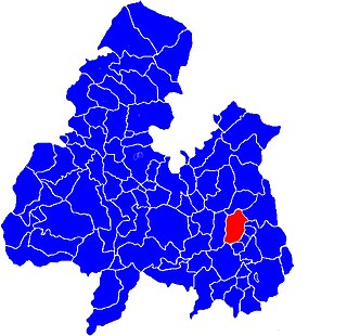
Loughmoe East is a civil parish in County Tipperary, Ireland.(Gaelic: Na Cealla Beaga). Also called CALLABEG, or KILNASEAR, the parish, in the barony of ELIOGARTY, County TIPPERARY, is in the province of MUNSTER, about 2 miles south-east of Templemore. This parish is situated on the river Suir, which separates it from Loughmoe-West, and on the road from Templemore to Thurles, and comprises 3417 statute acres.
Cloone is a townland in the civil parish of Loughmoe East, County Tipperary.
Derry is a townland in the civil parish of Loughmoe East, County Tipperary. Derry, Loughmoe East Civil Parish, Barony of Eliogarty, County Tipperary was originally 81 Acres, 3 Rood, 25 Perch.

Loughmoe West is a civil parish in County Tipperary, Ireland. It is one of 21 civil parishes in the barony of Eliogarty. The River Suir to the east forms the boundary with the parish of Loughmoe East. The village of Loughmore is situated in the townland of Tinvoher.
Kilbrickane is a relatively small townland, measuring just over 78 acres, in the civil parish of Loughmoe East, County Tipperary. The townland is 2km from the village of Loughmore, 4km from Templemore and 8km from Thurles.

Kilballyowen is a civil parish and a Catholic parish in County Clare, Ireland. It is located at the end of the Loop Head Peninsula which extends into the Atlantic Ocean to the north of the Shannon Estuary. The parish contains the villages of Cross, Kilbaha and Carrigaholt.


