This page is based on this
Wikipedia article Text is available under the
CC BY-SA 4.0 license; additional terms may apply.
Images, videos and audio are available under their respective licenses.
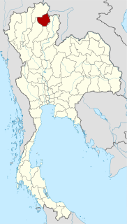
Phayao is one of the northern provinces (changwat) of Thailand. Neighboring provinces are Nan, Phrae, Lampang, and Chiang Rai. In the northeast it borders Xaignabouli of Laos.

Mae Chai is a district (amphoe) of Phayao Province in northern Thailand.

Mae Fa Luang is a district (amphoe) in the northern part of Chiang Rai Province, northern Thailand.

Thoeng is a district (amphoe) in the eastern part of Chiang Rai Province, northern Thailand.

Chiang Kham is a district (amphoe) in the northeastern part of Phayao Province, northern Thailand.

Mueang Phayao is the capital district of Phayao Province, northern Thailand.

Mae Chan is a district (amphoe) in the northern part of Chiang Rai Province, northern Thailand.

Mueang Chiang Rai is the capital district of Chiang Rai Province, northern Thailand.

Wang Nuea is the northernmost district (amphoe) of Lampang Province, northern Thailand.

Phan is a district (amphoe) in the southern part of Chiang Rai Province, northern Thailand.
Wiang is a Tai word for "fortified settlement" or "walled town, city" of Austroasiatic origin, from Proto-Austroasiatic *wa(a)ŋ. This toponymic element forms part of the names of certain ancient inhabited places located in an area stretching across Northern Thailand and Laos:
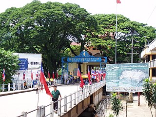
Wiang Phang Kham is a subdistrict (tambon) of Mae Sai District, in Chiang Rai Province, Thailand. In 2012 it had a total population of 20,252 people.

Mae Chai is a small town and subdistrict (tambon) in Mae Chai District, in Phayao Province, Thailand. It is the principal town in the district; the town is also split with the tambon of Si Thoi. As of 2005, it has a total population of 5,094 people. It is located in the north-western part of the province not far from the border with Lampang Province. It lies along the National Road 1, and is connected by road to Phayao in the south. To the north along the highway are Pa Faek and then Mae Yen across into Chiang Rai Province. The tambon has 10 villages under its jurisdiction. It lies partly within Mae Puem National Park. Mae Chai River is also a river running in the area.
Pa Faek is a large village and subdistrict (tambon) in Mae Chai District, in Phayao Province, Thailand. As of 2005, it has a total population of 5,538 people. It is located in the north-western part of the province not far from the border with Chiang Rai Province. It lies along the Thailand Route 1 and is connected by road to Charoen Rat, Mae Chai and Phayao in the south and Mae Yen across into Chiang Rai Province to the north. The tambon has 10 villages under its jurisdiction. The tambon has mountainous terrain in east. and plains in the middle with agricultural land and buildings.
Charoen Rat is a village and subdistrict (tambon) in Mae Chai District, in Phayao Province, Thailand. As of 2005, it has a total population of 4,141 people. It is located in the north-western part of the province not far from the border with Chiang Rai Province. It lies along the National Road 1 and is connected by road to Pa Faek in the north and Mae Chai and Phayao in the south. The tambon has 8 villages under its jurisdiction.
Doi Luang National Park is one of the biggest national parks in Northern Thailand.
Wiang Subdistrict is the name of the following tambon (subdistricts) in Thailand: