Manitoba Provincial Road 306

Last updated • 2 min readFrom Wikipedia, The Free Encyclopedia

Manitoba secondary 306.svg
Provincial Road 306
Route information
Maintained by Department of Infrastructure
Length36.1 km (22.4 mi)
Existed1992–present
Major junctions
South endManitoba secondary 243.svg PR 243 near Rosetown
Major intersectionsManitoba secondary 201.svg PR 201 near Gnadenthal
Manitoba Highway 14.svg PTH 14 in Plum Coulee
North endManitoba Highway 23.svg PTH 23 near Kane
Location
Country Canada
Province Manitoba
Rural municipalities Rhineland, Roland
Highway system
Manitoba secondary 305.svg PR 305 Manitoba secondary 307.svg PR 307

Provincial Road 306 (PR 306) is a 36.1-kilometre-long (22.4 mi) north-south highway in the Pembina Valley Region of Manitoba. It serves as a connection between the communities of Rosetown, Gnadenthal, Plum Coulee, and Kane.

Contents

Route description

PR 306 begins in the Municipality of Rhineland at an intersection with PR 243 (Boundary Commission Trail), just 3 kilometres (1.9 mi) north of the hamlet of Neuhorst and the United States border. It heads north as a paved two-lane highway to almost immediately travel through the Rosetown community before continuing north through rural farmland for several kilometres. After crossing a small creek, the highway has a junction with PR 201 just east of the town of Gnadenthal before continuing on to enter the town of Plum Coulee at an intersection with PTH 14. PR 306 mainly travels through neighbourhoods along the eastern side of town, where it crosses a bridge over the Plum River, before leaving Plum Coulee and crossing a floodway, where the pavement turns to gravel. The highway travels through rural farmland as it enters the Rural Municipality of Roland, crossing two more floodways before coming to an end at an intersection with PTH 23, just west of the community of Kane. [1] [2]

History

Manitoba secondary 306.svg
Provincial Route 306
Location Glass - Garson
Length21.7 km (13.5 mi)
Existed1966–1990

PR 306 was originally designated along what is now Dundee-Garson Road in the Rural Municipalities of Springfield and Brokenhead in the Eastman Region. It began in the Rural Municipality of Springfield at an intersection with PTH 15 (Dugald Road) just west of Anola, heading north to cross PR 213 at Hazelridge. After travelling through Sapton, the highway entered the Rural Municipality of Brokenhead and the town of Garson soon after along Gillis Street. PR 306 travelled along the eastern side of town before coming to an end at an intersection with PTH 44. This section became a municipal road by 1990. PR 306 was designated along its current alignment in 1992, which was part of a southerly extension of PR 248 prior to. [3] [4]

Major intersections

DivisionLocationkmmiDestinationsNotes
Rhineland 0.00.0Manitoba secondary 243.svg PR 243 (Boundary Commission Trail) Gretna, Reinland Southern terminus; road continues south as Road 13W
Rosetown 1.60.99Road 3N Rosetown
8.25.1Manitoba secondary 201.svg PR 201  Gnadenthal, Altona
Plum Coulee 17.310.7Manitoba Highway 14.svg PTH 14  Winkler, Rosenfeld
17.711.0Bridge over the Plum River
18.611.6Pavement ends
19.512.1Bridge over the Deadhorse Creek Floodway
Roland 32.820.4Bridge over Shannon Creek Floodway
35.321.9Bridge over Floodway
36.122.4Manitoba Highway 23.svg PTH 23  Roland, Morris Northern terminus; road continues as Road 13W
1.000 mi = 1.609 km; 1.000 km = 0.621 mi

Related Research Articles

<span class="mw-page-title-main">Manitoba Highway 2</span> Highway in Manitoba, Canada

Provincial Trunk Highway 2 is a 315-kilometre (196-mile) highway in the Canadian province of Manitoba. It runs from Highway 13 at the Manitoba-Saskatchewan border to Winnipeg's Perimeter Highway near Oak Bluff.

Provincial Trunk Highway 15 is a provincial highway in the Canadian province of Manitoba. It runs from Winnipeg's Perimeter Highway east to Elma where it ends at PTH 11. PTH 15 and the portion of Route 115 east of PTH 59 are collectively known as Dugald Road.

<span class="mw-page-title-main">Manitoba Highway 3</span> Highway in Manitoba, Canada

Provincial Trunk Highway 3 (PTH 3) is a major provincial highway located in the Canadian province of Manitoba. It runs from the Saskatchewan boundary to the southwest city limits of Winnipeg, where it continues as Winnipeg Route 155. Prior before to the implementation of Winnipeg's City Route System, it extended to Pembina Highway.

Provincial Trunk Highway 17 is a provincial highway in the Canadian province of Manitoba. It runs from a junction with PR 224 and PR 325 near Hodgson to a junction with PTH 9 near Winnipeg Beach.

Provincial Trunk Highway 5 is a provincial primary highway located in the Canadian province of Manitoba.

<span class="mw-page-title-main">Manitoba Highway 12</span> Highway in Manitoba

Provincial Trunk Highway 12 is a provincial primary highway located in the Canadian province of Manitoba. Lying entirely in the Eastman Region, it runs from the U.S. border to a dead end in Grand Beach. PTH 12 forms the Manitoba section of MOM's Way, a tourist route from Thunder Bay to Winnipeg. PTH 12 is primarily a two-lane highway except for two four-lane stretch between Steinbach and PTH 1 and a ten-kilometre concurrency with PTH 44.

Provincial Trunk Highway 23 is a major east-west provincial highway in the southern portion of the Canadian province of Manitoba. It runs from PTH 21 just south of Hartney to PTH 59 in La Rochelle. Along its route, PTH 23 passes through the communities of Elgin, Ninette, Baldur, Miami, Lowe Farm, and Morris.

Provincial Trunk Highway 44 is an east-west provincial highway in the Eastman Region of the Canadian province of Manitoba.

<span class="mw-page-title-main">Manitoba Highway 14</span> Provincial road in Manitoba, Canada

Provincial Highway 14 is a provincial highway in the Canadian province of Manitoba. PTH 14 is a 2 lane high-speed rural highway (100 km/h) and carries relatively high traffic volumes of approximately 1800 vehicles per day. The route extends west to east from its junction with PTH 3 to its junction with PTH 75, the Lord Selkirk Highway.

Provincial Trunk Highway 24 is a provincial highway in the Canadian province of Manitoba. It is an east–west route that runs from PTH 83 near Miniota, east through Oak River and Rapid City to the junction of PTH 10 and PR 262 between Brandon and Minnedosa.

Provincial Trunk Highway 25 is a provincial highway in the Canadian province of Manitoba. It is a short east-west route starting at PR 259 at Wheatland, east through Rivers, and terminating at PTH 10 six kilometres (3.7 mi) north of Forrest. PTH 25 serves as the major route, via PTH 10, between Rivers and Brandon.

Provincial Trunk Highway 50 is a provincial highway in the south-central region of the Canadian province of Manitoba. It runs from PTH 16 to PTH 5 and PR 361 in the village of McCreary.

Provincial Trunk Highway 45 is a provincial highway in the Parkland Region of the Canadian province of Manitoba. It runs from PTH 16 and PTH 83 in the town of Russell to PTH 10 five kilometres (3.1 mi) north of the village of Erickson.

Provincial Trunk Highway 41 is a short provincial highway in the far southwest region of the Canadian province of Manitoba. It runs from PTH 1 and PR 542 in the village of Kirkella to PTH 16 and PTH 83 just south of Binscarth.

<span class="mw-page-title-main">Manitoba Highway 34</span> Provincial highway in Manitoba, Canada

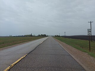
Provincial Trunk Highway 34 is a provincial primary highway located in the Canadian province of Manitoba. It runs from the U.S. border to PTH 16 at the town of Gladstone.

<span class="mw-page-title-main">Manitoba Provincial Road 242</span> Provincial road in Manitoba, Canada

Provincial Road 242 is a north-south provincial road in the Pembina Valley and Central Plains Regions of Manitoba, Canada.

<span class="mw-page-title-main">Manitoba Provincial Road 248</span> Provincial road in Manitoba, Canada

Provincial Road 248 is a north-south provincial road in the Pembina Valley and Central Plains regions of the Canadian province of Manitoba.

<span class="mw-page-title-main">Manitoba Provincial Road 243</span> Provincial road in Manitoba, Canada

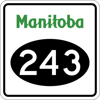
Provincial Road 243 is an east-west provincial road in the Pembina Valley Region of the Canadian province of Manitoba. It runs from PTH 75 near Emerson to PTH 32 near Friedensfeld West. Along the route, it passes north of Gretna using a small concurrence with PTH 30.

<span class="mw-page-title-main">Manitoba Provincial Road 322</span> Provincial Road in Manitoba, Canada

Provincial Road 322 is a 41.6-kilometre-long (25.8 mi) north–south highway in both the Interlake and Winnipeg Metro regions of Manitoba, Canada. It connects the communities of Grosse Isle, Argyle, Woodroyd, and Erinview.

<span class="mw-page-title-main">Manitoba Provincial Road 332</span> Provincial Road in Manitoba, Canada

Provincial Road 332 is a 87.2-kilometre-long (54.2 mi) north–south highway in the Pembina Valley and Central Plains regions of Manitoba. Serving as a northern continuation of the much shorter PTH 30, it connects the communities of Rosenfeld, Lowe Farm, Brunkild, Starbuck, and Dacotah.

References

  1. Government of Manitoba. "Official Highway Map of Manitoba section 2" (PDF). Retrieved 1 October 2024.
  2. "Map of Manitoba Provincial Road 306" (Map). Google Maps . Retrieved 1 October 2024.
  3. Government of Manitoba. "Official Highway Map of Manitoba 1990-1991" (PDF). Retrieved 3 October 2024.
  4. Government of Manitoba. "Official Highway Map of Manitoba 1992-1993" (PDF). Retrieved 3 October 2024.