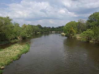
Pilica is a river in central Poland, the longest left tributary of the Vistula river, with a length of 333 kilometres and a basin area of 9,258 km2.
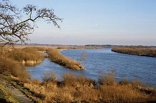
The Bug or Western Bug is a major river in Eastern Europe that flows through Belarus, Poland, and Ukraine, with a total length of 774 kilometres (481 mi). A tributary of the Narew, the Bug forms part of the border between Belarus and Poland for 178 kilometres (111 mi) and part of the border between Ukraine and Poland for 185 kilometres (115 mi).
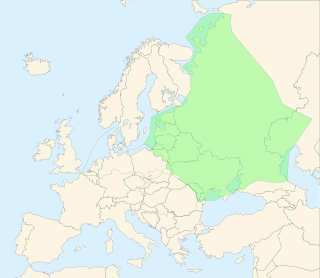
The East European Plain is a vast interior plain extending east of the North European Plain, and comprising several plateaus stretching roughly from 25 degrees longitude eastward. It includes Volhynian-Podolian Upland on its westernmost fringe, the Central Russian Upland, and, on the eastern border, encompasses the Volga Upland. The plain includes also a series of major river basins such as the Dnepr Basin, the Oka–Don Lowland, and the Volga Basin. At the southeastern point of the East European Plain are the Caucasus and Crimean mountain ranges. Together with the North European Plain, and covering the Baltic states, European Russia, Belarus, Ukraine, Moldova, southeastern Romania, and, at its southernmost point, the Danubian Plain in Northern Bulgaria, it constitutes the majority of the Great European Plain, the greatest mountain-free part of the European landscape. The plain spans approximately 4,000,000 km2 (2,000,000 sq mi) and averages about 170 m (560 ft) in elevation. The highest point of the plain, located in the Valdai Hills, is 346.9 metres (1,138.1 ft).

The North European Plain is a geomorphological region in Europe that covers all or parts of Belgium, the Netherlands, Germany, Denmark, and Poland.
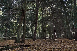
The Tuchola Forest, also known as Tuchola Pinewoods or Tuchola Conifer Woods, is a large forest complex near the town of Tuchola in northern Poland, which lies between the Brda and Wda Rivers, within the Gdańsk Pomerania region. The largest towns in the area are Czersk and Tuchola.
Grójec is a town in Poland, located in the Masovian Voivodeship, about 40 kilometres south of Warsaw. It is the capital of the urban-rural administrative district Grójec and Grójec County. It has 16,674 inhabitants (2017). Grójec surroundings are considered to be the biggest apple-growing area of Poland. It is said that the region makes up also for the biggest apple orchard of Europe. Statistically, every third apple sold in Poland is grown in Grójec – a unique local microclimate provides for their beautiful red colour.
Kampinos National Park is a National Park in east-central Poland, in Masovian Voivodeship, on the north-west outskirts of Warsaw. It has a sister park agreement with Indiana Dunes National Park, Indiana, United States.
The Manitoba Escarpment, or the Western Manitoba Uplands, are a range of hills along the Saskatchewan-Manitoba border. The eastern slopes of the range are considered to be a scarp. They were created by glacial scouring and formed the western shore of prehistoric Lake Agassiz.
The Great Lakes-St. Lawrence Lowlands, or simply St. Lawrence Lowlands, is a physiographic region of Eastern Canada that comprises a section of southern Ontario bounded on the north by the Canadian Shield and by 3 of the Great Lakes — Lake Huron, Lake Erie and Lake Ontario — and extends along the St. Lawrence River to the Strait of Belle Isle and the Atlantic Ocean. The lowlands comprise three sub-regions that were created by intrusions from adjacent physiographic regions — the West Lowland, Central Lowland and East Lowland. The West Lowland includes the Niagara Escarpment, extending from the Niagara River to the Bruce Peninsula and Manitoulin Island. The Central Lowland stretches between the Ottawa River and the St. Lawrence River. The East Lowland includes Anticosti Island, Îles de Mingan, and extends to the Strait of Belle Isle.

The Geology of Yorkshire in northern England shows a very close relationship between the major topographical areas and the geological period in which their rocks were formed. The rocks of the Pennine chain of hills in the west are of Carboniferous origin whilst those of the central vale are Permo-Triassic. The North York Moors in the north-east of the county are Jurassic in age while the Yorkshire Wolds to the south east are Cretaceous chalk uplands. The plain of Holderness and the Humberhead levels both owe their present form to the Quaternary ice ages. The strata become gradually younger from west to east.
Małopolska Upland is an upland located in southern part of Poland, in the historic region of Lesser Poland. It extends from the valley of the upper Vistula, between Kraków and Sandomierz, to Opoczno and Radomsko in the northwest. Average height is between 200 and 400 meters above sea level, with the highest peak being the Łysica in the Holy Cross Mountains. Major cities of the region are Kielce, Ostrowiec Świętokrzyski and, Skarżysko-Kamienna.

Sandomierz Basin is a lowland, located in southeastern Poland, between the Lesser Poland Upland, Lublin Upland and the Western Carpathians. Its name comes from the historical city of Sandomierz, and the basin has a triangular shape with the size of around 15,000 km2 (5,800 sq mi). It is drained by the Vistula River, as well as its eastern tributary, the San. Among major cities located in the Sandomierz Basin are Dębica, Jarosław, Mielec, Przemyśl, Przeworsk, Rzeszów, Stalowa Wola, Sandomierz, Tarnobrzeg, and Tarnów.

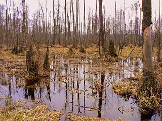
Puszcza Biała is the name given to the forest that extends in Poland from Pułtusk to Ostrów Mazowiecka. It is part of the Mazovian lowlands and consists of small trees, mostly pine.

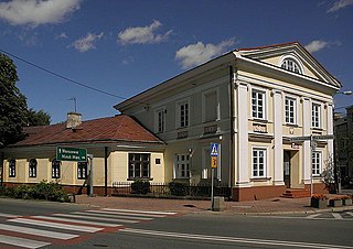
Nur is a village in Ostrów Mazowiecka County, Masovian Voivodeship, in east-central Poland. It is the seat of the gmina called Gmina Nur. It lies approximately 31 kilometres (19 mi) south-east of Ostrów Mazowiecka and 102 km (63 mi) north-east of Warsaw.

Suwalska Cavalry Brigade was a cavalry unit of the Polish Armed Forces of the Second Polish Republic in the interbellum period. It was created on April 1, 1937, out of the 4th Independent Cavalry Brigade. Its headquarters were stationed in Suwałki and the brigade consisted of these units:

The Vistula is the longest river in Poland and the ninth-longest river in Europe, at 1,047 kilometres in length. The drainage basin, reaching into three other nations, covers 193,960 km2 (74,890 sq mi), of which 168,868 km2 (65,200 sq mi) is in Poland.
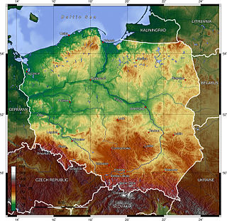
Poland is a country that extends across the North European Plain from the Sudetes and Carpathian Mountains in the south to the sandy beaches of the Baltic Sea in the north. Poland is the fifth-most populous country of the European Union and the ninth-largest country in Europe by area. The territory of Poland covers approximately 312,696 km2 (120,733 sq mi), of which 98.52% is land and 1.48% is water. The Polish coastline was estimated at 770 km (478 mi) in length. Poland's highest point is Mount Rysy, at 2,501 m (8,205 ft).

Mazovia or Masovia is a historical region in mid-north-eastern Poland. It spans the North European Plain, roughly between Łódź and Białystok, with Warsaw being the unofficial capital and largest city. Throughout the centuries, Mazovia developed a separate sub-culture featuring diverse folk songs, architecture, dress and traditions different from those of other Poles.

The Central European mixed forests ecoregion is a temperate hardwood forest covering much of northeastern Europe, from Germany to Russia. The area is only about one-third forested, with pressure from human agriculture leaving the rest in a patchwork of traditional pasture, meadows, wetlands. The ecoregion is in the temperate broadleaf and mixed forest biome, and the Palearctic realm, with a Humid Continental climate. It covers 731,154 km2 (282,300 sq mi).

The Bug-Narew Offensive from July 13 to August 27, 1915 was a major German victory during World War I on the Eastern Front. The Imperial German Army broke through 4 heavily fortified positions, inflicted defeats on superior enemy forces and pushed the Russian Army 300 km to the east, capturing 215,000 prisoners. But the German army also suffered relatively heavy casualties, about 30,000 killed and missing.
