Related Research Articles

Winnsboro is a town in Fairfield County, South Carolina, United States. The population was 3,550 at the 2010 census. The population was 3,215 at the 2020 census. A population decrease of approximately 9.5% for the same 10 year period. It is the county seat of Fairfield County. Winnsboro is part of the Columbia, South Carolina metropolitan Area. Winnsboro is a suburb of a Columbia, South Carolina.
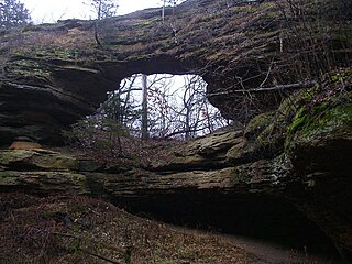
Natural Bridge State Park is a 530-acre (214 ha) state park of Wisconsin, United States, featuring Wisconsin's largest natural arch. Directly beneath the arch is the Raddatz Rockshelter, a rock shelter once used by Paleo-Indians and now listed on the National Register of Historic Places. The park is located southwest of Baraboo between the unincorporated communities of Leland and Denzer, in the town of Honey Creek.

Table Rock State Park is a 3,083-acre (12.48 km2) park at the edge of the Blue Ridge Mountains in northern Pickens County, South Carolina. The park includes Pinnacle Mountain, the tallest mountain totally within the state.

Gatecliff Rockshelter (26NY301) is a major archaeological site in the Great Basin area of the western United States that provides remarkable stratigraphy; it has been called the "deepest archaeological rock shelter in the Americas". Located in Mill Canyon of the Toquima Range in the Monitor Valley of central Nevada, Gatecliff Rockshelter has an elevation of 7,750 feet (2,360 m). David Hurst Thomas discovered Gatecliff Rockshelter in 1970 and began excavations in 1971. Full scale excavations occurred at Gatecliff Rockshelter for about seven field seasons in which nearly 33 feet (10 m) of sediments were exposed for a well-defined stratigraphic sequence. The well-preserved artifacts and undisturbed sediments at Gatecliff Rockshelter provides data and information have been applied to a range of research topics. Based on the analysis of the artifacts at Gatecliff Rockshelter, it can be determined that it was most likely a short-term field camp throughout prehistory. The latest evidence for human usage at Gatecliff occurs between ca. 5500 B.P. to 1250 B.P.
The Tomaquag Rock Shelters (RI-HP-1) are a prehistoric rock shelter site off Maxson Hill Road in Hopkinton, Rhode Island. The shelters are located under two east-facing granite outcrops in the valley drained by Tomaquag Brook. Nathan Kaye discovered the shelters in the late 1950s. Materials recovered from test excavations resulted in dating one shelter to 800 BC and the other to AD 800. Materials recovered include projectile points, stone knives, and evidence of stone tool construction. Both sites included evidence pointing to the presence of a fire pit.

This is a list of the National Register of Historic Places listings in Fairfield County, South Carolina.

Judaculla Rock is a curvilinear-shaped outcrop of soapstone known for its ancient carvings and petroglyphs. The archaeological site is located on a 0.85-acre rectangular-shaped property, now owned by Jackson County. It is approximately 60 meters east of Caney Fork Creek, a major branch of the northwestward-trending Tuckasegee River in the mountains of Western North Carolina.
Green's Shell Enclosure is a historic archeological site located at Hilton Head Island, Beaufort County, South Carolina. The site includes one of 20 or more prehistoric Indian shell middens in a ring shape located from the central coast of South Carolina to the central coast of Georgia. They are believed to date early in the second millennium BC, and they contain some of the earliest pottery known in North America.
Meekins Barn is a historic tobacco barn located near Floydale, Dillon County, South Carolina. It was built before 1935, and is an example of a log tobacco barn. It is a large, five -"room" log barn with a metal-covered gable roof. The building has an arched firebox on the left elevation, a brick foundation reinforced by concrete, and weatherboard has been added between the logs. The gable ends are also weatherboarded.

The Hidden Valley Rockshelter (44-BA-31) is a significant archaeological site located near the community of Warm Springs in Bath County, Virginia, United States. A large rockshelter located near the Jackson River, it has been occupied by humans for thousands of years, and it has been named a historic site.

Kincaid-Anderson House, also known as Fairfield, is a historic home located near Jenkinsville, Fairfield County, South Carolina. It was built about 1774, and is a two-story, brick Georgian style dwelling. It has a hipped roof and sits on a fieldstone foundation. It has small brick side wings that were added in a 1920s restoration. Also on the property is a two-story brick and frame work house that has been converted into a guesthouse. It was the home of James Kincaid, who was one of the first purchasers of cotton in the South Carolina upcountry and was possibly involved in the early development of a cotton gin.
Hunter House is a historic home located near Ridgeway, Fairfield County, South Carolina. It was built about 1820, and is a 1+1⁄2-story, "L"-shaped Federal style weatherboarded building on a raised brick basement. It has a gable roof and exterior end chimneys. The five-bay façade features a pedimented porch sheltering the three central bays.

Albion is a historic plantation house located near Blackstock, Fairfield County, South Carolina. It was built about 1840 by a wealthy planter named Alexander Douglas.
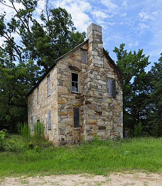
Old Stone House is a historic home located near Winnsboro, Fairfield County, South Carolina. It was built in 1784, and is a two-story, side-gable roofed, stone building, with a double-pile floor plan and stone end chimneys. The façade has a central door with a massive stone lintel flanked by single four-over-four windows with stone lintels. It was built by Samuel Gladney and in 1870 it was purchased by the Lebanon Presbyterian Church for use as a parsonage.

Camp Welfare is a historic African-American religious campground located near Monticello, Fairfield County, South Carolina. It was founded after the American Civil War by the African Methodist Episcopal Zion Church. It is a collection of approximately 100 one-story, frame, weatherboarded cabins called tents arranged in a double "U"-shape. The focal point of the camp is the arbor; a rough, gable roofed wooden shelter with wooden benches. Also located at the camp is Zion Church; a frame building with a gable roof surmounted by a belfry built about 1930.

Dr. Walter Brice House and Office is a historic plantation house and office located near Winnsboro, Fairfield County, South Carolina. It was built about 1840, and is a two-story, weatherboarded frame, L-shaped Greek Revival style dwelling. It features a two-tiered, pedimented front verandah supported by four wooden pillars. The Dr. Walter Brice Office is a 10-foot-by-12-foot weatherboarded frame building with a metal gable roof. Dr. Walter Brice was a prominent Fairfield County planter and physician before the American Civil War.

Furman Institution Faculty Residence is a historic residential building located near Winnsboro, Fairfield County, South Carolina. It was built about 1837, and is a two-story, brick building with a hipped roof and end chimneys. It has a single story, hip roofed front porch and a kitchen extension. The building serves as a visible reminder of the early history of Furman University and its brief establishment in Fairfield County.
Blair Mound is a historic archaeological site located near Winnsboro, Fairfield County, South Carolina. Blair Mound is an earthen mound structure in the form of a low, oval hummock. It measures approximately 75 by 50 yards and is just over 5 feet (1.5 m) high, with evidence of leveling for agricultural development.
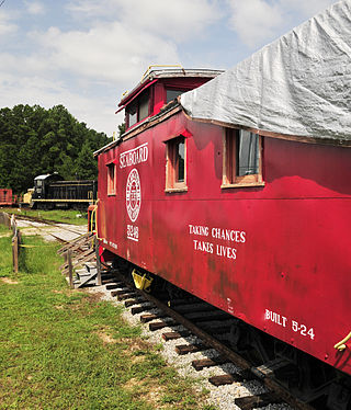
Rockton and Rion Railroad Historic District is a national historic district located near Winnsboro, Fairfield County, South Carolina. The district encompasses 40 contributing buildings, 6 contributing structures, and 2 contributing objects associated with the quarrying, finishing, and transporting of Winnsboro blue granite. The district resources were built between about 1883 and about 1945.
The LaGrange Rock Shelter is an archaeological site located on private property between Leighton and Muscle Shoals in Colbert County, Alabama, near the original campus of LaGrange College. The shelter measures 70 feet long by 15 feet deep and is located beneath a sandstone outcrop overlooking a dense series of Paleoindian sites in the valley below, which may have led to it being chosen for excavation.
References
- 1 2 "National Register Information System". National Register of Historic Places . National Park Service. July 9, 2010.
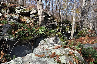
- ↑ Robert L. Stevenson and George Teague (April 1974). "McMeekin Rock Shelter" (pdf). National Register of Historic Places - Nomination and Inventory. Retrieved July 5, 2012.
- ↑ "McMeekin Rock Shelter, Fairfield County (Restricted Site)". National Register Properties in South Carolina. South Carolina Department of Archives and History. Retrieved July 5, 2012.
| Topics |  | |
|---|---|---|
| Lists by county |
| |
| Lists by city | ||
| Other lists | ||
| | This article about a property in Fairfield County, South Carolina on the National Register of Historic Places is a stub. You can help Wikipedia by expanding it. |