
Tamil Nadu, formerly Madras State, is one of the 29 states of India. Its capital and largest city is Chennai. Tamil Nadu lies in the southernmost part of the Indian subcontinent and is bordered by the union territory of Puducherry and the South Indian states of Kerala, Karnataka, and Andhra Pradesh. It is bounded by the Eastern Ghats on the north, by the Nilgiri Mountains, the Meghamalai Hills, and Kerala on the west, by the Bay of Bengal in the east, by the Gulf of Mannar and the Palk Strait on the southeast, and by the Indian Ocean on the south. The state shares a maritime border with the nation of Sri Lanka.

Nagercoil is a city in the southernmost Indian district of Kanyakumari in Tamil Nadu and a corporation. It is the administrative headquarters of Kanyakumari District in Tamil Nadu. The city, situated close to the tip of the Indian peninsula, lies in an undulating terrain between the Western Ghats and the Arabian Sea.
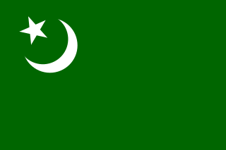
The Indian Union Muslim League (IUML) is a political party in India. It is recognized by the Election Commission of India as a State Party in Kerala.

Nilambur is a municipality and a taluk in the Malappuram district of the Indian state of Kerala. It is located close to the Nilgiris range of the Western Ghats on the banks of the Chaliyar River. It is about 40 kilometers from Malappuram city and 24 kilometers from Manjeri on the Kozhikode–Gudalur road called CNG road.

Kanyakumari district is the southernmost district in Tamil Nadu state and mainland India. It stands second in terms of population density among the districts of Tamil Nadu and next only to Chennai district. It is the richest district in Tamil Nadu in terms of per capita income, and also tops the state in Human Development Index (HDI), literacy and education. The district headquarters is Nagercoil.

Irula are a Dravidian ethnic group inhabiting the area of the Nilgiri mountains, in the states of Tamil Nadu and Kerala, India. A scheduled tribe, their population in this region is estimated at 25,000 people. People of Irula ethnicity are called Irular, and speak Irula, which belongs to the Dravidian family.
A town panchayat or panchayat is a small town of approximately 20,000 to 25,000 inhabitants. It is formed under the panchayati raj administrative system. In census data, the abbreviation T.P. is used to indicate a "town panchayat". Tamil Nadu was the first state to introduce the panchayat town as an intermediate step between rural villages and urban local bodies (ULB).
Kaliyakkavilai is a panchayat town in Kanniyakumari district in the Indian state of Tamil Nadu, close to the Tamil Nadu-Kerala border. It lies on Coimbatore-Kochi-Trivandrum-Kanyakumari National highway 47.

The Mullaperiyar Dam or Mullaiperiyar Dam is a masonry gravity dam on the Periyar River in the Indian state of Kerala It is located 881 m (2,890 ft) above mean sea level, on the Cardamom Hills of the Western Ghats in Thekkady, Idukki District of Kerala, South India. It was constructed between 1887 and 1895 by John Pennycuick and also reached in an agreement to divert water eastwards to the Madras Presidency area. It has a height of 53.6 m (176 ft) from the foundation, and a length of 365.7 m (1,200 ft). The Periyar National Park in Thekkady is located around the dam's reservoir. The dam is located in Kerala on the river Periyar, but is operated and maintained by Tamil Nadu state. Although the Periyar River has a total catchment area of 5398 km2 with 114 km2 in Tamil Nadu, the catchment area of the Mullaperiyar Dam itself lies entirely in Kerala. On 21 November 2014, the water level hit 142 feet for first time in 35 years. The reservoir again hit the maximum limit of 142 feet on 15 August 2018, following incessant rains in the state of Kerala.

Parambikulam Dam is an embankment dam on the Parambikulam River,
Parambikulam located in the Palakkad district in the Western Ghats of Kerala, India, ranks number one in India as well as in the top ten embankment dams in the world in volume in the year 2000.
Labbay, is an Islamic community in southern India found throughout the southern Indian states of Tamil Nadu, Karnataka and Kerala. They are also found in other parts of the world where they reside as Non-resident Indian and Person of Indian Origin emigrants and their descendants.
Thovalai taluk is a taluk of Kanyakumari district of the Indian state of Tamil Nadu. The headquarters of the taluk is the town of Boothapandi.
Konerirajapuram Vaidyanatha Ayyar (1878-1921) was a Carnatic vocalist from the Indian state of Tamil Nadu.

The Siruvani River is a river near Coimbatore, India. It is tributary of Bhavani river, which in turn is a tributary of Kaveri. Part of the Siruvani River is near Mannarkkad in the Indian District of Palakkad, Kerala. The river leads into two big tourist attractions in Southern India, namely, the Siruvani Dam and the Siruvani Waterfalls. The dam is also near The Banan Fort. Banan Fort and the Siruvani Dam, are 15 to 25 kilometres west of Coimbatore city. The river has a village named after it, or possibly vice versa.
The Coimbatore - Shoranur line connects Coimbatore in the Indian state of Tamil Nadu and Shoranur in Kerala. There is a branch line Pothanur–Coimbatore–Mettupalayam and Mettupalayam to Udhagamandalam via Nilgiri Mountain Railway. This network links the railway network in Kerala to the network in Tamil Nadu via the Palakkad Gap.

A parotta, porotta or barotta is a layered flatbread, originating from the Indian subcontinent, made from maida flour, popular in Southern India. It is a common street food in southern India, especially in Kerala, Tamil Nadu and the neighboring country of Sri Lanka. Parotta was introduced from Tamil Nadu to Malaysia by Tamil Indians and Sri Lankan Moor working in the Tuticorin harbour in the 1970s, from which it spread across the state to neighbouring states. Parottas are usually available as street food and in restaurants across Kerala, Tamil Nadu and parts of Karnataka, Andhra Pradesh and Telangana. At some places it is also served at weddings, religious festivals and feasts. It is prepared by kneading maida flour, egg, oil or ghee and water. The dough is beaten into thin layers and later forming a round spiralled into a ball using these thin layers. The ball is rolled flat and pan fried.
Venkatachalam may refer to:

