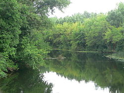
Morshansk is a town in Tambov Oblast, Russia, located on the Tsna River 93 kilometers (58 mi) north of Tambov. Population: 41,556 (2010 Census); 44,486 (2002 Census); 50,055 (1989 Census); 44,000 (1970).

Kotovsk is a town in Tambov Oblast, Russia, located on the Tsna River 13 kilometers (8.1 mi) south of Tambov. Population: 31,850 (2010 Census); 34,054 (2002 Census); 38,510 (1989 Census).

Uvarovo is a town in Tambov Oblast, Russia, located on the right bank of the Vorona River, 117 kilometers (73 mi) southeast of Tambov. Population: 26,830 (2010 Census); 29,690 (2002 Census); 34,554 (1989 Census).
Kirsanov is a town in Tambov Oblast, Russia, located on the Vorona River at its confluence with the Pursovka River 95 kilometers (59 mi) east of Tambov. Population: 17,224 (2010 Census); 18,506 (2002 Census); 20,754 (1989 Census).

Inzhavinsky District is an administrative and municipal district (raion), one of the twenty-three in Tambov Oblast, Russia. It is located in the east of the oblast. The district borders with Kirsanovsky District in the north, Turkovsky District of Saratov Oblast in the east, Uvarovsky District in the south, and with Rzhaksinsky District in the west. The area of the district is 1,830 square kilometers (710 sq mi). Its administrative center is the urban locality of Inzhavino. Population: 23,184 ; 27,843 (2002 Census); 33,964 (1989 Census). The population of Inzhavino accounts for 41.4% of the district's total population.

Kirsanovsky District is an administrative and municipal district (raion), one of the twenty-three in Tambov Oblast, Russia. It is located in the east of the oblast. The district borders with Gavrilovsky District in the north, Umyotsky District in the east, Inzhavinsky District in the south, and with Rasskazovsky District in the west. The area of the district is 1,307.8 square kilometers (504.9 sq mi). Its administrative center is the town of Kirsanov. Population: 21,756 ; 23,613 (2002 Census); 24,780 (1989 Census).

Morshansky District is an administrative and municipal district (raion), one of the twenty-three in Tambov Oblast, Russia. It is located in the north of the oblast and borders Shatsky District of Ryazan Oblast in the north, Zemetchinsky District of Penza Oblast in the east, Pichayevsky District in the south, and Sarayevsky District of Ryazan Oblast in the west. The area of the district is 2,880 square kilometers (1,110 sq mi). Its administrative center is the town of Morshansk. As of the 2010 Census, the total population of the district was 34,088.
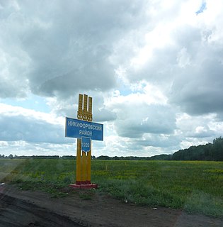
Nikiforovsky District is an administrative and municipal district (raion), one of the twenty-three in Tambov Oblast, Russia. It is located in the west and northwest of the oblast. The area of the district is 1,191.4 square kilometers (460.0 sq mi). Its administrative center is the urban locality of Dmitriyevka. Population: 20,066 ; 22,970 (2002 Census); 26,181 (1989 Census). The population of the administrative center accounts for 42.0% of the district's total population.

Pervomaysky District is an administrative and municipal district (raion), one of the twenty-three in Tambov Oblast, Russia. It is located in the northwest of the oblast. The area of the district is 941 square kilometers (363 sq mi). Its administrative center is the urban locality of Pervomaysky. Population: 29,277 ; 31,925 (2002 Census); 35,948 (1989 Census). The population of the administrative center accounts for 43.2% of the district's total population.

Rasskazovsky District is an administrative and municipal district (raion), one of the twenty-three in Tambov Oblast, Russia. It is located in the center of the oblast. The district borders with Bondarsky District in the north, Kirsanovsky District in the east, Sampursky District in the south, and with Tambovsky District in the west. The area of the district is 1,802 square kilometers (696 sq mi). Its administrative center is the town of Rasskazovo. Population: 22,991 ; 24,984 (2002 Census); 25,422 (1989 Census).

Rzhaksinsky District is an administrative and municipal district (raion), one of the twenty-three in Tambov Oblast, Russia. It is located in the south of the oblast. The district borders with Rasskazovsky District in the north, Inzhavinsky District in the east, Uvarovsky District in the south, and with Sampursky District in the west. The area of the district is 1,415 square kilometers (546 sq mi). Its administrative center is the urban locality of Rzhaksa. Population: 18,565 ; 21,981 (2002 Census); 26,111 (1989 Census). The population of Rzhaksa accounts for 28.0% of the district's total population.

Sampursky District is an administrative and municipal district (raion), one of the twenty-three in Tambov Oblast, Russia. It is located in the south of the oblast. The district borders with Rasskazovsky District in the north, Rzhaksinsky District in the east, Zherdevsky District in the south, and with Znamensky District in the west. The area of the district is 1,008 square kilometers (389 sq mi). Its administrative center is the rural locality of Satinka. Population: 14,204 ; 16,487 (2002 Census); 18,721 (1989 Census). The population of Satinka accounts for 25.1% of the district's total population.

Sosnovsky District is an administrative and municipal district (raion), one of the twenty-three in Tambov Oblast, Russia. It is located in the north of the oblast. The district borders with Morshansky District in the north, Pichayevsky District in the east, Tambovsky District in the south, and with Staroyuryevsky District in the west. The area of the district is 2,382 square kilometers (920 sq mi). Its administrative center is the urban locality of Sosnovka. Population: 31,641 ; 39,253 (2002 Census); 48,133 (1989 Census). The population of Sosnovka accounts for 29.0% of the district's total population.

Staroyuryevsky District is an administrative and municipal district (raion), one of the twenty-three in Tambov Oblast, Russia. It is located in the northwest of the oblast. The district borders with Sarayevsky District of Ryazan Oblast in the north, Sosnovsky District in the east, Michurinsky District in the south, and with Pervomaysky District in the west. The area of the district is 1,008 square kilometers (389 sq mi). Its administrative center is the rural locality of Staroyuryevo. Population: 14,553 ; 17,695 (2002 Census); 21,852 (1989 Census). The population of Staroyuryevo accounts for 42.2% of the district's total population.

Tambovsky District is an administrative and municipal district (raion), one of the twenty-three in Tambov Oblast, Russia. It is located in the center of the oblast. The district borders with Sosnovsky District in the north, Rasskazovsky District in the east, Znamensky District in the south, and with Nikiforovsky District in the west. The area of the district is 2,632 square kilometers (1,016 sq mi). Its administrative center is the city of Tambov. Population: 102,786 ; 102,018 (2002 Census); 80,793 (1989 Census).

Tokaryovsky District is an administrative and municipal district (raion), one of the twenty-three in Tambov Oblast, Russia. It is located in the southwest of the oblast. The district borders with Znamensky District in the north, Zherdevsky District in the east, Ertilsky District of Voronezh Oblast in the south, and with Morshansky District in the west. The area of the district is 1,434 square kilometers (554 sq mi). Its administrative center is the urban locality of Tokaryovka. Population: 17,898 ; 21,536 (2002 Census); 25,723 (1989 Census). The population of Tokaryovka accounts for 38.7% of the district's total population.
Umyotsky District is an administrative and municipal district (raion), one of the twenty-three in Tambov Oblast, Russia. It is located in the east of the oblast. The district borders with Gavrilovsky District in the north, Tamalinsky District of Penza Oblast in the east, Inzhavinsky District in the south, and with Kirsanovsky District in the west. The area of the district is 1,097 square kilometers (424 sq mi). Its administrative center is the urban locality of Umyot. Population: 12,044 ; 13,545 (2002 Census); 15,228 (1989 Census). The population of Umyot accounts for 39.4% of the district's total population.

Uvarovsky District is an administrative and municipal district (raion), one of the twenty-three in Tambov Oblast, Russia. It is located in the southeast of the oblast. The district borders with Inzhavinsky District in the north, Muchkapsky District in the east, Gribanovsky District of Voronezh Oblast in the south, and with Zherdevsky District in the west. The area of the district is 1,141 square kilometers (441 sq mi). Its administrative center is the town of Uvarovo. Population: 11,221 ; 12,737 (2002 Census); 13,974 (1989 Census).

Zherdevsky District is an administrative and municipal district (raion), one of the twenty-three in Tambov Oblast, Russia. It is located in the south of the oblast. The district borders with Rzhaksinsky District in the north, Uvarovsky District in the east, Ternovsky District of Voronezh Oblast in the south, and with Tokaryovsky District in the west. The area of the district is 1,397.77 square kilometers (539.68 sq mi). Its administrative center is the town of Zherdevka. Population: 30,331 ; 33,502 (2002 Census); 38,944 (1989 Census). The population of Zherdevka accounts for 50.1% of the district's total population.