Microregion of Guaratinguetá

Last updated
Microregion of
Guaratinguetá
Microregion
SaoPaulo Micro Guaratingueta.svg
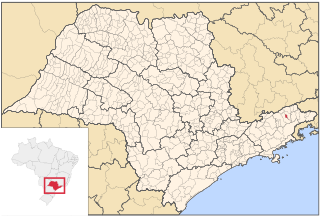
Location of Microregion of Guaratinguetá in the state of São Paulo
Country Flag of Brazil.svg  Brazil
Region Southeast
State Bandeira do Estado de Sao Paulo.svg  São Paulo
Mesoregion Vale do Paraíba Paulista
Time zone UTC-3 (UTC-3)
  Summer (DST) UTC-2 (UTC-2)

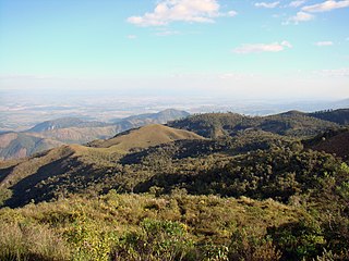
The Microregion of Guaratinguetá (Portuguese : Microrregião de Guaratinguetá) is a microregion in the east of São Paulo State, Brazil. The microregion is the bordered by the state of Rio de Janeiro to the north.

Portuguese language Romance language that originated in Portugal

Portuguese is a Western Romance language originating in the Iberian Peninsula. It is the sole official language of Portugal, Brazil, Cape Verde, Guinea-Bissau, Mozambique, Angola, and São Tomé and Príncipe. It also has co-official language status in East Timor, Equatorial Guinea and Macau in China. As the result of expansion during colonial times, a cultural presence of Portuguese and Portuguese creole speakers are also found in Goa, Daman and Diu in India; in Batticaloa on the east coast of Sri Lanka; in the Indonesian island of Flores; in the Malacca state of Malaysia; and the ABC islands in the Caribbean where Papiamento is spoken, while Cape Verdean Creole is the most widely spoken Portuguese-based Creole. Reintegrationists maintain that Galician is not a separate language, but a dialect of Portuguese. A Portuguese-speaking person or nation is referred to as "Lusophone" (Lusófono).

Brazil Federal republic in South America

Brazil, officially the Federative Republic of Brazil, is the largest country in both South America and Latin America. At 8.5 million square kilometers and with over 208 million people, Brazil is the world's fifth-largest country by area and the fifth most populous. Its capital is Brasília, and its most populated city is São Paulo. The federation is composed of the union of the 26 states, the Federal District, and the 5,570 municipalities. It is the largest country to have Portuguese as an official language and the only one in the Americas; it is also one of the most multicultural and ethnically diverse nations, due to over a century of mass immigration from around the world.

Rio de Janeiro (state) State of Brazil

Rio de Janeiro is one of the 27 federative units of Brazil. It has the second largest economy of Brazil, with the largest being that of the state of São Paulo.

Municipalities

The microregion consists of the following municipalities: [1]

Aparecida Municipality in Southeast Brazil, Brazil

Aparecida is a Brazilian municipality in the state of São Paulo. It is located in the fertile valley of the River Paraíba do Sul on the southern (right) bank. It is part of the Metropolitan Region of Vale do Paraíba e Litoral Norte. The population is 36,217 in an area of 121.08 km². The municipality is sometimes referred as Aparecida do Norte.

Cachoeira Paulista Municipality in Southeast Brazil, Brazil

Cachoeira Paulista is a municipality in the state of São Paulo in Brazil. It is part of the Metropolitan Region of Vale do Paraíba e Litoral Norte, in the Guaratinguetá Microregion.

Canas, São Paulo Municipality in Southeast Brazil, Brazil

Canas is a municipality in the state of São Paulo in Brazil. It is part of the Metropolitan Region of Vale do Paraíba e Litoral Norte. The population is 4,852 in an area of 53.26 km². The elevation is 530 m.

Related Research Articles

Paraíba Valley region in the eastern part of the state of São Paulo and the western part of the state of Rio de Janeiro, Brazil

The Paraíba Valley is a region in the eastern part of the state of São Paulo and the western part of the state of Rio de Janeiro, Brazil. The region is situated along the upper part of the Paraíba do Sul River, roughly between Rio de Janeiro and São Paulo. It has been one of the most important economic regions of Brazil since the start of coffee production in the 19th century. Since the 1950s the region has seen large scale industrialization. The largest cities in the valley are São José dos Campos, Taubaté, Jacareí, Pindamonhangaba, Guaratinguetá and Volta Redonda. The main highway in the valley is the Presidente Dutra Highway (BR-116),

Microregion of Bananal Microregion in Southeast, Brazil

The Microregion of Bananal is a microregion in the east of São Paulo State, Brazil.

Microregion of Vale do Rio dos Bois Microregion in Goiás, Brazil

Vale do Rio dos Bois Microregion is a statistical region in central Goiás state, Brazil. It lies west of the state capital, Goiânia. It takes its name from the Rio dos Bois, a river that flows through the microregion.

Microregion of Caraguatatuba Microregion in Southeast, Brazil

The Microregion of Caraguatatuba, often referred as Litoral Norte, is a microregion in the easternmost coastal part of São Paulo State, Brazil. The microregion is bordered by the state of Rio de Janeiro to the east. It is a famous touristic destination, mainly because of the 160 beaches. According to IBGE, Caraguatatuba Microregion has a GDP of R$2,019,94,.048,00 and a population of 281,532 people spread over an area of 1,947.702 km², which means that the density is 144.5/km². The population increases considerably during the summer, because of the tourists.

Esmeraldas, Minas Gerais city and municipality in Minas Gerais, Brazil

Esmeraldas is a Brazilian municipality located in the state of Minas Gerais. The city belongs to the mesoregion Metropolitana de Belo Horizonte and to the microregion of Belo Horizonte. In 2004 its population was estimated to be 58,784 inhabitants.

Riachão do Jacuípe Place in Northeast, Brazil

Riachão do Jacuípe is a Brazilian municipality of Bahia state. It's a place in Sisaleira region, Microregion of Serrinha.

Barão de Cocais municipality of Brazil

Barão de Cocais is a Brazilian municipality located in the state of Minas Gerais. Its population as of 2006 is estimated to be 28,432 people living in an altitude between 682 and 1425 meters. The area of the municipality is 340.675 square kilometres (131.535 sq mi). The city belongs to the mesoregion Metropolitana de Belo Horizonte and to the microregion of Itabira.

Ribeirão Vermelho human settlement in Brazil

Ribeirão Vermelho is a Brazilian municipality located in the state of Minas Gerais. The city belongs to the mesoregion of Campo das Vertentes and to the microregion of Lavras.

Urucânia Brazilian municipality located in the state of Minas Gerais

Urucânia is a Brazilian municipality located in the state of Minas Gerais. The city belongs to the mesoregion of Zona da Mata and to the microregion of Ponte Nova.

Microregion of Jaguarão Microregion in Rio Grande do Sul, Brazil

The Jaguarão microregion is a microregion in the southern part of the state of Rio Grande do Sul, Brazil. Its total area is of 6,331.228 km².

Microregion of Pelotas Micro-region in Rio Grande do Sul, Brazil

The Pelotas Microregion is a microregion in the southeastern part of the state of Rio Grande do Sul, Brazil. The area is 10,306.601 km².

Microregion of Litoral Lagunar Micro-region in Rio Grande do Sul, Brazil

The Litoral Lagunar Microregion is a microregion in the southern part of the state of Rio Grande do Sul, Brazil. Its total area is of 9,379.518 km².

Microregion of Serras de Sudeste Micro-region in Rio Grande do Sul, Brazil

The Serras de Sudeste Microregion is a microregion in the southern part of the state of Rio Grande do Sul, Brazil. It is named after a hill range named Serras de Sudeste, which means Southeastern Mountain Ranges. The area is 16,512.614 km².

Microregion of Entorno do Distrito Federal Microregion in Goiás, Brazil

Entorno do Distrito Federal Microregion is a statistical microregion in Goiás state, Brazil, consisting of municipalities located in the vicinity of the Federal District of Brazil.

São Gonçalo do Abaeté municipality of Brazil

São Gonçalo do Abaeté is a municipality in the north of the Brazilian state of Minas Gerais. Its population in 2007 was 6,156 inhabitants in a total area of 2,687 km². It is a large producer of cattle and grains.

Campo Alegre, Santa Catarina is a municipality in the state of Santa Catarina in the South region of Brazil.

Caridade is a municipality in the state of Ceará in the Northeast region of Brazil.

Remo, Virginia human settlement in Virginia, United States of America

Remo is an unincorporated community in Northumberland County, in the U.S. state of Virginia.

References

Coordinates: 22°48′57″S45°11′34″W / 22.81583°S 45.19278°W / -22.81583; -45.19278

Geographic coordinate system Coordinate system

A geographic coordinate system is a coordinate system that enables every location on Earth to be specified by a set of numbers, letters or symbols. The coordinates are often chosen such that one of the numbers represents a vertical position and two or three of the numbers represent a horizontal position; alternatively, a geographic position may be expressed in a combined three-dimensional Cartesian vector. A common choice of coordinates is latitude, longitude and elevation. To specify a location on a plane requires a map projection.