
Millinocket is a town in Penobscot County, Maine, United States.

Mount Katahdin is the highest mountain in the U.S. state of Maine at 5,267 feet (1,605 m). Named Katahdin by the Penobscot Native Americans, which means "The Greatest Mountain", it is located within Northeast Piscataquis, Piscataquis County, and is the centerpiece of Baxter State Park. It is a steep, tall masiff formed from a granite intrusion weathered to the surface. The flora and fauna on the mountain are typical of those found in northern New England.

The Penobscot River is a 109-mile-long (175 km) river in the U.S. state of Maine. Including the river's West Branch and South Branch increases the Penobscot's length to 264 miles (425 km), making it the second-longest river system in Maine and the longest entirely in the state. Its drainage basin contains 8,610 square miles (22,300 km2).

The Bangor and Aroostook Railroad was a United States railroad company that brought rail service to Aroostook County in northern Maine. Brightly painted BAR box cars attracted national attention in the 1950s. First-generation diesel locomotives operated on BAR until they were museum pieces. The economic downturn of the 1980s coupled with the departure of heavy industry from northern Maine forced the railroad to seek a buyer and end operations in 2003.
The Tinker Dam is a hydroelectric dam built on the Aroostook River in the Canadian province of New Brunswick and operated jointly by WPS Energy and NB Power. Its power house has a capacity of 34 megawatts.
Chesuncook Lake is a reservoir in the North Maine Woods and Piscataquis County, Maine. It is formed by the damming of the West Branch Penobscot River, by dams built in 1835, 1903, and 1916. It is approximately 22 miles (35 km) long and 1–4 miles wide, with a surface area of 25,183 acres (101.91 km2) and a maximum depth of 150 feet (46 m). It is the third-largest body of fresh water in Maine.

South Twin Lake having about 3,200 acres (13 km2) is wholly within Penobscot County, Maine. It is about 6 miles (10 km) west of Millinocket, Maine and is part of the Pemadumcook Chain of Lakes. The lake is centered at 45°37.25′N 68°51′W and has spillway elevation 492 feet (150 m) above sea level. It is part of the watershed of the West Branch of the Penobscot River.
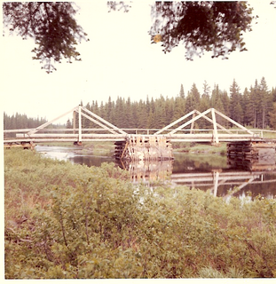
The Pemadumcook Chain of Lakes are a set of large lakes in north-central Maine in the United States.
The Baker Branch Saint John River is a 48.0-mile-long (77.2 km) river. This river is a tributary of the Saint John River, flowing in the Maine North Woods, in Maine, in the Northeastern United States.
The North Branch Penobscot River is a river in Somerset County, Maine. From its source at the outlet of Little Bog about 10 miles (16 km) east of the Canada–United States border in Maine Township 6, Range 17, WELS, the river runs 27.8 miles (44.7 km) southwest and southeast to its drowned confluence with the South Branch of the Penobscot River in Seboomook Lake in Pittston Academy Grant.

The West Branch Penobscot River is a 117-mile-long (188 km) tributary of the Penobscot River through the North Maine Woods in Maine. The river is also known as Abocadneticook, Kahgognamock, and Kettegwewick.
The Maine Northern Railway Company Limited is a 258 mi (415 km) U.S. and Canadian short line railroad owned by the New Brunswick Railway Company, a holding company that is part of "Irving Transportation Services", a division within the industrial conglomerate J.D. Irving Limited.
Charles P. Pray is an American politician from Maine. Pray was born in the paper mill town of Millinocket, Maine on August 15, 1945. He grew up in northern Piscataquis County, Maine attending a one-room schoolhouse from 1954-1959. He attended Maine Central Institute, graduating from Stearns High School in his birthplace of Millinocket in 1964. He then attended Ricker College in Houlton. In 1966, he enlisted with the US Air Force and served in Southeast Asia during the Vietnam War. Finishing with the Air Force in 1970, he returned to Maine and enrolled at the University of Maine, from which he graduated in 1973 with a B.A. in political science. In 1974, he was elected to the Maine Senate to represent Piscataquis County and the northern area of Penobscot County, which was the largest legislative district east of the Mississippi River. From 1978-1982, Pray served as Assistant Majority Leader of the Maine Senate. From 1982-1984, Pray served as Majority Leader. In 1984, Pray was elected by his peers as President of the Maine Senate, a position he held until a surprise defeat in 1992. He is one of two individuals to serve four terms but is the only Senate President in Maine history to hold the office for 8 full years.

Ripogenus Gorge is a rock-walled canyon formed where the West Branch Penobscot River crosses the Caribou Lake anticline. Ripogenus Falls controlled discharge from Ripogenus Lake until Ripogenus Dam was completed at the upstream end of the gorge in 1916. The dam forms a hydroelectric reservoir raising the level of Ripogenus Lake to include the upstream Chesuncook Lake, Caribou Lake, and Moose Pond. The resulting reservoir is often identified by the name of the largest included lake: Chesuncook. The gorge provides an unusual exposure of Maine North Woods bedrock typically covered by saturated glacial till. The Silurian Ripogenus Formation of weakly metamorphosed shallow marine siliciclastics and fossiliferous limestone has been described from investigation of the gorge.

Great Northern Paper Company was a Maine-based pulp and paper manufacturer that at its peak in the 1970s and 1980s operated mills in Arkansas, Georgia, Maine, and Wisconsin and produced 16.4% of the newsprint made in the United States.

The Central Maine & Québec Railway is a Class II freight railroad operating in the U.S. states of Maine and Vermont and the Canadian province of Quebec with headquarters in New York, NY. It is owned by Railroad Acquisition Holdings, LLC, a subsidiary of Fortress Investment Group, LLC.

East Millinocket is a town in Penobscot County, Maine, United States. The population was 1,723 at the 2010 census.
Rainbow Lake is the source of Rainbow Stream in Rainbow township in the North Maine Woods. Rainbow Stream discharges over a dam at the west end of the lake and flows 4 miles (6.4 km) south to Nahmakanta Lake. Nahmakanta Lake overflows through Nahmakanta Stream and Pemadumcook Chain of Lakes to the Penobscot River. The Appalachian Trail follows Rainbow Stream and the south shore of the lake; but the old logging road to the dam has deteriorated with boggy areas no longer passable by four-wheel drive vehicles. The lake has a small catchment basin and is surrounded by large granite boulders. The low nutrient input in this setting produces unusually clear water. The lake has a native population of brook trout.

State Route 157 (SR 157) is a 22-mile-long (35 km) state highway in the northern part of the U.S. state of Maine. It travels between the towns of Millinocket and Mattawamkeag generally following the northern banks of the West Branch Penobscot River and the Penobscot River. For just under a half of its length, it is concurrent with SR 11 from Millinocket to Medway. This portion is also concurrent with the Katahdin Woods & Waters Maine Scenic Byway.