
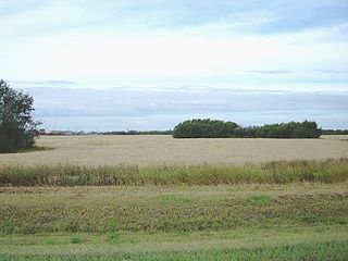
The Clark Fork, or the Clark Fork of the Columbia River, is a river in the U.S. states of Montana and Idaho, approximately 310 miles (500 km) long. The largest river by volume in Montana, it drains an extensive region of the Rocky Mountains in western Montana and northern Idaho in the watershed of the Columbia River. The river flows northwest through a long valley at the base of the Cabinet Mountains and empties into Lake Pend Oreille in the Idaho Panhandle. The Pend Oreille River in Idaho, Washington, and British Columbia, Canada which drains the lake to the Columbia in Washington, is sometimes included as part of the Clark Fork, giving it a total length of 479 miles (771 km), with a drainage area of 25,820 square miles (66,900 km2). In its upper 20 miles (32 km) in Montana near Butte, it is known as Silver Bow Creek. Interstate 90 follows much of the upper course of the river from Butte to northwest of Missoula. The highest point within the river's watershed is Mount Evans at 10,641 feet (3,243 m) in Deer Lodge County, Montana along the Continental Divide.

The Bitterroot River is a northward flowing 84-mile (135 km) river running through the Bitterroot Valley, from the confluence of its West and East forks near Conner in southern Ravalli County to its confluence with the Clark Fork River near Missoula in Missoula County, in western Montana. The Clark Fork River is tributary to the Columbia River and ultimately, the Pacific Ocean. The Bitterroot River is a Blue Ribbon trout fishery with a healthy population of native westslope cutthroat trout and bull trout. It is the third most fly fished river in Montana behind the Madison and Big Horn Rivers.
Aspen parkland refers to a very large area of transitional biome between prairie and boreal forest in two sections, namely the Peace River Country of northwestern Alberta crossing the border into British Columbia, and a much larger area stretching from central Alberta, all across central Saskatchewan to south central Manitoba and continuing into small parts of the US states of Minnesota and North Dakota. Aspen parkland consists of groves of aspen poplars and spruce interspersed with areas of prairie grasslands, also intersected by large stream and river valleys lined with aspen-spruce forests and dense shrubbery. This is the largest boreal-grassland transition zone in the world and is a zone of constant competition and tension as prairie and woodlands struggle to overtake each other within the parkland.

The Beaverhead–Deerlodge National Forest is the largest of the National Forests in Montana, United States. Covering 3.36 million acres (13,600 km2), the forest is broken into nine separate sections and stretches across eight counties in the southwestern area of the state. President Theodore Roosevelt named the two forests in 1908 and they were merged in 1996. Forest headquarters are located in Dillon, Montana. In Roosevelt's original legislation, the Deerlodge National Forest was called the Big Hole Forest Reserve. He created this reserve because the Anaconda Copper Mining Company, based in Butte, Montana, had begun to clearcut the upper Big Hole River watershed. The subsequent erosion, exacerbated by smoke pollution from the Anaconda smelter, was devastating the region. Ranchers and conservationists alike complained to Roosevelt, who made several trips to the area. (Munday 2001)

Bitterroot National Forest comprises 1.587 million acres (6,423 km²) in west-central Montana and eastern Idaho, of the United States. It is located primarily in Ravalli County, Montana, but also has acreage in Idaho County, Idaho (29.24%), and Missoula County, Montana (0.49%).

Lost Trail Pass is a mountain pass in the Rocky Mountains of the northwestern United States, on the border of Idaho and Montana in the Bitterroot Mountains. The pass is at an elevation of 7,014 feet (2,138 m) above sea level and is traversed by U.S. Highway 93.

The Centennial Mountains are the southernmost sub-range of the Bitterroot Range in the United States states of Idaho and Montana. The Centennial Mountains include the Western and Eastern Centennial Mountains. The range extends east from Monida Pass along the Continental Divide to Henrys Fork 48 km (30 mi) NNW of Ashton, Idaho; bounded on the west by Beaver Creek, on the north by Centennial Valley and Henrys Lake Mountains, on the east by Henrys Lake Flat, and on the south by Shotgun Valley and the Snake River Plain. The highest peak in the range is Mount Jefferson.

The Beaverhead Mountains, highest point Scott Peak, el. 11,393 feet (3,473 m), are a mountain range straddling the Continental Divide in the U.S. states of Montana and Idaho. They are a sub-range of the Bitterroot Range, and divide Beaverhead County, Montana from Lemhi County, Idaho and Clark County, Idaho.
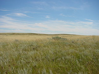
The Northern short grasslands is one of 867 terrestrial ecoregions defined by the World Wide Fund for Nature. This ecoregion includes parts of the Canadian provinces of Alberta and Saskatchewan, and the American Great Plains states of Montana, North Dakota, Wyoming, South Dakota and Nebraska. The United States Environmental Protection Agency (EPA) further breaks this ecoregion into the Northwestern Glaciated Plains and Northwestern Great Plains.

The Alberta Mountain forests are a temperate coniferous forests ecoregion of Canada.

The ecology of the Rocky Mountains is diverse due to the effects of a variety of environmental factors. The Rocky Mountains are the major mountain range in western North America, running from the far north of British Columbia in Canada to New Mexico in the southwestern United States, climbing from the Great Plains at or below 1,800 feet (550 m) to peaks of over 14,000 feet (4,300 m). Temperature and rainfall varies greatly also and thus the Rockies are home to a mixture of habitats including the alpine, subalpine and boreal habitats of the Northern Rocky Mountains in British Columbia and Alberta, the coniferous forests of Montana and Idaho, the wetlands and prairie where the Rockies meet the plains, a different mix of conifers on the Yellowstone Plateau in Wyoming and in the high Rockies of Colorado and New Mexico, and finally the alpine tundra of the highest elevations.

The South Central Rockies forests is a temperate coniferous forest ecoregion of the United States located mainly in Wyoming, Idaho, and Montana. It has a considerably drier climate than the North Central Rockies forest.
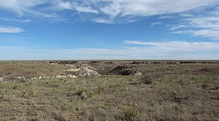
The Western short grasslands is a temperate grassland ecoregion of the United States.

The Colorado Rockies forests is a temperate coniferous forest ecoregion of the United States.

The North Central Rockies forests is a temperate coniferous forest ecoregion of Canada and the United States. This region gets more rain on average than the South Central Rockies forests and is notable for containing the only inland populations of many species from the Pacific coast.

The Central tall grasslands are a prairie ecoregion of the Midwestern United States, part of the North American Great Plains.

The Regional designations of Montana vary widely within the U.S state of Montana. The state is a large geographical area that is split by the Continental Divide, resulting in watersheds draining into the Pacific Ocean, Gulf of Mexico and Hudson's Bay. The state is approximately 545 miles (877 km) east to west along the Canada–United States border and 320 miles (510 km) north to south. The fourth largest state in land area, it has been divided up in official and unofficial ways into a variety of regions. Additionally, Montana is part of a number of larger federal government administrative regions.
Lewis and Clark Pass, el. 6,424 feet (1,958 m) is a mountain pass on the continental divide in Montana. It lies at the head of the drainages of the west flowing Blackfoot River and the east flowing Dearborn River. The pass is in the Helena National Forest in Lewis and Clark County. The Continental Divide Trail traverses north and south through the pass. At the time of the Lewis and Clark Expedition the pass was a much-used pathway where the native people living in what today is Montana crossed over the continental divide. The pass was crossed by Meriwether Lewis on July 7, 1806, on the return leg of the Lewis and Clark Expedition with a party of nine men and his dog Seaman. The pass was named for the expedition's two leaders–Lewis and William Clark. Lewis and Clark Pass is the only roadless pass on the entire Lewis and Clark National Historic Trail. It has gone from being one of the most used continental divide passes prior to the pioneer era to one of the least visited passes today. It can be accessed by a 1.5-mile (2.4 km) trail. Visitors will encounter the pass much as Lewis did in 1806. The furrows left by the countless dog and horse travois that crossed the pass are still visible and this is one of the places along the expedition's route that visitors may still encounter a grizzly bear. On a clear day, like Meriwether Lewis in 1806 one can see Square Butte in Cascade County, Montana, 40 miles (64 km) to the northeast.

Silver Bow Creek is a 26-mile-long (42 km) headwater stream of the Clark Fork (river) originating within the city limits of Butte, Montana, from the confluence of Little Basin and Blacktail Creeks. A former northern tributary, Yankee Doodle Creek, no longer flows directly into Silver Bow Creek as it is now captured by the Berkeley Pit. Silver Bow Creek flows northwest and north through a high mountain valley, passing east of Anaconda, Montana, where it becomes the Clark Fork at the confluence with Warm Springs Creek.

