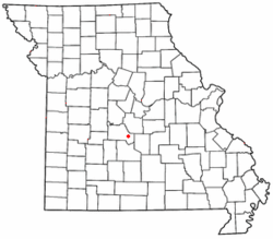
Stoutland is a city in Camden and Laclede counties in the U.S. state of Missouri. The population was 192 at the 2010 census.

Stanton is an unincorporated community in southern Franklin County, Missouri, United States. It lies on Interstate 44 at the junction with Missouri Supplemental Route W, which provides access to Meramec Caverns, located approximately two miles southeast along the Meramec River.
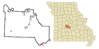
Branch is an unincorporated community in southwestern Camden County, Missouri, United States. It is located on Route 73 one mile south of U.S. Route 54. Macks Creek is four miles to the northeast. Tunas is approximately four miles south on Route 73 in Dallas County.
Golden is an unincorporated community and census-designated place in southeastern Barry County, Missouri, United States. It is approximately 20 miles (32 km) southeast of Cassville. It is located south of Table Rock Lake and one mile north of Missouri Route 86 on Highway J. At the 2020 census, Golden had a population of 275.
Broseley is an unincorporated community in eastern Butler County, Missouri, United States. It is located on Missouri Route 51, approximately ten miles southeast of Poplar Bluff. Nyssa is two miles to the south and Batesville is two miles to the north.
Saverton is an unincorporated community in eastern Ralls County, Missouri, United States. It is located adjacent to the Mississippi River, approximately ten miles southeast of Hannibal. Saverton is part of the Hannibal Micropolitan Statistical Area.

Hollywood is an unincorporated community in southern Dunklin County, Missouri, United States. It is located less than one mile from Route 164, approximately twelve miles south of Kennett.

Millersville is an unincorporated community in western Cape Girardeau County, Missouri, United States. It is located six miles (10 km) west of Jackson on Route 72.
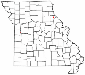
Prairie Hill is an unincorporated community in eastern Chariton County, Missouri, United States. The community is located at the intersection of Missouri routes W and HH approximately seven miles north-northeast of Salisbury. The Thomas Hill Reservoir dam is seven miles to the northeast in adjacent Randolph County.

Chesapeake is an unincorporated community and census-designated place in Lawrence County, Missouri, United States. It is located on Route 174, approximately five miles east of Mount Vernon.

Niangua Township is one of eleven townships in Camden County, Missouri, USA. As of the 2000 census, its population was 3,356.

Enders is an unincorporated community and census-designated place in Chase County, Nebraska, United States. As of the 2010 census it had a population of 42. Although Enders is unincorporated, it has a post office, with the ZIP code of 69027.
Connelsville is an unincorporated community in Nineveh Township, Adair County, Missouri, United States. The community is on Missouri Route 149 about three miles north of Novinger and eight miles northwest of Kirksville. Shuteye Creek flows past the north side of the town and its confluence with the Chariton River is about one mile to the east.
Bannister is an unincorporated community in southwest Camden County, in the U.S. state of Missouri.
Hugo is an unincorporated community in southern Camden County, in the U.S. state of Missouri. The community is located approximately 3.5 miles east-southeast of Camdenton on Missouri Route V, just north of Missouri Route 7.
Neongwah is an unincorporated community in Camden County, in the U.S. state of Missouri. The community sits above the Niangua River arm of the Lake of the Ozarks. Missouri Route 5 passes just east of the community and Camdenton is three miles to the southeast.
Toronto is an unincorporated community in Camden County, in the U.S. state of Missouri.
Wet Glaize is an unincorporated community in Camden County, in the Ozarks of central Missouri. The community is just east of Missouri Route 7 on Mill Creek, which is a tributary of the Wet Glaize Creek. Montreal is to the northwest on Route 7 and Richland is to the southeast. Mill Creek has a large fish hatchery in the vicinity of Wet Glaize.
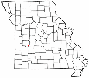
Grayson is a village in Clinton County, in the U.S. state of Missouri. It was listed as a census-designated place (CDP) in the 2020 census.
New Market is a census designated place in northern Platte County, in the U.S. state of Missouri. It lies within the Kansas City metropolitan area. The population was 88 at the 2020 census.