Municipal District of Lesser Slave River No. 124

Last updated

Municipal District of
Lesser Slave River No. 124
Lesser Slave River Marten Mountain.jpg
View from Marten Mountain
MD Lesser Slave River logo 2016.png
AB locator MUNICIPAL DISTRICT OF LESSER SLAVE RIVER NO 124.svg
Location within Alberta
CountryCanada
Province Alberta
Region Northern Alberta
Census division 17
Established1993
Incorporated1995
Government
[1]
   Reeve Murray Kerik
  Governing bodyM.D. of Lesser Slave River Council
   Administrative office Slave Lake
Area
 (2021) [2]
  Land10,041.79 km2 (3,877.16 sq mi)
Population
 (2021) [2]
  Total2,861
  Density0.3/km2 (0.8/sq mi)
Time zone UTC−7 (MST)
  Summer (DST) UTC−6 (MDT)
Website Official website OOjs UI icon edit-ltr-progressive.svg

The Municipal District of Lesser Slave River No. 124 is a municipal district (MD) in north-central Alberta, Canada. Its municipal office is located in the Town of Slave Lake. Located in Census Division 17, the MD takes its name from Lesser Slave River, which drains Lesser Slave Lake into the Athabasca River.

Contents

Geography

Communities and localities

The following localities are located within the MD of Lesser Slave River No. 124. [4]

Localities
Other places

Demographics

In the 2021 Census of Population conducted by Statistics Canada, the MD of Lesser Slave River No. 124 had a population of 2,861 living in 1,169 of its 1,500 total private dwellings, a change of

The population of the Municipal District of Lesser Slave River No. 124 according to its 2020 municipal census is 2,811, [5] a

In the 2016 Census of Population conducted by Statistics Canada, the MD of Lesser Slave River No. 124 had a population of 2,803 living in 1,090 of its 1,310 total private dwellings, a

Education

Southern parts of the MD are within Pembina Hills Public Schools, which formed in 1995 as a merger of three school districts. [8]

See also

Related Research Articles

<span class="mw-page-title-main">Sturgeon County</span> Municipal district in Alberta, Canada

Sturgeon County is a municipal district in the Edmonton Metropolitan Region of Alberta, Canada. It is north of Edmonton and west of the North Saskatchewan River. Sturgeon County is located in Division No. 11 and was named for the Sturgeon River.

<span class="mw-page-title-main">Municipal District of Bonnyville No. 87</span> Municipal district in Alberta, Canada

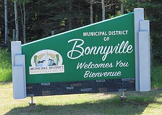
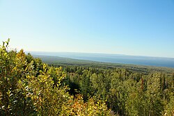
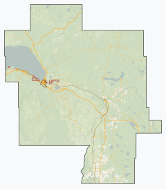
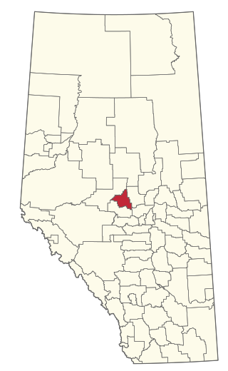
The Municipal District of Bonnyville No. 87 is a municipal district (MD) in northeastern Alberta, Canada in Division No. 12. On the east, it is adjacent to the province of Saskatchewan.

<span class="mw-page-title-main">Municipal District of Taber</span> Municipal district in Alberta, Canada

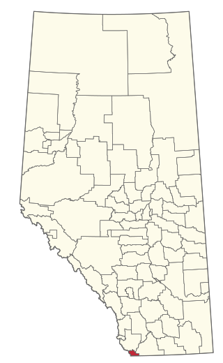
The Municipal District of Taber is a municipal district (MD) in southern Alberta, Canada. It is located in Census Division 2.

<span class="mw-page-title-main">Starland County</span> Municipal district in Alberta, Canada

Starland County is a municipal district located in southern Alberta, Canada.

<span class="mw-page-title-main">Westlock County</span> Municipal district in Alberta, Canada

Westlock County is a municipal district in central Alberta, Canada that is north of Edmonton. The county was formerly known as the Municipal District of Westlock No. 92, and was created in 1943 from the merger of five smaller municipal districts.

<span class="mw-page-title-main">County of Barrhead No. 11</span> Municipal district in Alberta, Canada

The County of Barrhead No. 11 is a municipal district in north central Alberta, Canada. It is located northwest of Edmonton and is in Census Division No. 13.

<span class="mw-page-title-main">Lac La Biche County</span> Specialized municipality in Alberta, Canada

Lac La Biche County is a specialized municipality within Division No. 12 in northern Alberta, Canada. It was established through the amalgamation of the Town of Lac La Biche and Lakeland County in 2007.

<span class="mw-page-title-main">Big Lakes County</span> Municipal district in Alberta, Canada

Big Lakes County, formerly the Municipal District of Big Lakes, is a municipal district in north-central Alberta, Canada.

<span class="mw-page-title-main">Northern Sunrise County</span> Municipal district in Alberta, Canada

Northern Sunrise County is a municipal district in northern Alberta, Canada. Located in Census Division 17, its municipal office is located east of the Town of Peace River at the intersection of Highway 2 and Highway 688.

<span class="mw-page-title-main">Lac Ste. Anne County</span> Municipal district in Alberta, Canada

Lac Ste. Anne County is a municipal district in central Alberta, Canada.

<span class="mw-page-title-main">Woodlands County</span> Municipal district in Alberta, Canada

Woodlands County is a municipal district in north-central Alberta, Canada. Located in Census Division No. 13, its municipal office is located outside but adjacent to the Town of Whitecourt. A second municipal office is located in the Hamlet of Fort Assiniboine.

<span class="mw-page-title-main">Mackenzie County</span> Specialized municipality in Alberta, Canada

Mackenzie County is a specialized municipality in northern Alberta, Canada. It is located in Census Division 17, along the Mackenzie Highway. The municipal office is located in the hamlet of Fort Vermilion.

<span class="mw-page-title-main">Municipal District of Opportunity No. 17</span> Municipal district in Alberta, Canada

The Municipal District of Opportunity No. 17 is a municipal district (MD) occupying a remote area in central northern Alberta, Canada. Located in Census Division 17 north of the Town of Athabasca, its municipal office is located in the Hamlet of Wabasca.

<span class="mw-page-title-main">County of St. Paul No. 19</span> Municipal district in Alberta, Canada

The County of St. Paul No. 19 is a municipal district in eastern central Alberta, Canada. Located in Census Division No. 12, its municipal office is located in the Town of St. Paul.

<span class="mw-page-title-main">Municipal District of Ranchland No. 66</span> Municipal district in Alberta, Canada

The Municipal District of Ranchland No. 66 is a municipal district (MD) in southwest Alberta, Canada. Containing no urban communities of any kind, its municipal office is located in Chain Lakes Provincial Park, approximately 38 km (24 mi) southwest of the Town of Nanton. Ranchland's rugged foothill terrain is unsuited for the crop agriculture practiced elsewhere in Alberta, and ranching remains the single livelihood of its inhabitants. With a 2016 population of 92, it is the least populated municipal district in Alberta, and its population density of 29 square kilometres for every resident is almost exactly equal to that of the Northwest Territories.

Canyon Creek is a hamlet in northern Alberta, Canada within the Municipal District of Lesser Slave River No. 124. It is located on Highway 2, approximately 234 kilometres (145 mi) east of Grande Prairie.

Flatbush is a hamlet in northern Alberta, Canada within the Municipal District of Lesser Slave River No. 124. It is located 3 kilometres (1.9 mi) south of Highway 44, approximately 135 kilometres (84 mi) northwest of Edmonton.

Smith is a hamlet in northern Alberta, Canada within the Municipal District of Lesser Slave River No. 124. It is located on Highway 2A, approximately 182 kilometres (113 mi) northwest of Edmonton, at the confluence of the Lesser Slave River and the Athabasca River.

Widewater is a hamlet in northern Alberta, Canada within the Municipal District of Lesser Slave River No. 124. It is located on Highway 2, approximately 225 kilometres (140 mi) northwest of Edmonton.

<span class="mw-page-title-main">Improvement District No. 4</span> Improvement district in Alberta, Canada

Improvement District No. 4, or Improvement District No. 04 (Waterton), is an improvement district in Alberta, Canada. Coextensive with Waterton Lakes National Park in southern Alberta, the improvement district provides local governance for lands within the park that are not within an Indian reserve.

References

  1. "Municipal Officials Search". Alberta Municipal Affairs. May 9, 2019. Retrieved October 1, 2021.
  2. 1 2 3 "Population and dwelling counts: Canada, provinces and territories, and census subdivisions (municipalities)". Statistics Canada. February 9, 2022. Retrieved February 9, 2022.
  3. 1 2 "Specialized and Rural Municipalities and Their Communities" (PDF). Alberta Municipal Affairs. January 12, 2022. Retrieved January 21, 2022.
  4. "Standard Geographical Classification (SGC) 2006, Economic Regions: 4817033 - Lesser Slave River No.124, geographical codes and localities, 2006". Statistics Canada. March 5, 2010. Retrieved August 11, 2012.
  5. 2019 Municipal Affairs Population List (PDF). Alberta Municipal Affairs. December 2019. ISBN   978-1-4601-4623-1 . Retrieved July 1, 2021.
  6. 2015 Municipal Affairs Population List (PDF). Alberta Municipal Affairs. ISBN   978-1-4601-2630-1 . Retrieved February 17, 2016.
  7. "Population and dwelling counts, for Canada, provinces and territories, and census subdivisions (municipalities), 2016 and 2011 censuses – 100% data (Alberta)". Statistics Canada. February 8, 2017. Retrieved February 8, 2017.
  8. "Our Division". Pembina Hills Public Schools . Retrieved August 25, 2019. 5310 - 49th Street Barrhead, Alberta T7N 1P3