Myronivka is located in Central Ukraine along a river valley of Rosava River, a tributary of Ros River. The distance to Kyiv - 106km. The city has an area of 904km2 (349sqmi). The Ukraine's capital Kyiv is approximately 94km (58mi) away from Myronivka.
The city traces its history to a settlement established by some Cossack or free settler Myron Zelenyi. In Ukrainian the word Zelenyi means green.
A local historian Leontiy Pokhylevych in his book "The legends about settlements in Kyiv Governorate", published in 1864, wrote, "The village of Myronivka received its name from a free settler Myron Zelenyi. The village consisted (it is then, 130 years ago) of seven ends (kutky) or parts, the actual Myronivka where the church is, Solomakhivka, Nebytivka, Sloboda, Okolotivka, Shafranivka, Rozmarynivka ..."
There are other legends, but in the center of each is the same name of a person Myron. Myronivka with the listed above ends was described, as it was mentioned, in 1863–64. In 1740 there were only twenty courtyards (households). In 1749 there was established a church which was opened in 1755. These words were left in his church records by the first priest of Myronivka Sava Chernyakhovsky. Among them, he mentions Myron, who in his definition lived exactly where now from the modern vulytsia Buznitskoho vulytsia Chkalova begins. There is where Myronivka starts.
Most recently the settlement is better known for its Zhdanov collective (kolkhoz) which for quite sometime was headed by Oleksandr Buznytskyi. Before that counts Branicki held here a private sugar factory which operated since 1858.
In 1876 through the village from Fastiv was laid a railway. First public school was opened in 1869.
According to Soviet propaganda almost whole Myronivka was involved in the 1905 Russian Revolution.
In 1911 in Myronivka was established research selection station to analyze harvest and level of sugar in sugar beets.
During the World War I, one third of village population was mobilized to war leading to hardship for the rest of the settlement.
In 1923 Myronivka became an administrative center of the newly created Myronivka Raion which was carved out of Kozyn and Karapyshi volosts. In 1923 the local railroad network was expanded after adding a railway branch between Myronivka and Kaharlyk. The railway hub became even more important later in 1938 when another branch to Kaniv was added.
In Myronivka was also established a state farm and machine-tractor station (MTS).
In the beginning of 1930s there were established two collective farms Stalin and Bilshovyk. During the 1932-1933 Holodomor 700 residents of the village died from starvation.
In 1938 the population of Myronivka grew over 6,000 residents and the settlement was given the status of urban-type settlement. There were built a department store, dinners, etc.
On 6 August 1941 Myronivka was occupied by the German troops after weeks of intense fighting. In the town acted several underground resistance groups supposedly led exclusively by Communists and Komsomol activists. On 31 January 1944 Myronivka was taken back by the Soviet troops of the 54th Fortified District. Over 1,200 residents of Myronivka were mobilized to the Red Army during the Nazi–Soviet War.
In 1950 there was established a big collective farm the Zhdanov kolkhoz uniting Bilshovyk and Budyonnyi arteles and later the Stalin kolkhoz. In 1951 a new train station building was built.
In 1968 Myronivka was granted a city status and the next year the city's sugar factory was awarded the Red Banner of the Ministry of Food Industry of the USSR.
In 1985 in the city was established a memorial complex to the 40th victory anniversary in the Soviet Great Patriotic War.
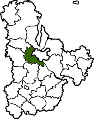
Until 18 July 2020, Myronivka served as an administrative center of Myronivka Raion. The raion was abolished that day as part of the administrative reform of Ukraine, which reduced the number of raions of Kyiv Oblast to seven. The area of Myronivka Raion was merged into Obukhiv Raion.[3][4]
The large produce company "Myronivskyi Khliboprodukt" (English: Myronivka Bread-Produce) has facilities in the town which include poultry production,[6] and animal fodder.[7]
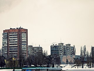
The town is home to a hospital,[8] and is served by a train station which sees dozens of trains daily.[9]
Gallery
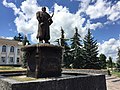
Erected in 2016, a statue of Myron Zelenyi, the settler of the city
Railway station
At Central Station
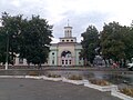
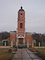
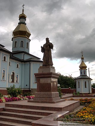
St Michael's Church
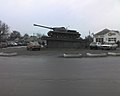
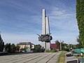
Memorial complex in place of the World War II mass grave
Myronivka Raion hospital
Related Research Articles
Myrhorod Raion is a raion (district) in Poltava Oblast of central Ukraine. The raion's administrative center is the city of Myrhorod. Population: 198,076.
Boiarka or Boyarka is a city in Fastiv Raion of Kyiv Oblast (region) of Ukraine, about 20 km SW from Kyiv. It hosts the administration of Boiarka urban hromada, one of the hromadas of Ukraine. Population: 34,394. The population in 2001 was 35,968.
Vyshneve is a city in Bucha Raion, Kyiv Oblast, Ukraine, located two kilometres (1.2 mi) south of the capital Kyiv. Vyshneve hosts the administration of Vyshneve urban hromada, one of the hromadas of Ukraine. It has a population of 42,983.
Kaharlyk is a small city in Kyiv Oblast (province) of Ukraine, located in Obukhiv Raion. Kaharlyk hosts the administration of Kaharlyk urban hromada, one of the hromadas of Ukraine. Population: 13,133.
Borodianka is an urban-type settlement in Bucha Raion, Kyiv Oblast, Ukraine. It hosts the administration of Borodianka settlement hromada, one of the hromadas of Ukraine. Population: 13,832. According to the 2001 census, its population was 12,535.
Bohuslav Raion was a raion (district) in Kyiv Oblast of Ukraine. Its administrative center was the city of Bohuslav. The raion was abolished on 18 July 2020 as part of the administrative reform of Ukraine, which reduced the number of raions of Kyiv Oblast to seven. The area of Bohuslav Raion was split between Bila Tserkva and Obukhiv Raions. The last estimate of the raion population was 33,318 .
Kyiv-Sviatoshyn Raion was a raion (district) in Kyiv Oblast of Ukraine, adjacent to the city of Kyiv which served as the administrative center for the raion. The city of Kyiv itself did not belong to the raion. The raion was abolished on 18 July 2020 as part of the administrative reform of Ukraine, which reduced the number of raions of Kyiv Oblast to seven. The area of Kyiv-Sviatoshyn Raion was split between Bucha, Fastiv, and Obukhiv Raions. The last estimate of the raion population was 210,123 .
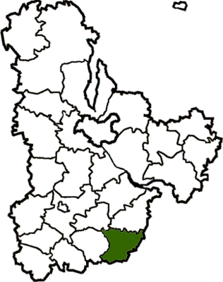
Myronivka Raion was a raion (district) in Kyiv Oblast of Ukraine. Its administrative center was the city of Myronivka. The raion was abolished on 19 July 2020 as part of the administrative reform of Ukraine, which reduced the number of raions of Kyiv Oblast to seven. The area of Myronivka Raion was merged into Obukhiv Raion. The last estimate of the raion population was 33,114 .
Obukhiv Raion is a raion (district) in Kyiv Oblast of Ukraine. Its administrative center is Obukhiv. Population: 227,209.
Vasylkiv Raion was a raion (district) in Kyiv Oblast of Ukraine. Its administrative center was Vasylkiv which is incorporated separately as a town of oblast significance and did not belong to the raion. The raion was abolished on 18 July 2020 as part of the administrative reform of Ukraine, which reduced the number of raions of Kyiv Oblast to seven. The area of Vasylkiv Raion was split between Bila Tserkva, Fastiv, and Obukhiv Raions. The last estimate of the raion population was 57,613 .
Zelenyi Bir is a small village in Fastiv Raion, Kyiv Oblast of central Ukraine. It belongs to Hlevakha settlement hromada, one of the hromadas of Ukraine. Zelenyi Bir has 794 inhabitants.
Krushynka is a small village in Fastiv Raion in the Kyiv Oblast (province) of northern Ukraine. It belongs to Hlevakha settlement hromada, one of the hromadas of Ukraine. Krushynka has 347 inhabitants.
Chabany is an urban-type settlement in Fastiv Raion of Kyiv Oblast (province), located on southern border of Kyiv. It hosts the administration of Chabany settlement hromada, one of the hromadas of Ukraine. Population: 5,334 .
Hrebinky is an urban-type settlement in Bila Tserkva Raion (district) of Kyiv Oblast (region) in northern Ukraine. It hosts the administration of Hrebinky settlement hromada, one of the hromadas of Ukraine. Its population is 6,993 as of the 2001 Ukrainian Census. Current population: 5,678 .
Henichesk Raion is one of the five administrative raions (districts) of Kherson Oblast in southern Ukraine. Its administrative centre is located in the city of Henichesk. Population: 118,059.
Kakhovka Raion is one of the administrative raions of Kherson Oblast in southern Ukraine. Its administrative center is located in the city of Nova Kakhovka. Population: 216,458.
Kyiv Oblast is subdivided into districts (raions) which are subdivided into territorial communities (hromadas).
Kovalivka is a village of Bila Tserkva Raion, Kyiv Oblast, Ukraine. It hosts the administration of Kovalivka rural hromada, one of the hromadas of Ukraine. The village is administered by its own rural council. The population is approximately 1,500.
Velykyi Bukryn is a village in Obukhiv Raion at the south of Kyiv Oblast, Ukraine, with about 100 inhabitants (2001). It belongs to Rzhyshchiv urban hromada, one of the hromadas of Ukraine.
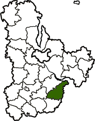
Korytyshche is a village (selo) in Obukhiv Raion, Kyiv Oblast, in south-west Ukraine. It belongs to Myronivka urban hromada, one of the hromadas of Ukraine.
This page is based on this Wikipedia article Text is available under the CC BY-SA 4.0 license; additional terms may apply. Images, videos and audio are available under their respective licenses.