Interstate 40 (I-40) is a major east–west Interstate Highway running through the south-central portion of the United States. At a length of 2,556.61 miles (4,114.46 km), it is the third-longest Interstate Highway in the country, after I-90 and I-80. From west to east, it passes through California, Arizona, New Mexico, Texas, Oklahoma, Arkansas, Tennessee, and North Carolina. Its western end is at I-15 in Barstow, California, while its eastern end is at a concurrency of U.S. Route 117 (US 117) and North Carolina Highway 132 (NC 132) in Wilmington, North Carolina. Major cities served by the interstate include Flagstaff, Arizona; Albuquerque, New Mexico; Amarillo, Texas; Oklahoma City, Oklahoma; Little Rock, Arkansas; Memphis, Nashville, and Knoxville in Tennessee; and Asheville, Winston-Salem, Greensboro, Durham, Raleigh, and Wilmington in North Carolina.

U.S. Route 412 is an east–west United States highway, first commissioned in 1982. U.S. 412 overlaps expressway-grade Cimarron Turnpike from Tulsa west to Interstate 35 and the Cherokee Turnpike from 5 miles (8.0 km) east of Chouteau, Oklahoma, to 8 miles (13 km) west of the Arkansas state line. It runs the entire length of the Oklahoma Panhandle and traverses the Missouri Bootheel.

Mid-Western Highway, sometimes Mid Western Highway, is a 518-kilometre (322 mi) state highway located in the central western and northern Riverina regions of New South Wales, Australia. The highway services rural communities and links the Great Western, Mitchell, Olympic, Newell, Cobb and Sturt highways. Mid-Western Highway forms part of the most direct route road link between Sydney and Adelaide, with its eastern terminus in Bathurst and western terminus in Hay. It is designated part of route A41 between Bathurst and Cowra, and route B64 between Cowra and Hay.

U.S. Route 56 is an east–west United States highway that runs for approximately 640 miles (1,030 km) in the Midwestern United States. US 56's western terminus is at Interstate 25 Business, US 412 and New Mexico State Road 21 in Springer, New Mexico and the highway's eastern terminus is at US 71 in Kansas City, Missouri. Much of it follows the Santa Fe Trail.

Interstate 164 (I-164) was a spur highway of I-64, between that highway and U.S. Highway 41 (US 41) in Evansville, Indiana. I-164, also known as the Robert D. Orr Highway, had a total length of 21.24 miles (34.18 km). Requested as an Interstate and approved in 1968, the freeway was opened to traffic on August 2, 1990.

Highway 21 is a north–south state highway in north central Arkansas. The route of 99.14 miles (159.55 km) runs from US Route 64 (US 64) in Clarksville north across US 62 to Missouri Route 13 at the Missouri state line The route is a two-lane highway with the exception of a brief concurrency with US 62, a four-lane highway, in Berryville.

U.S. Route 64 (US 64) is the longest numbered route in the U.S. state of North Carolina, running 604 miles (972 km) from the Tennessee state line to the Outer Banks. The route passes through the westernmost municipality in the state, Murphy, and one of the most easternmost municipalities, Manteo, making US 64 a symbolic representation of the phrase "from Murphy to Manteo" which is used to refer to the expanse of the state. The highway is a major east-west route through the central and eastern portion of the state.

Interstate 64 (I-64) in the US state of Virginia runs east–west through the middle of the state from West Virginia to the Hampton Roads region, for a total of 299 miles (481 km). It is notable for crossing the mouth of the harbor of Hampton Roads on the Hampton Roads Bridge–Tunnel (HRBT), the first bridge–tunnel to incorporate artificial islands, concurrent with U.S. Route 60 (US 60). Also noteworthy is a section through Rockfish Gap, a wind gap in the Blue Ridge Mountains, which was equipped with an innovative system of airport-style runway lighting embedded into the pavement to aid motorists during periods of poor visibility due to fog or other conditions.

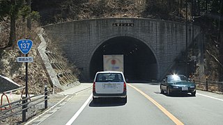
National Route 137 is a national highway of Japan connecting Fujiyoshida, Yamanashi and Fuefuki, Yamanashi in Japan, with a total length of 30 km (18.64 mi).

National Route 201 is a national highway of Japan connecting Higashi-ku, Fukuoka and Kanda, Fukuoka in Japan, with a total length of 64.5 km (40.08 mi).

National Route 328 is a national highway of Japan connecting the cities of Kagoshima and Izumi in Kagoshima prefecture, with a total length of 64.4 km (40.02 mi).

National Route 408 is a national highway of Japan connecting the cities of Narita, Chiba and Takanezawa, Tochigi, with a total length of 116.9 km (72.64 mi).
National Route 455 is a national highway of Japan connecting Morioka, Iwate and Iwaizumi, Iwate in Japan, with a total length of 104.4 kilometers (64.87 mi).

U.S. Route 64 is a U.S. highway running from Teec Nos Pos, Arizona east to Nags Head, North Carolina. In the U.S. state of Arkansas, the route runs 246.35 miles (396.46 km) from the Oklahoma border in Fort Smith east to the Tennessee border in Memphis. The route passes through several cities and towns, including Fort Smith, Clarksville, Russellville, Conway, Searcy, and West Memphis. US 64 runs parallel to Interstate 40 until Conway, when I-40 takes a more southerly route.

U.S. Route 64 (US-64) is a U.S. highway running from the Four Corners area to the Outer Banks of North Carolina. Between these two points, the highway passes through the entire width of Oklahoma; a total of 591.17 miles (951.40 km) of US-64 lies in the state of Oklahoma. US-64 enters the state from New Mexico, crossing the line between the two states between Clayton, New Mexico, and Boise City in Cimarron County. The route runs the full length of the Oklahoma Panhandle, then serves the northernmost tier of counties in the main body of the state before dipping southeastward to Tulsa, the state's second-largest city. From Tulsa, the highway continues southeast, leaving Oklahoma just west of Fort Smith, Arkansas. In addition to Tulsa, US-64 serves fifteen Oklahoma counties and the cities of Guymon, Woodward, Enid, and Muskogee.

Interstate 87 (I-87) is a partially completed Interstate Highway in the US state of North Carolina, the shortest designated primary Interstate Highway at 12.9 miles (20.8 km). The completed portion is in eastern Wake County, between Raleigh and Wendell; the majority of the completed route is known as the Knightdale Bypass, while the remaining three miles (4.8 km) follows the Raleigh Beltline (I-440). It is planned to continue northeast through Rocky Mount, Williamston, and Elizabeth City, ending in Norfolk, Virginia. It is signed as north–south, in keeping with the sign convention for most odd-numbered interstates, but the route goes primarily east–west, with the eastern direction aligning to the north designation. The entire route is concurrent with US Highway 64 (US 64), with portions also concurrent with I-440 and US 264.
National Highway 47 is a primary National Highway in India. It starts from Bamanbore in Gujarat and terminates at Nagpur in Maharashtra. This national highway is about 1,006 km (625 mi) long. Before renumbering of national highways in 2010, NH-47 was variously numbered as old national highways 8A, 59, 59A & 69.

National Highway 53, combination of old, & is a national highway in India. It connects Hajira in Gujarat and Paradeep port in Odisha. NH-53 traverses the states of Gujarat, Maharashtra, Chhattisgarh and Odisha in India. The road is the part of AH46 network in India and it is officially listed as running over 1949 km (1211 mi) from Kolkata to Surat. it is also known as Surat - Kolkata Highway. It passes through Maharashtra, Chhattisgarh and Odisha states.
National Highway 148M, commonly referred to as NH 148M is a national highway in India. It is a secondary route of National Highway 48. NH-148M runs in the state of Gujarat in India.
National Highway 751D, commonly referred to as NH 751D is a national highway in India. It is a secondary route of National Highway 51. NH-751D runs in the state of Gujarat in India.


