National Register of Historic Places listings in Aiken County, South Carolina

Last updated

Location of Aiken County in South Carolina Map of South Carolina highlighting Aiken County.svg
Location of Aiken County in South Carolina

This is a list of the National Register of Historic Places listings in Aiken County, South Carolina.

Contents

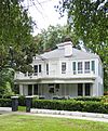
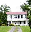
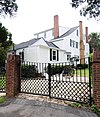
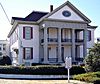
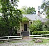
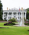
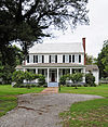
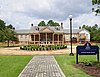
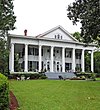
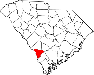
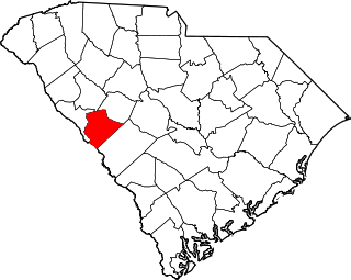
This is intended to be a complete list of the properties and districts on the National Register of Historic Places in Aiken County, South Carolina, United States. The locations of National Register properties and districts for which the latitude and longitude coordinates are included below, may be seen on a map. [1]

There are 44 properties and districts listed on the National Register in the county, including 1 National Historic Landmark.


    This National Park Service list is complete through NPS recent listings posted February 2, 2024. [2]

Map all coordinates using: OpenStreetMap

Current listings

[3] Name on the Register [4] ImageDate listed [5] Location City or townDescription
1 Aiken Colored Cemetery
Aiken Colored Cemetery Aiken Colored Cemetery.jpg
Aiken Colored Cemetery
March 19, 2007
(#07000182)
Florence St. and Hampton Ave.
33°34′16″N81°43′23″W / 33.571°N 81.722964°W / 33.571; -81.722964 (Aiken Colored Cemetery)
Aiken
2 Aiken County Hospital September 13, 2021
(#100006888)
828 Richland Ave. West
33°33′57″N81°43′45″W / 33.5657°N 81.7293°W / 33.5657; -81.7293 (Aiken County Hospital)
Aiken
3 Aiken Mile Track
Aiken Mile Track Aiken Mile Track.jpg
Aiken Mile Track
May 9, 1985
(#85000991)
Banks Mill Rd.
33°32′39″N81°41′57″W / 33.544167°N 81.699167°W / 33.544167; -81.699167 (Aiken Mile Track)
Aiken
4 Aiken Training Track
Aiken Training Track AIken Training Track.jpg
Aiken Training Track
May 9, 1985
(#85000992)
Two Notch Rd.
33°32′35″N81°42′30″W / 33.543056°N 81.708333°W / 33.543056; -81.708333 (Aiken Training Track)
Aiken
5 Aiken Winter Colony Historic District I
Aiken Winter Colony Historic District I Aiken Winter Colony Historic District 1.jpg
Aiken Winter Colony Historic District I
November 27, 1984
(#84000484)
Off U.S. Routes 1/78
33°32′59″N81°44′29″W / 33.549722°N 81.741389°W / 33.549722; -81.741389 (Aiken Winter Colony Historic District I)
Aiken
6 Aiken Winter Colony Historic District II
Aiken Winter Colony Historic District II Aiken Winter Colony Historic District 2.jpg
Aiken Winter Colony Historic District II
November 27, 1984
(#84000498)
Roughly bounded by railroad tracks, Colleton and 3rd Aves., and Laurens, South Boundary, and Marion Sts.
33°33′16″N81°43′15″W / 33.554444°N 81.720833°W / 33.554444; -81.720833 (Aiken Winter Colony Historic District II)
Aiken
7 Aiken Winter Colony Historic District III
Aiken Winter Colony Historic District III Aiken Winter Colony Historic District Three.jpg
Aiken Winter Colony Historic District III
November 27, 1984
(#84000508)
Roughly bounded by Edgefield Ave., Highland Park Dr., Fauburg, and Greenville St.
33°33′47″N81°43′40″W / 33.563056°N 81.727778°W / 33.563056; -81.727778 (Aiken Winter Colony Historic District III)
Aiken
8 Chancellor James P. Carroll House
Chancellor James P. Carroll House Chancellor James P Carroll House.jpg
Chancellor James P. Carroll House
November 23, 1977
(#77001209)
112 Gregg Ave.
33°33′59″N81°45′28″W / 33.566389°N 81.757778°W / 33.566389; -81.757778 (Chancellor James P. Carroll House)
Aiken
9 The Cedars
The Cedars The Cedars.jpg
The Cedars
June 17, 1993
(#93000539)
U.S. Route 278, 0.3 miles east of South Carolina Highway 125
33°25′38″N81°52′50″W / 33.427222°N 81.880556°W / 33.427222; -81.880556 (The Cedars)
Beech Island
10 Chinaberry
Chinaberry Chinaberry.jpg
Chinaberry
April 29, 1982
(#82003826)
441 York St., SE.
33°33′11″N81°43′18″W / 33.553056°N 81.721667°W / 33.553056; -81.721667 (Chinaberry)
Aiken
11 Coker Spring
Coker Spring Coker Spring.jpg
Coker Spring
January 18, 1978
(#78002490)
Coker Spring Rd.
33°32′59″N81°43′37″W / 33.549722°N 81.726944°W / 33.549722; -81.726944 (Coker Spring)
Aiken
12 Court Tennis Building
Court Tennis Building Aiken-Tennis-Club 03.jpg
Court Tennis Building
November 27, 1984
(#84000513)
Newberry and Park Sts.
33°33′34″N81°43′17″W / 33.559444°N 81.721389°W / 33.559444; -81.721389 (Court Tennis Building)
Aiken
13 Crossways
Crossways Crossways.jpg
Crossways
June 4, 1997
(#97000536)
450 E. Boundary St.
33°32′46″N81°41′27″W / 33.546111°N 81.690833°W / 33.546111; -81.690833 (Crossways)
Aiken
14 Dawson-Vanderhorst House
Dawson-Vanderhorst House Dawson Vanderhorst House.jpg
Dawson-Vanderhorst House
June 29, 1976
(#76001685)
Northeast of Aiken at the junction of Wire and New Bridge Rds.
33°34′49″N81°40′57″W / 33.580278°N 81.6825°W / 33.580278; -81.6825 (Dawson-Vanderhorst House)
Aiken
15 Fort Moore-Savano Town Site August 14, 1973
(#73001670)
West of Beech Island on the Savannah River [6]
33°25′53″N81°54′37″W / 33.431389°N 81.910278°W / 33.431389; -81.910278 (Fort Moore-Savano Town Site)
Beech Island
16 Gaston Livery Stable February 27, 2020
(#100005001)
1315 Richland Ave. East
33°33′15″N81°42′09″W / 33.5541°N 81.7026°W / 33.5541; -81.7026 (Gaston Livery Stable)
Aiken
17 Georgia Avenue-Butler Avenue Historic District
Georgia Avenue-Butler Avenue Historic District Georgia Avenue Butler Avenue Historic District.jpg
Georgia Avenue-Butler Avenue Historic District
April 5, 1984
(#84002017)
Georgia and Butler Aves. and Martintown Rd.
33°30′15″N81°57′52″W / 33.504167°N 81.964444°W / 33.504167; -81.964444 (Georgia Avenue-Butler Avenue Historic District)
North Augusta
18 Graniteville Historic District
Graniteville Historic District DETAIL VIEW OF SOUTH SIDE OF NORTH STAIR TOWER. GRANITE STRUCTURE IN BACKGROUND IS THE 'PICKER HOUSE' AREA EXPANDED IN THE 1940s. - Graniteville Mill, Marshall Street, Graniteville HAER SC,2-GRANV,1-4.tif
Graniteville Historic District
June 2, 1978
(#78002491)
South Carolina Highway 19 and Gregg St.
33°34′03″N81°48′24″W / 33.5675°N 81.806667°W / 33.5675; -81.806667 (Graniteville Historic District)
Graniteville
19 Charles Hammond House
Charles Hammond House Charles Hammond House.jpg
Charles Hammond House
October 2, 1973
(#73001672)
908 Martintown Rd., W.
33°31′33″N81°58′47″W / 33.525833°N 81.979722°W / 33.525833; -81.979722 (Charles Hammond House)
North Augusta
20 Hickman Mill Historic District
Hickman Mill Historic District GranitevilleSC OldMill.jpg
Hickman Mill Historic District
February 23, 2016
(#16000046)
Bounded by Marshall, Canal, and Hard Streets, and Horse Creek
33°33′54″N81°48′33″W / 33.564912°N 81.809036°W / 33.564912; -81.809036 (Hickman Mill Historic District)
Graniteville
21 Immanuel School
Immanuel School Immanuel School.jpg
Immanuel School
June 3, 2009
(#09000389)
120 York St., NE
33°33′38″N81°43′03″W / 33.560578°N 81.717586°W / 33.560578; -81.717586 (Immanuel School)
Aiken
22 Joye Cottage
Joye Cottage Joye Cottage.jpg
Joye Cottage
September 29, 1980
(#80003651)
463 Whiskey Rd. and 129 1st Ave.
33°33′12″N81°43′25″W / 33.553333°N 81.723611°W / 33.553333; -81.723611 (Joye Cottage)
Aiken
23 Legare-Morgan House
Legare-Morgan House Legare Morgan House.jpg
Legare-Morgan House
September 22, 1977
(#77001210)
241 Lauren St., SW.
33°33′23″N81°43′30″W / 33.556389°N 81.725°W / 33.556389; -81.725 (Legare-Morgan House)
Aiken
24 Lookaway Hall
Lookaway Hall Lookaway Hall.jpg
Lookaway Hall
August 13, 1992
(#92000962)
103 W. Forest Ave.
33°29′56″N81°58′08″W / 33.498889°N 81.968889°W / 33.498889; -81.968889 (Lookaway Hall)
North Augusta
25 McGhee Block January 30, 2024
(#100009883)
201-209 Richland Avenue W
33°33′40″N81°43′16″W / 33.5610°N 81.7211°W / 33.5610; -81.7211 (McGhee Block)
Aiken
26 Britton Mims Place June 4, 1997
(#97000539)
229 Edgefield Rd.
33°31′27″N81°56′59″W / 33.524167°N 81.949722°W / 33.524167; -81.949722 (Britton Mims Place)
North Augusta
27 Oakland Plantation
Oakland Plantation Oakland Plantation.jpg
Oakland Plantation
August 19, 2011
(#10001219)
2930 Storm Branch Rd.
33°26′59″N81°50′17″W / 33.449722°N 81.838056°W / 33.449722; -81.838056 (Oakland Plantation)
Beech Island vicinity
28 Phelps House
Phelps House Phelps House.jpg
Phelps House
June 10, 1974
(#74001819)
Barnwell Ave.
33°33′56″N81°43′29″W / 33.565556°N 81.724722°W / 33.565556; -81.724722 (Phelps House)
Aiken
29 Pickens House
Pickens House Pickens House.jpg
Pickens House
May 19, 1983
(#83002182)
101 Gregg Ave.
33°33′55″N81°45′39″W / 33.565278°N 81.760833°W / 33.565278; -81.760833 (Pickens House)
Aiken
30 Redcliffe
Redcliffe Redcliffe.jpg
Redcliffe
May 8, 1973
(#73001671)
1.5 miles northeast of Beech Island on South Carolina Highway 125
33°24′58″N81°52′56″W / 33.416111°N 81.882222°W / 33.416111; -81.882222 (Redcliffe)
Beech Island
31 Rosemary Hall
Rosemary Hall Rosemary Hall.jpg
Rosemary Hall
April 28, 1975
(#75001685)
804 Carolina Ave.
33°29′49″N81°58′12″W / 33.496944°N 81.97°W / 33.496944; -81.97 (Rosemary Hall)
North Augusta
32 St. Mary Help of Christians Church
St. Mary Help of Christians Church St Marys Help.jpg
St. Mary Help of Christians Church
March 25, 1982
(#82003827)
York St. and Park Ave.
33°33′28″N81°43′11″W / 33.557778°N 81.719722°W / 33.557778; -81.719722 (St. Mary Help of Christians Church)
Aiken
33 St. Thaddeus Episcopal Church
St. Thaddeus Episcopal Church St Thaddeus Episcopal Church.jpg
St. Thaddeus Episcopal Church
November 27, 1984
(#84000518)
Pendleton and Richland Sts.
33°33′41″N81°43′30″W / 33.561389°N 81.725°W / 33.561389; -81.725 (St. Thaddeus Episcopal Church)
Aiken
34 Salley Historic District
Salley Historic District Salley Historic District 1.jpg
Salley Historic District
October 27, 2000
(#00000554)
Bounded by Pine, Ferguson, Poplar, and Aldrich Sts.
33°33′56″N81°18′17″W / 33.565556°N 81.304722°W / 33.565556; -81.304722 (Salley Historic District)
Salley
35 Silver Bluff November 1, 1977
(#77001211)
Silver Bluff Rd. on the Savannah River [7]
33°18′38″N81°50′38″W / 33.310556°N 81.843889°W / 33.310556; -81.843889 (Silver Bluff)
Jackson
36 South Carolina Railroad September 23, 2021
(#100006995)
Address Restricted
Aiken vicinity
37 US Court House-Aiken, South Carolina
US Court House-Aiken, South Carolina Charles E. Simons, Jr. Federal Court House 1935.jpg
US Court House-Aiken, South Carolina
December 10, 2003
(#03001288)
223 Park Ave., SE.
33°33′32″N81°43′23″W / 33.558889°N 81.723056°W / 33.558889; -81.723056 (US Court House-Aiken, South Carolina)
Aiken
38 Vaucluse Mill Village Historic District
Vaucluse Mill Village Historic District VaucluseSC Houses.jpg
Vaucluse Mill Village Historic District
May 7, 1996
(#96000494)
South Carolina Highway 191, 3 miles north of Graniteville and 6 miles west of Aiken
33°36′54″N81°48′12″W / 33.615°N 81.803333°W / 33.615; -81.803333 (Vaucluse Mill Village Historic District)
Vaucluse
39 B.C. Wall House
B.C. Wall House BC Wall House.jpg
B.C. Wall House
November 27, 1992
(#92001632)
1008 West Ave.
33°30′08″N81°58′18″W / 33.502222°N 81.971667°W / 33.502222; -81.971667 (B.C. Wall House)
North Augusta
40 Warren Mill
Warren Mill Warren Mill - Southwest Elevation.jpg
Warren Mill
September 27, 2016
(#16000678)
Cty. Rd. P-1201 & SC 421
33°33′07″N81°48′31″W / 33.552022°N 81.808603°W / 33.552022; -81.808603 (Warren Mill)
Warrenville
41 Warrenville Elementary School
Warrenville Elementary School Warrenville Elementary School.jpg
Warrenville Elementary School
May 22, 2002
(#02000560)
115 Timmerman St.
33°32′53″N81°48′24″W / 33.548056°N 81.806667°W / 33.548056; -81.806667 (Warrenville Elementary School)
Warrenville
42 Whitehall
Whitehall Whitehall Historic Home.jpg
Whitehall
November 27, 1984
(#84000527)
902 Magnolia St.
33°32′31″N81°43′11″W / 33.541944°N 81.719722°W / 33.541944; -81.719722 (Whitehall)
Aiken
43 Willcox's
Willcox's Wilcoxs Exterior.jpg
Willcox's
March 19, 1982
(#82003828)
Colleton Ave.
33°33′25″N81°43′19″W / 33.556944°N 81.721944°W / 33.556944; -81.721944 (Willcox's)
Aiken
44 Zubly Cemetery
Zubly Cemetery Zubly Cemetery.jpg
Zubly Cemetery
January 28, 2002
(#01001548)
Forrest Dr.
33°24′20″N81°54′02″W / 33.405556°N 81.900556°W / 33.405556; -81.900556 (Zubly Cemetery)
Beech Island

See also

Related Research Articles

<span class="mw-page-title-main">National Register of Historic Places listings in Richland County, South Carolina</span>

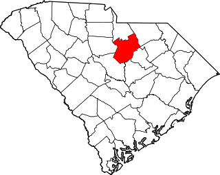
This is a list of the National Register of Historic Places listings in Richland County, South Carolina.

<span class="mw-page-title-main">National Register of Historic Places listings in Sumter County, South Carolina</span>

This is a list of the National Register of Historic Places listings in Sumter County, South Carolina.

<span class="mw-page-title-main">National Register of Historic Places listings in York County, South Carolina</span>

This is a list of the National Register of Historic Places listings in York County, South Carolina.

<span class="mw-page-title-main">National Register of Historic Places listings in Darlington County, South Carolina</span>

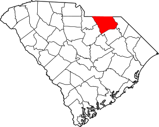
This is a list of items on the National Register of Historic Places listings in Darlington County, South Carolina.

<span class="mw-page-title-main">National Register of Historic Places listings in Fairfield County, South Carolina</span>

This is a list of the National Register of Historic Places listings in Fairfield County, South Carolina.

<span class="mw-page-title-main">National Register of Historic Places listings in Georgetown County, South Carolina</span>

This is a list of the National Register of Historic Places listings in Georgetown County, South Carolina.

<span class="mw-page-title-main">National Register of Historic Places listings in Berkeley County, South Carolina</span>

This is a list of the National Register of Historic Places listings in Berkeley County, South Carolina.

<span class="mw-page-title-main">National Register of Historic Places listings in Lancaster County, South Carolina</span>

This is a list of the National Register of Historic Places listings in Lancaster County, South Carolina.

<span class="mw-page-title-main">National Register of Historic Places listings in Florence County, South Carolina</span>

This is a list of the National Register of Historic Places listings in Florence County, South Carolina.

<span class="mw-page-title-main">National Register of Historic Places listings in Laurens County, South Carolina</span>

This is a list of the National Register of Historic Places listings in Laurens County, South Carolina.

<span class="mw-page-title-main">National Register of Historic Places listings in Allendale County, South Carolina</span>

This is a list of the National Register of Historic Places listings in Allendale County, South Carolina.

<span class="mw-page-title-main">National Register of Historic Places listings in Anderson County, South Carolina</span>

This is a list of the National Register of Historic Places listings in Anderson County, South Carolina.

<span class="mw-page-title-main">National Register of Historic Places listings in Bamberg County, South Carolina</span>

This is a list of the National Register of Historic Places listings in Bamberg County, South Carolina.

<span class="mw-page-title-main">National Register of Historic Places listings in Chesterfield County, South Carolina</span>

This is a list of the National Register of Historic Places listings in Chesterfield County, South Carolina.

<span class="mw-page-title-main">National Register of Historic Places listings in Dillon County, South Carolina</span>

This is a list of the National Register of Historic Places listings in Dillon County, South Carolina.

<span class="mw-page-title-main">National Register of Historic Places listings in Dorchester County, South Carolina</span>

This is a list of the National Register of Historic Places listings in Dorchester County, South Carolina.

<span class="mw-page-title-main">National Register of Historic Places listings in Edgefield County, South Carolina</span>

This is a list of the National Register of Historic Places listings in Edgefield County, South Carolina.

<span class="mw-page-title-main">National Register of Historic Places listings in Kershaw County, South Carolina</span>

This is a list of the National Register of Historic Places listings in Kershaw County, South Carolina.

<span class="mw-page-title-main">National Register of Historic Places listings in Marlboro County, South Carolina</span>

This is a list of the National Register of Historic Places listings in Marlboro County, South Carolina.

<span class="mw-page-title-main">National Register of Historic Places listings in Saluda County, South Carolina</span>

This is a list of the National Register of Historic Places listings in Saluda County, South Carolina.

References

  1. The latitude and longitude information provided in this table was derived originally from the National Register Information System, which has been found to be fairly accurate for about 99% of listings. Some locations in this table may have been corrected to current GPS standards.
  2. National Park Service, United States Department of the Interior, "National Register of Historic Places: Weekly List Actions", retrieved February 2, 2024.
  3. Numbers represent an alphabetical ordering by significant words. Various colorings, defined here, differentiate National Historic Landmarks and historic districts from other NRHP buildings, structures, sites or objects.
  4. "National Register Information System". National Register of Historic Places . National Park Service. March 13, 2009.
  5. The eight-digit number below each date is the number assigned to each location in the National Register Information System database, which can be viewed by clicking the number.
  6. "Fort Moore (historical)". Geographic Names Information System . United States Geological Survey, United States Department of the Interior.
  7. "Silver Bluff". Geographic Names Information System . United States Geological Survey, United States Department of the Interior.