National Register of Historic Places listings in Athens County, Ohio

Last updated

Location of Athens County in Ohio Map of Ohio highlighting Athens County.svg
Location of Athens County in Ohio

This is a list of the National Register of Historic Places listings in Athens County, Ohio.

Contents

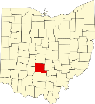
This is intended to be a complete list of the properties and districts on the National Register of Historic Places in Athens County, Ohio, United States. The locations of National Register properties and districts for which the latitude and longitude coordinates are included below, may be seen in an online map. [1]

There are 28 properties and districts listed on the National Register in the county, including 1 National Historic Landmark.


    This National Park Service list is complete through NPS recent listings posted December 15, 2023. [2]

Map all coordinates using: OpenStreetMap

Current listings

[3] Name on the Register [4] ImageDate listed [5] Location City or townDescription
1 Athens B & O Train Depot
Athens B & O Train Depot Athens Train Depot OH USA.JPG
Athens B & O Train Depot
January 11, 1983
(#83001944)
Depot St.
39°19′44″N82°06′21″W / 39.328889°N 82.105833°W / 39.328889; -82.105833 (Athens B & O Train Depot)
Athens The former railroad station for the B&O Railroad, an east-west line through Athens County.
2 Athens County Infirmary
Athens County Infirmary County home1.jpg
Athens County Infirmary
May 1, 2003
(#03000323)
13183 State Route 13
39°23′34″N82°07′08″W / 39.392667°N 82.118917°W / 39.392667; -82.118917 (Athens County Infirmary)
Dover Township Currently known as "The County Farm" or "The County Home." Today, it houses Job & Family Services.
3 Athens Downtown Historic District
Athens Downtown Historic District Athens Downtown Historic District OH USA.JPG
Athens Downtown Historic District
September 30, 1982
(#82003541)
N. Court St. between Carpenter and Union Sts. and Congress and College Sts.
39°19′48″N82°06′04″W / 39.329894°N 82.101094°W / 39.329894; -82.101094 (Athens Downtown Historic District)
Athens
4 Athens Governmental Buildings
Athens Governmental Buildings County Courthouse Athens OH USA.JPG
Athens Governmental Buildings
November 29, 1979
(#79001782)
E. State, E. Washington, Court, and W. Union Sts.
39°19′35″N82°06′02″W / 39.326389°N 82.100556°W / 39.326389; -82.100556 (Athens Governmental Buildings)
Athens
5 Athens State Hospital
Athens State Hospital KennedyMuseum OhioUniv.jpg
Athens State Hospital
March 11, 1980
(#80002936)
State Route 682 and Richland Ave.
39°18′56″N82°06′07″W / 39.315531°N 82.101906°W / 39.315531; -82.101906 (Athens State Hospital)
Athens The former state mental hospital, and formerly a working farm. Today owned by Ohio University and known as The Ridges.
6 Athens State Hospital Cow Barn
Athens State Hospital Cow Barn ASH Cow Barn Athens OH USA.JPG
Athens State Hospital Cow Barn
April 25, 1978
(#78002003)
Southwest of Athens off U.S. Route 33
39°18′52″N82°06′55″W / 39.314444°N 82.115278°W / 39.314444; -82.115278 (Athens State Hospital Cow Barn)
Athens Township Today known as the Dairy Barn; an art gallery
7 Beasley Building
Beasley Building Beasley Building Athens OH USA.JPG
Beasley Building
October 7, 1982
(#82001358)
93 W. Union St.
39°19′44″N82°06′18″W / 39.328889°N 82.105°W / 39.328889; -82.105 (Beasley Building)
Athens Currently known as Beasley Mills and used as subsidized apartments.
8 Blackwood Covered Bridge
Blackwood Covered Bridge Blackwood Covered Bridge-6.jpg
Blackwood Covered Bridge
June 23, 1978
(#78002004)
South of Athens on County Road 46
39°11′50″N81°58′29″W / 39.197222°N 81.974722°W / 39.197222; -81.974722 (Blackwood Covered Bridge)
Lodi Township Covered bridge on Blackwood Road (County Road 46) in southern Lodi Township, over the Shade River.
9 Joseph Clester House
Joseph Clester House Joseph Clester house.jpg
Joseph Clester House
November 26, 1980
(#80002940)
Southeast of Chauncey
39°22′36″N82°05′53″W / 39.376667°N 82.098056°W / 39.376667; -82.098056 (Joseph Clester House)
Dover Township
10 Manasseh Cutler Hall, Ohio University
Manasseh Cutler Hall, Ohio University Ohio University Cutler Hall.png
Manasseh Cutler Hall, Ohio University
October 15, 1966
(#66000604)
Ohio University campus
39°19′34″N82°06′02″W / 39.326111°N 82.100556°W / 39.326111; -82.100556 (Manasseh Cutler Hall, Ohio University)
Athens The oldest building on the Ohio University campus; fronts on College Green
11 Dew House
Dew House Dew House.jpg
Dew House
October 2, 1978
(#78002006)
Public Square
39°27′36″N82°13′56″W / 39.46°N 82.232222°W / 39.46; -82.232222 (Dew House)
Nelsonville
12 East State Street-Elmwood Place Historic District
East State Street-Elmwood Place Historic District Elmwood Place-1.jpg
East State Street-Elmwood Place Historic District
October 8, 2010
(#10000872)
138-234 and 169-277 E. State St.; 5-73, 6-74 Elmwood Place
39°20′12″N82°05′41″W / 39.336667°N 82.094722°W / 39.336667; -82.094722 (East State Street-Elmwood Place Historic District)
Athens
13 Federalton
Federalton Federalton.jpg
Federalton
August 13, 1976
(#76001369)
Northeast corner of Ohio State Route 329 and Zimmerman Hill Road in Stewart
39°18′31″N81°53′40″W / 39.308611°N 81.894444°W / 39.308611; -81.894444 (Federalton)
Rome Township Built in 1817. Formerly 51 State Street.
14 Thomas Jefferson Herrold House and Store
Thomas Jefferson Herrold House and Store TJHerroldHouse.jpg
Thomas Jefferson Herrold House and Store
November 21, 1980
(#80002937)
234 W. Washington St.
39°19′56″N82°06′37″W / 39.332222°N 82.110278°W / 39.332222; -82.110278 (Thomas Jefferson Herrold House and Store)
Athens On northeast corner of Washington Street and Shafer Street: When built, this section of Washington Street was Dean Street, and this section of Shafer Street was Cemetery Street.
15 Hocking Valley Coal Company Town Historic District
Hocking Valley Coal Company Town Historic District Eclipse Village-2.jpg
Hocking Valley Coal Company Town Historic District
June 22, 2007
(#07000579)
Jackson Dr. and Arbor Dr. in The Plains
39°21′51″N82°07′04″W / 39.364133°N 82.117697°W / 39.364133; -82.117697 (Hocking Valley Coal Company Town Historic District)
Athens Township Today this is known as Eclipse Village and is used for offices, residences, and a gathering hall. The photograph is of the restored company store.
16 Hocking Valley Railway Historic District
Hocking Valley Railway Historic District Hocking Valley Railway-6.jpg
Hocking Valley Railway Historic District
May 5, 1988
(#88000451)
Roughly between Bridge #494 in Logan and Bridge #629 in Nelsonville
39°27′31″N82°14′01″W / 39.4586°N 82.2336°W / 39.4586; -82.2336 (Hocking Valley Railway Historic District)
Nelsonville and York Township Extends into Hocking County
17 Kidwell Covered Bridge
Kidwell Covered Bridge Kidwell Covered Bridge1.jpg
Kidwell Covered Bridge
April 11, 1977
(#77001042)
1 mile north of Truetown
39°27′21″N82°06′13″W / 39.4558°N 82.1036°W / 39.4558; -82.1036 (Kidwell Covered Bridge)
Dover Township On Monserat Ridge Road between Ohio State Route 685 and Ohio State Route 13.
18 Mount Zion Baptist Church
Mount Zion Baptist Church Mt Zion Baptist Church Athens OH USA.JPG
Mount Zion Baptist Church
October 3, 1980
(#80002938)
Congress and Carpenter Sts.
39°19′57″N82°06′07″W / 39.3325°N 82.1019°W / 39.3325; -82.1019 (Mount Zion Baptist Church)
Athens A traditional black church on the northern fringe of downtown Athens
19 Nelsonville Historic District
Nelsonville Historic District Nelsonville Square-1.jpg
Nelsonville Historic District
June 14, 1996
(#96000672)
Roughly bounded by Canal, Jefferson, Scott, and Madison Sts.
39°27′42″N82°13′57″W / 39.4617°N 82.2325°W / 39.4617; -82.2325 (Nelsonville Historic District)
Nelsonville The central Nelsonville Business District; includes Stuart's Opera House
20 Ohio University Campus Green Historic District
Ohio University Campus Green Historic District Ohio University College Green.png
Ohio University Campus Green Historic District
June 11, 1979
(#79001783)
Ohio University campus
39°19′34″N82°06′01″W / 39.3261°N 82.1003°W / 39.3261; -82.1003 (Ohio University Campus Green Historic District)
Athens The original area of Ohio University, used for over 200 years; fronted on by Cutler Hall
21 Palos Covered Bridge
Palos Covered Bridge Palos Covered Bridge-1.jpg
Palos Covered Bridge
November 11, 1977
(#77001041)
1 mile north of Glouster off State Route 13
39°31′31″N82°04′19″W / 39.5253°N 82.0719°W / 39.5253; -82.0719 (Palos Covered Bridge)
Trimble Township Over Sunday Creek
22 Savage-Stewart House
Savage-Stewart House Savage-Stewart House.jpg
Savage-Stewart House
February 8, 1980
(#80002939)
Southeast of Canaanville on Canaanville Road
39°18′43″N81°58′33″W / 39.3119°N 81.9758°W / 39.3119; -81.9758 (Savage-Stewart House)
Canaan Township An historic orange brick house, now in severe disrepair.
23 Sheltering Arms Hospital
Sheltering Arms Hospital Sheltering arms-1.jpg
Sheltering Arms Hospital
June 25, 1982
(#82003542)
Clark St.
39°20′08″N82°06′43″W / 39.3356°N 82.1119°W / 39.3356; -82.1119 (Sheltering Arms Hospital)
Athens A birthing center began in a private home at 19 Clark Street. This grew to include a neighboring house, with additional structures built on. Its successor is nearby O'Bleness Memorial Hospital. The Sheltering Arms structure today houses subsidized apartments.
24 Stedman-Shafer Grocery Warehouse Building September 10, 2020
(#100005540)
21 North Shafer St.
39°19′58″N82°06′38″W / 39.3329°N 82.1105°W / 39.3329; -82.1105 (Stedman-Shafer Grocery Warehouse Building)
Athens
25 Stuart's Opera House
Stuart's Opera House Stuarts Opera House.jpg
Stuart's Opera House
December 29, 1978
(#78002007)
Public Sq. and Washington St.
39°27′39″N82°13′55″W / 39.4608°N 82.2319°W / 39.4608; -82.2319 (Stuart's Opera House)
Nelsonville Renovated once, then burned, then renovated again and today used for plays, music events, and other activities.
26 Sunday Creek Coal Company Mine No. 6
Sunday Creek Coal Company Mine No. 6 Millfield mine-1.jpg
Sunday Creek Coal Company Mine No. 6
May 23, 1978
(#78002005)
East of East Millfield
39°26′00″N82°04′39″W / 39.4332°N 82.0776°W / 39.4332; -82.0776 (Sunday Creek Coal Company Mine No. 6)
Dover Township Site of the Millfield Mine disaster.
27 Weethee Historic District
Weethee Historic District Weethee District house.jpg
Weethee Historic District
January 7, 1980
(#80002941)
North of Millfield
39°27′10″N82°05′41″W / 39.4528°N 82.0947°W / 39.4528; -82.0947 (Weethee Historic District)
Dover Township This property, on the upper end of Bell Road (beyond this house), once housed a small college.
28 White's-Vale Mill
White's-Vale Mill Whites Mill-1.jpg
White's-Vale Mill
July 29, 1982
(#82003543)
State Route 682
39°19′16″N82°07′32″W / 39.3211°N 82.1256°W / 39.3211; -82.1256 (White's-Vale Mill)
Athens Township This site today, known as White's Mill, houses a nursery and feed store.
29 Wolf Plains
Wolf Plains The Plains mound-1.jpg
Wolf Plains
May 31, 1974
(#74001399)
In the vicinity of The Plains [6]
39°22′30″N82°07′27″W / 39.375°N 82.1242°W / 39.375; -82.1242 (Wolf Plains)
Athens Township A Late Adena culture group of 30 earthworks including 22 conical mounds and nine circular enclosures, [7] located a few miles to the northwest of Athens

See also

Related Research Articles

<span class="mw-page-title-main">National Register of Historic Places listings in Hamilton County, Ohio</span>

This is a list of the National Register of Historic Places listings in Hamilton County, Ohio.

<span class="mw-page-title-main">National Register of Historic Places listings in Butler County, Ohio</span>

This is a list of the National Register of Historic Places listings in Butler County, Ohio.

<span class="mw-page-title-main">National Register of Historic Places listings in Montgomery County, Ohio</span>

This is a list of the National Register of Historic Places listings in Montgomery County, Ohio.

<span class="mw-page-title-main">National Register of Historic Places listings in Delaware County, Ohio</span>

This is a list of the National Register of Historic Places listings in Delaware County, Ohio.

<span class="mw-page-title-main">National Register of Historic Places listings in Warren County, Ohio</span>

This is a list of the National Register of Historic Places listings in Warren County, Ohio.

<span class="mw-page-title-main">National Register of Historic Places listings in Ashtabula County, Ohio</span>

This is a list of the National Register of Historic Places listings in Ashtabula County, Ohio.

<span class="mw-page-title-main">National Register of Historic Places listings in Greene County, Ohio</span>

This is a list of the National Register of Historic Places listings in Greene County, Ohio.

<span class="mw-page-title-main">National Register of Historic Places listings in Muskingum County, Ohio</span>

This is a list of the National Register of Historic Places listings in Muskingum County, Ohio.

<span class="mw-page-title-main">National Register of Historic Places listings in Clark County, Ohio</span>

This is a list of the National Register of Historic Places listings in Clark County, Ohio.

<span class="mw-page-title-main">National Register of Historic Places listings in Washington County, Ohio</span>

This is a list of the National Register of Historic Places listings in Washington County, Ohio.

<span class="mw-page-title-main">National Register of Historic Places listings in Ross County, Ohio</span>

This is a list of the National Register of Historic Places listings in Ross County, Ohio.

<span class="mw-page-title-main">National Register of Historic Places listings in Scioto County, Ohio</span>

This is a list of the National Register of Historic Places listings in Scioto County, Ohio.

<span class="mw-page-title-main">National Register of Historic Places listings in Clermont County, Ohio</span>

This is a list of the National Register of Historic Places listings in Clermont County, Ohio.

<span class="mw-page-title-main">National Register of Historic Places listings in Pickaway County, Ohio</span>

This is a list of the National Register of Historic Places listings in Pickaway County, Ohio, USA.

<span class="mw-page-title-main">National Register of Historic Places listings in Highland County, Ohio</span>

This is a list of the National Register of Historic Places listings in Highland County, Ohio.

<span class="mw-page-title-main">National Register of Historic Places listings in Perry County, Ohio</span>

This is a list of the National Register of Historic Places listings in Perry County, Ohio.

<span class="mw-page-title-main">National Register of Historic Places listings in Vinton County, Ohio</span>

This is a list of the National Register of Historic Places listings in Vinton County, Ohio.

<span class="mw-page-title-main">National Register of Historic Places listings in Meigs County, Ohio</span>

This is a list of the National Register of Historic Places listings in Meigs County, Ohio.

<span class="mw-page-title-main">National Register of Historic Places listings in Fulton County, Ohio</span>

This is a list of the National Register of Historic Places listings in Fulton County, Ohio.

<span class="mw-page-title-main">National Register of Historic Places listings in Pike County, Ohio</span>

This is a list of the National Register of Historic Places listings in Pike County, Ohio.

References

  1. The latitude and longitude information provided in this table was derived originally from the National Register Information System, which has been found to be fairly accurate for about 99% of listings. Some locations in this table may have been corrected to current GPS standards.
  2. National Park Service, United States Department of the Interior, "National Register of Historic Places: Weekly List Actions", retrieved December 15, 2023.
  3. Numbers represent an alphabetical ordering by significant words. Various colorings, defined here, differentiate National Historic Landmarks and historic districts from other NRHP buildings, structures, sites or objects.
  4. "National Register Information System". National Register of Historic Places . National Park Service. April 24, 2008.
  5. The eight-digit number below each date is the number assigned to each location in the National Register Information System database, which can be viewed by clicking the number.
  6. Location derived from Mills, William C. Archeological Atlas of Ohio. Columbus: Ohio State Archeological and Historical Society, 1914, 1914, page 5 and plate 5. The NRIS lists the site as "Address Restricted".
  7. "The Archaeological Conservancy-2008 Annual Report" (PDF). Archived from the original (PDF) on 2011-07-07. Retrieved 2010-02-03.