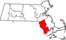
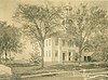
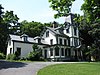
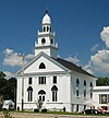
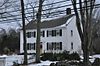
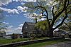
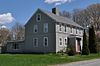
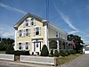
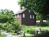
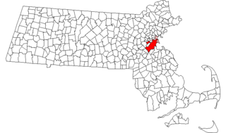
[2] Name on the Register [3] Image Date listed [4] Location City or town Description 1 Elisha Allen House Elisha Allen House June 6, 1983 (# 83000616 108 Homestead Ave. 41°52′51″N 71°16′09″W / 41.8808°N 71.2692°W / 41.8808; -71.2692 (Elisha Allen House ) Rehoboth 2 Anawan Club Clubhouse and Caretaker's House Anawan Club Clubhouse and Caretaker's House June 6, 1983 (# 83000618 13 Gorham St. 41°49′35″N 71°13′25″W / 41.826389°N 71.223611°W / 41.826389; -71.223611 (Anawan Club Clubhouse and Caretaker's House ) Rehoboth 3 Anawan Rock Anawan Rock June 6, 1983 (# 83000619 Anawan St. 41°51′54″N 71°12′52″W / 41.865°N 71.214444°W / 41.865; -71.214444 (Anawan Rock ) Rehoboth 4 Angle Tree Stone Angle Tree Stone January 1, 1976 (# 76000228 West of North Attleborough off High St. 41°59′06″N 71°21′54″W / 41.985°N 71.365°W / 41.985; -71.365 (Angle Tree Stone ) North Attleborough Extends into Plainville in Norfolk County . 5 David M. Anthony House David M. Anthony House February 16, 1990 (# 90000059 98 Bay Point Ave. 41°42′37″N 71°12′37″W / 41.710278°N 71.210278°W / 41.710278; -71.210278 (David M. Anthony House ) Swansea 6 Harold H. Anthony House Harold H. Anthony House February 12, 1990 (# 90000058 132 Bay Point Ave. 41°42′39″N 71°12′43″W / 41.710833°N 71.211944°W / 41.710833; -71.211944 (Harold H. Anthony House ) Swansea 7 Apponegansett Meeting House Apponegansett Meeting House March 14, 1991 (# 91000241 Russells Mills Rd. east of Fresh River Valley Rd. 41°35′02″N 70°59′43″W / 41.5839°N 70.9953°W / 41.5839; -70.9953 (Apponegansett Meeting House ) Dartmouth 8 Assonet Historic District Assonet Historic District September 9, 1999 (# 99001116 Roughly bounded by MA 24, a private lane, Conrail railroad racks, and High St. 41°47′36″N 71°04′12″W / 41.793333°N 71.07°W / 41.793333; -71.07 (Assonet Historic District ) Freetown 9 Attleborough Falls Gasholder Building Attleborough Falls Gasholder Building August 1, 1996 (# 96000848 380 Elm St. 41°58′28″N 71°19′11″W / 41.974444°N 71.319722°W / 41.974444; -71.319722 (Attleborough Falls Gasholder Building ) North Attleborough 10 Attleborough Falls Historic District Attleborough Falls Historic District January 6, 2004 (# 03001372 Mt. Hope St., just west of Reservoir St. to the Ten Mile River , Towne St. from Mt. Hope St. to the Ten Mile River 41°35′02″N 70°59′43″W / 41.583889°N 70.995278°W / 41.583889; -70.995278 (Attleborough Falls Historic District ) North Attleborough 11 Baker House Baker House June 6, 1983 (# 83000622 191 Hornbine St. 41°47′32″N 71°12′01″W / 41.792097°N 71.200188°W / 41.792097; -71.200188 (Baker House ) Rehoboth 12 Bark Street School Bark Street School February 16, 1990 (# 90000062 Stevens Rd. at Bark St. 41°44′58″N 71°09′50″W / 41.749444°N 71.163889°W / 41.749444; -71.163889 (Bark Street School ) Swansea 13 Barneyville Historic District Barneyville Historic District February 16, 1990 (# 90000052 Old Providence and Barneyville Rds. 41°46′17″N 71°17′00″W / 41.771389°N 71.283333°W / 41.771389; -71.283333 (Barneyville Historic District ) Swansea 14 H.F. Barrows Manufacturing Company Building H.F. Barrows Manufacturing Company Building August 30, 2001 (# 01000907 102 S. Washington St. 41°58′45″N 71°20′00″W / 41.979167°N 71.333333°W / 41.979167; -71.333333 (H.F. Barrows Manufacturing Company Building ) North Attleborough 15 Bay Road Bay Road May 5, 1972 (# 72000118 416-535 Bay Rd. (Foundry St. to the Norton town line) 42°00′36″N 71°07′17″W / 42.01°N 71.121389°W / 42.01; -71.121389 (Bay Road ) Easton 16 Bend of the Lane Bend of the Lane February 12, 1990 (# 90000057 181 Cedar Ave. 41°44′28″N 71°13′12″W / 41.7411°N 71.22°W / 41.7411; -71.22 (Bend of the Lane ) Swansea 17 Berkley Common Historic District Berkley Common Historic District January 19, 2016 (# 15000980 N. Main, S. Main, Porter & Locust Sts. 41°50′46″N 71°04′55″W / 41.846238°N 71.081978°W / 41.846238; -71.081978 (Berkley Common Historic District ) Berkley 18 Blackinton Houses and Park Blackinton Houses and Park April 20, 1979 (# 79000326 N. Main St. 41°57′01″N 71°17′31″W / 41.950278°N 71.291944°W / 41.950278; -71.291944 (Blackinton Houses and Park ) Attleboro 19 Abiah Bliss House Abiah Bliss House June 6, 1983 (# 83000625 154 Agricultural Ave. 41°53′23″N 71°16′25″W / 41.889704°N 71.273638°W / 41.889704; -71.273638 (Abiah Bliss House ) Rehoboth 20 Daniel Bliss Homestead Daniel Bliss Homestead June 6, 1983 (# 83000626 76 Homestead Ave. 41°52′43″N 71°15′53″W / 41.878611°N 71.264722°W / 41.878611; -71.264722 (Daniel Bliss Homestead ) Rehoboth 21 Borderland Historic District Borderland Historic District June 16, 1997 (# 97000497 Massapoag Avenue 42°04′02″N 71°09′24″W / 42.0671°N 71.1567°W / 42.0671; -71.1567 (Borderland Historic District ) Easton Coextensive with Borderland State Park , extending into Sharon in Norfolk County . 22 Nathan Bowen House Nathan Bowen House June 6, 1983 (# 83000633 26 Kelton St. 41°49′50″N 71°13′47″W / 41.8306°N 71.2297°W / 41.8306; -71.2297 (Nathan Bowen House ) Rehoboth 23 Bramble Hill Bramble Hill June 6, 1983 (# 83000634 32 Moulton St. 41°51′23″N 71°14′34″W / 41.8564°N 71.2428°W / 41.8564; -71.2428 (Bramble Hill ) Rehoboth 24 Brayton Homestead Brayton Homestead May 25, 2020 (# 100005077 159 Brayton Ave. 41°43′30″N 71°09′38″W / 41.7249°N 71.1605°W / 41.7249; -71.1605 (Brayton Homestead ) Somerset 25 Briggs Tavern Briggs Tavern June 6, 1983 (# 83000636 2 Anawan St. 41°54′13″N 71°13′09″W / 41.903611°N 71.219167°W / 41.903611; -71.219167 (Briggs Tavern ) Rehoboth 26 Brown House Brown House June 6, 1983 (# 83000639 384 Tremont St. 41°54′07″N 71°15′48″W / 41.901944°N 71.263333°W / 41.901944; -71.263333 (Brown House ) Rehoboth 27 John Brown IV House John Brown IV House February 16, 1990 (# 90000064 703 Pearse Rd. 41°43′40″N 71°13′41″W / 41.727778°N 71.228056°W / 41.727778; -71.228056 (John Brown IV House ) Swansea 28 Deacon John Buffington House Deacon John Buffington House February 16, 1990 (# 90000056 262 Cedar Ave. 41°44′25″N 71°13′05″W / 41.740278°N 71.218056°W / 41.740278; -71.218056 (Deacon John Buffington House ) Swansea 29 Cadman–White–Handy House Cadman–White–Handy House July 16, 1992 (# 92000831 202 Hixbridge Rd. 41°34′18″N 71°04′36″W / 41.571667°N 71.076667°W / 41.571667; -71.076667 (Cadman–White–Handy House ) Westport 30 Capron House Capron House July 21, 1978 (# 78000426 42 North Ave. 41°57′19″N 71°17′50″W / 41.955278°N 71.297222°W / 41.955278; -71.297222 (Capron House ) Attleboro 31 Carpenter Bridge Carpenter Bridge June 6, 1983 (# 83000641 Carpenter St. 41°51′18″N 71°15′22″W / 41.854905°N 71.256010°W / 41.854905; -71.256010 (Carpenter Bridge ) Rehoboth 32 Carpenter Homestead Carpenter Homestead September 17, 1993 (# 93000902 80 Walnut St. 41°51′02″N 71°18′15″W / 41.850556°N 71.304167°W / 41.850556; -71.304167 (Carpenter Homestead ) Seekonk 33 Carpenter House Carpenter House June 6, 1983 (# 83000642 89 Carpenter St. 41°51′17″N 71°15′17″W / 41.854722°N 71.254722°W / 41.854722; -71.254722 (Carpenter House ) Rehoboth 34 Christopher Carpenter House Christopher Carpenter House June 6, 1983 (# 83000643 60 Carpenter St. 41°51′21″N 71°15′06″W / 41.855833°N 71.251667°W / 41.855833; -71.251667 (Christopher Carpenter House ) Rehoboth 35 Col. Thomas Carpenter III House Col. Thomas Carpenter III House June 6, 1983 (# 83000644 77 Bay State Rd. 41°50′40″N 71°14′36″W / 41.844444°N 71.243333°W / 41.844444; -71.243333 (Col. Thomas Carpenter III House ) Rehoboth 36 Church of Christ, Swansea Church of Christ, Swansea February 16, 1990 (# 90000075 G.A.R. Highway/U.S. Route 6 at Maple Ave. 41°45′03″N 71°13′31″W / 41.750833°N 71.225278°W / 41.750833; -71.225278 (Church of Christ, Swansea ) Swansea 37 Pitt Clarke House Pitt Clarke House July 13, 1976 (# 76000230 42 Mansfield Ave. 41°58′13″N 71°11′40″W / 41.970278°N 71.194444°W / 41.970278; -71.194444 (Pitt Clarke House ) Norton 38 The Codding Farm The Codding Farm April 22, 2009 (# 09000236 217 High St. 41°59′09″N 71°20′33″W / 41.985697°N 71.342456°W / 41.985697; -71.342456 (The Codding Farm ) North Attleborough 39 Benjamin Cole House Benjamin Cole House February 16, 1990 (# 90000066 412 Old Warren Rd. 41°44′31″N 71°13′57″W / 41.7419°N 71.2325°W / 41.7419; -71.2325 (Benjamin Cole House ) Swansea 40 Colony Historic District Colony Historic District February 16, 1990 (# 90000079 Gardner's Neck and Mattapoisett Rds. at Mt. Hope Bay 41°42′35″N 71°12′23″W / 41.709722°N 71.206389°W / 41.709722; -71.206389 (Colony Historic District ) Swansea 41 Commonwealth Avenue Historic District Commonwealth Avenue Historic District December 12, 2003 (# 03001261 Northern side of Commonwealth Ave. from Stanley St. to beyond Robinson St. 41°58′11″N 71°18′37″W / 41.969722°N 71.310278°W / 41.969722; -71.310278 (Commonwealth Avenue Historic District ) North Attleborough 42 Coram Shipyard Historic District Coram Shipyard Historic District January 5, 1998 (# 97000625 2120, 2125, and 2130 Water St. 41°48′46″N 71°07′02″W / 41.8128°N 71.1172°W / 41.8128; -71.1172 (Coram Shipyard Historic District ) Dighton 43 Cottage–Freeman Historic District Cottage–Freeman Historic District December 12, 2003 (# 03001263 Cottage St. and Freeman St., from Commonwealth Ave. to the Ten Mile River and Park Ln. 41°58′03″N 71°18′38″W / 41.9675°N 71.310556°W / 41.9675; -71.310556 (Cottage–Freeman Historic District ) North Attleborough 44 Paul Cuffe Farm Paul Cuffe Farm May 30, 1974 (# 74000394 1504 Drift Rd. 41°32′57″N 71°04′06″W / 41.5492°N 71.0683°W / 41.5492; -71.0683 (Paul Cuffe Farm ) Westport National Historic Landmark 45 Caleb Cushing House and Farm Caleb Cushing House and Farm June 6, 1983 (# 83000660 186 Pine St. 41°51′05″N 71°17′16″W / 41.851479°N 71.287721°W / 41.851479; -71.287721 (Caleb Cushing House and Farm ) Rehoboth 46 Dighton Rock Dighton Rock July 2, 1971 (# 80000438 Across the Taunton River from Dighton in Dighton Rock State Park 41°48′46″N 71°06′38″W / 41.812778°N 71.110556°W / 41.812778; -71.110556 (Dighton Rock ) Berkley 47 Dighton Wharves Historic District Dighton Wharves Historic District July 17, 1997 (# 97000725 2298-2328 Pleasant St. 41°48′31″N 71°07′16″W / 41.8086°N 71.1211°W / 41.8086; -71.1211 (Dighton Wharves Historic District ) Dighton 48 Dodgeville Mill Dodgeville Mill December 14, 2018 (# 100003220 453 S Main St. 41°55′17″N 71°17′48″W / 41.9213°N 71.2966°W / 41.9213; -71.2966 (Dodgeville Mill ) Attleboro 49 Nathaniel Drown House Nathaniel Drown House June 6, 1983 (# 83000663 116 Summer St. 41°50′29″N 71°15′32″W / 41.841389°N 71.258889°W / 41.841389; -71.258889 (Nathaniel Drown House ) Rehoboth 50 East Attleborough Academy East Attleborough Academy April 4, 1985 (# 85000694 28 Sanford St. 41°56′46″N 71°17′06″W / 41.9461°N 71.285°W / 41.9461; -71.285 (East Attleborough Academy ) Attleboro 51 East Freetown Historic District East Freetown Historic District September 9, 1999 (# 99001115 Roughly along Howland, Gurney, and Washburn County Rds. 41°46′22″N 70°57′55″W / 41.7728°N 70.9653°W / 41.7728; -70.9653 (East Freetown Historic District ) Freetown 52 Elm Cottage/Blanding Farm Elm Cottage/Blanding Farm June 6, 1983 (# 83000666 103 Broad St. 41°50′16″N 71°17′29″W / 41.8378°N 71.2914°W / 41.8378; -71.2914 (Elm Cottage/Blanding Farm ) Rehoboth 53 Fairhaven High School and Academy Fairhaven High School and Academy January 22, 1981 (# 81000121 Huttleston Ave. 41°38′35″N 70°54′23″W / 41.6431°N 70.9064°W / 41.6431; -70.9064 (Fairhaven High School and Academy ) Fairhaven 54 Fairhaven Town Hall Fairhaven Town Hall January 22, 1981 (# 81000122 Center St. 41°38′11″N 70°54′14″W / 41.6364°N 70.9039°W / 41.6364; -70.9039 (Fairhaven Town Hall ) Fairhaven 55 Fire Barn Fire Barn January 28, 1982 (# 82004960 Commonwealth Ave. 41°58′17″N 71°18′52″W / 41.9714°N 71.3144°W / 41.9714; -71.3144 (Fire Barn ) North Attleborough 56 First Baptist Church and Society First Baptist Church and Society February 16, 1990 (# 90000060 Baptist St. 41°46′16″N 71°16′09″W / 41.7711°N 71.2692°W / 41.7711; -71.2692 (First Baptist Church and Society ) Swansea 57 First Parsonage for Second East Parish Church First Parsonage for Second East Parish Church April 2, 1980 (# 80000429 41 S. Main St. 41°56′36″N 71°17′07″W / 41.9433°N 71.2853°W / 41.9433; -71.2853 (First Parsonage for Second East Parish Church ) Attleboro Demolished. [5] 58 Fisher–Richardson House Fisher–Richardson House February 11, 1998 (# 98000096 354 Willow St. 42°00′37″N 71°13′42″W / 42.0103°N 71.2283°W / 42.0103; -71.2283 (Fisher–Richardson House ) Mansfield 59 Fort Phoenix Fort Phoenix November 9, 1972 (# 72000120 South of U.S. Route 6 in Fort Phoenix Park 41°37′26″N 70°54′11″W / 41.6239°N 70.9031°W / 41.6239; -70.9031 (Fort Phoenix ) Fairhaven 60 Furnace Village Historic District Furnace Village Historic District October 6, 1983 (# 83003938 MA 106/123 42°01′24″N 71°07′57″W / 42.0233°N 71.1325°W / 42.0233; -71.1325 (Furnace Village Historic District ) Easton 61 Francis L. Gardner House Francis L. Gardner House February 16, 1990 (# 90000077 1129 Gardner's Neck Rd. 41°43′15″N 71°12′09″W / 41.7208°N 71.2025°W / 41.7208; -71.2025 (Francis L. Gardner House ) Swansea 62 Joseph Gardner House Joseph Gardner House February 16, 1990 (# 90000076 1205 Gardner's Neck Rd. 41°43′07″N 71°12′15″W / 41.7186°N 71.2042°W / 41.7186; -71.2042 (Joseph Gardner House ) Swansea 63 Preserved Gardner House Preserved Gardner House February 16, 1990 (# 90000061 90 Milford Rd. 41°45′03″N 71°11′58″W / 41.7508°N 71.1994°W / 41.7508; -71.1994 (Preserved Gardner House ) Swansea 64 Samuel Gardner House Samuel Gardner House February 16, 1990 (# 90000068 1035 Gardner's Neck Rd. 41°43′22″N 71°12′08″W / 41.722778°N 71.202222°W / 41.722778; -71.202222 (Samuel Gardner House ) Swansea 65 Goff Farm Goff Farm June 6, 1983 (# 83000672 157 Perryville Rd. 41°52′02″N 71°15′30″W / 41.867222°N 71.258333°W / 41.867222; -71.258333 (Goff Farm ) Rehoboth Listed at 158 Perryville Rd. 66 Goff Homestead Goff Homestead June 6, 1983 (# 83000673 40 Maple Lane 41°50′50″N 71°13′27″W / 41.847222°N 71.224167°W / 41.847222; -71.224167 (Goff Homestead ) Rehoboth 67 H. H. Richardson Historic District of North Easton H. H. Richardson Historic District of North Easton December 23, 1987 (# 87002598 Main St., Elm St., and railway right-of-way off Oliver St. 42°04′12″N 71°06′02″W / 42.07°N 71.1006°W / 42.07; -71.1006 (H. H. Richardson Historic District of North Easton ) Easton Five buildings designed by H. H. Richardson ; contained within the North Easton Historic District 68 Head of the River Historic District Head of the River Historic District December 2, 2009 (# 09000965 2-28 Main St. 41°40′54″N 70°55′09″W / 41.681736°N 70.919186°W / 41.681736; -70.919186 (Head of the River Historic District ) Acushnet Extends into New Bedford . 69 Hebronville Mill Historic District Hebronville Mill Historic District May 17, 1984 (# 84002126 Knight Ave., Read St., and Phillip St. 41°54′18″N 71°19′12″W / 41.905°N 71.32°W / 41.905; -71.32 (Hebronville Mill Historic District ) Attleboro 70 High, Church and Gould Streets Historic District High, Church and Gould Streets Historic District November 12, 1999 (# 99001305 56-60-122 High St., 29-117 Church St., and 9-17 Gould St. 41°59′00″N 71°20′12″W / 41.983267°N 71.336642°W / 41.983267; -71.336642 (High, Church and Gould Streets Historic District ) North Attleborough 71 Hill School Hill School April 11, 1980 (# 80000432 4 Middle St. 41°35′13″N 70°56′25″W / 41.5869°N 70.9403°W / 41.5869; -70.9403 (Hill School ) Dartmouth 72 Hixville Village Historic District Hixville Village Historic District June 17, 1991 (# 91000698 Junction of Old Fall River, Hixville, and N. Hixville Rds. 41°40′56″N 71°01′56″W / 41.6822°N 71.0322°W / 41.6822; -71.0322 (Hixville Village Historic District ) Dartmouth 73 Hooper House Hooper House August 8, 1990 (# 90000074 306 Hortonville Rd. 41°45′30″N 71°11′49″W / 41.758333°N 71.196944°W / 41.758333; -71.196944 (Hooper House ) Swansea 74 Hornbine Baptist Church Hornbine Baptist Church June 6, 1983 (# 83000678 141 Hornbine Rd. 41°47′55″N 71°12′03″W / 41.798611°N 71.200833°W / 41.798611; -71.200833 (Hornbine Baptist Church ) Rehoboth 75 Hornbine School Hornbine School June 6, 1983 (# 83000679 144 Hornbine Road 41°47′53″N 71°12′07″W / 41.798056°N 71.201944°W / 41.798056; -71.201944 (Hornbine School ) Rehoboth 76 Welcome Horton Farm Welcome Horton Farm June 6, 1983 (# 83000680 122 Martin St. 41°47′58″N 71°14′14″W / 41.799444°N 71.237222°W / 41.799444; -71.237222 (Welcome Horton Farm ) Rehoboth 77 Hortonville Historic District Hortonville Historic District February 16, 1990 (# 90000051 Locust St. from Oak St. to Hortonville Rd. 41°46′27″N 71°12′36″W / 41.774167°N 71.21°W / 41.774167; -71.21 (Hortonville Historic District ) Swansea 78 House at 197 Hornbine Road House at 197 Hornbine Road June 6, 1983 (# 83000681 197 Hornbine Rd. 41°47′28″N 71°12′02″W / 41.791111°N 71.200556°W / 41.791111; -71.200556 (House at 197 Hornbine Road ) Rehoboth 79 House at 30 Kelton Street House at 30 Kelton Street June 6, 1983 (# 83000682 30 Kelton St. 41°49′50″N 71°13′51″W / 41.830556°N 71.230833°W / 41.830556; -71.230833 (House at 30 Kelton Street ) Rehoboth 80 Ingalls–Wheeler–Horton Homestead Site Ingalls–Wheeler–Horton Homestead Site June 6, 1983 (# 83000684 214 Chestnut St. 41°49′02″N 71°14′49″W / 41.817222°N 71.246944°W / 41.817222; -71.246944 (Ingalls–Wheeler–Horton Homestead Site ) Rehoboth 81 J. V. Johnson House J. V. Johnson House August 8, 1990 (# 90000069 36 Riverview Ave. 41°42′55″N 71°12′10″W / 41.715278°N 71.202778°W / 41.715278; -71.202778 (J. V. Johnson House ) Swansea 82 Kingsley House Kingsley House June 6, 1983 (# 83000688 108 Davis St. 41°46′44″N 71°15′48″W / 41.778964°N 71.263218°W / 41.778964; -71.263218 (Kingsley House ) Rehoboth Listed at 96 Davis Street. 83 Seth Knapp Jr. House Seth Knapp Jr. House June 6, 1983 (# 83000689 82 Water St. 41°48′46″N 71°16′52″W / 41.812778°N 71.281111°W / 41.812778; -71.281111 (Seth Knapp Jr. House ) Rehoboth 84 Long Plain Friends Meetinghouse Long Plain Friends Meetinghouse June 26, 1986 (# 86001374 1341 N. Main St. 41°44′50″N 70°54′07″W / 41.7472°N 70.9019°W / 41.7472; -70.9019 (Long Plain Friends Meetinghouse ) Acushnet 85 Long Plain School Long Plain School July 17, 2012 (# 12000413 1203 Main St. 41°44′15″N 70°53′47″W / 41.7375°N 70.8965°W / 41.7375; -70.8965 (Long Plain School ) Acushnet now known as the Long Plain Museum 86 Lowney Chocolate Factory Lowney Chocolate Factory April 12, 2016 (# 16000156 150 Oakland St. 42°02′22″N 71°12′52″W / 42.039565°N 71.214512°W / 42.039565; -71.214512 (Lowney Chocolate Factory ) Mansfield 87 Luther House Luther House August 8, 1990 (# 90000073 177 Market St. 41°45′52″N 71°16′09″W / 41.764444°N 71.269167°W / 41.764444; -71.269167 (Luther House ) Swansea 88 Luther Store Luther Store May 22, 1978 (# 78000438 West of Swansea at 160 Old Warren Rd. 41°44′41″N 71°13′25″W / 41.744722°N 71.223611°W / 41.744722; -71.223611 (Luther Store ) Swansea 89 Luther's Corner Luther's Corner February 16, 1990 (# 90000054 Old Warren and Pierce Rds. 41°44′42″N 71°13′27″W / 41.745°N 71.224167°W / 41.745; -71.224167 (Luther's Corner ) Swansea 90 William Luther House Upload image February 16, 1990 (# 90000067 79 Old Warren Rd. 41°44′46″N 71°13′16″W / 41.746111°N 71.221111°W / 41.746111; -71.221111 (William Luther House ) Swansea 91 D. E. Makepeace Company D. E. Makepeace Company July 18, 1985 (# 85001577 46 Pine St. 41°56′32″N 71°16′52″W / 41.942222°N 71.281111°W / 41.942222; -71.281111 (D. E. Makepeace Company ) Attleboro 92 Martin Farm Martin Farm June 6, 1983 (# 83000691 121 Martin St. 41°47′52″N 71°14′14″W / 41.797778°N 71.237222°W / 41.797778; -71.237222 (Martin Farm ) Rehoboth 93 Martin House Martin House May 2, 1974 (# 74000365 940 County St. 41°48′50″N 71°17′54″W / 41.813889°N 71.298333°W / 41.813889; -71.298333 (Martin House ) Seekonk 94 Martin House and Farm Martin House and Farm October 2, 1978 (# 78000437 22 Stoney Hill Rd. 41°45′50″N 71°15′36″W / 41.763889°N 71.26°W / 41.763889; -71.26 (Martin House and Farm ) Swansea 95 William P. Mason House William P. Mason House August 8, 1990 (# 90000121 5 Mason St. 41°46′21″N 71°16′24″W / 41.7725°N 71.273333°W / 41.7725; -71.273333 (William P. Mason House ) Swansea 96 Millicent Library Millicent Library May 15, 1986 (# 86001051 45 Center St. 41°38′41″N 70°54′15″W / 41.6447°N 70.9042°W / 41.6447; -70.9042 (Millicent Library ) Fairhaven 97 North Attleborough Town Center Historic District North Attleborough Town Center Historic District December 20, 1985 (# 85003168 Roughly N. and S. Washington St. between Fisher and Bank Sts. 41°58′59″N 71°20′00″W / 41.983056°N 71.333333°W / 41.983056; -71.333333 (North Attleborough Town Center Historic District ) North Attleborough 98 North Easton Historic District North Easton Historic District November 3, 1972 (# 72000119 Section of town north of and including both sides of Main-Lincoln St. 42°04′13″N 71°05′59″W / 42.070278°N 71.099722°W / 42.070278; -71.099722 (North Easton Historic District ) Easton 99 North Easton Railroad Station North Easton Railroad Station April 11, 1972 (# 72000125 80 Mechanic St. 42°04′11″N 71°06′14″W / 42.069722°N 71.103889°W / 42.069722; -71.103889 (North Easton Railroad Station ) Easton 100 Northbound and Southbound Stations Northbound and Southbound Stations January 5, 1989 (# 88003128 1 and 3 Mill St. 41°56′31″N 71°17′06″W / 41.941944°N 71.285°W / 41.941944; -71.285 (Northbound and Southbound Stations ) Attleboro 101 Norton Center Historic District Norton Center Historic District December 23, 1977 (# 77000170 MA 123 41°58′03″N 71°11′10″W / 41.9675°N 71.1861°W / 41.9675; -71.1861 (Norton Center Historic District ) Norton 102 Norton House Norton House February 16, 1990 (# 90000078 61 Old Providence Rd. 41°46′21″N 71°16′27″W / 41.7725°N 71.2742°W / 41.7725; -71.2742 (Norton House ) Swansea 103 Old Bay Road Old Bay Road November 8, 1974 (# 74000362 From Easton town line to Taunton town line 41°58′54″N 71°07′35″W / 41.9817°N 71.1264°W / 41.9817; -71.1264 (Old Bay Road ) Norton 104 Old Town Historic District Old Town Historic District May 30, 1991 (# 91000599 Near the junction of Old Post Road and Mt. Hope St. 41°56′40″N 71°20′24″W / 41.9444°N 71.34°W / 41.9444; -71.34 (Old Town Historic District ) North Attleborough 105 Oxford School Upload image February 17, 2023 (# 100008623 347 Main St. 41°39′25″N 70°54′30″W / 41.6570°N 70.9084°W / 41.6570; -70.9084 (Oxford School ) Fairhaven 106 Padanaram Village Historic District Padanaram Village Historic District September 5, 1985 (# 85002010 Elm, Water, Middle, High, Pleasant, Prospect, Hill, School, Fremont, and Bridge Sts. 41°35′08″N 70°56′30″W / 41.5856°N 70.9417°W / 41.5856; -70.9417 (Padanaram Village Historic District ) Dartmouth 107 Peck–Bowen House Peck–Bowen House June 6, 1983 (# 83000700 330 Fairview Ave. 41°52′20″N 71°13′42″W / 41.8722°N 71.2283°W / 41.8722; -71.2283 (Peck–Bowen House ) Rehoboth 108 James Perry House James Perry House June 6, 1983 (# 83000701 121 Perryville Rd. 41°51′41″N 71°15′26″W / 41.8614°N 71.2572°W / 41.8614; -71.2572 (James Perry House ) Rehoboth 109 Capt. Mial Pierce Farm Capt. Mial Pierce Farm June 6, 1983 (# 83000703 177 Hornbine Rd. 41°47′41″N 71°11′56″W / 41.7947°N 71.1989°W / 41.7947; -71.1989 (Capt. Mial Pierce Farm ) Rehoboth 110 Rehoboth Village Historic District Rehoboth Village Historic District June 6, 1983 (# 83000707 Bay State Rd. and Locust Ave. 41°50′26″N 71°15′09″W / 41.8406°N 71.2525°W / 41.8406; -71.2525 (Rehoboth Village Historic District ) Rehoboth 111 Robinson Building Upload image October 30, 2023 (# 100009506 37-41 Union St. 41°56′36″N 71°16′56″W / 41.9432°N 71.2821°W / 41.9432; -71.2821 (Robinson Building ) Attleboro 112 Capt. Joel Robinson House Capt. Joel Robinson House November 20, 1978 (# 78000428 111 Rocklawn Ave. 41°56′17″N 71°19′57″W / 41.9381°N 71.3325°W / 41.9381; -71.3325 (Capt. Joel Robinson House ) Attleboro 113 Russell Garrison Russell Garrison August 6, 2018 (# 100002215 Fort Street 41°35′52″N 70°57′25″W / 41.5978°N 70.9570°W / 41.5978; -70.9570 (Russell Garrison ) Dartmouth 114 Russells Mills Village Historic District Russells Mills Village Historic District September 5, 1985 (# 85002011 Russells Mills, Rock O' Dundee, Slades Corner, Horseneck, and Fisher Rds. 41°34′23″N 71°00′18″W / 41.5731°N 71.005°W / 41.5731; -71.005 (Russells Mills Village Historic District ) Dartmouth 115 Herbert A. Sadler House Herbert A. Sadler House October 21, 1982 (# 82000489 574 Newport Ave. 41°55′20″N 71°21′16″W / 41.9222°N 71.3544°W / 41.9222; -71.3544 (Herbert A. Sadler House ) Attleboro 116 Ezekiel Sawin House Ezekiel Sawin House June 15, 1979 (# 79000327 44 William St. 41°38′13″N 70°54′17″W / 41.6369°N 70.9047°W / 41.6369; -70.9047 (Ezekiel Sawin House ) Fairhaven 117 Short's Tavern Short's Tavern February 16, 1990 (# 90000072 282 Market St. 41°45′42″N 71°16′09″W / 41.7617°N 71.2692°W / 41.7617; -71.2692 (Short's Tavern ) Swansea 118 Simcock House Simcock House February 16, 1990 (# 90000063 1074 Sharps Lot Rd. 41°46′49″N 71°10′19″W / 41.7803°N 71.1719°W / 41.7803; -71.1719 (Simcock House ) Swansea 119 Smuggler's House Smuggler's House February 16, 1990 (# 90000065 361 Pearse Rd. 41°44′05″N 71°13′26″W / 41.7347°N 71.2239°W / 41.7347; -71.2239 (Smuggler's House ) Swansea 120 Soldiers' Memorial Library Soldiers' Memorial Library June 2, 1995 (# 95000681 Junction of Park Row and Union St. 42°01′24″N 71°13′02″W / 42.0233°N 71.2172°W / 42.0233; -71.2172 (Soldiers' Memorial Library ) Mansfield 121 Somerset Village Historic District Somerset Village Historic District March 13, 2020 (# 100005075 Avon St., Borland Ave., Cherry St., Church St., Clark St., Dublin St., High St., Main St., Maple St., Marsh St., Old Colony Ave., Palmer St., Peterson St., Pierce Ln., Pleasant St., School St., Simms Ave., and South St. 41°46′24″N 71°07′33″W / 41.7733°N 71.1258°W / 41.7733; -71.1258 (Somerset Village Historic District ) Somerset 122 South Swansea Union Church South Swansea Union Church February 16, 1990 (# 90000055 Gardner's Neck Rd. 41°43′27″N 71°12′05″W / 41.7242°N 71.2014°W / 41.7242; -71.2014 (South Swansea Union Church ) Swansea 123 South Washington Street Historic District South Washington Street Historic District October 12, 1995 (# 95001173 145-327 S. Washington St. and 1-6 Hunting St. 41°58′29″N 71°20′07″W / 41.9747°N 71.3353°W / 41.9747; -71.3353 (South Washington Street Historic District ) North Attleborough 124 Spring Brook Cemetery Spring Brook Cemetery December 6, 2007 (# 07001240 Spring St 42°01′07″N 71°13′20″W / 42.0187°N 71.2221°W / 42.0187; -71.2221 (Spring Brook Cemetery ) Mansfield 125 Swansea Friends Meeting House and Cemetery Swansea Friends Meeting House and Cemetery April 15, 2014 (# 14000156 223 Prospect Street 41°44′19″N 71°09′25″W / 41.7387°N 71.1569°W / 41.7387; -71.1569 (Swansea Friends Meeting House and Cemetery ) Somerset 126 Swansea Village Historic District Swansea Village Historic District February 16, 1990 (# 90000053 Roughly Main St. from Gardners Neck Rd. to Stephens Rd., and Ledge Rd. 41°44′47″N 71°11′26″W / 41.7464°N 71.1906°W / 41.7464; -71.1906 (Swansea Village Historic District ) Swansea 127 Towne Street Historic District Towne Street Historic District November 26, 2003 (# 03001210 Towne St. east of Jackson St. 41°58′21″N 71°18′44″W / 41.9725°N 71.3122°W / 41.9725; -71.3122 (Towne Street Historic District ) North Attleborough 128 Tucker Farm Historic District Tucker Farm Historic District August 25, 1988 (# 88000705 1178 Tucker Rd. 41°37′46″N 70°58′55″W / 41.6294°N 70.9819°W / 41.6294; -70.9819 (Tucker Farm Historic District ) Dartmouth 129 Unitarian Memorial Church Unitarian Memorial Church November 22, 1996 (# 96001374 102 Green St. 41°38′01″N 70°54′09″W / 41.6336°N 70.9025°W / 41.6336; -70.9025 (Unitarian Memorial Church ) Fairhaven 130 US Post Office–Attleboro Main US Post Office–Attleboro Main October 19, 1987 (# 87001767 75 Park St. 41°56′38″N 71°16′54″W / 41.9439°N 71.2817°W / 41.9439; -71.2817 (US Post Office–Attleboro Main ) Attleboro 1916 building now used as office by county and city 131 Samuel Viall House Samuel Viall House June 6, 1983 (# 83000728 85 Carpenter St. 41°51′17″N 71°15′15″W / 41.8547°N 71.2542°W / 41.8547; -71.2542 (Samuel Viall House ) Rehoboth 132 Walkden Farm Walkden Farm February 16, 1990 (# 90000071 495 Marvel St. 41°46′35″N 71°10′21″W / 41.7764°N 71.1725°W / 41.7764; -71.1725 (Walkden Farm ) Swansea 133 Watson, Newell & Company Factory Upload image November 5, 2020 (# 100005761 67 Mechanic St. 41°56′38″N 71°17′33″W / 41.9440°N 71.2926°W / 41.9440; -71.2926 (Watson, Newell & Company Factory ) Attleboro 134 Westport Point Historic District Westport Point Historic District June 25, 1992 (# 92000815 Roughly Main St. from Charles St. to the West Branch of the Westport River , including Cape Bial and Valentine Lns. 41°31′24″N 71°04′29″W / 41.5233°N 71.0747°W / 41.5233; -71.0747 (Westport Point Historic District ) Westport 135 Aaron Wheeler House Aaron Wheeler House June 6, 1983 (# 83000730 371 Fairview Ave. 41°52′28″N 71°13′24″W / 41.8744°N 71.2233°W / 41.8744; -71.2233 (Aaron Wheeler House ) Rehoboth 136 Wheeler–Ingalls House Wheeler–Ingalls House July 5, 1983 (# 83000731 51 Summer St. 41°50′04″N 71°14′51″W / 41.8344°N 71.2475°W / 41.8344; -71.2475 (Wheeler–Ingalls House ) Rehoboth 137 Woodcock–Hatch–Maxcy House Historic District Woodcock–Hatch–Maxcy House Historic District July 12, 1990 (# 90001081 362 N. Washington St. 41°59′34″N 71°19′50″W / 41.9928°N 71.3306°W / 41.9928; -71.3306 (Woodcock–Hatch–Maxcy House Historic District ) North Attleborough