National Register of Historic Places listings in Columbia County, Oregon
Last updated
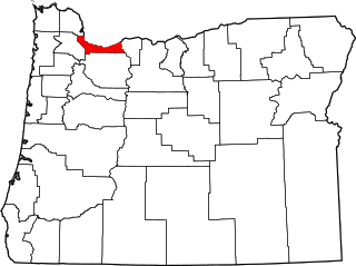
Location of Columbia County in Oregon
This list presents the full set of buildings, structures, objects, sites, or districts designated on the National Register of Historic Places in Columbia County, Oregon, and offers brief descriptive information about each of them. The National Register recognizes places of national, state, or local historic significance across the United States.[1] Out of over 90,000 National Register sites nationwide,[2]Oregon is home to over 2,000,[3] and 13 of those are found partially or wholly in Columbia County.
Charles Caples (1832–1906) was the first physician in Columbia County and built this home in 1870. Lucinda McBride Caples (d. 1916) served as a midwife and had family connections to many prominent Oregonians of the period. Charles, Lucinda, and the extended Caples family made important contributions to the early development of the town, including establishment of its first school.[7]
The Portland and Southwestern Railroad's 1910–1920 construction of this timber-lined tunnel across the Nehalem Divide was an unusual step for a loggingrailroad, which would typically rely on less permanent infrastructure. The tunnel and rail line were abandoned in 1945 as the timber industry transitioned to log transport by truck.[8]
The following list presents the full set of National Register of Historic Places listings in Multnomah County, Oregon. However, please see separate articles for listings in each of Portland's six quadrants.
↑ Oregon Parks and Recreation Department, Oregon Historic Sites Database, retrieved August 6, 2015. Note that a simple count of National Register records in this database returns a slightly higher total than actual listings, due to duplicate records. A close reading of detailed query results is necessary to arrive at the precise count.
↑ Numbers represent an alphabetical ordering by significant words. Various colorings, defined here, differentiate National Historic Landmarks and historic districts from other NRHP buildings, structures, sites or objects.
↑ The eight-digit number below each date is the number assigned to each location in the National Register Information System database, which can be viewed by clicking the number.
This page is based on this Wikipedia article Text is available under the CC BY-SA 4.0 license; additional terms may apply. Images, videos and audio are available under their respective licenses.