National Register of Historic Places listings in Columbiana County, Ohio

Last updated

Location of Columbiana County in Ohio Map of Ohio highlighting Columbiana County.svg
Location of Columbiana County in Ohio

This is a list of the National Register of Historic Places listings in Columbiana County, Ohio.

Contents

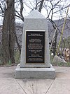
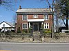
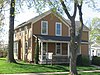
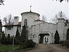
This is intended to be a complete list of the properties and districts on the National Register of Historic Places in Columbiana County, Ohio, United States. The locations of National Register properties and districts for which the latitude and longitude coordinates are included below, may be seen in an online map. [1]

There are 45 properties and districts listed on the National Register in the county, including 1 National Historic Landmark.


    This National Park Service list is complete through NPS recent listings posted March 1, 2024. [2]

Current listings

[3] Name on the Register [4] ImageDate listed [5] Location City or townDescription
1 Beginning Point of the U.S. Public Land Survey
Beginning Point of the U.S. Public Land Survey Beginning Point of the U.S. Public Land Survey front.jpg
Beginning Point of the U.S. Public Land Survey
October 15, 1966
(#66000606)
On the Ohio/Pennsylvania border, east of East Liverpool
40°38′33″N80°31′10″W / 40.6425°N 80.519444°W / 40.6425; -80.519444 (Beginning Point of the U.S. Public Land Survey)
East Liverpool Point from which the Public Land Survey System was performed, starting in 1785, which would open what was then the Northwest Territory for settlement. [6]
2 Hiram Bell Farmstead
Hiram Bell Farmstead Hiram Bell Farmstead front.jpg
Hiram Bell Farmstead
December 9, 1999
(#99001496)
43628 State Route 517
40°49′00″N80°40′34″W / 40.816667°N 80.676111°W / 40.816667; -80.676111 (Hiram Bell Farmstead)
Fairfield Township Greek Revival farmstead, designed and built in 1850 [4]
3 Burchfield Homestead
Burchfield Homestead Burchfield Homestead.jpg
Burchfield Homestead
March 23, 1999
(#99000320)
867 E. 4th St.
40°54′14″N80°50′57″W / 40.904027°N 80.849028°W / 40.904027; -80.849028 (Burchfield Homestead)
Salem Boyhood home of American watercolorist Charles E. Burchfield [7]
4 Carnegie Public Library
Carnegie Public Library Carnegie Public Library, East Liverpool.jpg
Carnegie Public Library
March 11, 1980
(#80002963)
219 E. 4th St.
40°37′04″N80°34′41″W / 40.617778°N 80.578056°W / 40.617778; -80.578056 (Carnegie Public Library)
East Liverpool The first library in Ohio funded by Andrew Carnegie, who spent a large part of his childhood in East Liverpool [8]
5 Richard L. Cawood Residence
Richard L. Cawood Residence Richard L. Cawood Residence, East Liverpool.jpg
Richard L. Cawood Residence
January 21, 1988
(#87002502)
2600 St. Clair Ave.
40°38′38″N80°34′23″W / 40.643889°N 80.573056°W / 40.643889; -80.573056 (Richard L. Cawood Residence)
East Liverpool Built in 1923 by Richard Cawood. [4]
6 Cherry Valley Coke Ovens
Cherry Valley Coke Ovens Cherry Valley Coke Ovens 3.jpg
Cherry Valley Coke Ovens
May 6, 1993
(#93000404)
Junction of Cherry Valley and Butcher Rds.
40°53′04″N80°45′21″W / 40.884444°N 80.755833°W / 40.884444; -80.755833 (Cherry Valley Coke Ovens)
Leetonia The site represents the largest remaining site of beehive coke ovens in North America [9]
7 Church Hill Road Covered Bridge
Church Hill Road Covered Bridge Church Hill Road Covered Bridge 2012-07-14.JPG
Church Hill Road Covered Bridge
June 11, 1975
(#75001347)
On dry ground at Elkton, off State Route 154
40°45′43″N80°42′13″W / 40.761944°N 80.703611°W / 40.761944; -80.703611 (Church Hill Road Covered Bridge)
Elkrun Township 
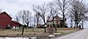
Built in 1870, one of the shortest covered bridges for public highway use in the United States. Relocated in 1963 when Church Hill Road was realigned [10]
8 City Hall
City Hall City Hall, East Liverpool.jpg
City Hall
November 14, 1985
(#85003511)
6th St.
40°37′12″N80°34′51″W / 40.62°N 80.580833°W / 40.62; -80.580833 (City Hall)
East Liverpool 
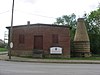
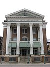
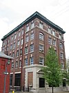
Built in 1934 as a project of the Civil Works Administration. Stylistically, the building is an example of Art Deco architecture that was prominent in the 1930s. [11]
9 Columbiana County Infirmary
Columbiana County Infirmary Columbiana County Infirmary.JPG
Columbiana County Infirmary
June 20, 1979
(#79001795)
West of Lisbon on County Home Rd.
40°46′40″N80°49′42″W / 40.777778°N 80.828333°W / 40.777778; -80.828333 (Columbiana County Infirmary)
Center Township
10 Diamond Historic District
Diamond Historic District Diamond Historic District, East Liverpool.jpg
Diamond Historic District
November 14, 1985
(#85003508)
Market and E. 6th Sts.
40°37′13″N80°34′47″W / 40.620278°N 80.579722°W / 40.620278; -80.579722 (Diamond Historic District)
East Liverpool
11 East Fifth Street Historic District
East Fifth Street Historic District East Fifth Street Historic District, East Liverpool.jpg
East Fifth Street Historic District
November 14, 1985
(#85003510)
Along E. 5th St. between Market St. and Broadway
40°37′08″N80°34′44″W / 40.618889°N 80.578889°W / 40.618889; -80.578889 (East Fifth Street Historic District)
East Liverpool
12 East Liverpool Downtown Historic District
East Liverpool Downtown Historic District Sturgis House in the East Liverpool Downtown Historic District.jpg
East Liverpool Downtown Historic District
May 30, 2001
(#01000591)
Roughly bounded by W. 6th St., Dresden Ave., Welch Ave., Broadway, Walnut St., E. 4th St., and East Alley
40°37′08″N80°34′46″W / 40.618889°N 80.579444°W / 40.618889; -80.579444 (East Liverpool Downtown Historic District)
East Liverpool
13 East Liverpool Post Office
East Liverpool Post Office East Liverpool Post Office.jpg
East Liverpool Post Office
November 21, 1976
(#76001384)
5th and Broadway Sts.
40°37′06″N80°34′38″W / 40.618333°N 80.577222°W / 40.618333; -80.577222 (East Liverpool Post Office)
East Liverpool
14 East Liverpool Pottery
East Liverpool Pottery East Liverpool Pottery.jpg
East Liverpool Pottery
October 7, 1971
(#71000636)
Southeastern corner of 2nd and Market Sts.
40°36′59″N80°34′52″W / 40.616389°N 80.581111°W / 40.616389; -80.581111 (East Liverpool Pottery)
East Liverpool
15 Nicholas Eckis House
Nicholas Eckis House Nicholas Eckis House.jpg
Nicholas Eckis House
January 3, 1980
(#80002962)
High St. in East Fairfield
40°49′21″N80°38′09″W / 40.8225°N 80.635833°W / 40.8225; -80.635833 (Nicholas Eckis House)
Fairfield Township
16 Elks Club
Elks Club Elks Club, East Liverpool.jpg
Elks Club
November 14, 1985
(#85003512)
139 W. 5th St.
40°37′11″N80°34′54″W / 40.619722°N 80.581667°W / 40.619722; -80.581667 (Elks Club)
East Liverpool
17 Episcopal Church of the Ascension and Manse
Episcopal Church of the Ascension and Manse Episcopal Church of the Ascension in Wellsville.jpg
Episcopal Church of the Ascension and Manse
May 15, 1986
(#86001061)
1101 and 1109 11th St.
40°36′07″N80°39′03″W / 40.601944°N 80.650833°W / 40.601944; -80.650833 (Episcopal Church of the Ascension and Manse)
Wellsville
18 Gaston's Mill-Lock No. 36, Sandy and Beaver Canal District
Gaston's Mill-Lock No. 36, Sandy and Beaver Canal District Lock 36.png
Gaston's Mill-Lock No. 36, Sandy and Beaver Canal District
May 23, 1974
(#74001423)
About 1 mi (1.6 km) south of Clarkson in Beaver Creek State Forest
40°43′39″N80°36′46″W / 40.7275°N 80.612778°W / 40.7275; -80.612778 (Gaston's Mill-Lock No. 36, Sandy and Beaver Canal District)
Middleton Township Water-powered mill constructed in 1837 powered by Little Beaver Creek. Lock 36 was one of 90 locks on the Sandy and Beaver Canal. Both renovated.
19 Godwin-Knowles House
Godwin-Knowles House Godwin-Knowles House, East Liverpool.jpg
Godwin-Knowles House
November 14, 1985
(#85003515)
422 Broadway
40°37′03″N80°34′38″W / 40.6175°N 80.577222°W / 40.6175; -80.577222 (Godwin-Knowles House)
East Liverpool A mansion built in 1890 and later converted into the local Masonic temple
20 Hanna-Kenty House
Hanna-Kenty House Hanna-Kenty House.JPG
Hanna-Kenty House
November 21, 2001
(#01001257)
251 E. High St.
40°46′28″N80°45′55″W / 40.774444°N 80.76541°W / 40.774444; -80.76541 (Hanna-Kenty House)
Lisbon
21 Hanoverton Canal Town District
Hanoverton Canal Town District Lockard House (1830), Hanoverton, Ohio.JPG
Hanoverton Canal Town District
August 3, 1977
(#77001050)
U.S. Route 30
40°45′09″N80°56′08″W / 40.7525°N 80.935556°W / 40.7525; -80.935556 (Hanoverton Canal Town District)
Hanoverton
22 Franklin Harris Farmstead
Franklin Harris Farmstead Franklin Harris Farmstead.JPG
Franklin Harris Farmstead
November 24, 1997
(#97001462)
3525 Depot Rd. south of Salem
40°50′57″N80°51′29″W / 40.849167°N 80.858056°W / 40.849167; -80.858056 (Franklin Harris Farmstead)
Butler Township
23 Daniel Howell Hise House
Daniel Howell Hise House Hise Wiki.jpg
Daniel Howell Hise House
March 25, 1999
(#99000319)
1100 Franklin Ave.
40°53′32″N80°50′32″W / 40.892222°N 80.842222°W / 40.892222; -80.842222 (Daniel Howell Hise House)
Salem Home of local abolitionist Daniel Howell Hise
24 Hostetter Inn
Hostetter Inn Hostetter Inn.JPG
Hostetter Inn
September 27, 1980
(#80002965)
Northwest of Lisbon at 32901 State Route 172
40°47′34″N80°52′50″W / 40.792778°N 80.880556°W / 40.792778; -80.880556 (Hostetter Inn)
Hanover Township
25 Ikirt House
Ikirt House Ikirt House, East Liverpool.jpg
Ikirt House
May 29, 1980
(#80002964)
200 6th St.
40°37′14″N80°34′54″W / 40.620556°N 80.581667°W / 40.620556; -80.581667 (Ikirt House)
East Liverpool
26 Jones-Bowman House
Jones-Bowman House Jones-Bowman House.jpg
Jones-Bowman House
December 12, 1976
(#76001383)
540 Pittsburgh St.
40°52′56″N80°41′07″W / 40.882361°N 80.685278°W / 40.882361; -80.685278 (Jones-Bowman House)
Columbiana
27 Homer Laughlin House
Homer Laughlin House Site of the Homer Laughlin House.jpg
Homer Laughlin House
November 14, 1985
(#85003513)
414 Broadway
40°37′03″N80°34′38″W / 40.6175°N 80.577222°W / 40.6175; -80.577222 (Homer Laughlin House)
East Liverpool Destroyed
28 Lisbon Historic District
Lisbon Historic District Town square of Lisbon, Ohio and Columbiana County courthouse.JPG
Lisbon Historic District
August 24, 1979
(#79001794)
U.S. Route 30 and State Route 45
40°46′23″N80°45′59″W / 40.773056°N 80.766389°W / 40.773056; -80.766389 (Lisbon Historic District)
Lisbon
29 Daniel McBean Farmstead
Daniel McBean Farmstead Daniel McBean Farmstead 2012-07-13.JPG
Daniel McBean Farmstead
January 12, 2005
(#05001518)
18709 Fife Coal Rd. northwest of Wellsville
40°37′48″N80°42′35″W / 40.63°N 80.709722°W / 40.63; -80.709722 (Daniel McBean Farmstead)
Yellow Creek Township
30 Middle Sandy Presbyterian Church
Middle Sandy Presbyterian Church Middle Sandy Presbyterian Church.JPG
Middle Sandy Presbyterian Church
May 13, 1994
(#94000414)
Homeworth Rd. in Homeworth
40°50′16″N81°04′10″W / 40.837778°N 81.069444°W / 40.837778; -81.069444 (Middle Sandy Presbyterian Church)
Knox Township
31 John H. Morgan Surrender Site
John H. Morgan Surrender Site Morgan's Surrender 2011-02-04.JPG
John H. Morgan Surrender Site
April 23, 1973
(#73001401)
3.1 mi (5.0 km) west of West Point on State Route 518
40°41′50″N80°44′38″W / 40.697222°N 80.743889°W / 40.697222; -80.743889 (John H. Morgan Surrender Site)
Wayne Township
32 New Garden Monthly Meetinghouse August 26, 2022
(#100008030)
32114 Winona Rd.
40°49′41″N80°53′38″W / 40.82813°N 80.8940°W / 40.82813; -80.8940 (New Garden Monthly Meetinghouse)
Hanoverton
33 Odd Fellows Temple
Odd Fellows Temple Odd Fellows Temple, East Liverpool.jpg
Odd Fellows Temple
November 14, 1985
(#85003514)
120 W. 6th St.
40°37′16″N80°34′50″W / 40.621111°N 80.580556°W / 40.621111; -80.580556 (Odd Fellows Temple)
East Liverpool
34 Mary A. Patterson Memorial
Mary A. Patterson Memorial Mary A. Patterson Memorial, East Liverpool.jpg
Mary A. Patterson Memorial
November 14, 1985
(#85003516)
E. 4th St.
40°37′03″N80°34′42″W / 40.6175°N 80.578333°W / 40.6175; -80.578333 (Mary A. Patterson Memorial)
East Liverpool
35 Potters National Bank
Potters National Bank Old Potters National Bank, East Liverpool.jpg
Potters National Bank
November 14, 1985
(#85003518)
Broadway and 4th St.
40°37′01″N80°34′40″W / 40.616944°N 80.577778°W / 40.616944; -80.577778 (Potters National Bank)
East Liverpool Demolished on 16 November 2010 [12]
36 Potters Savings and Loan
Potters Savings and Loan Potters Savings and Loan from Washington.jpg
Potters Savings and Loan
November 14, 1985
(#85003517)
Washington and Broadway
40°37′08″N80°34′41″W / 40.618889°N 80.578056°W / 40.618889; -80.578056 (Potters Savings and Loan)
East Liverpool
37 Salem Downtown Historic District
Salem Downtown Historic District State Street in the Salem Downtown HD.jpg
Salem Downtown Historic District
December 7, 1995
(#95001416)
Roughly bounded by Vine Ave., Ohio Ave., E. Pershing St., S. Ellsworth Ave. and Sugar Tree Alley
40°53′59″N80°49′34″W / 40.899722°N 80.826111°W / 40.899722; -80.826111 (Salem Downtown Historic District)
Salem
38 Salem Methodist Episcopal Church
Salem Methodist Episcopal Church Salem United Methodist Church.jpg
Salem Methodist Episcopal Church
March 9, 1995
(#95000167)
244 S. Broadway
40°53′56″N80°51′18″W / 40.898889°N 80.855000°W / 40.898889; -80.855000 (Salem Methodist Episcopal Church)
Salem
39 Charles Nelson Schmick House
Charles Nelson Schmick House Charles Nelson Schmick House.JPG
Charles Nelson Schmick House
March 21, 1991
(#91000250)
110 Walnut St.
40°52′47″N80°45′36″W / 40.879722°N 80.76°W / 40.879722; -80.76 (Charles Nelson Schmick House)
Leetonia
40 South Lincoln Avenue Historic District
South Lincoln Avenue Historic District South Lincoln Avenue Historic District.JPG
South Lincoln Avenue Historic District
August 26, 1993
(#93000876)
S. Lincoln Ave., roughly between Pershing and Summit Sts.
40°53′42″N80°50′59″W / 40.895°N 80.849722°W / 40.895; -80.849722 (South Lincoln Avenue Historic District)
Salem
41 John Street House
John Street House John Street House.jpg
John Street House
October 10, 1973
(#73001400)
631 N. Ellsworth Ave.
40°54′17″N80°51′26″W / 40.904722°N 80.857222°W / 40.904722; -80.857222 (John Street House)
Salem Underground Railroad stop and home of son of city founder
42 Teegarden-Centennial Covered Bridge
Teegarden-Centennial Covered Bridge Teegarden-Centennial Covered Bridge.JPG
Teegarden-Centennial Covered Bridge
August 10, 2000
(#00000961)
Eagleton Rd. (Township Road 761), 0.1 mi (0.16 km) east of County Road 411, south of Salem
40°49′18″N80°49′38″W / 40.821667°N 80.827222°W / 40.821667; -80.827222 (Teegarden-Centennial Covered Bridge)
Salem Township
43 Cassius Clark Thompson House
Cassius Clark Thompson House Cassius Clark Thompson House, East Liverpool.jpg
Cassius Clark Thompson House
September 28, 1971
(#71000637)
305 Walnut St.
40°36′59″N80°34′34″W / 40.616389°N 80.576111°W / 40.616389; -80.576111 (Cassius Clark Thompson House)
East Liverpool
44 Travelers Hotel
Travelers Hotel Travelers Hotel, East Liverpool.jpg
Travelers Hotel
July 15, 1986
(#86001718)
115 E. 4th St.
40°37′05″N80°34′48″W / 40.618056°N 80.58°W / 40.618056; -80.58 (Travelers Hotel)
East Liverpool
45 YMCA
YMCA YMCA, East Liverpool.jpg
YMCA
November 14, 1985
(#85003509)
Washington and 4th Sts.
40°37′04″N80°34′45″W / 40.617778°N 80.579167°W / 40.617778; -80.579167 (YMCA)
East Liverpool

See also

Related Research Articles

<span class="mw-page-title-main">National Register of Historic Places listings in Erie County, Ohio</span>

This is a list of the National Register of Historic Places listings in Erie County, Ohio.

<span class="mw-page-title-main">National Register of Historic Places listings in Stark County, Ohio</span>

This is a list of the National Register of Historic Places listings in Stark County, Ohio.

<span class="mw-page-title-main">National Register of Historic Places listings in Mahoning County, Ohio</span>

This is a list of the National Register of Historic Places listings in Mahoning County, Ohio.

<span class="mw-page-title-main">National Register of Historic Places listings in Licking County, Ohio</span>

This is a list of the National Register of Historic Places listings in Licking County, Ohio.

<span class="mw-page-title-main">National Register of Historic Places listings in Ashtabula County, Ohio</span>

This is a list of the National Register of Historic Places listings in Ashtabula County, Ohio.

<span class="mw-page-title-main">National Register of Historic Places listings in Miami County, Ohio</span>

This is a list of the National Register of Historic Places listings in Miami County, Ohio.

<span class="mw-page-title-main">National Register of Historic Places listings in Clark County, Ohio</span>

This is a list of the National Register of Historic Places listings in Clark County, Ohio.

<span class="mw-page-title-main">National Register of Historic Places listings in Washington County, Ohio</span>

This is a list of the National Register of Historic Places listings in Washington County, Ohio.

<span class="mw-page-title-main">National Register of Historic Places listings in Trumbull County, Ohio</span>

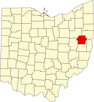
This is a list of the National Register of Historic Places listings in Trumbull County, Ohio.

<span class="mw-page-title-main">National Register of Historic Places listings in Allen County, Ohio</span>

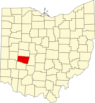
This is a list of the National Register of Historic Places listings in Allen County, Ohio.

<span class="mw-page-title-main">National Register of Historic Places listings in Portage County, Ohio</span>

This is a list of the National Register of Historic Places listings in Portage County, Ohio.

<span class="mw-page-title-main">National Register of Historic Places listings in Athens County, Ohio</span>

This is a list of the National Register of Historic Places listings in Athens County, Ohio.

<span class="mw-page-title-main">National Register of Historic Places listings in Auglaize County, Ohio</span>

This is a list of the National Register of Historic Places listings in Auglaize County, Ohio.

<span class="mw-page-title-main">National Register of Historic Places listings in Guernsey County, Ohio</span>

This is a list of the National Register of Historic Places listings in Guernsey County, Ohio.

<span class="mw-page-title-main">National Register of Historic Places listings in Jefferson County, Ohio</span>

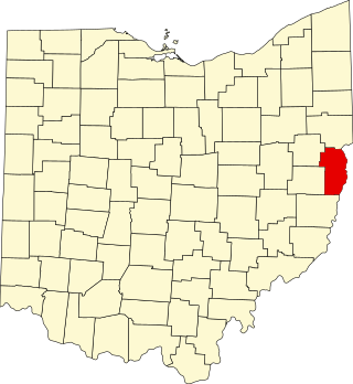
This is a list of the National Register of Historic Places listings in Jefferson County, Ohio.

<span class="mw-page-title-main">National Register of Historic Places listings in Jackson County, Ohio</span>

This is a list of the National Register of Historic Places listings in Jackson County, Ohio.

<span class="mw-page-title-main">National Register of Historic Places listings in Carroll County, Ohio</span>

This is a list of the National Register of Historic Places listings in Carroll County, Ohio.

<span class="mw-page-title-main">National Register of Historic Places listings in Wyandot County, Ohio</span>

This is a list of the National Register of Historic Places listings in Wyandot County, Ohio.

<span class="mw-page-title-main">National Register of Historic Places listings in Noble County, Ohio</span>

This is a list of the National Register of Historic Places listings in Noble County, Ohio.

<span class="mw-page-title-main">National Register of Historic Places listings in Harrison County, Ohio</span>

This is a list of the National Register of Historic Places listings in Harrison County, Ohio.

References

  1. The latitude and longitude information provided in this table was derived originally from the National Register Information System, which has been found to be fairly accurate for about 99% of listings. Some locations in this table may have been corrected to current GPS standards.
  2. National Park Service, United States Department of the Interior, "National Register of Historic Places: Weekly List Actions", retrieved March 1, 2024.
  3. Numbers represent an alphabetical ordering by significant words. Various colorings, defined here, differentiate National Historic Landmarks and historic districts from other NRHP buildings, structures, sites or objects.
  4. 1 2 3 "National Register Information System". National Register of Historic Places . National Park Service. April 24, 2008.
  5. The eight-digit number below each date is the number assigned to each location in the National Register Information System database, which can be viewed by clicking the number.
  6. Joseph S. Mendinghall (December 27, 1974). "National Register of Historic Places Inventory-Nomination: Beginning Point / Beginning Point of the U.S. Public Land Survey" (pdf). National Park Service.
  7. Mattevi, Cheryl. "Burchfield Homestead Museum". Burchfield Homestead Museum. Burchfield Homestead Society. Retrieved 14 August 2022.
  8. "A More Complete History". Carnegie Public Library; East Liverpool, Ohio. Carnegie Public Library. Retrieved 18 September 2011.
  9. Greier, Mary Ann (30 October 2010). "Leetonia coke ovens earn prestigious award". Morning Journal (Lisbon, Ohio). Archived from the original on 2 January 2014. Retrieved 12 April 2012.
  10. Moore, Elma Lee. Ohio's Covered Bridges. Charleston: Arcadia, 2010, 35.
  11. Ohio Historic Places Dictionary. North American Book Dist LLC. 2008. p. 156. ISBN   9781878592705.
  12. McElwain, Michael D. What Once Was, East Liverpool Review , 2010-11-21. Accessed 2010-12-19.