National Register of Historic Places listings in Douglas County, Wisconsin

Last updated

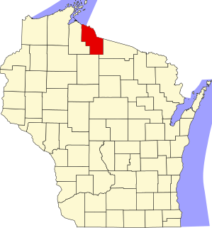
Location of Douglas County in Wisconsin Map of Wisconsin highlighting Douglas County.svg
Location of Douglas County in Wisconsin

This is a list of the National Register of Historic Places listings in Douglas County, Wisconsin. It is intended to provide a comprehensive listing of entries in the National Register of Historic Places that are located in Douglas County, Wisconsin. The locations of National Register properties for which the latitude and longitude coordinates are included below may be seen in a map. [1]

Contents

There are 21 properties and districts listed on the National Register in the county. Another property was once listed but has been removed.


    This National Park Service list is complete through NPS recent listings posted August 12, 2022. [2]

Map all coordinates using: OpenStreetMap  
Download coordinates as: KML

Current listings

[3] Name on the Register [4] ImageDate listed [5] Location City or townDescription
1 Berkshire Block
Berkshire Block BerkshireBlockSuperiorWI.JPG
Berkshire Block
June 27, 1985
(#85001466)
917-927 Tower Avenue
46°43′37″N92°06′15″W / 46.726944°N 92.104167°W / 46.726944; -92.104167 (Berkshire Block)
Superior Business block built in 1892 in Romanesque Revival style with exterior of Kasota limestone, and finished by Scandinavian craftsmen. First housed the State Bank of Wisconsin, later department stores, Holden Insurance, and now AMSOIL. [6]
2 Brule-St. Croix Portage
Brule-St. Croix Portage GPS tagged St. Croix Portage, WI.jpg
Brule-St. Croix Portage
October 15, 1970
(#70000033)
Brule River State Forest
46°23′18″N91°45′25″W / 46.388333°N 91.756944°W / 46.388333; -91.756944 (Brule-St. Croix Portage)
Solon Springs Two-mile portage trail from the St. Croix River in the Mississippi watershed to the Bois Brule River in the Great Lakes watershed. Used by Native Americans and early European explorers. The first recorded was du Lhut in 1680, later Jonathan Carver and Henry Schoolcraft. [7]
3 Davidson Windmill
Davidson Windmill Davidson Windmill.jpg
Davidson Windmill
August 3, 1979
(#79000075)
SE of Superior on WI 13
46°38′56″N91°54′21″W / 46.648889°N 91.905833°W / 46.648889; -91.905833 (Davidson Windmill)
Lakeside Finnish immigrant Jacob Davidson (Jaako Tapola) constructed this windmill in 1900 to grind animal feed. [8]
4 Douglas County Courthouse
Douglas County Courthouse DouglasCountyCourthouseSuperiorWI.JPG
Douglas County Courthouse
March 9, 1982
(#82000664)
1313 Belknap Street
46°43′16″N92°05′49″W / 46.721111°N 92.096944°W / 46.721111; -92.096944 (Douglas County Courthouse)
Superior Massive three-story limestone and marble courthouse built 1918-1919 in Classical Revival style. [9]
5 Empire Block
Empire Block EmpireBlockSuperiorWI.JPG
Empire Block
June 27, 1985
(#85001467)
1202-1208 Tower Avenue
46°43′27″N92°06′12″W / 46.724167°N 92.103333°W / 46.724167; -92.103333 (Empire Block)
Superior Victorian Romanesque business block designed by Carl Wirth and built in 1892. [6] Lurye's Furniture was an occupant from 1937 to 2012. [10]
6 Antoine and Sarah Gordon House June 10, 2022
(#100007769)
97 Cty. Rd. Y
46°15′31″N91°44′27″W / 46.2587°N 91.7407°W / 46.2587; -91.7407 (Antoine and Sarah Gordon House)
Gordon The core of this house is a log cabin built in 1859 by the founder of Gordon as his home, trading post, and a resting place on the stagecoach line running from Fort Snelling to Bayfield. The Gordons helped support a local Ojibwa and Metis community into the 1880s. [11]
7 Lake Nebagamon Auditorium
Lake Nebagamon Auditorium LakeNebagamonAuditorium.jpg
Lake Nebagamon Auditorium
September 14, 1981
(#81000041)
1st Street
46°30′48″N91°41′56″W / 46.513333°N 91.698889°W / 46.513333; -91.698889 (Lake Nebagamon Auditorium)
Lake Nebagamon Rustic-styled community center with cobblestone chimney, built in 1936. [12]
8 Maryland Block
Maryland Block TheTelegramBldgSuperiorWI.JPG
Maryland Block
June 27, 1985
(#85001468)
1221-1227 Tower Avenue
46°43′24″N92°06′15″W / 46.723333°N 92.104167°W / 46.723333; -92.104167 (Maryland Block)
Superior Neoclassical commercial building developed by the Land and River Improvement Company and built in 1892. A.k.a. the Badger Building. [13]
9 METEOR (Whaleback carrier)
METEOR (Whaleback carrier) SSMeteor.jpg
METEOR (Whaleback carrier)
September 9, 1974
(#74000081)
NW tip of Barkers Island
46°43′23″N92°03′47″W / 46.723056°N 92.063056°W / 46.723056; -92.063056 (METEOR (Whaleback carrier))
Superior 380-foot whaleback freighter, the last remaining in the world. Built in 1896 in Superior, the Meteor hauled iron ore, grain, and liquids up and down the Great Lakes until 1969. Now a museum. A boundary decrease was approved on April 26, 2018.
10 Minnesota Block-Board of Trade Bldg.
Minnesota Block-Board of Trade Bldg. MinnesotaBlockSuperiorWI.JPG
Minnesota Block-Board of Trade Bldg.
June 27, 1985
(#85001470)
1501-1511 Tower Avenue
46°43′14″N92°06′14″W / 46.720556°N 92.103889°W / 46.720556; -92.103889 (Minnesota Block-Board of Trade Bldg.)
Superior Four-story Neoclassical building, supposedly fireproof, designed by C. C. Haight and built in 1892 [14] by the Land and River Improvement Company. Housed Spicer-Fanning Dry Goods in lower floors and Board of Trade in upper. [15]
11 New Jersey Building
New Jersey Building GlobeNews.jpg
New Jersey Building
September 22, 1983
(#83003373)
1422-1432 Tower Avenue and 1705-1723 Belknap Street
46°43′16″N92°06′11″W / 46.721111°N 92.103056°W / 46.721111; -92.103056 (New Jersey Building)
Superior Business block built in 1889 in Romanesque Revival style by the Land and River Improvement Co. Named for the investors, from New Jersey. Originally housed 5 storefronts on street level and six luxury apartments above. [6]
12 New York Block
New York Block NYblockSuperiorWI.jpg
New York Block
June 27, 1985
(#85001472)
1402-1412 Tower Avenue
46°43′18″N92°06′12″W / 46.721667°N 92.103333°W / 46.721667; -92.103333 (New York Block)
Superior Romanesque Revival business block built in 1890 by the Land and River Improvement Co. Named for the investors, from New York. Housed ten stores at street level. [15]
13 Northern Block
Northern Block NorthernBlockSuperiorWI.jpg
Northern Block
June 27, 1985
(#85001471)
2229 East 5th Street
46°42′14″N92°02′55″W / 46.703889°N 92.048611°W / 46.703889; -92.048611 (Northern Block)
Superior Business block constructed in 1892 by local investors. [15]
14 Martin Pattison House
Martin Pattison House FairlawnSuperiorWI.jpg
Martin Pattison House
February 12, 1981
(#81000042)
906 East 2nd Street
46°43′05″N92°03′46″W / 46.718056°N 92.062778°W / 46.718056; -92.062778 (Martin Pattison House)
Superior Queen Anne-style home with four-story turret, built around 1890 by Pattison, a lumber and mining baron and mayor of Superior. Became the Superior Children's Home orphanage from 1920 to 1962. Now the Fairlawn Museum. [16]
15 Roosevelt Terrace
Roosevelt Terrace RooseveltTerraceSuperiorWI.jpg
Roosevelt Terrace
January 12, 2005
(#04001483)
1700-1714 North 21st Street and 2105-2109 Ogden Avenue
46°42′55″N92°06′10″W / 46.715278°N 92.102778°W / 46.715278; -92.102778 (Roosevelt Terrace)
Superior Apartment building owned by James Roosevelt, Sr., father of FDR. Designed by Carl Wirth in 1890 in Richardsonian Romanesque style. [15]
16 Superior Entry South Breakwater Light
Superior Entry South Breakwater Light Wisconsin Point Light house.jpg
Superior Entry South Breakwater Light
March 1, 2007
(#07000102)
Superior Entry South Breakwater offshore end. 0.4 mi (0.64 km). NE of Wisconsin Point
46°42′37″N92°00′22″W / 46.710278°N 92.006111°W / 46.710278; -92.006111 (Superior Entry South Breakwater Light)
Superior Lighthouse built in 1913 to guide ships to the entry to Duluth-Superior harbor through the ten-mile sandbar which shelters it. [17]
17 A.D. Thompson Cabin August 11, 2022
(#100007979)
13393 South St. Croix Rd.
46°16′49″N91°46′14″W / 46.2802°N 91.7705°W / 46.2802; -91.7705 (A.D. Thompson Cabin)
Gordon
18 Trade and Commerce Building
Trade and Commerce Building OldCityHallSuperiorWI.jpg
Trade and Commerce Building
May 8, 1979
(#79000076)
916 Hammond Avenue
46°43′38″N92°05′50″W / 46.727222°N 92.097222°W / 46.727222; -92.097222 (Trade and Commerce Building)
Superior Five-story office building designed by Clarence H. Johnston, Sr. in Richardsonian Romanesque style and built around 1890 by Henry Minot's Superior Improvement Company. Later housed Superior's city hall. [15] [18]
19 Washington Block
Washington Block WashingtonBlockSuperiorWI.jpg
Washington Block
June 27, 1985
(#85001473)
1517-1523 Tower Avenue
46°43′12″N92°06′14″W / 46.72°N 92.103889°W / 46.72; -92.103889 (Washington Block)
Superior Office block built in 1890 by the Land and River Improvement Company and W. H. Folsom of New York. Housed the Northwest Hanna Coal Company offices, among others. [15]
20 Wemyss Building
Wemyss Building Site of demolished Wemyss Building 1.jpg
Wemyss Building
June 27, 1985
(#85001474)
1301-1305 Tower Avenue
46°43′23″N92°06′15″W / 46.7231°N 92.1042°W / 46.7231; -92.1042 (Wemyss Building)
Superior Commercial building, probably designed by Carl Wirth, with elements of Romanesque and Classical Revival styles. Built in 1892 by the Land and River Improvement Company and named for its manager, Rowland J. Wemyss. [15] The building was demolished. [19]
21 Wisconsin Point
Wisconsin Point 2009 Wisconsin Point Burial Site.JPG
Wisconsin Point
July 8, 2021
(#100006701)
Address Restricted
Superior vicinitySite of a Chippewa village and cemetery from the mid-1800s. [20] [21]

Former listing

[3] Name on the RegisterImageDate listedDate removedLocationCity or townDescription
1 Massachusetts Block June 27, 1985
(#85001469)
April 6, 20111525-1531 Tower Avenue
46°43′10″N92°06′14″W / 46.7194°N 92.1039°W / 46.7194; -92.1039 (Massachusetts Block)
Superior Office block designed by Carl Wirth in Romanesque Revival style and constructed 1889. Part of Speculative Commercial Blocks of Superior's Boom Period 1888–1892 Thematic Resource. Demolished 1990. [15]

See also

Related Research Articles

National Register of Historic Places listings in Brown County, Wisconsin

This is a list of the National Register of Historic Places listings in Brown County, Wisconsin. It is intended to provide a comprehensive listing of entries in the National Register of Historic Places that are located in Brown County, Wisconsin. The locations of National Register properties for which the latitude and longitude coordinates are included below may be seen in a map.

National Register of Historic Places listings in St. Croix County, Wisconsin

This is a list of the National Register of Historic Places listings in St. Croix County, Wisconsin. It is intended to provide a comprehensive listing of entries in the National Register of Historic Places that are located in St. Croix County, Wisconsin. The locations of National Register properties for which the latitude and longitude coordinates are included below may be seen in a map.

National Register of Historic Places listings in Waupaca County, Wisconsin

This is a list of the National Register of Historic Places listings in Waupaca County, Wisconsin. It is intended to provide a comprehensive listing of entries in the National Register of Historic Places that are located in Waupaca County, Wisconsin. The locations of National Register properties for which the latitude and longitude coordinates are included below may be seen in a map.
National Register of Historic Places listings in Oconto County, Wisconsin

This is a list of the National Register of Historic Places listings in Oconto County, Wisconsin. It is intended to provide a comprehensive listing of entries in the National Register of Historic Places that are located in Oconto County, Wisconsin. The locations of National Register properties for which the latitude and longitude coordinates are included below may be seen in a map.

National Register of Historic Places listings in Ashland County, Wisconsin

This is a list of the National Register of Historic Places listings in Ashland County, Wisconsin. It is intended to provide a comprehensive listing of entries in the National Register of Historic Places that are located in Ashland County, Wisconsin. The locations of National Register properties for which the latitude and longitude coordinates are included below may be seen in a map.

National Register of Historic Places listings in Marinette County, Wisconsin

This is a list of the National Register of Historic Places listings in Marinette County, Wisconsin. It is intended to provide a comprehensive listing of entries in the National Register of Historic Places that are located in Marinette County, Wisconsin. The locations of National Register properties for which the latitude and longitude coordinates are included below may be seen in a map.

National Register of Historic Places listings in Bayfield County, Wisconsin

This is a list of the National Register of Historic Places listings in Bayfield County, Wisconsin. It is intended to provide a comprehensive listing of entries in the National Register of Historic Places that are located in Bayfield County, Wisconsin. The locations of National Register properties for which the latitude and longitude coordinates are included below may be seen in a map.

National Register of Historic Places listings in Trempealeau County, Wisconsin

This is a list of the National Register of Historic Places listings in Trempealeau County, Wisconsin. It is intended to provide a comprehensive listing of entries in the National Register of Historic Places that are located in Trempealeau County, Wisconsin. The locations of National Register properties for which the latitude and longitude coordinates are included below may be seen in a map.
National Register of Historic Places listings in Portage County, Wisconsin

This is a list of the National Register of Historic Places listings in Portage County, Wisconsin. It is intended to provide a comprehensive listing of entries in the National Register of Historic Places that are located in Portage County, Wisconsin. The locations of National Register properties for which the latitude and longitude coordinates are included below may be seen in a map.
National Register of Historic Places listings in Pierce County, Wisconsin

This is a list of the National Register of Historic Places listings in Pierce County, Wisconsin. It is intended to provide a comprehensive listing of entries in the National Register of Historic Places that are located in Pierce County, Wisconsin. The locations of National Register properties for which the latitude and longitude coordinates are included below may be seen in a map.

National Register of Historic Places listings in Chippewa County, Wisconsin

This is a list of the National Register of Historic Places listings in Chippewa County, Wisconsin. It is intended to provide a comprehensive listing of entries in the National Register of Historic Places that are located in Chippewa County, Wisconsin. The locations of National Register properties for which the latitude and longitude coordinates are included below may be seen in a map.

National Register of Historic Places listings in Waushara County, Wisconsin

This is a list of the National Register of Historic Places listings in Waushara County, Wisconsin. It is intended to provide a comprehensive listing of entries in the National Register of Historic Places that are located in Waushara County, Wisconsin. The locations of National Register properties for which the latitude and longitude coordinates are included below may be seen in a map.

National Register of Historic Places listings in Buffalo County, Wisconsin

This is a list of the National Register of Historic Places listings in Buffalo County, Wisconsin. It is intended to provide a comprehensive listing of entries in the National Register of Historic Places that are located in Buffalo County, Wisconsin. The locations of National Register properties for which the latitude and longitude coordinates are included below may be seen in a map.

National Register of Historic Places listings in Polk County, Wisconsin

This is a list of the National Register of Historic Places listings in Polk County, Wisconsin. It is intended to provide a comprehensive listing of entries in the National Register of Historic Places that are located in Polk County, Wisconsin. The locations of National Register properties for which the latitude and longitude coordinates are included below may be seen in a map.

National Register of Historic Places listings in Vilas County, Wisconsin

This is a list of the National Register of Historic Places listings in Vilas County, Wisconsin. It is intended to provide a comprehensive listing of entries in the National Register of Historic Places that are located in Vilas County, Wisconsin. The locations of National Register properties for which the latitude and longitude coordinates are included below may be seen in a map.
National Register of Historic Places listings in Taylor County, Wisconsin

This is a list of the National Register of Historic Places listings in Taylor County, Wisconsin. It is intended to provide a comprehensive listing of entries in the National Register of Historic Places that are located in Taylor County, Wisconsin. The locations of National Register properties for which the latitude and longitude coordinates are included below may be seen in a map.

National Register of Historic Places listings in Burnett County, Wisconsin

This is a list of the National Register of Historic Places listings in Burnett County, Wisconsin. It is intended to provide a comprehensive listing of entries in the National Register of Historic Places that are located in Burnett County, Wisconsin. The locations of National Register properties for which the latitude and longitude coordinates are included below may be seen in a map.

National Register of Historic Places listings in Florence County, Wisconsin

This is a list of the National Register of Historic Places listings in Florence County, Wisconsin. It is intended to provide a comprehensive listing of entries in the National Register of Historic Places that are located in Florence County, Wisconsin. The locations of National Register properties for which the latitude and longitude coordinates are included below may be seen in a map.
National Register of Historic Places listings in Iron County, Wisconsin

This is a list of the National Register of Historic Places listings in Iron County, Wisconsin. It is intended to provide a comprehensive listing of entries in the National Register of Historic Places that are located in Iron County, Wisconsin. The locations of National Register properties for which the latitude and longitude coordinates are included below may be seen in a map.

National Register of Historic Places listings in Sawyer County, Wisconsin

This is a list of the National Register of Historic Places listings in Sawyer County, Wisconsin. It is intended to provide a comprehensive listing of entries in the National Register of Historic Places that are located in Sawyer County, Wisconsin. The locations of National Register properties for which the latitude and longitude coordinates are included below may be seen in a map.

References

  1. The latitude and longitude information provided is primarily from the National Register Information System, and has been found to be fairly accurate for about 99% of listings. For 1%, the location info may be way off. We seek to correct the coordinate information wherever it is found to be erroneous. Please leave a note in the Discussion page for this article if you believe any specific location is incorrect.
  2. National Park Service, United States Department of the Interior, "National Register of Historic Places: Weekly List Actions", retrieved August 12, 2022.
  3. 1 2 Numbers represent an alphabetical ordering by significant words. Various colorings, defined here, differentiate National Historic Landmarks and historic districts from other NRHP buildings, structures, sites or objects.
  4. "National Register Information System". National Register of Historic Places . National Park Service. April 24, 2008.
  5. The eight-digit number below each date is the number assigned to each location in the National Register Information System database, which can be viewed by clicking the number.
  6. 1 2 3 Superior Business Improvement District – Historical Walking Tour (PDF). Superior, Wisconsin: Superior Business Improvement District.
  7. "History of the Area". Brule River State Forests. Wisconsin Department of Natural Resources. Retrieved 2012-12-26.
  8. Zimm, John (Spring 2009). "Wisconsin's Historic Windmills". Wisconsin Magazine of History. 92 (3): 30. Retrieved 2012-12-26.
  9. "Douglas County Courthouse". Wisconsin National Register of Historic Places. Wisconsin Historical Society. Retrieved 2012-12-26.
  10. "Lurye's Furniture in Superior closing". Duluth News Tribune. 2012-12-26. Retrieved 2012-12-27.
  11. "Gordon, Antoine and Sarah, House". Wisconsin National Register of Historic Places. Wisconsin Historical Society. Retrieved 2022-06-12.
  12. "Lake Nebagamon Auditorium". Architecture and History Inventory. Wisconsin Historical Society. Retrieved 2014-01-24.
  13. "Maryland Block". Architecture and History Inventory. Wisconsin Historical Society. Retrieved 2012-12-27.
  14. "Minnesota Block". Architecture and History Inventory. Wisconsin Historical Society. Retrieved 2012-12-27.
  15. 1 2 3 4 5 6 7 8 Lusignan, Paul R.; Thomas Hendrickson. Massachusetts Block. National Park Service – Historical American Buildings Survey.
  16. "Fairlawn History". Superior Public Museums. Retrieved 2013-01-27.
  17. Pepper, Terry. "Superior Entry Lighthouse". Seeing the Light. Terry Pepper. Retrieved 2013-01-27.
  18. "Trade and Commerce Building". Architecture and History Inventory. Wisconsin Historical Society. Retrieved 2013-02-02.
  19. "Wemyss Block". Architecture and History Inventory. Wisconsin Historical Society. Retrieved May 8, 2013.
  20. "Wisconsin Point". Wisconsin Historical Society. Retrieved 2021-07-18.
  21. "Wisconsin Point Restoration Site". St. Louis River Estuary - the Stories and the Science. Retrieved 2021-07-18.