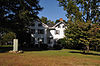
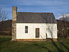
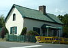
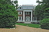
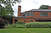
[3] Name on the Register [4] Image Date listed [5] Location City or town Description 1 Ashleigh Ashleigh August 14, 1973 (# 73002012 South of Delaplane, off U.S. Route 17 38°54′08″N 77°55′07″W / 38.902222°N 77.918611°W / 38.902222; -77.918611 (Ashleigh ) Delaplane 2 Ashville Historic District Ashville Historic District February 11, 2004 (# 04000043 4236-4130 Ashville Rd. and part of Old Ashville Rd. 38°51′54″N 77°55′21″W / 38.865000°N 77.922500°W / 38.865000; -77.922500 (Ashville Historic District ) Marshall 3 Atoka Historic District Atoka Historic District November 27, 2004 (# 04001266 1461, 1466, 1468, and 1481 Atoka Rd. and 7258 and 7260 Rectors Ln. 38°58′30″N 77°48′33″W / 38.975000°N 77.809167°W / 38.975000; -77.809167 (Atoka Historic District ) Atoka 4 Auburn Battlefield Auburn Battlefield December 5, 2011 (# 11000873 Bounded by Casanova, Auburn Baptist Church, and Catlett 38°42′09″N 77°42′06″W / 38.702611°N 77.701667°W / 38.702611; -77.701667 (Auburn Battlefield ) Catlett part of the Civil War in Virginia Multiple Property Submission (MPS) 5 Belle Grove Belle Grove August 30, 2006 (# 06000756 1402 Winchester Rd. 38°58′46″N 77°57′16″W / 38.979444°N 77.954444°W / 38.979444; -77.954444 (Belle Grove ) Delaplane 6 Beverley Mill Beverley Mill February 23, 1972 (# 72001411 Junction of State Route 55 and Beverleys Mill Rd. 38°49′28″N 77°42′38″W / 38.824583°N 77.710556°W / 38.824583; -77.710556 (Beverley Mill ) The Plains 7 Blue Ridge Farm Blue Ridge Farm August 30, 2006 (# 06000753 1799 Blue Ridge Farm Rd. 38°57′28″N 77°52′43″W / 38.957778°N 77.878611°W / 38.957778; -77.878611 (Blue Ridge Farm ) Upperville 8 Brentmoor Brentmoor January 20, 1978 (# 78003016 173 Main St. 38°42′42″N 77°47′26″W / 38.711667°N 77.790556°W / 38.711667; -77.790556 (Brentmoor ) Warrenton 9 Bristersburg Historic District Bristersburg Historic District May 21, 2009 (# 09000336 Parts of Elk Run and Bristersburg Rds. 38°35′01″N 77°36′47″W / 38.583611°N 77.613056°W / 38.583611; -77.613056 (Bristersburg Historic District ) Bristersburg 10 Broad Run-Little Georgetown Rural Historic District Broad Run-Little Georgetown Rural Historic District April 21, 2016 (# 16000205 Roughly bounded by The Plains, the Bull Run Mountains , State Route 55 , Bust Head Rd., and Hopewell Rd. 38°49′29″N 77°43′53″W / 38.824722°N 77.731389°W / 38.824722; -77.731389 (Broad Run-Little Georgetown Rural Historic District ) Broad Run Extends into Prince William County 11 Burrland Farm Historic District Burrland Farm Historic District November 7, 1997 (# 97001406 Burrland Ln. 38°57′08″N 77°45′05″W / 38.952222°N 77.751389°W / 38.952222; -77.751389 (Burrland Farm Historic District ) Middleburg 12 Calverton Historic District Calverton Historic District August 12, 2010 (# 10000542 Parts of Bristersburg and Catlett Rds. 38°38′07″N 77°40′25″W / 38.635278°N 77.673611°W / 38.635278; -77.673611 (Calverton Historic District ) Calverton 13 Carters Run Rural Historic District Carters Run Rural Historic District May 15, 2014 (# 14000236 Generally centered along Carters Run, Scotts Rd., and the eastern side of Free State Rd. 38°49′50″N 77°51′24″W / 38.830556°N 77.856667°W / 38.830556; -77.856667 (Carters Run Rural Historic District ) Marshall 14 Casanova Historic District Casanova Historic District November 16, 2005 (# 05001264 Parts of Casanova Rd., Rogues Rd., and Weston Rd. 38°39′28″N 77°43′02″W / 38.657778°N 77.717222°W / 38.657778; -77.717222 (Casanova Historic District ) Casanova 15 Catlett Historic District Catlett Historic District February 21, 2008 (# 08000069 Prospect Ave. and parts of Gaskins Ln. and Tenerife, Elk Run, Old Catlett, Catlett, Old Dumfries, and Catlett School Rds. 38°39′16″N 77°38′27″W / 38.654444°N 77.640833°W / 38.654444; -77.640833 (Catlett Historic District ) Catlett 16 Cromwell's Run Rural Historic District Cromwell's Run Rural Historic District September 19, 2008 (# 08000907 Along Atoka Rd., roughly bounded on the west by Goose Creek, on the north by U.S. Route 50 , and on the east by Cromwell's Run; also bounded by the Fauquier County line on the north and the existing Cromwell's Run Rural Historic District on the east 38°56′35″N 77°49′20″W / 38.943056°N 77.822222°W / 38.943056; -77.822222 (Cromwell's Run Rural Historic District ) Rectortown Second set of boundaries represents a boundary increase of November 12, 2008 17 Crooked Run Valley Rural Historic District Crooked Run Valley Rural Historic District May 27, 2004 (# 04000550 Roughly bounded by the Fauquier County line, Interstate 66 , Delaplane Grade Rd., Naked Mountain, and State Route 55 38°55′50″N 77°57′24″W / 38.930556°N 77.956667°W / 38.930556; -77.956667 (Crooked Run Valley Rural Historic District ) Paris 18 Dakota Dakota July 27, 2005 (# 05000768 8134 Springs Rd. 38°42′12″N 77°48′25″W / 38.703333°N 77.807083°W / 38.703333; -77.807083 (Dakota ) Warrenton 19 Deerfield Deerfield January 14, 2019 (# 100003309 9009 John S. Mosby Highway 38°59′20″N 77°52′36″W / 38.988889°N 77.876667°W / 38.988889; -77.876667 (Deerfield ) Upperville 20 Delaplane Historic District Delaplane Historic District February 11, 2004 (# 04000050 Parts of Delaplane Grade Rd. and Rokeby Rd. 38°54′56″N 77°55′12″W / 38.915556°N 77.920000°W / 38.915556; -77.920000 (Delaplane Historic District ) Delaplane 21 Galemont Galemont September 25, 2012 (# 12000824 5071 Galemont Ln. 38°50′00″N 77°44′05″W / 38.833457°N 77.734635°W / 38.833457; -77.734635 (Galemont ) Broad Run 22 Germantown Archeological Sites Upload image September 16, 1982 (# 82004555 Southeast of Rogues Rd. [6] 38°36′49″N 77°43′13″W / 38.613611°N 77.720278°W / 38.613611; -77.720278 (Germantown Archeological Sites ) Midland 23 Green Pastures Green Pastures May 29, 2002 (# 02000596 2337 Zulla Rd. 38°56′30″N 77°46′26″W / 38.941667°N 77.773889°W / 38.941667; -77.773889 (Green Pastures ) Middleburg 24 Heflin's Store Heflin's Store February 11, 2004 (# 04000046 5310 Blantyre Rd. 38°49′28″N 77°43′55″W / 38.824306°N 77.731944°W / 38.824306; -77.731944 (Heflin's Store ) Little Georgetown 25 The Hollow The Hollow January 16, 2004 (# 03001442 Leeds Manor Rd. and north of Marshall School Ln. 38°54′34″N 77°59′38″W / 38.909444°N 77.993889°W / 38.909444; -77.993889 (The Hollow ) Markham Boyhood home of John Marshall , Chief Justice of the United States 1801-1835 26 Hopefield Hopefield March 10, 2009 (# 09000120 6763 Airlie Rd. 38°44′51″N 77°47′31″W / 38.747500°N 77.791944°W / 38.747500; -77.791944 (Hopefield ) Warrenton 27 Hume Historic District Hume Historic District February 21, 2008 (# 08000070 Hume and Leeds Manor Rds. 38°49′51″N 77°59′56″W / 38.830833°N 77.998889°W / 38.830833; -77.998889 (Hume Historic District ) Hume 28 Little River Rural Historic District Little River Rural Historic District February 14, 2014 (# 14000011 Roughly bounded by U.S. Route 50 , Bull Run Mountain Rd., and Landmark School Rd. 38°54′57″N 77°44′39″W / 38.915833°N 77.744167°W / 38.915833; -77.744167 (Little River Rural Historic District ) The Plains 29 Loretta Loretta December 23, 1993 (# 93001442 Eastern side of U.S. Route 17 , 3,500 feet (1,100 m) north of the Warrenton town limits 38°44′53″N 77°48′32″W / 38.748194°N 77.808750°W / 38.748194; -77.808750 (Loretta ) Warrenton 30 Markham Historic District Markham Historic District November 17, 2005 (# 05001261 Parts of E. State Route 55 , Farm House Rd., Leeds Manor Rd., Old Markham Rd., Poverty Hollow Lane, Rail Stop Rd., and Stone Church Rd. 38°54′18″N 77°59′40″W / 38.905000°N 77.994444°W / 38.905000; -77.994444 (Markham Historic District ) Markham 31 Marshall Historic District Marshall Historic District March 19, 2007 (# 07000191 Including parts of Anderson Ave., Emerald Ln., Frost St., Main St., Rosstown Rd., Wild Aster Ct., and Winchester Rd. 38°51′59″N 77°51′17″W / 38.866267°N 77.854678°W / 38.866267; -77.854678 (Marshall Historic District ) Marshall 32 John Marshall's Leeds Manor Rural Historic District John Marshall's Leeds Manor Rural Historic District November 1, 2007 (# 07001138 Centered along Leeds Manor Rd. from Leeds Church to Raven Ln. 38°54′38″N 77°59′26″W / 38.910556°N 77.990556°W / 38.910556; -77.990556 (John Marshall's Leeds Manor Rural Historic District ) Markham 33 Melrose Melrose February 10, 1983 (# 83003281 North of Casanova on Rogues Rd. 38°40′25″N 77°42′33″W / 38.673611°N 77.709167°W / 38.673611; -77.709167 (Melrose ) Casanova 34 Midland Historic District Midland Historic District January 31, 2019 (# 100003392 Includes parts of Rogues, Midland, Catlett, Dowell, Germantown, and Old Carolina Rds., and Linden, Chestnut, and 2nd Sts. 38°35′53″N 77°43′27″W / 38.598056°N 77.724167°W / 38.598056; -77.724167 (Midland Historic District ) Midland 35 Mill House Mill House January 12, 1984 (# 84003527 U.S. Route 50 38°58′10″N 77°47′29″W / 38.969444°N 77.791389°W / 38.969444; -77.791389 (Mill House ) Middleburg 36 Gen. William Mitchell House Gen. William Mitchell House December 8, 1976 (# 76002112 0.5 miles (0.80 km) south of Middleburg on The Plains Rd. 38°57′44″N 77°44′36″W / 38.962222°N 77.743333°W / 38.962222; -77.743333 (Gen. William Mitchell House ) Middleburg 37 Monterosa Monterosa January 25, 1991 (# 90002193 343 Culpeper St. 38°42′27″N 77°48′01″W / 38.707500°N 77.800278°W / 38.707500; -77.800278 (Monterosa ) Warrenton 38 Morgantown Historic District Morgantown Historic District February 11, 2004 (# 04000045 Roughly surrounding the junction of Freestate Rd. and Mount Nebo Church Rd., as well as a discontiguous cemetery located approximately 0.2 miles (0.32 km) to the southeast at the end of Mount Nebo Church Rd. 38°50′29″N 77°52′47″W / 38.841389°N 77.879722°W / 38.841389; -77.879722 (Morgantown Historic District ) Marshall 39 Morven Morven May 30, 2002 (# 02000597 3918 Leeds Manor Rd. 38°52′21″N 77°59′51″W / 38.872500°N 77.997500°W / 38.872500; -77.997500 (Morven ) Markham 40 Mount Hope Mount Hope February 1, 2006 (# 05001625 6015 Georgetown Rd. 38°47′30″N 77°44′02″W / 38.791667°N 77.733889°W / 38.791667; -77.733889 (Mount Hope ) New Baltimore 41 Mt. Bleak-Skye Farm (030-0283) Mt. Bleak-Skye Farm (030-0283) May 24, 2004 (# 04000552 11012 Edmonds Ln. 38°59′28″N 77°57′57″W / 38.991111°N 77.965833°W / 38.991111; -77.965833 (Mt. Bleak-Skye Farm (030-0283) ) Delaplane 42 New Baltimore Historic District New Baltimore Historic District February 11, 2004 (# 04000044 Parts of Old Alexandria Turnpike, Mason Ln., Georgetown Rd., and Beverley's Mill Rd. 38°46′01″N 77°43′36″W / 38.766944°N 77.726667°W / 38.766944; -77.726667 (New Baltimore Historic District ) New Baltimore 43 North Wales North Wales June 29, 1999 (# 99000726 7392 Ironwood Ln. 38°40′24″N 77°49′16″W / 38.673333°N 77.821111°W / 38.673333; -77.821111 (North Wales ) Warrenton 44 Number 18 School in Marshall Number 18 School in Marshall November 7, 1997 (# 97001405 Junction of State Route 55 and Whiting Rd. 38°52′11″N 77°49′54″W / 38.869722°N 77.831528°W / 38.869722; -77.831528 (Number 18 School in Marshall ) Marshall 45 Oak Hill Oak Hill June 18, 1973 (# 73002013 2.2 miles (3.5 km) south of Delaplane 38°53′16″N 77°54′03″W / 38.887778°N 77.900833°W / 38.887778; -77.900833 (Oak Hill ) Delaplane 46 Oakley Oakley February 24, 1983 (# 83003282 East of Upperville on U.S. Route 50 38°58′36″N 77°51′55″W / 38.976667°N 77.865278°W / 38.976667; -77.865278 (Oakley ) Upperville 47 The Oaks The Oaks May 30, 2002 (# 02000585 8457 Oaks Rd. 38°41′08″N 77°50′32″W / 38.685556°N 77.842222°W / 38.685556; -77.842222 (The Oaks ) Warrenton 48 Oakwood Oakwood February 2, 2016 (# 15001038 7433 Oakwood Dr. 38°43′38″N 77°50′59″W / 38.727222°N 77.849722°W / 38.727222; -77.849722 (Oakwood ) Warrenton 49 Old Denton Old Denton March 12, 2012 (# 12000123 7064 Young Rd. 38°54′55″N 77°47′45″W / 38.915278°N 77.795833°W / 38.915278; -77.795833 (Old Denton ) The Plains 50 Old Fauquier County Jail Old Fauquier County Jail January 20, 1978 (# 78003015 Fauquier County Courthouse Sq. 38°42′49″N 77°47′46″W / 38.713611°N 77.796111°W / 38.713611; -77.796111 (Old Fauquier County Jail ) Warrenton 51 Orlean Historic District Orlean Historic District August 14, 2009 (# 09000615 Parts of John Barnton Payne and Leeds Manor Rds. 38°45′10″N 77°57′50″W / 38.752778°N 77.963889°W / 38.752778; -77.963889 (Orlean Historic District ) Orlean 52 Paradise Paradise April 11, 2014 (# 14000147 158 Winchester St. 38°43′02″N 77°47′57″W / 38.717222°N 77.799167°W / 38.717222; -77.799167 (Paradise ) Warrenton 53 Paris Historic District Paris Historic District March 21, 2007 (# 07000192 Federal St. and parts of Republican St. and Gap Run Rd. 39°00′17″N 77°57′06″W / 39.004722°N 77.951667°W / 39.004722; -77.951667 (Paris Historic District ) Paris 54 The Plains Historic District The Plains Historic District May 21, 2014 (# 14000232 Parts of Main, Mosby, Lee, Bragg, Stuart, Jackson, Pickett, and Broad Sts., Fauquier and Loudoun Aves., and Hopewell Rd. 38°51′44″N 77°46′27″W / 38.862222°N 77.774167°W / 38.862222; -77.774167 (The Plains Historic District ) The Plains 55 Rectortown Historic District Rectortown Historic District November 27, 2004 (# 04001267 Roughly bounded by Maidstone, Rectortown, Atoka, Lost Corner, and Crenshaw Rds. 38°55′12″N 77°51′38″W / 38.920000°N 77.860556°W / 38.920000; -77.860556 (Rectortown Historic District ) Rectortown 56 Remington Historic District Remington Historic District May 5, 2005 (# 05000395 Parts of E. and W. Bowen St., N. Church St., N. Franklin St., N. John Stone St., E. and W. Main St., S. Mill St., Sumerduck Rd., Tinpot Run Lane, and E. and W. Washington St. 38°32′06″N 77°48′26″W / 38.535000°N 77.807222°W / 38.535000; -77.807222 (Remington Historic District ) Remington 57 St. James Baptist Church and Cemetery Upload image November 22, 2021 (# 100007186 7353 Botha Rd. 38°35′24″N 77°48′37″W / 38.5901°N 77.8102°W / 38.5901; -77.8102 (St. James Baptist Church and Cemetery ) Bealeton 58 Silver Hill Baptist Church and School Upload image December 15, 2022 (# 100008482 13323 Silver Hill Rd. 38°28′57″N 77°41′45″W / 38.4826°N 77.6957°W / 38.4826; -77.6957 (Silver Hill Baptist Church and School ) Bealeton 59 Sumerduck Historic District Sumerduck Historic District May 21, 2009 (# 09000337 Parts of Sumerduck Rd. 38°27′37″N 77°43′39″W / 38.460278°N 77.727500°W / 38.460278; -77.727500 (Sumerduck Historic District ) Sumerduck 60 Thoroughfare Gap Battlefield Thoroughfare Gap Battlefield November 18, 1999 (# 99001374 Junction of Interstate 66 and State Route 55 38°49′26″N 77°42′52″W / 38.823889°N 77.714444°W / 38.823889; -77.714444 (Thoroughfare Gap Battlefield ) Broad Run Extends into Prince William County 61 Upperville Colt and Horse Show Grounds Upload image April 1, 2022 (# 100007572 8301 John S. Mosby Hwy. 38°59′17″N 77°51′15″W / 38.9880°N 77.8541°W / 38.9880; -77.8541 (Upperville Colt and Horse Show Grounds ) Upperville vicinity 62 Upperville Historic District Upperville Historic District October 18, 1972 (# 72001394 Including the entire village extending approximately 1 mile (1.6 km) along U.S. Route 50 38°59′39″N 77°53′03″W / 38.994167°N 77.884167°W / 38.994167; -77.884167 (Upperville Historic District ) Upperville 63 Vint Hill Farms Station Historic District Upload image November 8, 2021 (# 100007135 Aiken Dr., Kennedy Rd., Vint Hill Pkwy., Farm Station Rd., Bludau Dr., Sigler Rd. 38°44′39″N 77°40′54″W / 38.7443°N 77.6818°W / 38.7443; -77.6818 (Vint Hill Farms Station Historic District ) Warrenton 64 Warrenton Historic District Warrenton Historic District October 13, 1983 (# 83004243 Roughly Main, Waterloo, Alexandria, Winchester, Culpeper, High, Falmouth, Lee, and Horner Sts. 38°42′40″N 77°47′35″W / 38.711111°N 77.793056°W / 38.711111; -77.793056 (Warrenton Historic District ) Warrenton 65 Waveland Waveland August 20, 2004 (# 04000888 Carter's Run Rd. 38°49′50″N 77°51′24″W / 38.830556°N 77.856667°W / 38.830556; -77.856667 (Waveland ) Marshall 66 Waverly Waverly March 26, 1979 (# 79003040 South of Middleburg on Halfway Rd. 38°55′51″N 77°44′39″W / 38.930833°N 77.744167°W / 38.930833; -77.744167 (Waverly ) Middleburg 67 Weston Weston December 6, 1996 (# 96001447 4477 Weston Rd. 38°39′48″N 77°41′57″W / 38.663333°N 77.699167°W / 38.663333; -77.699167 (Weston ) Casanova 68 Woodside Woodside August 12, 2009 (# 09000616 9525 Maidstone Rd. 38°54′13″N 77°54′06″W / 38.903611°N 77.901667°W / 38.903611; -77.901667 (Woodside ) Delaplane 69 Yew Hill-Robert Ashby's Tavern-Shacklett's Tavern Yew Hill-Robert Ashby's Tavern-Shacklett's Tavern January 20, 2005 (# 04001535 10030 State Route 55 38°54′26″N 77°55′11″W / 38.907222°N 77.919722°W / 38.907222; -77.919722 (Yew Hill-Robert Ashby's Tavern-Shacklett's Tavern ) Delaplane 70 Yorkshire House Yorkshire House June 1, 2005 (# 05000522 405 Winchester St. 38°43′23″N 77°47′57″W / 38.723056°N 77.799167°W / 38.723056; -77.799167 (Yorkshire House ) Warrenton