National Register of Historic Places listings in Fayette County, Texas

Last updated

Location of Fayette County in Texas Fayette County Texas.png
Location of Fayette County in Texas

This is a list of the National Register of Historic Places listings in Fayette County, Texas.

Contents

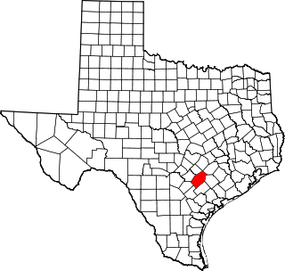
This is intended to be a complete list of properties and districts listed on the National Register of Historic Places in Fayette County, Texas. There are four districts and 19 individual properties listed on the National Register in the county. The individually listed properties include one State Historic Site, five State Antiquities Landmarks, and seven Recorded Texas Historic Landmarks. Three districts together include numerous additional Recorded Texas Historic Landmarks. Three properties were formerly listed on the National Register including one that has since been relisted after relocation.


    This National Park Service list is complete through NPS recent listings posted October 20, 2023. [1]

Current listings

Map all coordinates using: OpenStreetMap

The locations of National Register properties and districts may be seen in a mapping service provided. [2]

[3] Name on the RegisterImageDate listed [4] Location City or townDescription
1 Bedstead Truss Bridge
Bedstead Truss Bridge Bedstead Truss Bridge, Schulenburg, Texas.JPG
Bedstead Truss Bridge
November 29, 2013
(#13000888)
0.1 mi. NW. of jct. of Hillje & Kallus Sts.
29°40′27″N96°54′39″W / 29.67405°N 96.91084°W / 29.67405; -96.91084 (Bedstead Truss Bridge)
Schulenburg State Antiquities Landmark, Recorded Texas Historic Landmark; formerly the Mulberry Creek Bridge, originally listed on the National Register in 1975 (listing number 75001976), removed in May 2013 due to relocation.
2 Bethlehem Lutheran Church
Bethlehem Lutheran Church BethlehemLutheranChurch1 (1 of 1).jpg
Bethlehem Lutheran Church
August 10, 1978
(#78002928)
White St.
30°03′46″N96°41′58″W / 30.062778°N 96.699444°W / 30.062778; -96.699444 (Bethlehem Lutheran Church)
Round Top Recorded Texas Historic Landmark
3 Cummins Creek Bridge
Cummins Creek Bridge Bridge Round Top.JPG
Cummins Creek Bridge
April 21, 1975
(#75001975)
2 mi (3.2 km). NW of Round Top over Cummins Creek
30°04′07″N96°43′09″W / 30.068611°N 96.719167°W / 30.068611; -96.719167 (Cummins Creek Bridge)
Round Top State Antiquities Landmark; replaced in 1996
4 Dubina Historic District
Dubina Historic District Sts Cyril & Methodius Catholic Church in Dubina, Texas.jpg
Dubina Historic District
September 27, 2003
(#03000970)
Roughly bounded by FM 1383 and Cty Rd. 480
29°43′44″N96°50′08″W / 29.728889°N 96.835556°W / 29.728889; -96.835556 (Dubina Historic District)
Dubina
5 East Navidad River Bridge
East Navidad River Bridge GENERAL VIEW OF THE EAST NAVIDAD RIVER BRIDGE, SOUTH SIDE, LOOKING NORTHWEST. - East Navidad River Bridge, Spanning East Navidad River at FM1579, Schulenburg, Fayette County, TX HAER TX,75-SCHU.V,1-2.tif
East Navidad River Bridge
August 18, 2014
(#14000497)
FM 1579 at East Navidad River
29°40′59″N96°50′47″W / 29.682939°N 96.846481°W / 29.682939; -96.846481 (East Navidad River Bridge)
Schulenburg
6 Nathaniel W. Faison House
Nathaniel W. Faison House Faisonhouse2.JPG
Nathaniel W. Faison House
March 11, 2010
(#08000538)
822 S. Jefferson
29°53′57″N96°52′22″W / 29.899206°N 96.872764°W / 29.899206; -96.872764 (Nathaniel W. Faison House)
La Grange Recorded Texas Historic Landmark
7 Fayette County Courthouse and Jail
Fayette County Courthouse and Jail Fayette County Courthouse (1 of 1).jpg
Fayette County Courthouse and Jail
January 23, 1975
(#75001973)
Courthouse Sq. and 104 Main St.
29°54′19″N96°52′43″W / 29.905278°N 96.878611°W / 29.905278; -96.878611 (Fayette County Courthouse and Jail)
La Grange State Antiquities Landmark, includes Recorded Texas Historic Landmark; part of Fayette County Courthouse Square Historic District
8 Fayette County Courthouse Square Historic District
Fayette County Courthouse Square Historic District DowntownLaGrange1 (1 of 1).jpg
Fayette County Courthouse Square Historic District
January 16, 2001
(#00001664)
Roughly bounded by Main, Lafayette, Franklin, Colorado, Jefferson, Washington, and Crockett Sts.
29°54′17″N96°52′39″W / 29.904722°N 96.8775°W / 29.904722; -96.8775 (Fayette County Courthouse Square Historic District)
La Grange Includes Recorded Texas Historic Landmarks
9 Fayetteville Historic District
Fayetteville Historic District Fayetteville downtown1 (1 of 1).jpg
Fayetteville Historic District
July 10, 2008
(#08000657)
Roughly bounded by E. Bell, N. Thompson (FM 1291), E. Fayette, E. Main (SH 159), Post Oak Lane,
29°54′26″N96°40′26″W / 29.90732°N 96.67396°W / 29.90732; -96.67396 (Fayetteville Historic District)
Fayetteville Includes Recorded Texas Historic Landmarks
10 Flatonia Historic District
Flatonia Historic District Flatonia2 (1 of 1).jpg
Flatonia Historic District
June 26, 2017
(#100001223)
Roughly bounded by N. Main, 7th, Middle, Market, 6th, Penn, S. Main & Faires Sts.
29°41′15″N97°06′31″W / 29.687381°N 97.108485°W / 29.687381; -97.108485 (Flatonia Historic District)
Flatonia Includes Recorded Texas Historic Landmarks
11 Mier Expedition and Dawson's Men Monument and Tomb
Mier Expedition and Dawson's Men Monument and Tomb Monument hill monument.jpg
Mier Expedition and Dawson's Men Monument and Tomb
March 6, 2019
(#100003486)
414 TX Loop 92, Monument Hill and Kreische Brewery State Historic Sites.
29°53′20″N96°52′37″W / 29.889027°N 96.876972°W / 29.889027; -96.876972 (Mier Expedition and Dawson's Men Monument and Tomb)
La Grange State Historic Site, State Antiquities Landmark
12 Henry L. Kreische Brewery and House
Henry L. Kreische Brewery and House Kreische brewery remains.jpg
Henry L. Kreische Brewery and House
April 16, 1975
(#75001974)
S of La Grange off U.S. 77 on Monument Hill
29°53′23″N96°52′29″W / 29.889722°N 96.874722°W / 29.889722; -96.874722 (Henry L. Kreische Brewery and House)
La Grange State Historic Site, State Antiquities Landmark
13 Nativity of Mary, Blessed Virgin Catholic Church
Nativity of Mary, Blessed Virgin Catholic Church Blessed virgin catholic church 2008.jpg
Nativity of Mary, Blessed Virgin Catholic Church
June 21, 1983
(#83003136)
FM 2672
29°43′03″N96°55′40″W / 29.7175°N 96.927778°W / 29.7175; -96.927778 (Nativity of Mary, Blessed Virgin Catholic Church)
High Hill
14 William Neese Sr. Homestead
William Neese Sr. Homestead WilliamNeeseHomestead (1 of 1).jpg
William Neese Sr. Homestead
February 18, 1975
(#75001977)
On TX 237
30°01′06″N96°43′54″W / 30.018333°N 96.731667°W / 30.018333; -96.731667 (William Neese Sr. Homestead)
Warrenton
15 Sengelmann Hall and City Meat Market Building
Sengelmann Hall and City Meat Market Building Sengelmann Hall Schulenburg Wiki.jpg
Sengelmann Hall and City Meat Market Building
June 18, 2009
(#09000451)
527 and 529-533 N. Main St.
29°40′47″N96°54′19″W / 29.679822°N 96.905228°W / 29.679822; -96.905228 (Sengelmann Hall and City Meat Market Building)
Schulenburg
16 Simon Pytlovany House April 14, 1975
(#75001972)
1.5 mi (2.4 km). S of Dubina on FR 1383
29°42′45″N96°50′20″W / 29.7125°N 96.838889°W / 29.7125; -96.838889 (Simon Pytlovany House)
Dubina
17 Schulenburg Cotton Compress
Schulenburg Cotton Compress Schulenburgcotton.jpg
Schulenburg Cotton Compress
September 13, 1979
(#79002938)
James and Main Sts.
29°40′43″N96°54′45″W / 29.678611°N 96.9125°W / 29.678611; -96.9125 (Schulenburg Cotton Compress)
Schulenburg
18 St. James Episcopal Church
St. James Episcopal Church St james episcopal church lagrange 2008.jpg
St. James Episcopal Church
June 18, 1976
(#76002026)
Monroe and Colorado Sts.
29°54′29″N96°52′25″W / 29.908056°N 96.873611°W / 29.908056; -96.873611 (St. James Episcopal Church)
La Grange Recorded Texas Historic Landmark
19 St. John the Baptist Catholic Church
St. John the Baptist Catholic Church St john the baptist ammannsville 2012.jpg
St. John the Baptist Catholic Church
June 21, 1983
(#83003137)
FM 1383
29°47′14″N96°51′32″W / 29.787222°N 96.858889°W / 29.787222; -96.858889 (St. John the Baptist Catholic Church)
Ammannsville
20 St. Mary's Church of the Assumption
St. Mary's Church of the Assumption St marys church of the assumption 2008.jpg
St. Mary's Church of the Assumption
June 21, 1983
(#83003138)
FM 1295
29°40′11″N97°04′00″W / 29.669722°N 97.066667°W / 29.669722; -97.066667 (St. Mary's Church of the Assumption)
Praha
21 State Highway 71 Bridge at the Colorado River
State Highway 71 Bridge at the Colorado River State highway 71 bridge at the colorado river.jpg
State Highway 71 Bridge at the Colorado River
October 10, 1996
(#96001120)
TX 71, .8 mi E of jct. with FM 609
29°54′05″N96°53′12″W / 29.901389°N 96.886667°W / 29.901389; -96.886667 (State Highway 71 Bridge at the Colorado River)
La Grange
22 Winedale Inn Complex
Winedale Inn Complex Winedale inn complex 2008.jpg
Winedale Inn Complex
June 22, 1970
(#70000745)
Off FM 1457
30°05′11″N96°38′29″W / 30.086389°N 96.641389°W / 30.086389; -96.641389 (Winedale Inn Complex)
Winedale State Antiquities Landmark, includes Recorded Texas Historic Landmark; now a division of The Center for American History, The University of Texas at Austin
23 Zapp Building
Zapp Building Fayetteville Zapp (1 of 1).jpg
Zapp Building
June 23, 1983
(#83003139)
Fayette and Washington Sts.
29°54′15″N96°40′37″W / 29.904167°N 96.676944°W / 29.904167; -96.676944 (Zapp Building)
Fayetteville Recorded Texas Historic Landmark; part of Fayetteville Historic District; brick two-story Romanesque Revival mercantile building and emporium constructed in 1900.

Former listings

[3] Name on the RegisterImageDate listedDate removedLocationCity or townDescription
1 Buckner's Creek Bridge May 29, 1976
(#76002025)
April 21, 198810 mi. N of Flatonia over Buckner's Creek
Flatonia State Antiquities Landmark; demolished in 1988
2 Mount Eliza July 17, 1978
(#78002927)
August 30, 1994Three miles south of LaGrange on US Highway 77
LaGrange Relocated in 1988.

See also

Related Research Articles

<span class="mw-page-title-main">National Register of Historic Places listings in Bastrop County, Texas</span>

This is a list of the National Register of Historic Places listings in Bastrop County, Texas.

<span class="mw-page-title-main">National Register of Historic Places listings in Williamson County, Texas</span>

This is a list of the National Register of Historic Places listings in Williamson County, Texas.

<span class="mw-page-title-main">National Register of Historic Places listings in San Augustine County, Texas</span>

This is a list of the National Register of Historic Places listings in San Augustine County, Texas.

<span class="mw-page-title-main">National Register of Historic Places listings in Wharton County, Texas</span>

This is a list of the National Register of Historic Places listings in Wharton County, Texas.

<span class="mw-page-title-main">National Register of Historic Places listings in Gillespie County, Texas</span>

This is a list of the National Register of Historic Places listings in Gillespie County, Texas.

<span class="mw-page-title-main">National Register of Historic Places listings in Harrison County, Texas</span>

This is a list of the National Register of Historic Places listings in Harrison County, Texas.

<span class="mw-page-title-main">National Register of Historic Places listings in Fannin County, Texas</span>

This is a list of the National Register of Historic Places listings in Fannin County, Texas.

<span class="mw-page-title-main">National Register of Historic Places listings in Johnson County, Texas</span>

This is a list of the National Register of Historic Places listings in Johnson County, Texas.

<span class="mw-page-title-main">National Register of Historic Places listings in Goliad County, Texas</span>

This is a list of the National Register of Historic Places listings in Goliad County, Texas.

<span class="mw-page-title-main">National Register of Historic Places listings in Brazoria County, Texas</span>

This is a list of the National Register of Historic Places listings in Brazoria County, Texas.

<span class="mw-page-title-main">National Register of Historic Places listings in Comal County, Texas</span>

This is a list of the National Register of Historic Places listings in Comal County, Texas.

<span class="mw-page-title-main">National Register of Historic Places listings in Kendall County, Texas</span>

This is a list of the National Register of Historic Places listings in Kendall County, Texas.

<span class="mw-page-title-main">National Register of Historic Places listings in Gonzales County, Texas</span>

This is a list of the National Register of Historic Places listings in Gonzales County, Texas.

<span class="mw-page-title-main">National Register of Historic Places listings in Grayson County, Texas</span>

This is a list of the National Register of Historic Places listings in Grayson County, Texas.

<span class="mw-page-title-main">National Register of Historic Places listings in Medina County, Texas</span>

This is a list of the National Register of Historic Places listings in Medina County, Texas.

<span class="mw-page-title-main">National Register of Historic Places listings in Aransas County, Texas</span>

This is a list of the National Register of Historic Places listings in Aransas County, Texas.

<span class="mw-page-title-main">National Register of Historic Places listings in Shackelford County, Texas</span>

This is a list of the National Register of Historic Places listings in Shackelford County, Texas.

<span class="mw-page-title-main">National Register of Historic Places listings in Dimmit County, Texas</span>

This is a list of the National Register of Historic Places listings in Dimmit County, Texas.

<span class="mw-page-title-main">National Register of Historic Places listings in Menard County, Texas</span>

This is a list of the National Register of Historic Places listings in Menard County, Texas.

<span class="mw-page-title-main">National Register of Historic Places listings in Kinney County, Texas</span>

This is a list of the National Register of Historic Places listings in Kinney County, Texas.

References

  1. National Park Service, United States Department of the Interior, "National Register of Historic Places: Weekly List Actions", retrieved October 20, 2023.
  2. The latitude and longitude information provided in this table was derived originally from the National Register Information System, which has been found to be fairly accurate for about 99% of listings. Some locations in this table may have been corrected to current GPS standards.
  3. 1 2 Numbers represent an alphabetical ordering by significant words. Various colorings, defined here, differentiate National Historic Landmarks and historic districts from other NRHP buildings, structures, sites or objects.
  4. The eight-digit number below each date is the number assigned to each location in the National Register Information System database, which can be viewed by clicking the number.

Commons-logo.svg Media related to National Register of Historic Places in Fayette County, Texas at Wikimedia Commons