National Register of Historic Places listings in Haywood County, North Carolina

Last updated

North Carolina Map Highlighting Haywood County.PNG

This list includes properties and districts listed on the National Register of Historic Places in Haywood County, North Carolina. Click the "Map of all coordinates" link to the right to view an online map of all properties and districts with latitude and longitude coordinates in the table below. [1]

Contents

Map all coordinates using: OpenStreetMap  
Download coordinates as: KML

Current listings


    This National Park Service list is complete through NPS recent listings posted November 3, 2022. [2]

[3] Name on the Register [4] ImageDate listed [5] Location City or townDescription
1 Boone-Withers House
Boone-Withers House Boone-Withers House, Waynesville, NC (32840903608).jpg
Boone-Withers House
July 21, 1983
(#83001889)
305 Church St.
35°29′26″N82°59′25″W / 35.4906°N 82.9903°W / 35.4906; -82.9903 (Boone-Withers House)
Waynesville
2 Canton Main Street Historic District
Canton Main Street Historic District The Imperial Hotel, Canton, NC (32845310438).jpg
Canton Main Street Historic District
September 7, 2005
(#05000958)
Bounded roughly by Park St., Main St., Bridge St., and Adams St.
35°31′59″N82°50′19″W / 35.5331°N 82.8386°W / 35.5331; -82.8386 (Canton Main Street Historic District)
Canton
3 Cataloochee Historic District November 2, 2022
(#100008348)
Cataloochee Rd., Great Smoky Mountains National Park (GRSM)
35°38′24″N83°04′50″W / 35.6400°N 83.0806°W / 35.6400; -83.0806 (Cataloochee Historic District)
Cataloochee
4 Colonial Theater
Colonial Theater Colonial Theater - Canton NC.jpg
Colonial Theater
March 15, 2000
(#00000226)
55-57 Park St.
35°31′56″N82°50′24″W / 35.5322°N 82.84°W / 35.5322; -82.84 (Colonial Theater)
Canton
5 Davis Family House
Davis Family House Davis Family House.jpg
Davis Family House
December 27, 1996
(#96001527)
N side of NC 1355, .8 miles NW of Ferguson Br. over the Pigeon River
35°37′21″N82°58′26″W / 35.6225°N 82.9739°W / 35.6225; -82.9739 (Davis Family House)
Crabtree
6 Former Citizens Bank and Trust Company Building
Former Citizens Bank and Trust Company Building Citizens Bank and Trust Company Building, Waynesville, NC (39750590633).jpg
Former Citizens Bank and Trust Company Building
March 14, 1991
(#91000261)
161 N. Main St.
35°29′27″N82°59′14″W / 35.4908°N 82.9872°W / 35.4908; -82.9872 (Former Citizens Bank and Trust Company Building)
Waynesville
7 Former US Post Office Building
Former US Post Office Building Old Post Office, Waynesville, NC (39750534163).jpg
Former US Post Office Building
March 14, 1991
(#91000262)
16 S. Main St.
35°29′23″N82°59′18″W / 35.4896°N 82.9883°W / 35.4896; -82.9883 (Former US Post Office Building)
Waynesville
8 Francis Grist Mill
Francis Grist Mill Francis Grist Mill.JPG
Francis Grist Mill
May 1, 2013
(#13000228)
14 Hugh Massie Rd.
35°28′29″N82°57′28″W / 35.4746°N 82.9579°W / 35.4746; -82.9579 (Francis Grist Mill)
Waynesville
9 Frog Level Historic District
Frog Level Historic District Depot Street, Waynesville, NC (45991209244).jpg
Frog Level Historic District
August 28, 2003
(#03000854)
Roughly bounded by Commerce and Boundary Sts., Water St. and Richland Creek, Depot St., and 80 Commerce St.
35°29′40″N82°59′26″W / 35.4944°N 82.9906°W / 35.4944; -82.9906 (Frog Level Historic District)
Waynesville
10 Green Hill Cemetery
Green Hill Cemetery William Thomas Crawford grave at Green Hill Cemetery.jpg
Green Hill Cemetery
June 1, 2018
(#100000897)
Veterans Cir.
35°29′01″N82°59′27″W / 35.4836°N 82.9908°W / 35.4836; -82.9908 (Green Hill Cemetery)
Waynesville
11 James M. Gwyn House July 12, 1984
(#84002335)
NC 276
35°26′48″N82°48′59″W / 35.4467°N 82.8164°W / 35.4467; -82.8164 (James M. Gwyn House)
Cruso
12 Haywood County Courthouse
Haywood County Courthouse Haywood County Courthouse, Waynesville, NC (45800478465).jpg
Haywood County Courthouse
May 10, 1979
(#79001721)
Main and Depot Sts.
35°29′33″N82°59′14″W / 35.4925°N 82.9872°W / 35.4925; -82.9872 (Haywood County Courthouse)
Waynesville
13 Haywood County Hospital
Haywood County Hospital Old Haywood County Hospital, Waynesville, NC (46715374811).jpg
Haywood County Hospital
June 18, 2018
(#100002596)
1230 N. Main St.
35°29′49″N82°58′20″W / 35.4969°N 82.9722°W / 35.4969; -82.9722 (Haywood County Hospital)
Waynesville
14 Alden and Thomasene Howell House
Alden and Thomasene Howell House Alden and Thomasene Howell House.jpg
Alden and Thomasene Howell House
April 22, 2003
(#03000300)
129 Woolsey Heights
35°29′42″N82°58′47″W / 35.495°N 82.9797°W / 35.495; -82.9797 (Alden and Thomasene Howell House)
Waynesville
15 Lambuth Inn
Lambuth Inn Lambuth Inn, Lake Junaluska, NC (46642287502).jpg
Lambuth Inn
July 29, 1982
(#82003466)
Lambeth Dr.
35°31′44″N82°58′01″W / 35.5289°N 82.9669°W / 35.5289; -82.9669 (Lambuth Inn)
Lake Junaluska
16 Masonic Hall
Masonic Hall Old Masonic Hall, Waynesville, NC (31773979077).jpg
Masonic Hall
June 9, 1988
(#88000729)
37 Church St.
35°29′23″N82°59′20″W / 35.4897°N 82.9889°W / 35.4897; -82.9889 (Masonic Hall)
Waynesville
17 Mount Zion United Methodist Church
Mount Zion United Methodist Church Mount Zion United Methodist Church, Crabtree, NC.jpg
Mount Zion United Methodist Church
February 5, 1986
(#86000156)
SR 1503
35°36′18″N82°54′14″W / 35.605°N 82.9039°W / 35.605; -82.9039 (Mount Zion United Methodist Church)
Crabtree
18 Patton Farm
Patton Farm Patton Farmhouse, West Canton, NC.jpg
Patton Farm
November 10, 1980
(#80002845)
SW of Canton
35°32′20″N82°52′34″W / 35.5389°N 82.8761°W / 35.5389; -82.8761 (Patton Farm)
Phillipsville
19 Pigeon Street School April 26, 2021
(#100006459)
450 Pigeon St.
35°29′02″N82°58′59″W / 35.4840°N 82.9830°W / 35.4840; -82.9830 (Pigeon Street School)
Waynesville
20 Charles and Annie Quinlan House
Charles and Annie Quinlan House Charles and Annie Quinlan House.jpg
Charles and Annie Quinlan House
September 7, 2005
(#05000959)
274 S. Main St.
35°29′12″N82°59′27″W / 35.4868°N 82.9907°W / 35.4868; -82.9907 (Charles and Annie Quinlan House)
Waynesville
21 Clyde H. Ray Sr. House
Clyde H. Ray Sr. House Clyde H. Ray Sr. House.jpg
Clyde H. Ray Sr. House
October 22, 1996
(#96001089)
80312 Love Ln.
35°29′49″N82°59′32″W / 35.4969°N 82.9922°W / 35.4969; -82.9922 (Clyde H. Ray Sr. House)
Waynesville
22 Shackford Hall
Shackford Hall Shackford Hall, Lake Junaluska, NC (45970267024).jpg
Shackford Hall
April 25, 2001
(#01000419)
80 Shackford Hall Rd.
35°31′28″N82°58′41″W / 35.524444°N 82.978056°W / 35.524444; -82.978056 (Shackford Hall)
Lake Junaluska
23 Shelton House
Shelton House The Shelton House, Waynesville, NC (39750418213).jpg
Shelton House
January 31, 1979
(#79001722)
307 Shelton St.
35°29′05″N82°59′09″W / 35.484722°N 82.985833°W / 35.484722; -82.985833 (Shelton House)
Waynesville
24 Shook-Welch-Smathers House
Shook-Welch-Smathers House Shook House, Clyde, NC (32820465158).jpg
Shook-Welch-Smathers House
September 12, 2008
(#08000891)
178 Morgan St.
35°31′54″N82°55′05″W / 35.531675°N 82.918003°W / 35.531675; -82.918003 (Shook-Welch-Smathers House)
Clyde
25 Frank Smathers House
Frank Smathers House Frank Smathers House, Waynesville, NC (45991228464).jpg
Frank Smathers House
July 10, 1998
(#98000730)
724 Smathers St.
35°30′24″N82°58′51″W / 35.506667°N 82.980833°W / 35.506667; -82.980833 (Frank Smathers House)
Waynesville
26 Spread Out Historic District
Spread Out Historic District First Presbyterian Church, Waynesville, NC (46663067542).jpg
Spread Out Historic District
December 28, 2010
(#10001095)
Roughly bounded by N. Main St., Walnut St., and Beech St.
35°29′51″N82°58′45″W / 35.497500°N 82.979167°W / 35.497500; -82.979167 (Spread Out Historic District)
Waynesville
27 Dr. J. Howell Way House
Dr. J. Howell Way House Dr. J. Howell Way House.jpg
Dr. J. Howell Way House
September 11, 1980
(#80002846)
301 S. Main St.
35°29′16″N82°59′21″W / 35.487778°N 82.989167°W / 35.487778; -82.989167 (Dr. J. Howell Way House)
Waynesville
28 Waynesville Main Street Historic District
Waynesville Main Street Historic District Main Street, Waynesville, NC (46715558161).jpg
Waynesville Main Street Historic District
December 16, 2005
(#05001414)
Roughly bounded by Depot St., Church and E. Sts, Wall St., and Montgomery St.
35°29′29″N82°59′15″W / 35.491389°N 82.987500°W / 35.491389; -82.987500 (Waynesville Main Street Historic District)
Waynesville
29 West Fork Pigeon River Pratt Truss Bridge
West Fork Pigeon River Pratt Truss Bridge West Fork Pigeon River Pratt Truss Bridge, Bethel, NC.jpg
West Fork Pigeon River Pratt Truss Bridge
January 10, 2019
(#100003296)
Spans the West Fork of Pigeon R. between L. Logan Rd. & Heavenly Dr, .6 mi. S of US 276
35°27′49″N82°54′00″W / 35.4636°N 82.9000°W / 35.4636; -82.9000 (West Fork Pigeon River Pratt Truss Bridge)
Bethel
30 Windover
Windover Windover Inn, Waynesville, NC.jpg
Windover
January 25, 2018
(#100002048)
40 Old Hickory St.
35°29′13″N83°00′05″W / 35.487041°N 83.001349°W / 35.487041; -83.001349 (Windover)
Waynesville

See also

Related Research Articles

<span class="mw-page-title-main">National Register of Historic Places listings in Alamance County, North Carolina</span>

This list includes properties and districts listed on the National Register of Historic Places in Alamance County, North Carolina. Click the "Map of all coordinates" link to the right to view an online map of all properties and districts with latitude and longitude coordinates in the table below.

<span class="mw-page-title-main">National Register of Historic Places listings in Craven County, North Carolina</span>

This list includes properties and districts listed on the National Register of Historic Places in Craven County, North Carolina. Click the "Map of all coordinates" link to the right to view an online map of all properties and districts with latitude and longitude coordinates in the table below.

<span class="mw-page-title-main">National Register of Historic Places listings in Warren County, North Carolina</span>

This list includes properties and districts listed on the National Register of Historic Places in Warren County, North Carolina. Click the "Map of all coordinates" link to the right to view a Google map of all properties and districts with latitude and longitude coordinates in the table below.

<span class="mw-page-title-main">National Register of Historic Places listings in Martin County, North Carolina</span>

This list includes properties and districts listed on the National Register of Historic Places in Martin County, North Carolina. Click the "Map of all coordinates" link to the right to view an online map of all properties and districts with latitude and longitude coordinates in the table below.

<span class="mw-page-title-main">National Register of Historic Places listings in Lenoir County, North Carolina</span>

This list includes properties and districts listed on the National Register of Historic Places in Lenoir County, North Carolina. Click the "Map of all coordinates" link to the right to view an online map of all properties and districts with latitude and longitude coordinates in the table below.

<span class="mw-page-title-main">National Register of Historic Places listings in Chowan County, North Carolina</span>

This list includes properties and districts listed on the National Register of Historic Places in Chowan County, North Carolina. Click the "Map of all coordinates" link to the right to view a Google map of all properties and districts with latitude and longitude coordinates in the table below.

<span class="mw-page-title-main">National Register of Historic Places listings in Bertie County, North Carolina</span>

This list includes properties and districts listed on the National Register of Historic Places in Bertie County, North Carolina. Click the "Map of all coordinates" link to the right to view an online map of all properties and districts with latitude and longitude coordinates in the table below.

<span class="mw-page-title-main">National Register of Historic Places listings in Ashe County, North Carolina</span>

This list includes properties and districts listed on the National Register of Historic Places in Ashe County, North Carolina. Click the "Map of all coordinates" link to the right to view an online map of all properties and districts with latitude and longitude coordinates in the table below.

<span class="mw-page-title-main">National Register of Historic Places listings in Vance County, North Carolina</span>

This list includes properties and districts listed on the National Register of Historic Places in Vance County, North Carolina. Click the "Map of all coordinates" link to the right to view an online map of all properties and districts with latitude and longitude coordinates in the table below.

<span class="mw-page-title-main">National Register of Historic Places listings in Cleveland County, North Carolina</span>

This list includes properties and districts listed on the National Register of Historic Places in Cleveland County, North Carolina. Click the "Map of all coordinates" link to the right to view an online map of all properties and districts with latitude and longitude coordinates in the table below.

<span class="mw-page-title-main">National Register of Historic Places listings in Perquimans County, North Carolina</span>

This list includes properties and districts listed on the National Register of Historic Places in Perquimans County, North Carolina. Click the "Map of all coordinates" link to the right to view a Google map of all properties and districts with latitude and longitude coordinates in the table below.

<span class="mw-page-title-main">National Register of Historic Places listings in Onslow County, North Carolina</span>

This list includes properties and districts listed on the National Register of Historic Places in Onslow County, North Carolina. Click the "Map of all coordinates" link to the right to view a Google map of all properties and districts with latitude and longitude coordinates in the table below.

<span class="mw-page-title-main">National Register of Historic Places listings in Northampton County, North Carolina</span>

This list includes properties and districts listed on the National Register of Historic Places in Northampton County, North Carolina. Click the "Map of all coordinates" link to the right to view an online map of all properties and districts with latitude and longitude coordinates in the table below.

<span class="mw-page-title-main">National Register of Historic Places listings in Pender County, North Carolina</span>

This list includes properties and districts listed on the National Register of Historic Places in Pender County, North Carolina. Click the "Map of all coordinates" link to the right to view an online map of all properties and districts with latitude and longitude coordinates in the table below.

<span class="mw-page-title-main">National Register of Historic Places listings in Union County, North Carolina</span>

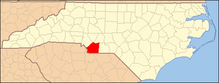
This list includes properties and districts listed on the National Register of Historic Places in Union County, North Carolina. Click the "Map of all coordinates" link to the right to view a Google map of all properties and districts with latitude and longitude coordinates in the table below.

This list includes properties and districts listed on the National Register of Historic Places in Avery County, North Carolina. Click the "Map of all coordinates" link to the right to view an online map of all properties and districts with latitude and longitude coordinates in the table below.

<span class="mw-page-title-main">National Register of Historic Places listings in Greene County, North Carolina</span>

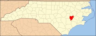
This list includes properties and districts listed on the National Register of Historic Places in Greene County, North Carolina. Click the "Map of all coordinates" link to the right to view a Google map of all properties and districts with latitude and longitude coordinates in the table below.

<span class="mw-page-title-main">National Register of Historic Places listings in Tyrrell County, North Carolina</span>

This list includes properties and districts listed on the National Register of Historic Places in Tyrrell County, North Carolina. Click the "Map of all coordinates" link to the right to view a Google map of all properties and districts with latitude and longitude coordinates in the table below.

<span class="mw-page-title-main">National Register of Historic Places listings in Columbus County, North Carolina</span>

This list includes properties and districts listed on the National Register of Historic Places in Columbus County, North Carolina. Click the "Map of all coordinates" link to the right to view an online map of all properties and districts with latitude and longitude coordinates in the table below.

<span class="mw-page-title-main">National Register of Historic Places listings in McDowell County, North Carolina</span>

This list includes properties and districts listed on the National Register of Historic Places in McDowell County, North Carolina. Click the "Map of all coordinates" link to the right to view a Google map of all properties and districts with latitude and longitude coordinates in the table below.

References

  1. The latitude and longitude information provided in this table was derived originally from the National Register Information System, which has been found to be fairly accurate for about 99% of listings. Some locations in this table may have been corrected to current GPS standards.
  2. National Park Service, United States Department of the Interior, "National Register of Historic Places: Weekly List Actions", retrieved November 3, 2022.
  3. Numbers represent an alphabetical ordering by significant words. Various colorings, defined here, differentiate National Historic Landmarks and historic districts from other NRHP buildings, structures, sites or objects.
  4. "National Register Information System". National Register of Historic Places . National Park Service. April 24, 2008.
  5. The eight-digit number below each date is the number assigned to each location in the National Register Information System database, which can be viewed by clicking the number.