National Register of Historic Places listings in Ingham County, Michigan

Last updated

Location of Ingham County in Michigan Map of Michigan highlighting Ingham County.svg
Location of Ingham County in Michigan

This is a list of the National Register of Historic Places listings in Ingham County, Michigan.

Contents

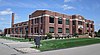
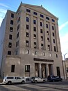
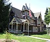
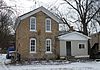
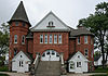
This is intended to be a complete list of the properties and districts on the National Register of Historic Places in Ingham County, Michigan, United States. The locations of National Register properties and districts for which the latitude and longitude coordinates are included below, may be seen in an online map. [1]

There are 52 properties and districts listed on the National Register in the county, including 1 National Historic Landmark.


    This National Park Service list is complete through NPS recent listings posted December 1, 2023. [2]

Map all coordinates using: OpenStreetMap

Current listings

[3] Name on the Register [4] ImageDate listed [5] Location City or townDescription
1 Arbaugh's Department Store Building
Arbaugh's Department Store Building Arbaugh Department Store.jpg
Arbaugh's Department Store Building
July 20, 2007
(#07000748)
401 S. Washington
42°43′46″N84°33′07″W / 42.729444°N 84.551944°W / 42.729444; -84.551944 (Arbaugh's Department Store Building)
Lansing
2 Ash Street-Sycamore Creek Bridge
Ash Street-Sycamore Creek Bridge Ash Street Bridge Mason.jpg
Ash Street-Sycamore Creek Bridge
January 14, 2000
(#99001673)
M-36 over Sycamore Creek
42°34′45″N84°26′51″W / 42.579167°N 84.4475°W / 42.579167; -84.4475 (Ash Street-Sycamore Creek Bridge)
Mason
3 Bailey Buildings
Bailey Buildings View of the Bailey Building from across the street, as seen in October 2021.jpg
Bailey Buildings
April 8, 2021
(#100006364)
513 West Ionia St.
42°44′09″N84°33′33″W / 42.735833°N 84.559167°W / 42.735833; -84.559167 (Bailey Buildings)
Lansing
4 Barnes Avenue School
Barnes Avenue School Barnes Avenue School 1920.jpg
Barnes Avenue School
November 30, 2023
(#100008811)
1028 West Barnes Ave.
42°42′55″N84°34′00″W / 42.715278°N 84.566667°W / 42.715278; -84.566667 (Barnes Avenue School)
Lansing
5 Brown-Price House
Brown-Price House Brown-Price House Lansing.JPG
Brown-Price House
March 22, 1984
(#84001429)
1003 N. Washington Ave.
42°44′42″N84°33′09″W / 42.745°N 84.5525°W / 42.745; -84.5525 (Brown-Price House)
Lansing
6 Capital Bank Tower
Capital Bank Tower BojiTower.jpg
Capital Bank Tower
December 6, 2005
(#05001357)
124 W. Allegan St.
42°43′58″N84°33′11″W / 42.732778°N 84.553056°W / 42.732778; -84.553056 (Capital Bank Tower)
Lansing Now known as Boji Tower
7 Central Methodist Episcopal Church
Central Methodist Episcopal Church Central Methodist Church.jpg
Central Methodist Episcopal Church
September 17, 1980
(#80001864)
215 N. Capitol Ave.
42°44′06″N84°33′16″W / 42.735°N 84.554444°W / 42.735; -84.554444 (Central Methodist Episcopal Church)
Lansing
8 Central School
Central School Central School East Lansing MI.JPG
Central School
April 10, 1986
(#86000709)
325 W. Grand River Ave.
42°44′11″N84°29′20″W / 42.736389°N 84.488889°W / 42.736389; -84.488889 (Central School)
East Lansing
89 Courthouse Square Historic District
Courthouse Square Historic District Downtown Buildings -- Mason, Michigan.jpg
Courthouse Square Historic District
June 6, 1985
(#85001243)
Bounded by Park, E. Columbia, Rodgers and South
42°34′43″N84°26′31″W / 42.578611°N 84.441944°W / 42.578611; -84.441944 (Courthouse Square Historic District)
Mason
10 Dodge Mansion
Dodge Mansion Turner-Dodge House Lansing.JPG
Dodge Mansion
September 14, 1972
(#72000621)
106 E. North St.
42°45′03″N84°33′08″W / 42.750833°N 84.552222°W / 42.750833; -84.552222 (Dodge Mansion)
Lansing
11 Emery Houses
Emery Houses The Emery Houses 326-328.jpg
Emery Houses
December 10, 1993
(#93001409)
320-322 and 326-328 W. Ottawa
42°44′05″N84°33′25″W / 42.734722°N 84.556944°W / 42.734722; -84.556944 (Emery Houses)
Lansing
12 Eustace Hall†
Eustace Hall+ MSU Eustace Cole Hall.jpg
Eustace Hall†
September 3, 1971
(#71000395)
470 W. Circle Dr.
42°43′57″N84°28′47″W / 42.7325°N 84.479722°W / 42.7325; -84.479722 (Eustace Hall†)
East Lansing
13 Federal Building
Federal Building Federal Building Lansing.jpg
Federal Building
September 17, 1980
(#80001865)
315 W. Allegan St.
42°43′55″N84°33′23″W / 42.731944°N 84.556389°W / 42.731944; -84.556389 (Federal Building)
Lansing
14 First Baptist Church
First Baptist Church First Baptist Church in Lansing.jpg
First Baptist Church
September 17, 1980
(#80001866)
227 N. Capitol Ave.
42°44′08″N84°33′16″W / 42.735556°N 84.554444°W / 42.735556; -84.554444 (First Baptist Church)
Lansing
15 Franklin Avenue Presbyterian Church
Franklin Avenue Presbyterian Church North Presbyterian Church Lansing south view.JPG
Franklin Avenue Presbyterian Church
May 27, 1988
(#88000564)
108 W. Grand River Ave.
42°44′53″N84°33′08″W / 42.748056°N 84.552222°W / 42.748056; -84.552222 (Franklin Avenue Presbyterian Church)
Lansing
16 Walter H. French Junior High School
Walter H. French Junior High School Walter French Jr High School Lansing.jpg
Walter H. French Junior High School
December 30, 2014
(#14001097)
1900 S. Cedar St.
42°42′40″N84°32′54″W / 42.7112°N 84.5483°W / 42.7112; -84.5483 (Walter H. French Junior High School)
Lansing
17 Genesee Street School
Genesee Street School Genesee St School Lansing.JPG
Genesee Street School
April 7, 2014
(#14000124)
835 W. Genesee St.
42°44′19″N84°33′49″W / 42.738595°N 84.563609°W / 42.738595; -84.563609 (Genesee Street School)
Lansing
18 Richard and Deborah (Brough) Glaister House
Richard and Deborah (Brough) Glaister House Richard and Deborah (Brought) Glaister House.jpg
Richard and Deborah (Brough) Glaister House
March 21, 2017
(#100000763)
402 S. Walnut St.
42°43′47″N84°33′26″W / 42.729765°N 84.557334°W / 42.729765; -84.557334 (Richard and Deborah (Brough) Glaister House)
Lansing
19 Goetsch-Winckler House
Goetsch-Winckler House Goetsch Winckler House, 2009.jpg
Goetsch-Winckler House
December 13, 1995
(#95001423)
2410 Hulett Rd., Meridian Township
42°42′29″N84°26′21″W / 42.708056°N 84.439167°W / 42.708056; -84.439167 (Goetsch-Winckler House)
Okemos
20 Grand Trunk Western Rail Station/Lansing Depot
Grand Trunk Western Rail Station/Lansing Depot Grand Trunk Depot Lansing.jpg
Grand Trunk Western Rail Station/Lansing Depot
July 3, 1980
(#80004605)
1203 S. Washington Ave.
42°43′10″N84°33′05″W / 42.719444°N 84.551389°W / 42.719444; -84.551389 (Grand Trunk Western Rail Station/Lansing Depot)
Lansing
21 Ingham County Courthouse
Ingham County Courthouse Ingham County Courthouse Mason.jpg
Ingham County Courthouse
December 13, 1971
(#71000397)
315 S. Jefferson St.
42°34′47″N84°26′33″W / 42.5797°N 84.4425°W / 42.5797; -84.4425 (Ingham County Courthouse)
Mason
22 J.W. Knapp Company Building
J.W. Knapp Company Building Knapps Building.jpg
J.W. Knapp Company Building
May 21, 1983
(#83000851)
300 S. Washington Ave.
42°43′52″N84°33′10″W / 42.731111°N 84.552778°W / 42.731111; -84.552778 (J.W. Knapp Company Building)
Lansing
23 Lansing Artillery Michigan National Guard Armory
Lansing Artillery Michigan National Guard Armory National Guard Armory Lansing.jpg
Lansing Artillery Michigan National Guard Armory
December 13, 2010
(#10001025)
330 Marshall St.
42°44′14″N84°31′31″W / 42.7373°N 84.5253°W / 42.7373; -84.5253 (Lansing Artillery Michigan National Guard Armory)
Lansing
24 Lansing Downtown Historic District
Lansing Downtown Historic District Michigan National Tower Profile.JPG
Lansing Downtown Historic District
July 22, 2009
(#09000551)
N. and S. Washington, Grand, N. and S. Capitol, Michigan Ave., Allegan, Washtenaw, Kalamazoo, Lenawee, and Townsend
42°43′53″N84°33′11″W / 42.731331°N 84.553039°W / 42.731331; -84.553039 (Lansing Downtown Historic District)
Lansing
25 Lansing Woman's Club Building
Lansing Woman's Club Building The Lansing Woman's Club Building.jpg
Lansing Woman's Club Building
September 17, 1980
(#80001867)
118 W. Ottawa St.
42°44′05″N84°33′11″W / 42.734722°N 84.553056°W / 42.734722; -84.553056 (Lansing Woman's Club Building)
Lansing
26 Maple Grove Cemetery
Maple Grove Cemetery Maple Grove Cemetery.jpg
Maple Grove Cemetery
June 6, 1985
(#85001237)
W. Columbia St.
42°35′03″N84°26′44″W / 42.584167°N 84.445556°W / 42.584167; -84.445556 (Maple Grove Cemetery)
Mason
27 Masonic Temple Building
Masonic Temple Building Masonic Temple East Lansing MI.JPG
Masonic Temple Building
March 29, 1999
(#98001083)
314 M.A.C. Ave.
42°44′10″N84°28′49″W / 42.736111°N 84.480278°W / 42.736111; -84.480278 (Masonic Temple Building)
East Lansing
28 Masonic Temple Building
Masonic Temple Building Masonic Temple Building Cooley Law School.jpg
Masonic Temple Building
September 17, 1980
(#80001868)
217 S. Capitol Ave.
42°43′55″N84°33′12″W / 42.731944°N 84.553333°W / 42.731944; -84.553333 (Masonic Temple Building)
Lansing
29 Merrylees-Post House
Merrylees-Post House Merrylees-Post House Mason.jpg
Merrylees-Post House
June 6, 1985
(#85001238)
519 W. Ash St.
42°34′44″N84°27′04″W / 42.578889°N 84.451111°W / 42.578889; -84.451111 (Merrylees-Post House)
Mason
30 Michigan Central Railroad Mason Depot
Michigan Central Railroad Mason Depot Mason Depot.jpg
Michigan Central Railroad Mason Depot
June 6, 1985
(#85001239)
111 N. Mason St.
42°34′58″N84°26′55″W / 42.582778°N 84.448611°W / 42.582778; -84.448611 (Michigan Central Railroad Mason Depot)
Mason
31 Michigan Millers Mutual Fire Insurance Company Building
Michigan Millers Mutual Fire Insurance Company Building 120 W Ottawa Lansing.jpg
Michigan Millers Mutual Fire Insurance Company Building
September 17, 1980
(#80001869)
120-122 W. Ottawa St.
42°44′05″N84°33′12″W / 42.734722°N 84.553333°W / 42.734722; -84.553333 (Michigan Millers Mutual Fire Insurance Company Building)
Lansing
32 Michigan School for the Blind
Michigan School for the Blind Michigan School for the Blind administration building Lansing.jpg
Michigan School for the Blind
July 26, 2018
(#100002714)
715 W. Willow St.
42°44′54″N84°33′53″W / 42.7483°N 84.5647°W / 42.7483; -84.5647 (Michigan School for the Blind)
Lansing
33 Michigan State Capitol
Michigan State Capitol 71msc 1.jpg
Michigan State Capitol
January 25, 1971
(#71000396)
Capitol and Michigan Aves.
42°44′01″N84°33′20″W / 42.733611°N 84.555556°W / 42.733611; -84.555556 (Michigan State Capitol)
Lansing
34 Michigan State Medical Society Building
Michigan State Medical Society Building Michigan State Medical Society.jpg
Michigan State Medical Society Building
November 30, 2011
(#11000864)
120 W. Saginaw St.
42°44′49″N84°29′05″W / 42.746823°N 84.484606°W / 42.746823; -84.484606 (Michigan State Medical Society Building)
East Lansing
35 Darius B. Moon House
Darius B. Moon House Darius B Moon House Lansing.jpg
Darius B. Moon House
November 30, 1982
(#82000535)
216 Huron St.
42°43′56″N84°34′18″W / 42.7321°N 84.5718°W / 42.7321; -84.5718 (Darius B. Moon House)
Lansing
36 J.H. Moores Memorial Natatorium
J.H. Moores Memorial Natatorium J H Moores Memorial Natatorium Lansing.jpg
J.H. Moores Memorial Natatorium
January 14, 1985
(#85000096)
420 Moores River Dr.
42°43′01″N84°33′23″W / 42.716944°N 84.556389°W / 42.716944; -84.556389 (J.H. Moores Memorial Natatorium)
Lansing
37 Mutual Building
Mutual Building Mutual Building.jpg
Mutual Building
September 17, 1980
(#80001870)
208 N. Capitol Ave.
42°44′07″N84°33′13″W / 42.735278°N 84.553611°W / 42.735278; -84.553611 (Mutual Building)
Lansing
38 Philip Nice House
Philip Nice House Philip Nice House Mason.jpg
Philip Nice House
June 6, 1985
(#85001240)
321 Center St.
42°34′59″N84°26′52″W / 42.583056°N 84.447778°W / 42.583056; -84.447778 (Philip Nice House)
Mason
39 North Lansing Historic Commercial District
North Lansing Historic Commercial District Dickens Village 2008 019 (Small).jpg
North Lansing Historic Commercial District
April 30, 1976
(#76001029)
611 East-127 West Cesar E. Chavez Ave., 1207-1250 Turner Rd., 901-1135 North Washington St., and adjacent streets
42°44′52″N84°33′00″W / 42.747778°N 84.55°W / 42.747778; -84.55 (North Lansing Historic Commercial District)
Lansing 
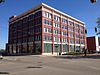
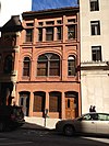
The portion of the district designated in 1976 included buildings within a one-block radius of the intersection of Turner Street and Cesar E. Chavez Avenue (then Grand River Avenue). A boundary increase was approved in 2021 expanding the district to the listed boundaries.
40 Ottawa Street Power Station
Ottawa Street Power Station 7135 oss.jpg
Ottawa Street Power Station
November 26, 2008
(#08001103)
217 E. Ottawa St.
42°44′05″N84°33′02″W / 42.734639°N 84.550444°W / 42.734639; -84.550444 (Ottawa Street Power Station)
Lansing
41 Prudden Wheel Company Building
Prudden Wheel Company Building Prudden Building Lansing 2.jpg
Prudden Wheel Company Building
May 30, 2007
(#07000478)
707 Prudden St.
42°44′27″N84°32′33″W / 42.740833°N 84.5425°W / 42.740833; -84.5425 (Prudden Wheel Company Building)
Lansing
42 Pulver Brothers Filling Station
Pulver Brothers Filling Station Pulver Brothers Filling Station.jpg
Pulver Brothers Filling Station
August 4, 2016
(#16000507)
127 W. Grand River Ave.
42°44′50″N84°33′12″W / 42.747214°N 84.553469°W / 42.747214; -84.553469 (Pulver Brothers Filling Station)
Lansing
43 John Rayner House
John Rayner House John Raynor House Mason.jpg
John Rayner House
June 6, 1985
(#85001241)
725 E. Ash St.
42°34′42″N84°25′53″W / 42.578333°N 84.431389°W / 42.578333; -84.431389 (John Rayner House)
Mason
44 Smith-Turner House
Smith-Turner House Smith-Turner House Lansing.JPG
Smith-Turner House
July 11, 1980
(#80004604)
326 W. Grand River Ave.
42°44′51″N84°33′24″W / 42.7475°N 84.556667°W / 42.7475; -84.556667 (Smith-Turner House)
Lansing
45 Somerville Barn
Somerville Barn Somerville Barn.jpg
Somerville Barn
March 17, 2005
(#05000152)
1050 N. College Rd.
42°36′45″N84°28′59″W / 42.6125°N 84.483056°W / 42.6125; -84.483056 (Somerville Barn)
Alaiedon Township
46 St. Katherine's Chapel
St. Katherine's Chapel St. Katherine's Episcopal Chapel, 4650 Meridian Road, Williamston Twp (Ingham County, Michigan).jpg
St. Katherine's Chapel
July 8, 1970
(#70000272)
4650 Meridian Rd.,
42°43′07″N84°21′43″W / 42.718611°N 84.361944°W / 42.718611; -84.361944 (St. Katherine's Chapel)
Williamstown Township
47 St. Mary Cathedral
St. Mary Cathedral St. Mary Cathedral (Lansing, Michigan).jpg
St. Mary Cathedral
November 2, 1990
(#90001716)
229 Seymour St.
42°44′08″N84°33′22″W / 42.735556°N 84.556111°W / 42.735556; -84.556111 (St. Mary Cathedral)
Lansing
48 State Office Building
State Office Building Lewis Cass Office Building Lansing.jpg
State Office Building
May 17, 1984
(#84001432)
320 S. Walnut St.
42°43′50″N84°33′28″W / 42.730556°N 84.557778°W / 42.730556; -84.557778 (State Office Building)
Lansing
49 Stockbridge Town Hall
Stockbridge Town Hall Stockbridge Town Hall.jpg
Stockbridge Town Hall
March 10, 1980
(#80001872)
101 S. Clinton St.
42°27′02″N84°10′46″W / 42.450556°N 84.179444°W / 42.450556; -84.179444 (Stockbridge Town Hall)
Stockbridge
50 Strand Theatre and Arcade
Strand Theatre and Arcade Strand Theatre.jpg
Strand Theatre and Arcade
September 17, 1980
(#80001871)
211-219 S. Washington Ave.
42°43′55″N84°33′05″W / 42.731944°N 84.551389°W / 42.731944; -84.551389 (Strand Theatre and Arcade)
Lansing
51 Union Depot†
Union Depot+ LansingUnionDepot.JPG
Union Depot†
July 21, 1995
(#95000869)
637 E. Michigan Ave.
42°44′04″N84°32′36″W / 42.734444°N 84.543333°W / 42.734444; -84.543333 (Union Depot†)
Lansing
52 Westside Neighborhood Historic District
Westside Neighborhood Historic District Westside Historic District Mason.jpg
Westside Neighborhood Historic District
June 6, 1985
(#85001242)
Roughly bounded by W. Maple, W. Ash, Lansing and McRoberts Sts.
42°34′47″N84°26′56″W / 42.579722°N 84.448889°W / 42.579722; -84.448889 (Westside Neighborhood Historic District)
Mason
53 Williamston Downtown Historic District
Williamston Downtown Historic District Downtown Williamston.jpg
Williamston Downtown Historic District
December 12, 2012
(#12001029)
1st blocks of E. & W. Grand River Ave. & S. Putnam St.
42°41′21″N84°17′00″W / 42.68923°N 84.2832°W / 42.68923; -84.2832 (Williamston Downtown Historic District)
Williamston

Former listings

[3] Name on the RegisterImageDate listedDate removedLocationCity or townDescription
1 Benjamin Davis House
Benjamin Davis House DavisHouseLansing.png
Benjamin Davis House
February 7, 1972
(#72001589)
September 11, 1972528 S. Washington Ave.
42°43′40″N84°33′00″W / 42.727778°N 84.55°W / 42.727778; -84.55 (Benjamin Davis House)
Lansing Demolished in 1972.
2 Reo Motor Car Company Plant
Reo Motor Car Company Plant Reo factory 1977.jpg
Reo Motor Car Company Plant
June 2, 1978
(#78001500)
March 5, 19862100 S. Washington St.
42°42′35″N84°33′20″W / 42.70973°N 84.55556°W / 42.70973; -84.55556 (Reo Motor Car Company Plant)
Lansing Demolished by January 14, 1980. Formerly a National Historic Landmark. [6]

See also

Related Research Articles

<span class="mw-page-title-main">National Register of Historic Places listings in Alger County, Michigan</span>

This is a list of the National Register of Historic Places listings in Alger County, Michigan.

<span class="mw-page-title-main">National Register of Historic Places listings in Berrien County, Michigan</span>

This is a list of the National Register of Historic Places listings in Berrien County, Michigan.

<span class="mw-page-title-main">National Register of Historic Places listings in Cheboygan County, Michigan</span>

This is a list of the National Register of Historic Places listings in Cheboygan County, Michigan.

<span class="mw-page-title-main">National Register of Historic Places listings in Chippewa County, Michigan</span>

This is a list of the National Register of Historic Places listings in Chippewa County, Michigan.

<span class="mw-page-title-main">National Register of Historic Places listings in Emmet County, Michigan</span>

This is a list of the National Register of Historic Places listings in Emmet County, Michigan.

<span class="mw-page-title-main">National Register of Historic Places listings in Leelanau County, Michigan</span>

This is a list of the National Register of Historic Places listings in Leelanau County, Michigan.

<span class="mw-page-title-main">National Register of Historic Places listings in Jackson County, Michigan</span>

This is a list of the National Register of Historic Places listings in Jackson County, Michigan.

<span class="mw-page-title-main">National Register of Historic Places listings in Menominee County, Michigan</span>

This is a list of the National Register of Historic Places listings in Menominee County, Michigan.

<span class="mw-page-title-main">National Register of Historic Places listings in Manistee County, Michigan</span>

This is a list of the National Register of Historic Places listings in Manistee County, Michigan.

<span class="mw-page-title-main">National Register of Historic Places listings in Marquette County, Michigan</span>

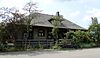
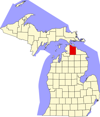
There are 40 properties or districts on the National Register of Historic Places in Marquette County in the US state of Michigan. The locations of National Register properties and districts in Marquette County for which the latitude and longitude coordinates are included below, may be seen in a map.

<span class="mw-page-title-main">National Register of Historic Places listings in Mackinac County, Michigan</span>

This is a list of the National Register of Historic Places listings in Mackinac County, Michigan.

<span class="mw-page-title-main">National Register of Historic Places listings in Sanilac County, Michigan</span>

This is a list of the National Register of Historic Places listings in Sanilac County, Michigan.

<span class="mw-page-title-main">National Register of Historic Places listings in St. Joseph County, Michigan</span>

This is a list of the National Register of Historic Places listings in St. Joseph County, Michigan.

<span class="mw-page-title-main">National Register of Historic Places listings in Washington County, Virginia</span>

This is a list of the National Register of Historic Places listings in Washington County, Virginia.

<span class="mw-page-title-main">National Register of Historic Places listings in Blair County, Pennsylvania</span>

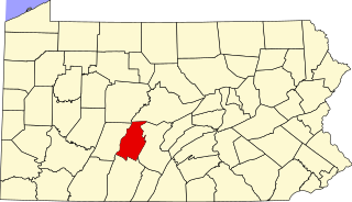
This is a list of the National Register of Historic Places listings in Blair County, Pennsylvania.

<span class="mw-page-title-main">National Register of Historic Places listings in Pittsylvania County, Virginia</span>

This is a list of the National Register of Historic Places listings in Pittsylvania County, Virginia.

<span class="mw-page-title-main">National Register of Historic Places listings in Sussex County, Virginia</span>

This is a list of the National Register of Historic Places listings in Sussex County, Virginia.

<span class="mw-page-title-main">National Register of Historic Places listings in Presque Isle County, Michigan</span>

This is a list of the National Register of Historic Places listings in Presque Isle County, Michigan.

<span class="mw-page-title-main">National Register of Historic Places listings in Gogebic County, Michigan</span>

This is a list of the National Register of Historic Places listings in Gogebic County, Michigan.

<span class="mw-page-title-main">National Register of Historic Places listings in Gratiot County, Michigan</span>

This is a list of the National Register of Historic Places listings in Gratiot County, Michigan.

References

  1. The latitude and longitude information provided in this table was derived originally from the National Register Information System, which has been found to be fairly accurate for about 99% of listings. Some locations in this table may have been corrected to current GPS standards.
  2. National Park Service, United States Department of the Interior, "National Register of Historic Places: Weekly List Actions", retrieved December 1, 2023.
  3. 1 2 Numbers represent an alphabetical ordering by significant words. Various colorings, defined here, differentiate National Historic Landmarks and historic districts from other NRHP buildings, structures, sites or objects.
  4. "National Register Information System". National Register of Historic Places . National Park Service. March 13, 2009.
  5. The eight-digit number below each date is the number assigned to each location in the National Register Information System database, which can be viewed by clicking the number.
  6. http://www.nps.gov/nhl/find/withdrawn/reo.htm [ dead link ]